Lower Loowit Falls
Skamania County, Washington
Your visit at a glance
- Waterfall height
- 36 ft (11 m)
- Location
- Skamania County, Washington
- Access status
- National monument trails from Windy Ridge; falls seen from the Loowit Trail ford
- The walk
- No single figure is published; Northwest Waterfall Survey segments: 2 3/4 miles to the Loowit Trail, 3/4 mile to the Loowit Falls trail, then about a mile to the ford
- Ground & access
- Open pumice plain with no shade, crossing gullies and lahar channels. Loowit Creek can surge on hot days and the canyon walls are unstable. Landslides can damage the trail.
Lower Loowit Falls is a plunge of about 35 to 60 feet where Loowit Creek leaves its canyon in the breached crater of Mount St. Helens. It is seen from the Loowit Trail at the Loowit Creek ford, about a third of a mile away. From Windy Ridge, walk the Truman Trail, which follows an old service road, and follow signs for Loowit Falls. About 2 miles in, the Windy Trail climbs to the Loowit Trail; turn right (west). Pass the junction for the Loowit Falls viewpoint trail and continue downhill on the Loowit Trail, staying left where the Willow Springs Trail joins, to the ford of Loowit Creek. Lower Loowit Falls is visible to the south. Return the same way or loop back by the Willow Springs and Truman trails. Off-trail travel is prohibited in this area, so view the falls from the trail.
Plan your visit
Windy Ridge Viewpoint at the end of Forest Road 99, down the Truman Trail (No. 207), then the Windy Trail (No. 216E) to the Loowit Trail (No. 216), west past the Loowit Falls trail to the Loowit Creek ford, with Lower Loowit Falls in view upstream
The Northwest Waterfall Survey gives 2 3/4 miles from the parking lot to the Loowit Trail, another 3/4 mile to the Loowit Falls Trail, and another mile to the Loowit Creek ford, where the falls is visible about 1/3 mile away. It says a return via the Willow Springs and Truman trails makes a loop of about 9 miles.
Open pumice plain with no shade, crossing gullies and lahar channels. Loowit Creek can surge on hot days and the canyon walls are unstable. Landslides can damage the trail.
Where to start
Windy Ridge Interpretive Site at the end of Forest Road 99, reached from Randle by FR 25 or from Cougar by FR 90 and FR 25. The Truman Trail leaves from the far end of the parking lot.
Timing & water
The Forest Service says high-elevation trails typically melt out by mid-July. Parts of the Truman Trail and Forest Road 99 have had weekday closures for construction; check the monument alerts before going. The area is day-use only, and the Forest Service lists no pets or stock on the Truman Trail.
Before you go
The Forest Service lists $5 per vehicle per day or a valid recreation pass at Windy Ridge.
Visitor informationVisit sources
More waterfalls nearby
Within 40 straight-line miles. Road and trail distances will differ.
- Middle Loowit FallsSkamania County, WA0.3 miS
- Lower Step Falls98 ft (30 m) · Skamania County, WA0.6 miSW
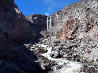 Loowit FallsMonument trail to the falls overlook186 ft (56.7 m) · Skamania County, WA0.7 miS
- Step FallsMonument trail; the falls are seen from the Loowit Trail near the Loowit Creek ford115 ft (35 m) · Skamania County, WA0.8 miSW
- Sheep Canyon Falls89 ft (27 m) · Cowlitz County, WA4.4 miSW
- Upper Sheep Canyon FallsPartial: last section is an unsigned, possibly abandoned trail98 ft (30 m) · Cowlitz County, WA4.4 miSW
- Lower Sheep Canyon FallsCowlitz County, WA4.5 miSW
- Middle Sheep Canyon FallsCowlitz County, WA4.5 miSW
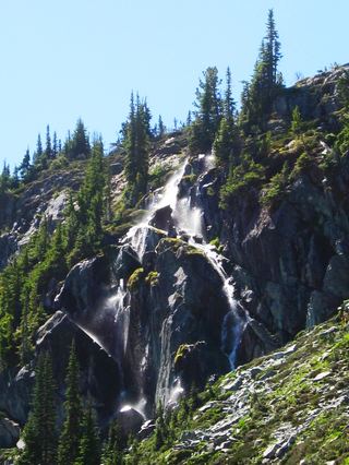 Harmony FallsLakeshore route; original falls submergedSkamania County, WA4.5 miNE