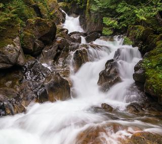
Monkey Cage Falls
King County, Washington
Your visit at a glance
- Waterfall height
- 16 ft (4.9 m)
- Location
- King County, Washington
- Access status
- Lower loop reported closed in 2026; Monkey Cage viewing-deck access unconfirmed
- The walk
- Current permitted walking distance unknown
- Ground & access
- Historical approach uses woodland paths, a wooden bridge and a viewing-deck spur. Current continuity of this approach is unverified.
Northwest Waterfall Survey identifies Monkey Cage Falls on the Tye River and documents a viewing deck reached by the downstream Nature Loop from Deception Falls picnic area. A June 23, 2026 firsthand report says the lower loop was closed. The current USFS picnic-area page says site open but does not resolve access to this particular deck. Do not cross closed bridges or use the unmaintained opposite-bank approach.
Plan your visit
Deception Falls Nature Loop viewing deck; access needs confirmation
The specialist guide places a viewing-deck spur about 500 feet beyond a bridge; that is not the full parking-to-falls distance.
Historical approach uses woodland paths, a wooden bridge and a viewing-deck spur. Current continuity of this approach is unverified.
Where to start
USFS documents the Deception Falls picnic area at US Highway 2 milepost 56, north side of the highway. The open picnic site does not by itself confirm access to Monkey Cage Falls.
Timing & water
Lower loop closure reported June 23, 2026 by Must Hike Must Eat. The reviewed USFS site page is marked open; reopening of the deck approach is not confirmed. Verify with Skykomish Ranger District and obey posted closures.
Before you go
USFS lists no fee for the picnic area.
Visitor informationVisit sources
More waterfalls nearby
Within 40 straight-line miles. Road and trail distances will differ.
 Deception FallsResearched walking routeKing County, WA0.2 miS
- Alpine FallsKing County, WA1.5 miW
- Sunray Falls394 ft (120 m) · King County, WA8.2 miSW
- Shoestring FallsResearched visit notes984 ft (300 m) · King County, WA8.2 miSW
- Engle Falls489 ft (149 m) · King County, WA8.8 miSW
- Lower Copper Falls46 ft (14 m) · King County, WA9.2 miSW
- Middle Copper Falls49 ft (15 m) · King County, WA9.2 miSW
- Upper Copper FallsTrail connection supported; precise viewing point and distance unconfirmed39 ft (12 m) · King County, WA9.3 miSW
- Pea Soup FallsKing County, WA9.6 miS