Gossamer Falls
King County, Washington
Your visit at a glance
- Waterfall height
- Not recorded
- Location
- King County, Washington
- Access status
- Logging road walk on DNR land, then an off-trail scramble; road damaged at the stream
- The walk
- The Northwest Waterfall Survey places Switchback Falls at the 2.6-mile mark of the road walk; Gossamer Falls is a short distance beyond and upstream
- Ground & access
- Gravel logging road with steady climbing and active truck traffic, then an off-trail scramble on a steep slope. Debris-flow damage at the stream crossings.
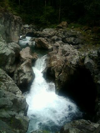
Gossamer Falls is a 102-foot veiling falls on a small branch of Big Blowout Creek on the south side of Bessemer Mountain, on a parcel of Department of Natural Resources land near North Bend. Walk up the gated Bessemer Road, which climbs gently for the first mile to where it meets the CCC Trail. Keep to the main road uphill where trails and spurs branch off. About a mile and three-quarters from the gate is an active quarry where trucks and heavy equipment may work on weekdays; stay out of the quarry area. Continue straight past the quarry and up three sharp switchbacks to Switchback Falls beside the road. One more switchback and a fifth of a mile further, the road crosses the top of Switchback Falls, and Gossamer Falls can be seen upstream. For a closer view, scramble up the slope to the left of the stream and traverse through open forest about 300 feet to the base. The survey reports that a debris flow stripped the trees beside the falls and destroyed the road in four places where it crosses this stream, so the last part of the approach can be rough and changeable. Return the same way.
Plan your visit
Gated DNR Bessemer Road off Middle Fork Snoqualmie Road, up the road past the quarry to Switchback Falls, then off-trail up the slope to the base of Gossamer Falls
The Northwest Waterfall Survey gives the 2.6-mile mark at Switchback Falls, then one more switchback and a fifth of a mile to where the road crosses the top of Switchback Falls, then about 300 feet of off-trail travel to the base. It gives no single total.
Gravel logging road with steady climbing and active truck traffic, then an off-trail scramble on a steep slope. Debris-flow damage at the stream crossings.
Where to start
The gated road is on the left about seven and a half miles up Middle Fork Snoqualmie Road (Forest Road 56) from I-90 Exit 34, with a Discover Pass Required sign. Do not block the gate; WTA says there is a pullout on the right about a hundred yards farther up.
Timing & water
WTA says the road is reachable virtually year-round because of its low elevation. The survey describes the stream as likely seasonal.
Before you go
A Discover Pass is required to park.
Visitor informationVisit sources
More waterfalls nearby
Within 40 straight-line miles. Road and trail distances will differ.
- Switchback FallsPartial: walk on an active logging road with debris-flow damage near the fallsKing County, WA0.1 miS
- Vortex FallsKing County, WA0.3 miSW
- Big Blowout FallsKing County, WA0.4 miSW
- Lower Big Blowout FallsKing County, WA0.5 miS
- Raven FallsKing County, WA1.7 miE
- Teneriffe FallsSigned DNR trail with steep switchbacks to the falls; Discover Pass requiredKing County, WA4.6 miSW
 Fantastic FallsClosed to all public access at landowners' request33 ft (10 m) · King County, WA5.0 miW
- Nine Hour FallsKing County, WA5.4 miE
- Tin Cup Joe Falls463 ft (141.1 m) · King County, WA6.5 miE