Silver Falls
Lewis County, Washington
Your visit at a glance
- Waterfall height
- 95 ft (29 m)
- Location
- Lewis County, Washington
- Access status
- National park trail loop to a falls viewpoint; slippery ledges near the falls
- The walk
- About 1.3 miles to the viewpoint spur, per Visit Rainier; the full loop is 2.7 miles
- Ground & access
- Forest trail with a high bridge over the river gorge. The area around the falls is wet, slippery and treacherous; stay on the trail and behind the railings.
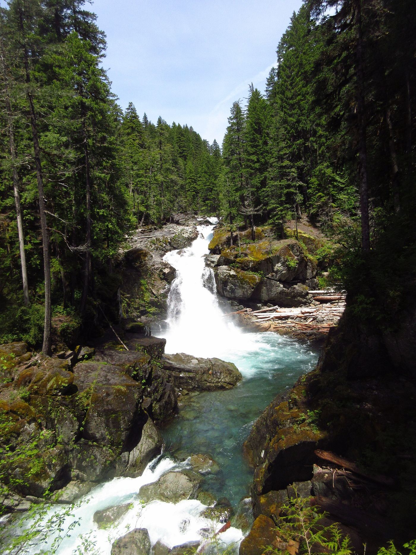
Photo credit
Photo: VitaleBaby, Public domain, via Wikimedia CommonsSilver Falls is a 60-foot drop of the Ohanapecosh River into an amphitheater of old-growth forest in Mount Rainier National Park. Visit Rainier describes a loop from the Ohanapecosh Visitor Center: walk a short way up the campground's B loop road to the trail on the left, pass the old Ohanapecosh Hot Springs site on a boardwalk, cross Laughingwater Creek, and continue upstream. Cross the river on a high bridge over a narrow chasm; at about 1.3 miles a short spur leads to a viewpoint at the falls. Return the same way, or continue to the Eastside Trail junction, keep left, and follow the loop back to the campground amphitheater. The National Park Service also lists trail access from the Grove of the Patriarchs and Laughingwater Creek trailheads.
Plan your visit
Ohanapecosh Visitor Center, campground B loop road, Silver Falls Trail upstream to the spur to the falls viewpoint
Visit Rainier places the spur to the falls viewpoint at about 1.3 miles and the end of the loop at 2.7 miles. WTA lists the loop as 3.0 miles round trip.
Forest trail with a high bridge over the river gorge. The area around the falls is wet, slippery and treacherous; stay on the trail and behind the railings.
Where to start
Ohanapecosh Visitor Center and campground day-use parking off Highway 123, about 3.5 miles north of the Highway 12 junction.
Timing & water
No season limits are stated. When Ohanapecosh Campground is closed, the National Park Service also lists trail access from the Grove of the Patriarchs and Laughingwater Creek trailheads.
Before you go
Mount Rainier National Park's entrance pass is $30 per private vehicle for seven consecutive days. WTA lists no separate parking pass for this trailhead.
Visitor informationVisit sources
- Visit Rainier: Hike the Silver Falls Loop
- Visit Rainier: Hike the Silver Falls Loop
- Visit Rainier: Hike the Silver Falls Loop
- National Park Service: Mount Rainier waterfall guide
- National Park Service: Mount Rainier waterfall guide
- Washington Trails Association: Silver Falls Loop
- National Park Service: Mount Rainier fees and passes
More waterfalls nearby
Within 40 straight-line miles. Road and trail distances will differ.
- Cougar FallsLewis County, WA3.3 miW
- Fish Ladder FallsLewis County, WA3.8 miSE
- Middle Steven's Creek FallsShort national park trail to a fenced viewpoint; entrance pass requiredLewis County, WA3.9 miW
- Stafford FallsNational park trail from a roadside trailhead; steep climb on the returnPierce County, WA4.7 miN
- Marie FallsPierce County, WA5.0 miNW
- Chinook CascadesPierce County, WA5.2 miN
- Twin FallsPierce County, WA5.2 miNW
- Mary Belle FallsPierce County, WA5.5 miNW
- Sylvia FallsWonderland Trail to an unsigned viewpoint; entrance pass requiredLewis County, WA5.5 miW