Viviane Falls
Chelan County, Washington
Your visit at a glance
- Waterfall height
- 197 ft (60 m)
- Location
- Chelan County, Washington
- Access status
- Long wilderness trail; free day-use permit at the trailhead; scramble for a clear view
- The walk
- About 9.75 miles one way and 5,100 feet of gain from the Snow Creek trailhead, per the Northwest Waterfall Survey
- Ground & access
- Long, steep wilderness trail with large elevation gain. Rugged granite near Lake Viviane with some scramble sections. The final view needs an off-trail scramble up the creek.
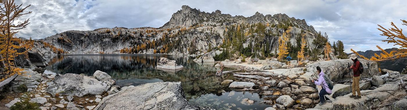
Viviane Falls is the largest waterfall in the Enchantment Lakes Basin in the Alpine Lakes Wilderness near Leavenworth. Snow Creek leaves Lake Viviane and drops about 215 feet down a fractured granite cliff, split into two channels. From the Snow Lakes Trailhead, follow the Snow Lakes Trail up past Nada Lake and the Snow Lakes toward Lake Viviane. The survey says a clear view needs a scramble up the creek about 100 vertical feet from the trail. The stretch between Upper Snow Lake and Lake Viviane is rugged, with some scrambling. This is a long, strenuous trip; the survey says day hiking is discouraged for all but the strongest hikers. Return the same way.
Plan your visit
Snow Lakes Trailhead on Icicle Road, the Snow Lakes Trail (Snow Creek Trail) past Nada and Snow Lakes to where the trail passes closest to the base of the falls below Lake Viviane
The Northwest Waterfall Survey gives about 9.75 miles and 5,100 feet of elevation gain along the Snow Creek Trail to where the trail passes closest to the base of the falls. The return distance is not stated.
Long, steep wilderness trail with large elevation gain. Rugged granite near Lake Viviane with some scramble sections. The final view needs an off-trail scramble up the creek.
Where to start
Snow Lakes Trailhead on the left side of Icicle Road (Forest Road 7600), 4.3 miles from Leavenworth. Park only on the left side of the road. Parking is limited, and visitors may have to park far from the trailhead.
Timing & water
Overnight permits apply May 15 to October 31. One of the two channels runs dry in autumn. Dogs are not allowed on the Snow Lakes Trail or in the Enchantment Permit Area.
Before you go
Day use: $5 per vehicle per day or $30 annual; Northwest Forest Pass and Interagency passes are honored. Day-use wilderness permits are free and self-issued at the trailhead. Overnight camping needs an advance permit from May 15 to October 31.
Visitor informationVisit sources
- Northwest Waterfall Survey: Viviane Falls
- Northwest Waterfall Survey: Viviane Falls
- Northwest Waterfall Survey: Viviane Falls
- Northwest Waterfall Survey: Viviane Falls
- Northwest Waterfall Survey: Viviane Falls
- Washington Trails Association: Enchantment Lakes
- USDA Forest Service: Snow Lakes Trailhead
- USDA Forest Service: Snow Lakes Trailhead
- USDA Forest Service: Snow Lakes Trailhead
- USDA Forest Service: Snow Lakes Trailhead
- USDA Forest Service: Snow Lakes Trailhead
- USDA Forest Service: Snow Lakes Trailhead
- USDA Forest Service: Snow Lakes Trailhead
- USDA Forest Service: Snow Lakes Trailhead
More waterfalls nearby
Within 40 straight-line miles. Road and trail distances will differ.
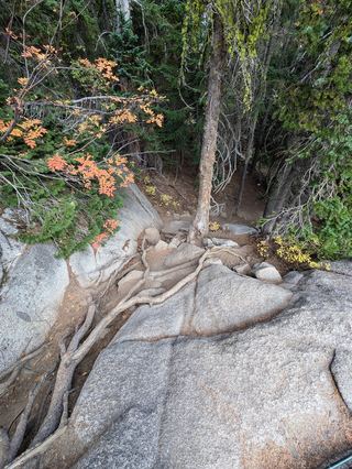 Upper Snow Creek FallsLong wilderness trail that passes the base of the falls148 ft (45 m) · Chelan County, WA0.3 miSE
- Drury FallsPartial: highway-side view documented; no designated parking or walkway1,267 ft (386.2 m) · Chelan County, WA11 miN
- Pea Soup FallsKing County, WA20 miW
- Whinnimic Falls350 ft (106.7 m) · Kittitas County, WA23 miW
- Iceberg Lake FallsKing County, WA25 miW
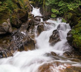 Deception FallsResearched walking routeKing County, WA25 miNW
- Monkey Cage FallsLower loop reported closed in 2026; Monkey Cage viewing-deck access unconfirmed16 ft (4.9 m) · King County, WA25 miNW
- Angeline FallsDistant viewing route identified; precise sighting point unverified424 ft (129.2 m) · King County, WA26 miW
- Big Heart FallsWaterfall viewing approach unconfirmed1,262 ft (384.7 m) · King County, WA26 miW