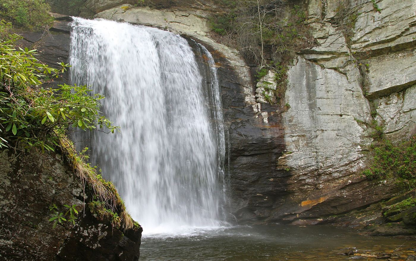
Waterfalls near Brevard, NC
654 named waterfalls within 30 miles of Brevard, closest first. Distances are straight-line from the town center.
Visits with route details
Read the walking route, starting point and current access notes.
- Williamson Creek FallsPartial guide: roadside view only; private land and no parking spot describedTransylvania County, NC
- Kuykendall FallsLong forest-road walk and steep bushwhack; route from a 2014 trekTransylvania County, NC
- Key FallsPartial guide: private land, roadside view only, parking spot not confirmedTransylvania County, NC
- Cathey's Creek FallsShort steep path from a forest road pullout; wading for the open viewTransylvania County, NC
- Laughing FallsPartial guide: informal parking at gates, no trail to the base, private land beyondTransylvania County, NC
 Looking Glass FallsResearched visit notes59 ft (18 m) · Transylvania County, NC
- Connestee FallsCounty park boardwalk viewpoint; base closed to visitorsTransylvania County, NC
- Upper Cedar Rock FallsNational forest trail with a short scramble at the endTransylvania County, NC
 Cedar Rock FallsEstablished Forest Service trail with an unsigned side path; two firsthand sources agreeTransylvania County, NC
- Batson Creek FallsPublic park overlook; falls on private landTransylvania County, NC
- Grogan Creek FallsForest Service trails with a short scramble; two firsthand sources agreeTransylvania County, NC
- Barbara FallsRoadside bushwhack; private land on the far bankTransylvania County, NC
- Lower Rockhouse Creek FallsRoadside view with a short path; very small pull-offTransylvania County, NC
 Slick Rock FallsPossible road-access closure: confirm FS 475B access and parking before visiting.Transylvania County, NC
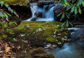 Lower Slick Rock FallsNational forest; short informal pathTransylvania County, NC
- Christmas FallsPartial guide: no maintained trail; faint path, bushwhack and wading in a state forestTransylvania County, NC
- Merry FallsRoadside waterfall in a state forest; very limited parkingTransylvania County, NC
- Middle Rockhouse Creek FallsPartial guide: 2014 description, no defined parking, steep informal pathTransylvania County, NC
- Whaleback FallsNational forest; short path and a steep scramble to the riverTransylvania County, NC
- Cannon Creek FallsState forest trail; short walkTransylvania County, NC
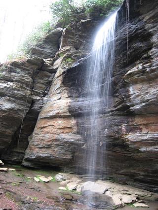 Moore Cove FallsResearched visit notes49 ft (15 m) · Transylvania County, NC
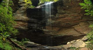 Little Moore Cove FallsNational forest trail and short informal side path; post-Helene condition unverified26 ft (8 m) · Transylvania County, NC
- Long Branch FallsGated forest road walk with a short steep side path; two firsthand sources agreeTransylvania County, NC
 Upper Little Moore Cove FallsPartial guide: off-trail Class III bushwhack on an unofficial path beyond the Forest Service trailTransylvania County, NC
- Avery Creek FallsNational forest trail route documentedTransylvania County, NC
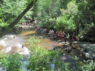 Sliding RockSource-reviewed route and parkingTransylvania County, NC
- Cove Creek FallsForest Service trails documented by two recent accountsTransylvania County, NC
- Caney Bottom FallsTrailside view on a Forest Service trail; no safe path to the baseTransylvania County, NC
- Clawhammer FallsPartial guide: short off-trail finish and the FR 477 vehicle closure status is unverifiedTransylvania County, NC
- Toms Spring FallsNational forest gated road; easy walkTransylvania County, NC
- Little Looking Glass FallsRoadside pullout; short steep pathsTransylvania County, NC
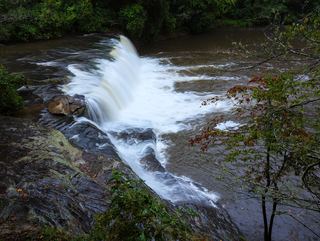 Hooker FallsShort graded trail in DuPont State Recreational ForestTransylvania County, NC
- Upper Avery Creek FallsPartial guide: forest trail route described; vehicle access on FR 477 was limited and current status is unknownTransylvania County, NC
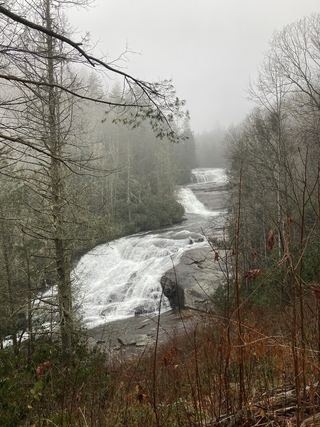 Triple FallsShort popular trail in DuPont State Recreational ForestTransylvania County, NC
- Upper Toms Spring FallsNational forest loop on a forest road and trailTransylvania County, NC
- Pulpit FallsPartial guide: private ministry land; access allowed per a visitor guide, owner policy not confirmedTransylvania County, NC
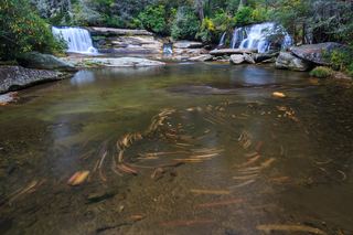 French Broad FallsPrivate land with permitted public access; short path documented by three accountsTransylvania County, NC
- Bird Rock FallsPrivate land with permitted public access; short riverside path documented by two accountsTransylvania County, NC
- Lower Laurel Fork FallsUnofficial creekside path with a rock ledge; short scramble to the creekTransylvania County, NC
- Twin FallsPartial: forest trail documented; road gate status near the trailhead not confirmedTransylvania County, NC
- Bent Field FallsShort path and deep river wade; low water onlyTransylvania County, NC
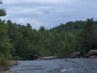 High FallsState forest trail; short walk to overlookTransylvania County, NC
- Boxcar FallsEstablished path with a river ford; distant view of a small fallsTransylvania County, NC
- Logging Road FallsEasy walk on a gated forest roadTransylvania County, NC
- Bridal Veil FallsState forest roads and trail documented by two accounts; official road work noticeTransylvania County, NC
- Big Bearwallow FallsInformal roadside pullout and steep scramble pathTransylvania County, NC
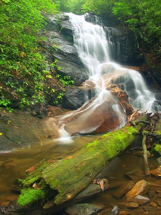 Log Hollow FallsGated forest road walk; easyTransylvania County, NC
- Gemini FallsPartial guide: unofficial path then a difficult trail-less climb; experienced off-trail hikers onlyTransylvania County, NC
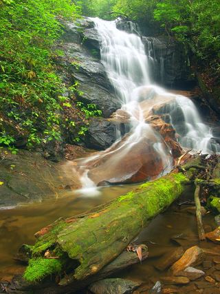 Upper Log Hollow FallsForest road walk and steep side path in Pisgah National ForestTransylvania County, NC
- Grassy Creek FallsPartial: state forest road walk; final turn to the falls not describedTransylvania County, NC
- Laurel Fork FallsPartial: no trail for the last half mile; difficult bushwhack52 ft (16 m) · Transylvania County, NC
- Upper Logging Road FallsNational forest; forest road then a short off-trail climbTransylvania County, NC
- Lemon FallsRoadside pullout and short steep scrambleTransylvania County, NC
- Discovery FallsNational forest; forest road and unofficial pathTransylvania County, NC
- High FallsPartial guide: unofficial path and river wade; trail beyond Billy Branch not checked since HeleneTransylvania County, NC
- Cherry Cove FallsDetailed firsthand route on unofficial paths from a Forest Service roadTransylvania County, NC
- Bennett Cove FallsPublished route on national forest land; informal side pathsTransylvania County, NC
- Reece Place FallsState forest trail and old roads; creek crossing near the fallsTransylvania County, NC
- East Fork FallsVery short path from a small state forest pulloutTransylvania County, NC
- Skinny Dip FallsShort trail from a Blue Ridge Parkway overlook; creek crossing without a bridgeHaywood County, NC
- Shuck Ridge Creek FallsLong Forest Service trail hike with a steep scramble to the baseTransylvania County, NC
- Twin Boulder FallsLong national forest hike; last half mile on an unofficial path66 ft (20 m) · Transylvania County, NC
- Jenn's FallsPartial guide: final approach is off trail and described by one firsthand sourceTransylvania County, NC
- No-Name Cove FallsSide path and faint path; scramble to the upper baseTransylvania County, NC
- Poundingmill Branch FallsForest road and unofficial path in Pisgah National ForestTransylvania County, NC
- Billy Branch FallsGated forest road and riverside trail; unmarked side path at the endTransylvania County, NC
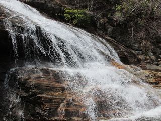 Yellowstone FallsNational forest trails, then a steep scramble path; base not recommended98 ft (30 m) · Haywood County, NC
- Tucker Creek FallsNational forest; steep bank and creek walkTransylvania County, NC
- Second FallsResearched visit notes66 ft (20 m) · Haywood County, NC
- Wintergreen FallsState forest roads and trail from Guion FarmHenderson County, NC
- Upper Kiesee FallsPartial guide: the access road is closed and the path may have changed since loggingTransylvania County, NC
- Beetree Fork FallsDocumented road walk and bank scramble on national forest land33 ft (10 m) · Transylvania County, NC
- Kiesee FallsPartial guide: access road closed for storm damage; bushwhack with an exposed rock faceTransylvania County, NC
- Upper Beetree Fork FallsShort road walk and bank scramble from a national forest pull-offTransylvania County, NC
- Summey Cove FallsPartial: FS 140 closed for storm damage; view mostly blocked by treesTransylvania County, NC
- Lower Chestnut FallsPartial guide: access road closed for storm damage; bushwhack and creek walkTransylvania County, NC
- Chestnut FallsPartial guide: FR 140 closed for storm damage; long road walk and faint pathTransylvania County, NC
- Pigeon Branch FallsPartial guide: off-trail route; the waterfall position is not publishedTransylvania County, NC
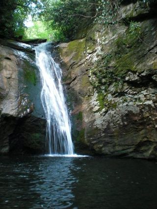 Courthouse FallsApproach road closed due to storm damage; no open parking-to-falls route verified.33 ft (10 m) · Transylvania County, NC
- Cody FallsPartial guide: Courthouse Creek Road is closed for storm damage and foot access on it is not confirmedTransylvania County, NC
- Upper FallsNational forest trails from Blue Ridge Parkway overlooks; busy area49 ft (15 m) · Haywood County, NC
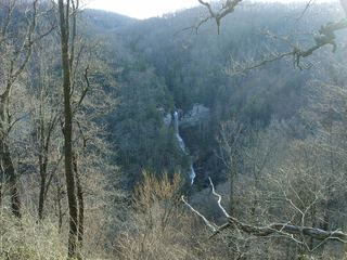 Raven Cliff FallsResearched visit notesGreenville County, SC
- Silver Steps FallsState park wilderness trail route and parking documentedGreenville County, SC
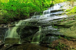 Barnett Branch Trail FallsShort national forest trail walk to fallsTransylvania County, NC
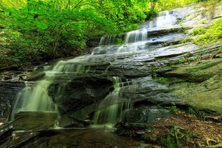 Little Barnett Branch Trail FallsPartial: maintained trail; the sources do not name this upper fallsTransylvania County, NC
- Upper Courthouse FallsPartial guide: Courthouse Creek Road is closed to vehicles, so the walk is about 4 miles each wayTransylvania County, NC
- Graveley FallsState forest old-road walk; two firsthand sources agree, roadside parking onlyTransylvania County, NC
- Upper Toll Road FallsPartial guide: no trail above Toll Road Falls; off-trail scrambleGreenville County, SC
- Toll Road FallsPartial guide: position from one visitor account; exact match to this listing probableGreenville County, SC
- Red Rock FallsPartial: FS 140 closed for storm damage; old unmaintained creekside pathTransylvania County, NC
- Cliff FallsState park trail route and parking documented; trail feeGreenville County, SC
- Firewater FallsState park trail passes the falls; trail access feeGreenville County, SC
- Rainbow FallsOfficial state park trail to the base of the falls138 ft (42 m) · Greenville County, SC
- Ben's SluicePartial guide: the position of Ben's Sluice beyond Jones Gap Falls comes from one visitor accountGreenville County, SC
- John Neal FallsForest road and unofficial logging road with six creek crossingsTransylvania County, NC
- Jones Gap FallsState park trail route and parking documented; admission feeGreenville County, SC
- Bradley Creek FallsPartial guide: the last stretch is off trail with no marked path, and road access to the trailhead may be closedTransylvania County, NC
- Upper Bubbling Spring Branch FallsNational forest; short creekside path with several crossingsHaywood County, NC
- Lower Bubbling Spring Branch FallsShort unofficial creekside path with crossingsHaywood County, NC
- Wildcat FallsForest trail to a bridge at the falls197 ft (60 m) · Haywood County, NC
- Waterfalls of Flat Laurel CreekPartial: trail to the cascades documented; which cascade this listing marks is not confirmedHaywood County, NC
- Slate Rock Creek FallsPartial guide: road to the trailhead listed as closed after Hurricane HeleneHenderson County, NC
- Confusion FallsPartial guide: camp permission needed by phone; last section is an unmarked pathGreenville County, SC
- Lower Wildcat FallsNational forest; steep off-trail descent and river crossing39 ft (12 m) · Haywood County, NC
- Bernie's FallsDocumented unmarked route on national forest land; route finding neededTransylvania County, NC
- Bubbling Spring Branch CascadesShort roadside scramble documented by two firsthand sourcesHaywood County, NC
- Drip Rock FallsPartial guide: roadside falls; the small pull-off is on a highway curveGreenville County, SC
- Mashbox FallsPartial guide: no trail; steep off-trail descent from US 276Greenville County, SC
- Double Branch FallsPartial guide: off trail approach with no path; most recent account is from 2017Transylvania County, NC
- Sam Branch FallsPartial guide: no trail; roadside shoulder parking; creek walk for experienced hikers only66 ft (20 m) · Haywood County, NC
- Little Wildcat FallsRoadside view; needs high waterHaywood County, NC
- Hospital Rock FallsState park trail from the Jones Gap State Park office areaGreenville County, SC
- Mount Hardy FallsUnblazed wilderness trail and short bushwhack; needs high water98 ft (30 m) · Haywood County, NC
- Rocky Branch FallsPartial guide: distant view only; exact listing match probableGreenville County, SC
- Evans FallsPartial guide: no official trail; old road and an overgrown logging gradeGreenville County, SC
- Tanasee Creek FallsPartial guide: no maintained trail; creek walk and wade described by one sourceJackson County, NC
- Lower Sam Branch FallsNational forest; short scramble path across a landslideHaywood County, NC
- Wash Hollow FallsShort path with a creek crossing from a highway pull-off49 ft (15 m) · Haywood County, NC
- Sunburst FallsRoadside view from an NC 215 pullout in Pisgah National ForestHaywood County, NC
- Eastern Stream FallsState park trail route and trailhead documented; small parking areaGreenville County, SC
- Oil Camp FallsPartial guide: gated old road; land manager and exact drop not confirmedGreenville County, SC
- Herrin Knob FallsNational forest; short road walk then off-trail bushwhackJackson County, NC
- Upper Dill FallsShort steep path from the end of a seasonal forest roadJackson County, NC
- Dill FallsShort old-road walk from a seasonal forest road; three firsthand sources agreeJackson County, NC
- Lower Cavern FallsPartial: overgrown old roads, two creek wades and a bushwhack; no trailJackson County, NC
- Cavern FallsPartial: old road with wades, then a steep bushwhack with no trailJackson County, NC
- Beech Bottom FallsBuilt state trail with signed parking and observation deckPickens County, SC
- Heritage FallsHeritage preserve loop trail to the top of the fallsGreenville County, SC
- Upper Falls Creek FallsPartial guide: upper-section identity and final side path not confirmedGreenville County, SC
- Falls Creek FallsMountain Bridge Wilderness trail from the Falls Creek trailheadGreenville County, SC
- Little Bird FallsWilderness path; very short walk from NC 215Haywood County, NC
- Bee Branch FallsNational forest trail plus a short off-trail sectionHenderson County, NC
- Little East Fork FallsPartial: wilderness trail; sources give different distances to the fallsHaywood County, NC
- Double Drop FallsPartial guide: trail to the area, then an unmarked off-trail descentTransylvania County, NC
- Horseshoe FallsPartial: no trail to the falls; final approach is a steep bushwhackJackson County, NC
- Upper Wildcat FallsPartial guide: view only; the path onto the upper falls is closed and the exact closure point is not describedGreenville County, SC
- Ashmore FallsPreserve trail to a distant view from the Lake Wattacoo damGreenville County, SC
- Sweet Thing On SlickumPartial guide: highway-shoulder parking and an unmarked informal pathGreenville County, SC
- Buckeye FallsPartial: wilderness trail then an off-trail creek walk66 ft (20 m) · Haywood County, NC
- Maple Spring Branch FallsPartial guide: faint unofficial descent and scramble from the trailTransylvania County, NC
- Last Falls on SlickumPartial guide: highway-shoulder parking and an unmarked informal pathPickens County, SC
- Yellow Patch FallsPartial guide: the last part is an off-trail descent near cliffsJackson County, NC
- Twin FallsPartial guide: off-trail route with a rope descent; park approval of the route not confirmed16 ft (5 m) · Transylvania County, NC
- Toxaway FallsRoadside view from the US 64 bridge catwalks246 ft (75 m) · Transylvania County, NC
- Lower Balsam FallsUnofficial path with a creek crossing; difficultJackson County, NC
- Lauren FallsDifficult unofficial creek paths from a Forest Service recreation areaJackson County, NC
- Middle Wildcat FallsRoadside state wayside with stone steps beside the fallsGreenville County, SC
- Balsam FallsPublished route on national forest land; unofficial final pathJackson County, NC
- Lower Wildcat FallsRoadside falls at a state park service waysideGreenville County, SC
- Patricia FallsDifficult unofficial creek paths from a Forest Service recreation areaJackson County, NC
- Wolf Mountain FallsPartial: forest road, then a steep off-trail descentJackson County, NC
- Spring Bluff FallsPartial guide: state park trail; the park trail description does not name this fallsPickens County, SC
- Green Creek FallsPartial guide: view from the Table Rock Trail; name and exact drop from one visitor accountPickens County, SC
- Lower Rhapsodie FallsUnmaintained trail with a river rock hopJackson County, NC
- Lower Dismal FallsUnmaintained trail with steep sections and a boulder climb at the endJackson County, NC
- Rhapsodie FallsUnmaintained but obvious path with a river crossing and a very steep climb66 ft (20 m) · Jackson County, NC
- Carrick Creek FallsState park trail to an observation deck near the trailheadPickens County, SC
- Mill Creek FallsState park trail and spur documented; very strenuousPickens County, SC
- Dismal FallsUnofficial, unmaintained route with ropes documented by two accounts; very strenuous131 ft (40 m) · Jackson County, NC
- Chub Line FallsPartial: state park trail then an unmarked very steep descentTransylvania County, NC
- Gage Creek FallsShort old-road walk documented by one firsthand source with GPSJackson County, NC
- Wintergreen FallsState park trails, then a faint riverside path for the last half mile164 ft (50 m) · Transylvania County, NC
- Charley Bridge FallsRoadside falls with a very steep scramble to the base, one firsthand accountJackson County, NC
- Upper Middle Prong FallsPartial guide: route is to Middle Prong Falls as a whole; the exact upper drop is not identifiedHaywood County, NC
- Lower Bearwallow FallsPartial guide: no trail for the final descent; park position on access unclearTransylvania County, NC
- Lower Middle Prong FallsPartial guide: steep off-trail finish; sources call this waterfall Middle Prong FallsHaywood County, NC
- Upper Wintergreen FallsPartial guide: the last part is a long off-trail route that needs navigation skills66 ft (20 m) · Transylvania County, NC
- Shower FallsPartial guide: roadside view of private land; almost no parkingJackson County, NC
- Big Beartrap FallsDocumented wilderness approach; last half mile on a steep unofficial pathHaywood County, NC
- Bear Canyon FallsState park trail then a very steep off-trail bushwhackTransylvania County, NC
- Berry Branch FallsForest road walk then off-trail; final approach not described in detailHaywood County, NC
- Virginia Hawkins FallsPreserve trail route and trailhead documented; very limited parkingPickens County, SC
- Little Beartrap FallsGated forest roads; view from the old road crossingHaywood County, NC
- Upper Bearwallow FallsState park trail; short steep walk to an overlook98 ft (30 m) · Transylvania County, NC
- Yucca FallsPartial guide: off-trail bushwhack and steep scramble; parking and distance not givenPickens County, SC
- Paw Paw FallsPartial guide: off-trail route only loosely described and the exact waterfall position is not publishedTransylvania County, NC
- Split Rock FallsPartial: state park trails, a creek ford and a bushwhackTransylvania County, NC
- Paradise FallsNational forest; steep unofficial paths and dam-controlled flowJackson County, NC
- Indian Camp FallsPartial: state park trails, a creek ford and an unmeasured bushwhack; no published distanceTransylvania County, NC
- Elbow FallsPanthertown trails and a defined side path from the Cold Mountain Gap accessJackson County, NC
- Lichen FallsPartial guide: river wade with no trail; location given by description onlyJackson County, NC
- Riding Ford FallsBackcountry trail route from Cold Mountain GapJackson County, NC
- Jawbone FallsNamed national forest trails, then a short informal path to the baseJackson County, NC
- Red Butt FallsNational forest trails; short unofficial path and scrambleJackson County, NC
- Twin FallsPartial guide: private nature preserve; the listing says hikers go at their own riskPickens County, SC
- Carlton FallsForest Service trails then an unofficial path, documented by two accountsJackson County, NC
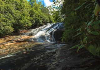 Warden FallsForest trails, then a steep scramble path to the baseJackson County, NC
- Greenland Creek FallsMarked Panthertown trails from the Cold Mountain Gap accessJackson County, NC
- Roy Taylor FallsPartial guide: no maintained trail; final approach is a short bushwhack described by one sourceJackson County, NC
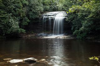 Schoolhouse FallsNational forest trailsJackson County, NC
- Mac's FallsNational forest trail; short side pathJackson County, NC
- Pothole FallsShort backcountry trail from Cold Mountain GapJackson County, NC
- Stairway FallsState park trailhead; unofficial side path in the national forest39 ft (12 m) · Transylvania County, NC
- Upper Sols Creek FallsPartial guide: unofficial path, and land ownership along the first part of the path is not confirmedJackson County, NC
- Turtleback FallsState park trailhead; national forest trail13 ft (4 m) · Transylvania County, NC
- Rainbow FallsMarked trail from Gorges State Park; steep, popular hike128 ft (39 m) · Transylvania County, NC
- Drift FallsPublic trail to a boundary view; falls on private land33 ft (10 m) · Transylvania County, NC
- Sidepocket FallsPartial guide: rough unmaintained path below Stairway Falls; route last described in detail in 200349 ft (15 m) · Transylvania County, NC
- Laurel Fork FallsLong Foothills Trail route to the falls overlook documentedPickens County, SC
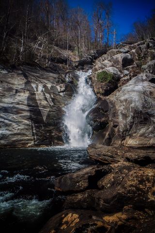 Windy FallsPartial guide: unofficial route to the top of a dangerous falls; trail name not in the current park trail list197 ft (60 m) · Transylvania County, NC
- Sols Creek FallsPartial guide: falls on private land; legal view only by boat from Bear Creek LakeJackson County, NC
- Nellies FallsUnofficial trail with creek crossingsJackson County, NC
- Panthertown Creek FallsPartial guide: the last section is an off-trail bushwhack with no pathJackson County, NC
- Granny Burrell FallsWest-entrance route and parking researchedJackson County, NC
- Rough Butt Creek FallsPartial: wet fords, faint path, and land status of the access drive not confirmedJackson County, NC
- Pleasant Ridge FallsCounty park nature trail to the falls documentedGreenville County, SC
- Bearcamp Creek FallsPartial guide: route source is from 2006 and the match to this waterfall is probableTransylvania County, NC
- Upper Sugar Creek FallsPartial guide: informal flagged path; road status beyond the bridge not statedJackson County, NC
- Frolictown FallsMarked Panthertown trails from the Salt Rock Gap accessJackson County, NC
- Sugar Creek FallsNational forest old road; creek crossingJackson County, NC
- Wilderness FallsWest-entrance route; old Salt Rock shortcut closedJackson County, NC
- Hilliard FallsLong backcountry trail hike; about 12 miles returnTransylvania County, NC
- Reid Branch FallsNational forest old road; steep side path20 ft (6 m) · Transylvania County, NC
- White Owl FallsShort roadside scramble path in national forest; wade for the best view13 ft (4 m) · Transylvania County, NC
- High FallsGated old road and unofficial side trail; river wade for the best view49 ft (15 m) · Transylvania County, NC
- Simon FallsNational forest old road; river ford requiredTransylvania County, NC
- Joe Pack FallsPartial: off-trail river route; parking and distance not statedTransylvania County, NC
- Twin FallsPartial guide: private land; only a view of the top from a public road bridge; no parking describedTransylvania County, NC
- Rich FallsOld logging road, river wade and very steep side pathTransylvania County, NC
- Big FallsPartial guide: unofficial trail, dangerous ford and scramble; parking and land permission details unconfirmed197 ft (60 m) · Transylvania County, NC
- Hidden Dome FallsNational forest; river ford and off-trail route, very difficultTransylvania County, NC
- John's JumpShort unofficial path from a roadside pull-off; two firsthand sources agreeTransylvania County, NC
- Bell Park FallsCounty park trail and stairs to an observation deckHenderson County, NC
- DEW FallsNational forest; very short walk from a roadside gateTransylvania County, NC
- Chastine Creek FallsPartial guide: 2006 roadside account, private land on the lower road, parking unconfirmedJackson County, NC
- Wright Creek FallsPartial guide: boat access only; lake route not publishedOconee County, SC
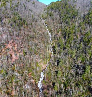 Corbin Creek FallsFee recreation area; maintained trail reaches only the lowest section of a long cascadeTransylvania County, NC
- Lower Whitewater FallsResearched visit notesOconee County, SC
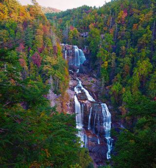 Upper Whitewater FallsResearched visit notes410 ft (125 m) · Transylvania County, NC
- Hornet FallsPartial: unofficial paths and a creek-walk; 2017 report onlyTransylvania County, NC
- Merge Lane FallsPartial: unofficial paths; 2017 report onlyTransylvania County, NC
- Case FallsPartial guide: hiker parking at the turnaround is not confirmed and post-storm conditions are unreportedHenderson County, NC
- Briefcase FallsPartial guide: bushwhack finish, hiker parking permission uncertain, storm damage unverifiedHenderson County, NC
- Lower Hungry River FallsPartial guide: post-Helene route goes down a landslide; conditions last checked late 2024Henderson County, NC
- Moses Creek FallsUnsigned path with creek crossings; wade in high waterJackson County, NC
- Nasty FallsPartial guide: no trail; creek walk, informal parking, distance not publishedTransylvania County, NC
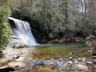 Upper Silver Run FallsShort trail, then a steep root climb and informal pathJackson County, NC
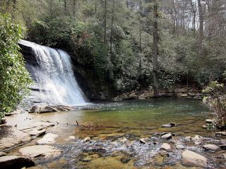 Silver Run FallsResearched walking route26 ft (8 m) · Jackson County, NC
- Poe Creek FallsPartial guide: name conflict; Waterfall Hero calls this point Upper Poe Creek FallsPickens County, SC
- Middle Poe Creek FallsState park trail route and trailhead documentedPickens County, SC
- Upper Hungry River FallsRoadside view and short path on Green River Game LandHenderson County, NC
- Lower Poe Creek FallsState park trail route and trailhead documentedPickens County, SC
- Sunshine FallsGame land trail and extremely steep roped path to the riverPolk County, NC
- Coyote FallsShort unofficial path from a highway pullout; two firsthand sources agreeJackson County, NC
- Pulliam Creek FallsPartial guide: the last stretch up Pulliam Creek and current game land access are not confirmedPolk County, NC
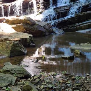 Pearson's FallsAdvance reservation required89 ft (27 m) · Polk County, NC
- Fishtop FallsPartial: short game land path; access road status after Helene unconfirmedPolk County, NC
- Emily FallsGame land trail; short easy walkPolk County, NC
- Stairstep FallsGame land trails with a creek crossing and steep scramblePolk County, NC
- Cashiers Sliding RockShort trail from a small roadside lot at the Chattooga River bridgeJackson County, NC
- Norton FallsPartial guide: boat access only; launch point and parking not identifiedJackson County, NC
- Hidden FallsPartial guide: boat access only; marina parking and boating distance not publishedJackson County, NC
- High FallsBuilt trail with stairs from Pines Recreation Area; flow depends on dam releases98 ft (30 m) · Jackson County, NC
- Upper Sloan Bridge FallsPartial guide: steep scramble path; which drop the sources describe is not confirmedOconee County, SC
- Hiker's Peril FallsOfficial long-distance trail and picnic area parking documentedOconee County, SC
- Hatcher FallsPartial guide: distant view only from an unofficial trail on private land; the falls are on private property33 ft (10 m) · Jackson County, NC
- Melrose FallsPartial guide: open trail, but road access affected by the US 176 closurePolk County, NC
- Little Bradley FallsPolk Trails marks the trail open; creek crossings required.49 ft (15 m) · Polk County, NC
- Mill Creek FallsPartial: boat-only waterfall; launch point and current cruise details not confirmedJackson County, NC
- Big Bradley FallsWritten approval required; trail organization reports Helene closure75 ft (23 m) · Polk County, NC
- Bee Cove FallsPartial guide: final approach off-trail; listing match probableOconee County, SC
- Woodfin CascadesBlue Ridge Parkway overlook; roadside view and short scrambleJackson County, NC
- Upper Cave FallsPartial guide: beyond the end of the official trail; steep bushwhack above Cave FallsGreenville County, SC
- Lower Cave FallsPartial guide: beyond the end of the official trail; scramble path up a side streamGreenville County, SC
- Fall Creek FallsPartial guide: boat access only; listing match probableOconee County, SC
- Upper Scotsman Creek FallsNational forest; roadside parking and a short off-trail descentJackson County, NC
- Milton Bradley FallsPartial: access road closed after Helene; route documented before the stormPolk County, NC
- Scotsman Creek FallsPartial: no real trail; very steep unofficial path from the roadJackson County, NC
- Lower Scotsman Creek FallsPartial guide: no trail below Scotsman Falls; wading and bushwhacking from 2005 directionsJackson County, NC
- Moonshiners FallsPartial guide: beyond the end of the official trail; river crossing and short scrambleGreenville County, SC
- Marilou Bradley FallsPartial: pre-Helene route; access road under repairPolk County, NC
- Fowler Creek FallsPartial: wilderness trail then an extremely steep bushwhackJackson County, NC
- Blue Wall FallsPartial guide: preserve trail to a waterfall view; exact match to this listing not confirmedGreenville County, SC
- Cane Creek FallsPartial guide: no trail, steep bushwhack from a gated forest roadMacon County, NC
- Pothole FallsRoadside bridge view; scramble to the baseMacon County, NC
- Turtle Rock FallsPartial guide: informal route from one visitor description; parking not describedPolk County, NC
- Highlands FallsDistant roadside view only; the falls itself is on private club landMacon County, NC
- Upper Buff Creek FallsPartial guide: long unmarked route with an off-trail finish; current conditions unknownJackson County, NC
- Fungi FallsPartial guide: permission to walk the gated road past private land is unconfirmed; no trail; post-storm status unknownPolk County, NC
- Little Bearwallow FallsPartial guide: usual trailhead closed after Helene; long alternative with restricted road accessBuncombe County, NC
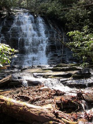 Spoonauger FallsSource-reviewed route and parkingOconee County, SC
- Walkingstick FallsPartial guide: roadside view only; private land and no parking spot describedMacon County, NC
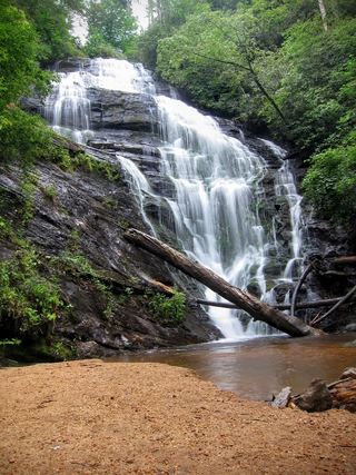 King Creek FallsResearched visit notes66 ft (20 m) · Oconee County, SC
- Stick FallsNational forest; short bushwhack with a cliffMacon County, NC
- Lower Stick FallsPartial: short but steep bushwhack near cliffs; no trailMacon County, NC
- Slick Stick FallsPartial guide: no trail; bushwhack and creekwalk onlyMacon County, NC
- Buck Creek FallsPartial guide: no trail, steep bushwhack from a gated forest roadMacon County, NC
- Sillers FallsShort path on a town greenwayPolk County, NC
- Pinky FallsPartial guide: land trust preserve; exact pull-off and trail length not confirmedMacon County, NC
- Fisher FallsTown park trail with free trailhead permit; trailside viewJackson County, NC
- Miuka FallsNational forest trail from SC 107 near Cherry HillOconee County, SC
- Little Creek FallsPartial guide: steep bushwhack finish, parking spot not describedMacon County, NC
- Crane FallsPartial guide: no published distance; informal creek pathOconee County, SC
- Big Bend FallsNational forest trail route documented; steep final descent to the riverOconee County, SC
- Secret FallsPartial guide: final 300 yards are cross-country with no trail markingsOconee County, SC
- Crane Creek FallsPartial guide: off-trail bushwhack of about half a mile; no trailOconee County, SC
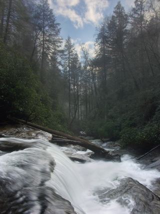 Secret FallsForest Service trail with steps to the base; road gated in winterMacon County, NC
- Gina FallsPartial guide: no trail to the falls, difficult bushwhack from the West Fork TrailJackson County, NC
- Shunkawauken FallsPrivate property; roadside view only148 ft (45 m) · Polk County, NC
- Ranger FallsNational forest trail in a fee recreation areaMacon County, NC
- Lower Satulah FallsDistant roadside view from an overlook; no access closerMacon County, NC
- Satulah FallsSafe stopping location unconfirmedMacon County, NC
- Naiad FallsBoat access only; private land at the fallsMacon County, NC
- Sequoah FallsRoadside view of a dam spillwayMacon County, NC
Closest with a photo
All 654 waterfalls
- Glen Cannon FallsTransylvania County, NC2.2 miE
- Glencannon FallsTransylvania County, NC2.2 miE
- Williamson Creek FallsPartial guide: roadside view only; private land and no parking spot describedTransylvania County, NC2.5 miE
- Warrior FallsTransylvania County, NC2.7 miNW
- Bambi FallsTransylvania County, NC2.7 miNW
- Fawn Branch FallsTransylvania County, NC2.8 miNW
- King Creek FallsTransylvania County, NC2.8 miNW
- Whitetail FallsTransylvania County, NC2.8 miNW
- Saxifrage FallsTransylvania County, NC3.0 miNW
- Maidenhair FallsTransylvania County, NC3.1 miSE
- Kuykendall FallsLong forest-road walk and steep bushwhack; route from a 2014 trekTransylvania County, NC3.1 miW
- Rhododendron FallsTransylvania County, NC3.3 miSE
- Key FallsPartial guide: private land, roadside view only, parking spot not confirmedTransylvania County, NC3.4 miE
- Stick Biscuit FallsTransylvania County, NC3.5 miS
- Phillips FallsTransylvania County, NC3.5 miSE
- Revels Prong FallsTransylvania County, NC3.7 miW
- Dunns Rock FallsTransylvania County, NC3.8 miS
- Cathey's Creek FallsShort steep path from a forest road pullout; wading for the open viewTransylvania County, NC3.9 miW
- Cedar Rock FallsTransylvania County, NC4.4 miW
- Laughing FallsPartial guide: informal parking at gates, no trail to the base, private land beyondTransylvania County, NC4.6 miNE
- William FallsTransylvania County, NC4.7 miS
- Silver Ribbon FallsTransylvania County, NC4.7 miNE
- Looking Glass FallsResearched visit notes59 ft (18 m) · Transylvania County, NC4.8 miNW
- Connestee FallsCounty park boardwalk viewpoint; base closed to visitorsTransylvania County, NC4.8 miS
- Upper Cedar Rock FallsNational forest trail with a short scramble at the endTransylvania County, NC4.8 miNW
- Cedar Rock FallsEstablished Forest Service trail with an unsigned side path; two firsthand sources agreeTransylvania County, NC4.8 miNW
- Batson Creek FallsPublic park overlook; falls on private landTransylvania County, NC4.8 miS
- Middle Batson Creek FallsTransylvania County, NC4.9 miS
- Grogan Creek FallsForest Service trails with a short scramble; two firsthand sources agreeTransylvania County, NC5.0 miNW
- Barbara FallsRoadside bushwhack; private land on the far bankTransylvania County, NC5.1 miW
- Upper Batson Creek FallsTransylvania County, NC5.1 miS
- Grace FallsTransylvania County, NC5.1 miW
- Lower Rockhouse Creek FallsRoadside view with a short path; very small pull-offTransylvania County, NC5.3 miNW
- Slick Rock FallsPossible road-access closure: confirm FS 475B access and parking before visiting.Transylvania County, NC5.5 miNW
- Lower Slick Rock FallsNational forest; short informal pathTransylvania County, NC5.5 miNW
- Sutton FallsTransylvania County, NC5.5 miNE
- Christmas FallsPartial guide: no maintained trail; faint path, bushwhack and wading in a state forestTransylvania County, NC5.6 miSE
- Merry FallsRoadside waterfall in a state forest; very limited parkingTransylvania County, NC5.6 miSE
- Transylvania FallsTransylvania County, NC5.7 miNW
- Middle Rockhouse Creek FallsPartial guide: 2014 description, no defined parking, steep informal pathTransylvania County, NC5.7 miNW
- Whaleback FallsNational forest; short path and a steep scramble to the riverTransylvania County, NC5.7 miNW
- Tranquility FallsTransylvania County, NC5.8 miNW
- Cannon Creek FallsState forest trail; short walkTransylvania County, NC5.8 miSE
- Moore Cove FallsResearched visit notes49 ft (15 m) · Transylvania County, NC5.9 miNW
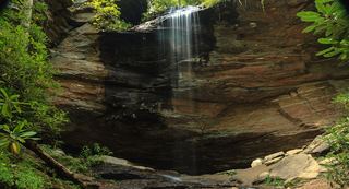 Upper Moore Cove FallsTransylvania County, NC6.0 miNW
Show the other 609 waterfalls, 6.0 mi to 30 mi away
- Upper Rockhouse Creek FallsTransylvania County, NC6.0 miNW
- Little Moore Cove FallsNational forest trail and short informal side path; post-Helene condition unverified26 ft (8 m) · Transylvania County, NC6.0 miNW
- Long Branch FallsGated forest road walk with a short steep side path; two firsthand sources agreeTransylvania County, NC6.0 miNW
- Upper Little Moore Cove FallsPartial guide: off-trail Class III bushwhack on an unofficial path beyond the Forest Service trailTransylvania County, NC6.0 miNW
- Avery Creek FallsNational forest trail route documentedTransylvania County, NC6.1 miN
- Sliding RockSource-reviewed route and parkingTransylvania County, NC6.1 miNW
- Cove Creek FallsForest Service trails documented by two recent accountsTransylvania County, NC6.3 miNW
- Caney Bottom FallsTrailside view on a Forest Service trail; no safe path to the baseTransylvania County, NC6.4 miNW
- Hidden FallsTransylvania County, NC6.4 miNW
- Clawhammer FallsPartial guide: short off-trail finish and the FR 477 vehicle closure status is unverifiedTransylvania County, NC6.4 miN
- Toms Spring FallsNational forest gated road; easy walkTransylvania County, NC6.5 miNW
- Little Looking Glass FallsRoadside pullout; short steep pathsTransylvania County, NC6.5 miNW
- Mystery FallsTransylvania County, NC6.6 miNW
- Sitton Creek FallsTransylvania County, NC6.6 miNE
- Hooker FallsShort graded trail in DuPont State Recreational ForestTransylvania County, NC6.6 miE
- Upper Avery Creek FallsPartial guide: forest trail route described; vehicle access on FR 477 was limited and current status is unknownTransylvania County, NC6.9 miN
- Big Bearpen FallsTransylvania County, NC6.9 miNW
- Triple FallsShort popular trail in DuPont State Recreational ForestTransylvania County, NC7.1 miE
- Justus Cove FallsTransylvania County, NC7.1 miNW
- Powerline FallsTransylvania County, NC7.1 miN
- Upper Toms Spring FallsNational forest loop on a forest road and trailTransylvania County, NC7.1 miNW
- Pulpit FallsPartial guide: private ministry land; access allowed per a visitor guide, owner policy not confirmedTransylvania County, NC7.2 miW
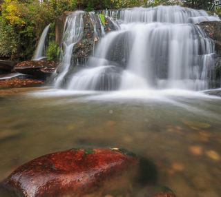 Shoal Creek FallsTransylvania County, NC7.2 miW
- French Broad FallsPrivate land with permitted public access; short path documented by three accountsTransylvania County, NC7.2 miW
- Bird Rock FallsPrivate land with permitted public access; short riverside path documented by two accountsTransylvania County, NC7.2 miW
- Lower Laurel Fork FallsUnofficial creekside path with a rock ledge; short scramble to the creekTransylvania County, NC7.3 miNW
- Twin FallsPartial: forest trail documented; road gate status near the trailhead not confirmedTransylvania County, NC7.3 miN
- Bent Field FallsShort path and deep river wade; low water onlyTransylvania County, NC7.3 miSW
- High FallsState forest trail; short walk to overlookTransylvania County, NC7.4 miE
- Boxcar FallsEstablished path with a river ford; distant view of a small fallsTransylvania County, NC7.4 miSW
- Logging Road FallsEasy walk on a gated forest roadTransylvania County, NC7.4 miNW
- Bridal Veil FallsState forest roads and trail documented by two accounts; official road work noticeTransylvania County, NC7.5 miSE
- Big Bearwallow FallsInformal roadside pullout and steep scramble pathTransylvania County, NC7.5 miSW
- Log Hollow FallsGated forest road walk; easyTransylvania County, NC7.5 miNW
- Gemini FallsPartial guide: unofficial path then a difficult trail-less climb; experienced off-trail hikers onlyTransylvania County, NC7.5 miNW
- Upper Log Hollow FallsForest road walk and steep side path in Pisgah National ForestTransylvania County, NC7.5 miNW
- Grassy Creek FallsPartial: state forest road walk; final turn to the falls not describedTransylvania County, NC7.6 miE
- Laurel Fork FallsPartial: no trail for the last half mile; difficult bushwhack52 ft (16 m) · Transylvania County, NC7.6 miNW
- Whitmire FallsTransylvania County, NC7.7 miSW
- Upper Logging Road FallsNational forest; forest road then a short off-trail climbTransylvania County, NC7.7 miNW
- Spice Cove FallsTransylvania County, NC7.7 miSW
- Lemon FallsRoadside pullout and short steep scrambleTransylvania County, NC7.7 miW
- Discovery FallsNational forest; forest road and unofficial pathTransylvania County, NC7.7 miNW
- Sassafras Knob FallsTransylvania County, NC7.8 miNW
- Shoal Creek FallsHenderson County, NC7.8 miE
- High FallsPartial guide: unofficial path and river wade; trail beyond Billy Branch not checked since HeleneTransylvania County, NC8.0 miN
- Cherry Cove FallsDetailed firsthand route on unofficial paths from a Forest Service roadTransylvania County, NC8.0 miNW
- Bennett Cove FallsPublished route on national forest land; informal side pathsTransylvania County, NC8.1 miNW
- Reece Place FallsState forest trail and old roads; creek crossing near the fallsTransylvania County, NC8.3 miS
- East Fork FallsVery short path from a small state forest pulloutTransylvania County, NC8.3 miS
- Skinny Dip FallsShort trail from a Blue Ridge Parkway overlook; creek crossing without a bridgeHaywood County, NC8.3 miNW
- Shuck Ridge Creek FallsLong Forest Service trail hike with a steep scramble to the baseTransylvania County, NC8.4 miNW
- Twin Boulder FallsLong national forest hike; last half mile on an unofficial path66 ft (20 m) · Transylvania County, NC8.4 miNW
- Jenn's FallsPartial guide: final approach is off trail and described by one firsthand sourceTransylvania County, NC8.5 miSE
- No-Name Cove FallsSide path and faint path; scramble to the upper baseTransylvania County, NC8.5 miNW
- Poundingmill Branch FallsForest road and unofficial path in Pisgah National ForestTransylvania County, NC8.6 miN
- Dark Prong FallsHaywood County, NC8.6 miNW
- Billy Branch FallsGated forest road and riverside trail; unmarked side path at the endTransylvania County, NC8.6 miN
- Yellowstone FallsNational forest trails, then a steep scramble path; base not recommended98 ft (30 m) · Haywood County, NC8.7 miNW
- Tucker Creek FallsNational forest; steep bank and creek walkTransylvania County, NC8.7 miW
- Buttermilk FallsTransylvania County, NC8.8 miS
- Second FallsResearched visit notes66 ft (20 m) · Haywood County, NC8.8 miNW
- Wintergreen FallsState forest roads and trail from Guion FarmHenderson County, NC8.9 miE
- Diamond Creek FallsTransylvania County, NC8.9 miSW
- Upper Kiesee FallsPartial guide: the access road is closed and the path may have changed since loggingTransylvania County, NC8.9 miW
- Serpentine FallsHaywood County, NC8.9 miNW
- Beetree Fork FallsDocumented road walk and bank scramble on national forest land33 ft (10 m) · Transylvania County, NC8.9 miW
- Kiesee FallsPartial guide: access road closed for storm damage; bushwhack with an exposed rock faceTransylvania County, NC8.9 miW
- Upper Beetree Fork FallsShort road walk and bank scramble from a national forest pull-offTransylvania County, NC9.0 miW
- Summey Cove FallsPartial: FS 140 closed for storm damage; view mostly blocked by treesTransylvania County, NC9.0 miW
- Lower Chestnut FallsPartial guide: access road closed for storm damage; bushwhack and creek walkTransylvania County, NC9.2 miW
- Chestnut FallsPartial guide: FR 140 closed for storm damage; long road walk and faint pathTransylvania County, NC9.2 miW
- Lamance Creek FallsTransylvania County, NC9.2 miW
- Pigeon Branch FallsPartial guide: off-trail route; the waterfall position is not publishedTransylvania County, NC9.3 miN
- Courthouse FallsApproach road closed due to storm damage; no open parking-to-falls route verified.33 ft (10 m) · Transylvania County, NC9.4 miW
- Cody FallsPartial guide: Courthouse Creek Road is closed for storm damage and foot access on it is not confirmedTransylvania County, NC9.5 miW
- Upper FallsNational forest trails from Blue Ridge Parkway overlooks; busy area49 ft (15 m) · Haywood County, NC9.5 miNW
- First FallsTransylvania County, NC9.5 miSW
- Second FallsTransylvania County, NC9.5 miSW
- Lower Greasy Cove FallsHaywood County, NC9.6 miNW
- Plaid FallsTransylvania County, NC9.6 miSW
- GPS FallsHaywood County, NC9.7 miNW
- Upper Dark Prong FallsHaywood County, NC9.7 miNW
- Eastatoe FallsTransylvania County, NC9.7 miSW
- Slab FallsHenderson County, NC9.8 miE
- Raven Cliff FallsResearched visit notesGreenville County, SC9.8 miSE
- Silver Steps FallsState park wilderness trail route and parking documentedGreenville County, SC9.8 miSE
- Barnett Branch Trail FallsShort national forest trail walk to fallsTransylvania County, NC9.8 miN
- Claypole Branch FallsTransylvania County, NC9.8 miSW
- Ivestor Ridge FallsHaywood County, NC9.9 miNW
- Little Barnett Branch Trail FallsPartial: maintained trail; the sources do not name this upper fallsTransylvania County, NC9.9 miN
- Upper Courthouse FallsPartial guide: Courthouse Creek Road is closed to vehicles, so the walk is about 4 miles each wayTransylvania County, NC10.0 miW
- Notch FallsGreenville County, SC10.0 miSE
- Bruce Knob FallsTransylvania County, NC10 miW
- Graveley FallsState forest old-road walk; two firsthand sources agree, roadside parking onlyTransylvania County, NC10 miS
- OMG FallsGreenville County, SC10 miSE
- Johnnies Creek FallsTransylvania County, NC10 miW
- Cradle FallsTransylvania County, NC10 miN
- Confluence FallsGreenville County, SC10 miSE
- Pounding Mill FallsTransylvania County, NC10 miSW
- Bluff FallsGreenville County, SC10 miSE
- Bullpen Cove FallsHaywood County, NC10 miNW
- Thunder FallsGreenville County, SC10 miSE
- Upper Toll Road FallsPartial guide: no trail above Toll Road Falls; off-trail scrambleGreenville County, SC10 miSE
- Upper Greasy Cove FallsHaywood County, NC10 miNW
- Toll Road FallsPartial guide: position from one visitor account; exact match to this listing probableGreenville County, SC10 miSE
- Red Rock FallsPartial: FS 140 closed for storm damage; old unmaintained creekside pathTransylvania County, NC10 miNW
- Arrowhead FallsTransylvania County, NC10 miS
- Jane Cantrell FallsGreenville County, SC10 miS
- Lovers FallsTransylvania County, NC10 miSW
- McCall Mill ShoalsTransylvania County, NC10 miSW
- Cliff FallsState park trail route and parking documented; trail feeGreenville County, SC11 miSE
- Firewater FallsState park trail passes the falls; trail access feeGreenville County, SC11 miSE
- Shower Bath FallsGreenville County, SC11 miSE
- Rainbow FallsOfficial state park trail to the base of the falls138 ft (42 m) · Greenville County, SC11 miSE
- Ben's SluicePartial guide: the position of Ben's Sluice beyond Jones Gap Falls comes from one visitor accountGreenville County, SC11 miSE
- John Neal FallsForest road and unofficial logging road with six creek crossingsTransylvania County, NC11 miW
- Jones Gap FallsState park trail route and parking documented; admission feeGreenville County, SC11 miSE
- Cascade FallsGreenville County, SC11 miSE
- Lower Thompson Ridge FallsTransylvania County, NC11 miN
- Upper Thompson Ridge FallsTransylvania County, NC11 miN
- Slicking FallsGreenville County, SC11 miS
- Bradley Creek FallsPartial guide: the last stretch is off trail with no marked path, and road access to the trailhead may be closedTransylvania County, NC11 miN
- Upper Bubbling Spring Branch FallsNational forest; short creekside path with several crossingsHaywood County, NC11 miNW
- Rock Cliff FallsGreenville County, SC11 miSE
- Lower Bubbling Spring Branch FallsShort unofficial creekside path with crossingsHaywood County, NC11 miNW
- Split FallsHaywood County, NC11 miNW
- Johnny Tiller FallsHenderson County, NC11 miN
- Mossy Cave FallsTransylvania County, NC11 miW
- Wildcat FallsForest trail to a bridge at the falls197 ft (60 m) · Haywood County, NC11 miNW
- Waterfalls of Flat Laurel CreekPartial: trail to the cascades documented; which cascade this listing marks is not confirmedHaywood County, NC11 miNW
- Moonshine FallsGreenville County, SC11 miSE
- Slate Rock Creek FallsPartial guide: road to the trailhead listed as closed after Hurricane HeleneHenderson County, NC11 miN
- Middle Wildcat FallsHaywood County, NC11 miNW
- Confusion FallsPartial guide: camp permission needed by phone; last section is an unmarked pathGreenville County, SC11 miSE
- Lower Wildcat FallsNational forest; steep off-trail descent and river crossing39 ft (12 m) · Haywood County, NC11 miNW
- Little Sam FallsHaywood County, NC11 miNW
- Bernie's FallsDocumented unmarked route on national forest land; route finding neededTransylvania County, NC11 miW
- Bubbling Spring Branch CascadesShort roadside scramble documented by two firsthand sourcesHaywood County, NC11 miNW
- Secret FallsGreenville County, SC11 miSE
- Drip Rock FallsPartial guide: roadside falls; the small pull-off is on a highway curveGreenville County, SC11 miSE
- Mashbox FallsPartial guide: no trail; steep off-trail descent from US 276Greenville County, SC11 miSE
- Double Branch FallsPartial guide: off trail approach with no path; most recent account is from 2017Transylvania County, NC11 miW
- Sam Branch FallsPartial guide: no trail; roadside shoulder parking; creek walk for experienced hikers only66 ft (20 m) · Haywood County, NC11 miNW
- Powerline FallsGreenville County, SC11 miSE
- Upper Bald Knob FallsJackson County, NC11 miW
- Upper Rockyface FallsTransylvania County, NC12 miW
- Little Wildcat FallsRoadside view; needs high waterHaywood County, NC12 miNW
- Hospital Rock FallsState park trail from the Jones Gap State Park office areaGreenville County, SC12 miSE
- Mount Hardy FallsUnblazed wilderness trail and short bushwhack; needs high water98 ft (30 m) · Haywood County, NC12 miNW
- Lower Rockyface FallsJackson County, NC12 miW
- Lower Bald Knob FallsJackson County, NC12 miW
- Rocky Branch FallsPartial guide: distant view only; exact listing match probableGreenville County, SC12 miSE
- Misty FallsGreenville County, SC12 miSE
- Evans FallsPartial guide: no official trail; old road and an overgrown logging gradeGreenville County, SC12 miSE
- Tanasee Creek FallsPartial guide: no maintained trail; creek walk and wade described by one sourceJackson County, NC12 miW
- Bear FallsGreenville County, SC12 miSE
- Lower Sam Branch FallsNational forest; short scramble path across a landslideHaywood County, NC12 miNW
- Wash Hollow FallsShort path with a creek crossing from a highway pull-off49 ft (15 m) · Haywood County, NC12 miNW
- Boren Mill ShoalsTransylvania County, NC12 miSW
- Sunburst FallsRoadside view from an NC 215 pullout in Pisgah National ForestHaywood County, NC12 miNW
- Tributary Three FallsJackson County, NC12 miW
- Boulderfield Falls164 ft (50 m) · Haywood County, NC12 miNW
- Eastern Stream FallsState park trail route and trailhead documented; small parking areaGreenville County, SC12 miSE
- Banded Rock FallsJackson County, NC12 miW
- Dove FallsTransylvania County, NC12 miW
- Shangri-La FallsTransylvania County, NC12 miSW
- Foremost Cove FallsGreenville County, SC12 miSE
- Ghosted FallsGreenville County, SC12 miSE
- Oil Camp FallsPartial guide: gated old road; land manager and exact drop not confirmedGreenville County, SC12 miSE
- Wildfire FallsGreenville County, SC12 miSE
- Cathey Gap FallsJackson County, NC12 miW
- Polka Dot FallsGreenville County, SC12 miSE
- Herrin Knob FallsNational forest; short road walk then off-trail bushwhackJackson County, NC12 miW
- Head Foremost FallsGreenville County, SC12 miSE
- Shiprock FallsGreenville County, SC12 miSE
- Upper Dill FallsShort steep path from the end of a seasonal forest roadJackson County, NC12 miW
- Dill FallsShort old-road walk from a seasonal forest road; three firsthand sources agreeJackson County, NC12 miW
- Lower Cavern FallsPartial: overgrown old roads, two creek wades and a bushwhack; no trailJackson County, NC12 miW
- Cavern FallsPartial: old road with wades, then a steep bushwhack with no trailJackson County, NC12 miW
- Stair Step FallsTransylvania County, NC12 miSW
- Frozen Creek ShoalsTransylvania County, NC12 miSW
- Parker Creek FallsJackson County, NC12 miW
- Mossy Cove FallsGreenville County, SC12 miSE
- Upper Buckeye FallsHaywood County, NC12 miNW
- Hog Wild Cave FallsPickens County, SC12 miSW
- Beech Bottom FallsBuilt state trail with signed parking and observation deckPickens County, SC13 miS
- Mill ShoalsTransylvania County, NC13 miW
- Upper Mill ShoalsTransylvania County, NC13 miW
- Sheephead FallsHaywood County, NC13 miNW
- Heritage FallsHeritage preserve loop trail to the top of the fallsGreenville County, SC13 miSE
- Persistence FallsPickens County, SC13 miSW
- Lower Heritage FallsGreenville County, SC13 miSE
- Upper Falls Creek FallsPartial guide: upper-section identity and final side path not confirmedGreenville County, SC13 miSE
- Firefly FallsPickens County, SC13 miS
- Falls Creek FallsMountain Bridge Wilderness trail from the Falls Creek trailheadGreenville County, SC13 miSE
- Little Bird FallsWilderness path; very short walk from NC 215Haywood County, NC13 miNW
- Upper Maple Spring Branch FallsTransylvania County, NC13 miSW
- Chute FallsGreenville County, SC13 miSE
- Bee Branch FallsNational forest trail plus a short off-trail sectionHenderson County, NC13 miN
- Lower Falls Creek FallsGreenville County, SC13 miSE
- Little East Fork FallsPartial: wilderness trail; sources give different distances to the fallsHaywood County, NC13 miNW
- Double Drop FallsPartial guide: trail to the area, then an unmarked off-trail descentTransylvania County, NC13 miSW
- Horseshoe FallsPartial: no trail to the falls; final approach is a steep bushwhackJackson County, NC13 miW
- Spider Tunnel FallsPickens County, SC13 miSE
- Upper New Millennium FallsGreenville County, SC13 miSE
- Elmo FallsTransylvania County, NC13 miW
- Emily's CascadeTransylvania County, NC13 miW
- Middle New Millennium FallsGreenville County, SC13 miSE
- Middle Cold Creek FallsJackson County, NC13 miW
- Lower New Millennium FallsGreenville County, SC13 miSE
- Upper Wildcat FallsPartial guide: view only; the path onto the upper falls is closed and the exact closure point is not describedGreenville County, SC13 miSE
- Rock Creek FallsHenderson County, NC13 miE
- The ShoalsTransylvania County, NC13 miSW
- Cleft FallsTransylvania County, NC13 miW
- Aunt Sallys Falls33 ft (10 m) · Jackson County, NC13 miW
- Havilah FallsJackson County, NC13 miW
- Ashmore FallsPreserve trail to a distant view from the Lake Wattacoo damGreenville County, SC13 miSE
- Sweet Thing On SlickumPartial guide: highway-shoulder parking and an unmarked informal pathGreenville County, SC13 miSE
- Rock Palace FallsPickens County, SC13 miS
- Stillhouse FallsTransylvania County, NC13 miW
- Devil's Canyon FallsTransylvania County, NC13 miW
- Taper FallsTransylvania County, NC13 miSW
- Buckeye FallsPartial: wilderness trail then an off-trail creek walk66 ft (20 m) · Haywood County, NC13 miNW
- Boushell FallsTransylvania County, NC13 miSW
- Maple Spring Branch FallsPartial guide: faint unofficial descent and scramble from the trailTransylvania County, NC13 miSW
- Last Falls on SlickumPartial guide: highway-shoulder parking and an unmarked informal pathPickens County, SC13 miSE
- Auger Hole FallsTransylvania County, NC13 miSW
- Yellow Patch FallsPartial guide: the last part is an off-trail descent near cliffsJackson County, NC13 miW
- Twin FallsPartial guide: off-trail route with a rope descent; park approval of the route not confirmed16 ft (5 m) · Transylvania County, NC13 miSW
- Luner FallsTransylvania County, NC13 miSW
- Toxaway FallsRoadside view from the US 64 bridge catwalks246 ft (75 m) · Transylvania County, NC13 miSW
- Indian Creek FallsTransylvania County, NC13 miSW
- Lower Balsam FallsUnofficial path with a creek crossing; difficultJackson County, NC13 miW
- Lauren FallsDifficult unofficial creek paths from a Forest Service recreation areaJackson County, NC13 miW
- Middle Wildcat FallsRoadside state wayside with stone steps beside the fallsGreenville County, SC13 miSE
- Balsam FallsPublished route on national forest land; unofficial final pathJackson County, NC13 miW
- Big Pisgah FallsJackson County, NC13 miW
- Lower Wildcat FallsRoadside falls at a state park service waysideGreenville County, SC13 miSE
- Patricia FallsDifficult unofficial creek paths from a Forest Service recreation areaJackson County, NC13 miW
- Hank Hill FallsGreenville County, SC14 miSE
- Great FallsTransylvania County, NC14 miSW
- Diamond FallsJackson County, NC14 miW
- Turley FallsHenderson County, NC14 miNE
- Laurel Blossom FallsJackson County, NC14 miW
- Wolf Mountain FallsPartial: forest road, then a steep off-trail descentJackson County, NC14 miW
- Bearpen FallsTransylvania County, NC14 miSW
- Upper Indian Creek FallsTransylvania County, NC14 miSW
- Upper Wolf Mountain FallsJackson County, NC14 miW
- Sweetest Thing FallsGreenville County, SC14 miSE
- Middle Indian Creek FallsTransylvania County, NC14 miSW
- Mossy Cove FallsPickens County, SC14 miS
- Spring Bluff FallsPartial guide: state park trail; the park trail description does not name this fallsPickens County, SC14 miS
- Rocky Bottom Gorge FallsPickens County, SC14 miS
- Green Creek FallsPartial guide: view from the Table Rock Trail; name and exact drop from one visitor accountPickens County, SC14 miS
- Lower Indian Creek FallsTransylvania County, NC14 miSW
- Lower Rhapsodie FallsUnmaintained trail with a river rock hopJackson County, NC14 miW
- Rock Bottom FallsPickens County, SC14 miS
- Bella FallsPickens County, SC14 miSW
- Evil Ducky FallsPickens County, SC14 miSW
- Lower Dismal FallsUnmaintained trail with steep sections and a boulder climb at the endJackson County, NC14 miW
- Rhapsodie FallsUnmaintained but obvious path with a river crossing and a very steep climb66 ft (20 m) · Jackson County, NC14 miW
- Carrick Creek FallsState park trail to an observation deck near the trailheadPickens County, SC14 miS
- $10,000 FallsGreenville County, SC14 miSE
- Pinball FallsGreenville County, SC14 miSE
- Irish FallsGreenville County, SC14 miSE
- Indian Ford Falls98 ft (30 m) · Transylvania County, NC14 miSW
- Sweet Pete FallsGreenville County, SC14 miSE
- Mill Creek FallsState park trail and spur documented; very strenuousPickens County, SC14 miS
- Eel Line FallsTransylvania County, NC14 miSW
- Step Around FallsTransylvania County, NC14 miSW
- Dismal FallsUnofficial, unmaintained route with ropes documented by two accounts; very strenuous131 ft (40 m) · Jackson County, NC14 miW
- Chub Line FallsPartial: state park trail then an unmarked very steep descentTransylvania County, NC14 miSW
- Poplar Hollow FallsPickens County, SC14 miS
- Pinnacle Mountain FallsPickens County, SC14 miS
- Bailey's FallsGreenville County, SC14 miSE
- Rock Creek FallsTransylvania County, NC14 miSW
- Tommy Wyche FallsGreenville County, SC14 miE
- Toxaway ShoalsTransylvania County, NC14 miSW
- Gage Creek FallsShort old-road walk documented by one firsthand source with GPSJackson County, NC14 miW
- Mountain Cat FallsPickens County, SC14 miS
- Lower Poplar Hollow FallsPickens County, SC14 miS
- Palmetto Trail FallsPickens County, SC14 miS
- Eden FallsPickens County, SC14 miS
- Sky Falls148 ft (45 m) · Transylvania County, NC14 miSW
- Wintergreen FallsState park trails, then a faint riverside path for the last half mile164 ft (50 m) · Transylvania County, NC14 miSW
- Charley Bridge FallsRoadside falls with a very steep scramble to the base, one firsthand accountJackson County, NC14 miW
- Upper Middle Prong FallsPartial guide: route is to Middle Prong Falls as a whole; the exact upper drop is not identifiedHaywood County, NC14 miNW
- Lower Bearwallow FallsPartial guide: no trail for the final descent; park position on access unclearTransylvania County, NC14 miSW
- Lower Middle Prong FallsPartial guide: steep off-trail finish; sources call this waterfall Middle Prong FallsHaywood County, NC14 miNW
- Upper Wintergreen FallsPartial guide: the last part is a long off-trail route that needs navigation skills66 ft (20 m) · Transylvania County, NC14 miSW
- Land Bridge FallsTransylvania County, NC14 miSW
- Little Deep Ford FallsTransylvania County, NC14 miSW
- Shower FallsPartial guide: roadside view of private land; almost no parkingJackson County, NC14 miW
- John Fisher FallsTransylvania County, NC14 miW
- Big Beartrap FallsDocumented wilderness approach; last half mile on a steep unofficial pathHaywood County, NC15 miNW
- Avery FallsTransylvania County, NC15 miSW
- Charley Creek FallsJackson County, NC15 miW
- Paris FallsTransylvania County, NC15 miSW
- Bear Canyon FallsState park trail then a very steep off-trail bushwhackTransylvania County, NC15 miSW
- Teds FallsTransylvania County, NC15 miSW
- Berry Branch FallsForest road walk then off-trail; final approach not described in detailHaywood County, NC15 miNW
- Bluff FallsTransylvania County, NC15 miSW
- Virginia Hawkins FallsPreserve trail route and trailhead documented; very limited parkingPickens County, SC15 miSW
- Little Beartrap FallsGated forest roads; view from the old road crossingHaywood County, NC15 miNW
- Mill Creek FallsTransylvania County, NC15 miSW
- Rocky Knob FallsJackson County, NC15 miW
- Lake FallsHenderson County, NC15 miE
- Sidewinder FallsGreenville County, SC15 miE
- The NarrowsPickens County, SC15 miS
- Tuckasegee River FallsJackson County, NC15 miW
- Upper Bearwallow FallsState park trail; short steep walk to an overlook98 ft (30 m) · Transylvania County, NC15 miSW
- Zen FallsGreenville County, SC15 miE
- Indian Branch FallsTransylvania County, NC15 miSW
- Indian Camp Branch FallsTransylvania County, NC15 miSW
- Camp McCall FallsPickens County, SC15 miS
- Raven Rock FallsJackson County, NC15 miW
- Upper Rachael Creek FallsPickens County, SC15 miS
- Anvil Horn FallsJackson County, NC15 miW
- Rachaels RacewayPickens County, SC15 miS
- Deep Ford FallsTransylvania County, NC15 miSW
- Triple FallsPickens County, SC15 miS
- Jumble FallsPickens County, SC15 miS
- Upper Yucca FallsPickens County, SC15 miS
- Yucca FallsPartial guide: off-trail bushwhack and steep scramble; parking and distance not givenPickens County, SC15 miS
- Middle Rachael Creek FallsPickens County, SC15 miS
- Lower Yucca FallsPickens County, SC15 miS
- Rachael Creek FallsPickens County, SC15 miS
- Paw Paw FallsPartial guide: off-trail route only loosely described and the exact waterfall position is not publishedTransylvania County, NC15 miSW
- Chute FallsTransylvania County, NC15 miSW
- Euphoria FallsPickens County, SC15 miS
- Split Rock FallsPartial: state park trails, a creek ford and a bushwhackTransylvania County, NC15 miSW
- Paradise FallsNational forest; steep unofficial paths and dam-controlled flowJackson County, NC15 miW
- Indian Camp FallsPartial: state park trails, a creek ford and an unmeasured bushwhack; no published distanceTransylvania County, NC15 miSW
- Slickens Creek FallsJackson County, NC15 miW
- Doe Branch FallsJackson County, NC16 miW
- Bonas Defeat FallsJackson County, NC16 miW
- Alewine FallsPickens County, SC16 miS
- Awanita Falls13 ft (4 m) · Greenville County, SC16 miSE
- Elbow FallsPanthertown trails and a defined side path from the Cold Mountain Gap accessJackson County, NC16 miW
- Lichen FallsPartial guide: river wade with no trail; location given by description onlyJackson County, NC16 miW
- Riding Ford FallsBackcountry trail route from Cold Mountain GapJackson County, NC16 miW
- Jawbone FallsNamed national forest trails, then a short informal path to the baseJackson County, NC16 miW
- Red Butt FallsNational forest trails; short unofficial path and scrambleJackson County, NC16 miW
- Grandmas Kitchen FallsJackson County, NC16 miW
- Twin FallsPartial guide: private nature preserve; the listing says hikers go at their own riskPickens County, SC16 miS
- Carlton FallsForest Service trails then an unofficial path, documented by two accountsJackson County, NC16 miSW
- Good Golly FallsPickens County, SC16 miS
- Warden FallsForest trails, then a steep scramble path to the baseJackson County, NC16 miW
- Gauley FallsPickens County, SC16 miS
- Greenland Creek FallsMarked Panthertown trails from the Cold Mountain Gap accessJackson County, NC16 miW
- Halfway FallsJackson County, NC16 miW
- Roy Taylor FallsPartial guide: no maintained trail; final approach is a short bushwhack described by one sourceJackson County, NC16 miW
- Split Rock FallsTransylvania County, NC16 miSW
- Schoolhouse FallsNational forest trailsJackson County, NC16 miW
- Mac's FallsNational forest trail; short side pathJackson County, NC16 miW
- Boomer Inn FallsHaywood County, NC16 miNW
- Pothole FallsShort backcountry trail from Cold Mountain GapJackson County, NC16 miW
- Stairway FallsState park trailhead; unofficial side path in the national forest39 ft (12 m) · Transylvania County, NC16 miSW
- Upper Sols Creek FallsPartial guide: unofficial path, and land ownership along the first part of the path is not confirmedJackson County, NC16 miW
- Turtleback FallsState park trailhead; national forest trail13 ft (4 m) · Transylvania County, NC16 miSW
- Piney Mountain FallsJackson County, NC16 miNW
- Monolith FallsPickens County, SC16 miSW
- Deception FallsPickens County, SC16 miSW
- Rainbow FallsMarked trail from Gorges State Park; steep, popular hike128 ft (39 m) · Transylvania County, NC16 miSW
- Drift FallsPublic trail to a boundary view; falls on private land33 ft (10 m) · Transylvania County, NC16 miSW
- Lower Bearwallow FallsJackson County, NC16 miNW
- Confluence FallsJackson County, NC16 miNW
- Bearwallow FallsJackson County, NC16 miNW
- Sidepocket FallsPartial guide: rough unmaintained path below Stairway Falls; route last described in detail in 200349 ft (15 m) · Transylvania County, NC16 miSW
- Little FallsTransylvania County, NC17 miSW
- Laurel Fork FallsLong Foothills Trail route to the falls overlook documentedPickens County, SC17 miSW
- Miller FallsTransylvania County, NC17 miSW
- Windy FallsPartial guide: unofficial route to the top of a dangerous falls; trail name not in the current park trail list197 ft (60 m) · Transylvania County, NC17 miSW
- Flat Creek FallsJackson County, NC17 miW
- Hen Tail FallsTransylvania County, NC17 miSW
- Rooster Tail FallsTransylvania County, NC17 miSW
- Sols Creek FallsPartial guide: falls on private land; legal view only by boat from Bear Creek LakeJackson County, NC17 miW
- Standing Up Rock FallsTransylvania County, NC17 miSW
- Mount Toxaway FallsJackson County, NC17 miSW
- Nellies FallsUnofficial trail with creek crossingsJackson County, NC17 miW
- Gladie Creek FallsJackson County, NC17 miW
- Coolidge FallsJackson County, NC17 miW
- Rockhouse FallsTransylvania County, NC17 miSW
- Panthertown Creek FallsPartial guide: the last section is an off-trail bushwhack with no pathJackson County, NC17 miW
- Granny Burrell FallsWest-entrance route and parking researchedJackson County, NC17 miW
- Rough Butt Creek FallsPartial: wet fords, faint path, and land status of the access drive not confirmedJackson County, NC17 miW
- Narrows FallsJackson County, NC17 miSW
- Cane Creek FallsPickens County, SC17 miSW
- Pleasant Ridge FallsCounty park nature trail to the falls documentedGreenville County, SC18 miSE
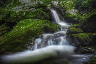 Verde FallsJackson County, NC18 miW
- Tiger Rock FallsJackson County, NC18 miW
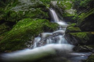 Robinson Creek FallsJackson County, NC18 miW
- Bearcamp Creek FallsPartial guide: route source is from 2006 and the match to this waterfall is probableTransylvania County, NC18 miSW
- Upper Sugar Creek FallsPartial guide: informal flagged path; road status beyond the bridge not statedJackson County, NC18 miW
- Mill Creek FallsOconee County, SC18 miSW
- Big Falls of Beechflat CreekJackson County, NC18 miNW
- Rudis FallsTransylvania County, NC18 miSW
- Frolictown FallsMarked Panthertown trails from the Salt Rock Gap accessJackson County, NC18 miW
- Sugar Creek FallsNational forest old road; creek crossingJackson County, NC18 miW
- Big Branch FallsJackson County, NC18 miW
- Dryland Laurel Branch FallsJackson County, NC18 miW
- Devils Hole Creek FallsPickens County, SC18 miSW
- Never Ending FallsPickens County, SC18 miSW
- Divinity FallsPickens County, SC18 miSW
- Great FallsJackson County, NC18 miW
- Wilderness FallsWest-entrance route; old Salt Rock shortcut closedJackson County, NC18 miW
- Hilliard FallsLong backcountry trail hike; about 12 miles returnTransylvania County, NC18 miSW
- Laurel FallsJackson County, NC18 miW
- Slatten FallsJackson County, NC18 miW
- Reid Branch FallsNational forest old road; steep side path20 ft (6 m) · Transylvania County, NC18 miSW
- Unmentionable FallsTransylvania County, NC18 miSW
- Packs FallsJackson County, NC18 miW
- Pittypat FallsJackson County, NC18 miW
- Adams Creek FallsPickens County, SC18 miS
- White Owl FallsShort roadside scramble path in national forest; wade for the best view13 ft (4 m) · Transylvania County, NC18 miSW
- Prince Cove FallsPickens County, SC18 miSW
- High FallsGated old road and unofficial side trail; river wade for the best view49 ft (15 m) · Transylvania County, NC19 miSW
- Simon FallsNational forest old road; river ford requiredTransylvania County, NC19 miSW
- Maidenhair FallsJackson County, NC19 miW
- Bestos FallsTransylvania County, NC19 miSW
- Twin FallsJackson County, NC19 miW
- Fairfield FallsJackson County, NC19 miW
- Tumblin' Fun FallsTransylvania County, NC19 miSW
- Joe Pack FallsPartial: off-trail river route; parking and distance not statedTransylvania County, NC19 miSW
- Twin FallsPartial guide: private land; only a view of the top from a public road bridge; no parking describedTransylvania County, NC19 miSW
- Rich FallsOld logging road, river wade and very steep side pathTransylvania County, NC19 miSW
- Standing Stone FallsTransylvania County, NC19 miSW
- Julie FallsJackson County, NC19 miW
- Charlie FallsJackson County, NC19 miW
- Will FallsJackson County, NC19 miW
- Big FallsPartial guide: unofficial trail, dangerous ford and scramble; parking and land permission details unconfirmed197 ft (60 m) · Transylvania County, NC19 miSW
- Hidden Dome FallsNational forest; river ford and off-trail route, very difficultTransylvania County, NC19 miSW
- John's JumpShort unofficial path from a roadside pull-off; two firsthand sources agreeTransylvania County, NC19 miSW
- Bell Park FallsCounty park trail and stairs to an observation deckHenderson County, NC19 miE
- DEW FallsNational forest; very short walk from a roadside gateTransylvania County, NC19 miSW
- Slippery Witch FallsTransylvania County, NC19 miSW
- Twin FallsJackson County, NC19 miW
- Chastine Creek FallsPartial guide: 2006 roadside account, private land on the lower road, parking unconfirmedJackson County, NC20 miW
- Powerhouse FallsHenderson County, NC20 miE
- Big FallsGreenville County, SC20 miE
- Lower Abbs Creek FallsJackson County, NC20 miW
- Mizelle FallsPickens County, SC20 miS
- Edge of the World FallsHenderson County, NC20 miE
- Silver Ribbon FallsPickens County, SC20 miS
- Allie's FallsPickens County, SC20 miS
- Fulfillment FallsJackson County, NC20 miSW
- Upper Abbs Creek FallsJackson County, NC20 miW
- Triple FallsPickens County, SC21 miS
- Wright Creek FallsPartial guide: boat access only; lake route not publishedOconee County, SC21 miSW
- Pork Chop FallsPickens County, SC21 miS
- Aggrandizement FallsTransylvania County, NC21 miSW
- Corbin Creek FallsFee recreation area; maintained trail reaches only the lowest section of a long cascadeTransylvania County, NC21 miSW
- Dana FallsTransylvania County, NC21 miSW
- Lower Whitewater FallsResearched visit notesOconee County, SC21 miSW
- Big Hole FallsTransylvania County, NC21 miSW
- Democrat Canyon FallsTransylvania County, NC21 miSW
- Upper Whitewater FallsResearched visit notes410 ft (125 m) · Transylvania County, NC21 miSW
- Waddle Branch FallsTransylvania County, NC21 miSW
- Double Spring Mountain FallsOconee County, SC21 miSW
- Glassyrock Creek FallsJackson County, NC21 miW
- Hornet FallsPartial: unofficial paths and a creek-walk; 2017 report onlyTransylvania County, NC21 miSW
- Leland FallsHenderson County, NC21 miE
- Pacolet FallsHenderson County, NC21 miE
- Merge Lane FallsPartial: unofficial paths; 2017 report onlyTransylvania County, NC21 miSW
- Case FallsPartial guide: hiker parking at the turnaround is not confirmed and post-storm conditions are unreportedHenderson County, NC21 miE
- Briefcase FallsPartial guide: bushwhack finish, hiker parking permission uncertain, storm damage unverifiedHenderson County, NC22 miE
- Portage Left FallsJackson County, NC22 miSW
- 55MPH FallsTransylvania County, NC22 miSW
- Bedrock FallsTransylvania County, NC22 miSW
- Catamount FallsJackson County, NC22 miW
- Spelunker FallsPickens County, SC22 miS
- Wheelchair Accessable FallsJackson County, NC22 miSW
- Crosscut FallsPickens County, SC22 miS
- Big Ledge FallsJackson County, NC22 miSW
- Lower Hungry River FallsPartial guide: post-Helene route goes down a landslide; conditions last checked late 2024Henderson County, NC22 miE
- Exit FallsTransylvania County, NC22 miSW
- Noisy FallsJackson County, NC22 miSW
- Entrance FallsTransylvania County, NC22 miSW
- Moses Creek FallsUnsigned path with creek crossings; wade in high waterJackson County, NC22 miW
- Nasty FallsPartial guide: no trail; creek walk, informal parking, distance not publishedTransylvania County, NC22 miSW
- Onion Cliff FallsJackson County, NC22 miW
- FR89 FallsJackson County, NC22 miSW
- Upper Silver Run FallsShort trail, then a steep root climb and informal pathJackson County, NC22 miSW
- Doghobble FallsJackson County, NC22 miSW
- Silver Run FallsResearched walking route26 ft (8 m) · Jackson County, NC22 miSW
- Poe Creek FallsPartial guide: name conflict; Waterfall Hero calls this point Upper Poe Creek FallsPickens County, SC22 miS
- Middle Poe Creek FallsState park trail route and trailhead documentedPickens County, SC22 miS
- Upper Hungry River FallsRoadside view and short path on Green River Game LandHenderson County, NC22 miE
- Lower Poe Creek FallsState park trail route and trailhead documentedPickens County, SC22 miS
- Sunshine FallsGame land trail and extremely steep roped path to the riverPolk County, NC22 miE
- Coyote FallsShort unofficial path from a highway pullout; two firsthand sources agreeJackson County, NC22 miSW
- Pulliam Creek FallsPartial guide: the last stretch up Pulliam Creek and current game land access are not confirmedPolk County, NC22 miE
- Pearson's FallsAdvance reservation required89 ft (27 m) · Polk County, NC23 miE
- Betsy FallsJackson County, NC23 miW
- Grassy Creek FallsJackson County, NC23 miW
- Bad Creek FallsOconee County, SC23 miSW
- Fishtop FallsPartial: short game land path; access road status after Helene unconfirmedPolk County, NC23 miE
- Hurricane FallsJackson County, NC23 miW
- Clearwater FallsPickens County, SC23 miS
- Rainbow FallsJackson County, NC23 miW
- Oleta FallsHenderson County, NC23 miE
- Silver Slip FallsJackson County, NC23 miSW
- Emily FallsGame land trail; short easy walkPolk County, NC24 miE
- Loobie FallsPolk County, NC24 miE
- Stairstep FallsGame land trails with a creek crossing and steep scramblePolk County, NC24 miE
- Onion FallsJackson County, NC24 miW
- Cashiers Sliding RockShort trail from a small roadside lot at the Chattooga River bridgeJackson County, NC24 miSW
- Breakbone FallsJackson County, NC24 miW
- Norton FallsPartial guide: boat access only; launch point and parking not identifiedJackson County, NC24 miW
- Slatten Branch FallsOconee County, SC24 miSW
- Hidden FallsPartial guide: boat access only; marina parking and boating distance not publishedJackson County, NC24 miW
- First FallsJackson County, NC24 miW
- High FallsBuilt trail with stairs from Pines Recreation Area; flow depends on dam releases98 ft (30 m) · Jackson County, NC24 miW
- Puncheon Camp Creek FallsHenderson County, NC24 miNE
- Upper Sloan Bridge FallsPartial guide: steep scramble path; which drop the sources describe is not confirmedOconee County, SC24 miSW
- Lower Sloan Bridge FallsOconee County, SC24 miSW
- Hiker's Peril FallsOfficial long-distance trail and picnic area parking documentedOconee County, SC24 miSW
- Hatcher FallsPartial guide: distant view only from an unofficial trail on private land; the falls are on private property33 ft (10 m) · Jackson County, NC24 miW
- Pleasant Grove Church FallsJackson County, NC24 miSW
- Big Fall Creek FallsPolk County, NC25 miE
- Upper Melrose FallsPolk County, NC25 miE
- Melrose FallsPartial guide: open trail, but road access affected by the US 176 closurePolk County, NC25 miE
- Hemlock ShoalsPolk County, NC25 miE
- Corkscrew FallsJackson County, NC25 miSW
- Little Bradley FallsPolk Trails marks the trail open; creek crossings required.49 ft (15 m) · Polk County, NC25 miE
- Mill Creek FallsPartial: boat-only waterfall; launch point and current cruise details not confirmedJackson County, NC25 miW
- Big Bradley FallsWritten approval required; trail organization reports Helene closure75 ft (23 m) · Polk County, NC25 miE
- Game Land FallsPolk County, NC25 miE
- Bee Cove FallsPartial guide: final approach off-trail; listing match probableOconee County, SC25 miSW
- Wolf Creek FallsJackson County, NC25 miW
- Woodfin FallsJackson County, NC25 miNW
- Cullowhee Creek FallsJackson County, NC25 miW
- Brenda FallsGreenville County, SC26 miE
- Woodfin CascadesBlue Ridge Parkway overlook; roadside view and short scrambleJackson County, NC26 miNW
- Upper Cave FallsPartial guide: beyond the end of the official trail; steep bushwhack above Cave FallsGreenville County, SC26 miE
- Cave FallsGreenville County, SC26 miE
- Lower Cave FallsPartial guide: beyond the end of the official trail; scramble path up a side streamGreenville County, SC26 miE
- Fall Creek FallsPartial guide: boat access only; listing match probableOconee County, SC26 miSW
- Upper Scotsman Creek FallsNational forest; roadside parking and a short off-trail descentJackson County, NC26 miSW
- Milton Bradley FallsPartial: access road closed after Helene; route documented before the stormPolk County, NC26 miE
- Scotsman Creek FallsPartial: no real trail; very steep unofficial path from the roadJackson County, NC26 miSW
- Lower Scotsman Creek FallsPartial guide: no trail below Scotsman Falls; wading and bushwhacking from 2005 directionsJackson County, NC26 miSW
- Bradley Cooper FallsPolk County, NC26 miE
- Moonshiners FallsPartial guide: beyond the end of the official trail; river crossing and short scrambleGreenville County, SC26 miE
- Marilou Bradley FallsPartial: pre-Helene route; access road under repairPolk County, NC26 miE
- Fowler Creek FallsPartial: wilderness trail then an extremely steep bushwhackJackson County, NC26 miSW
- Lower Cavern FallsPolk County, NC26 miE
- Cavern FallsPolk County, NC26 miE
- Blue Wall FallsPartial guide: preserve trail to a waterfall view; exact match to this listing not confirmedGreenville County, SC27 miE
- Cane Creek FallsPartial guide: no trail, steep bushwhack from a gated forest roadMacon County, NC27 miSW
- Bead and Lace FallsHenderson County, NC27 miNE
- Pothole FallsRoadside bridge view; scramble to the baseMacon County, NC27 miSW
- Lyn Lowry FallsHaywood County, NC27 miNW
- Alyssa FallsHaywood County, NC27 miNW
- Campbell Creek FallsHaywood County, NC27 miNW
- Plott Hound FallsHaywood County, NC27 miNW
- Turtle Rock FallsPartial guide: informal route from one visitor description; parking not describedPolk County, NC27 miE
- Highlands FallsDistant roadside view only; the falls itself is on private club landMacon County, NC27 miSW
- Lower Buff Creek FallsJackson County, NC27 miNW
- Upper Buff Creek FallsPartial guide: long unmarked route with an off-trail finish; current conditions unknownJackson County, NC27 miNW
- Fungi FallsPartial guide: permission to walk the gated road past private land is unconfirmed; no trail; post-storm status unknownPolk County, NC27 miE
- Little Bearwallow FallsPartial guide: usual trailhead closed after Helene; long alternative with restricted road accessBuncombe County, NC28 miNE
- Rainy FallsPolk County, NC28 miE
- Spoonauger FallsSource-reviewed route and parkingOconee County, SC28 miSW
- Walkingstick FallsPartial guide: roadside view only; private land and no parking spot describedMacon County, NC28 miSW
- 10,000 Trillium FallsJackson County, NC28 miNW
- Green Grotto FallsPolk County, NC28 miE
- Dark Hollow FallsJackson County, NC28 miNW
- King Creek FallsResearched visit notes66 ft (20 m) · Oconee County, SC28 miSW
- Pinkerton Pool FallsMacon County, NC28 miSW
- Stick FallsNational forest; short bushwhack with a cliffMacon County, NC28 miSW
- Lower Stick FallsPartial: short but steep bushwhack near cliffs; no trailMacon County, NC28 miSW
- Slick Stick FallsPartial guide: no trail; bushwhack and creekwalk onlyMacon County, NC29 miSW
- Buck Creek FallsPartial guide: no trail, steep bushwhack from a gated forest roadMacon County, NC29 miW
- Sillers FallsShort path on a town greenwayPolk County, NC29 miE
- Pinky FallsPartial guide: land trust preserve; exact pull-off and trail length not confirmedMacon County, NC29 miW
- Fisher FallsTown park trail with free trailhead permit; trailside viewJackson County, NC29 miNW
- Miuka FallsNational forest trail from SC 107 near Cherry HillOconee County, SC29 miSW
- Lower Miuka FallsOconee County, SC29 miSW
- Little Miuka FallsOconee County, SC29 miSW
- Little Creek FallsPartial guide: steep bushwhack finish, parking spot not describedMacon County, NC29 miSW
- Skitty Creek FallsMacon County, NC29 miW
- Crane FallsPartial guide: no published distance; informal creek pathOconee County, SC29 miSW
- Big Bend FallsNational forest trail route documented; steep final descent to the riverOconee County, SC29 miSW
- Secret FallsPartial guide: final 300 yards are cross-country with no trail markingsOconee County, SC29 miSW
- Deadfall FallsOconee County, SC29 miSW
- Prospector FallsOconee County, SC29 miSW
- Yellow Jacket FallsOconee County, SC29 miSW
- Crane Creek FallsPartial guide: off-trail bushwhack of about half a mile; no trailOconee County, SC29 miSW
- Laurel FallsMacon County, NC29 miW
- Secret FallsForest Service trail with steps to the base; road gated in winterMacon County, NC29 miSW
- Gina FallsPartial guide: no trail to the falls, difficult bushwhack from the West Fork TrailJackson County, NC29 miNW
- Lower Horse Creek FallsPolk County, NC29 miE
- Shunkawauken FallsPrivate property; roadside view only148 ft (45 m) · Polk County, NC29 miE
- Ranger FallsNational forest trail in a fee recreation areaMacon County, NC29 miW
- Crossland Creek FallsOconee County, SC29 miSW
- Lower Satulah FallsDistant roadside view from an overlook; no access closerMacon County, NC30 miSW
- Tom's FallsBuncombe County, NC30 miNE
- Lower Wash Branch FallsOconee County, SC30 miSW
- Wolf Creek FallsRutherford County, NC30 miNE
- Satulah FallsSafe stopping location unconfirmedMacon County, NC30 miSW
- Upper Wash Branch FallsOconee County, SC30 miSW
- Naiad FallsBoat access only; private land at the fallsMacon County, NC30 miSW
- Upper Pool Creek FallsRutherford County, NC30 miNE
- Pool Creek FallsRutherford County, NC30 miNE
- Camp Minnehaha FallsBuncombe County, NC30 miNE
- Silver FallsRutherford County, NC30 miNE
- Sequoah FallsRoadside view of a dam spillwayMacon County, NC30 miW