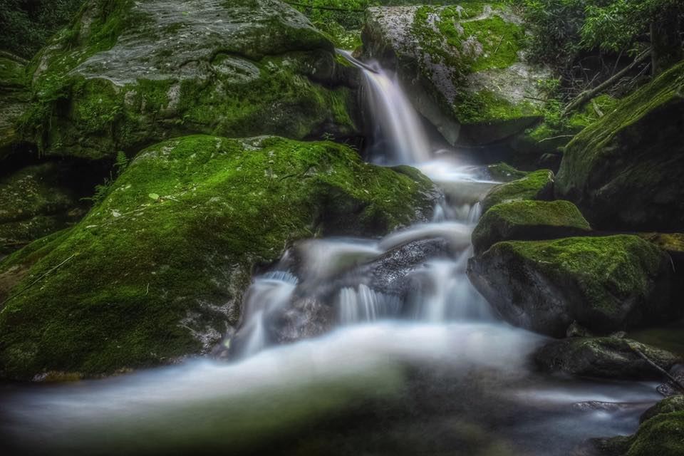
Waterfalls near Cullowhee, NC
604 named waterfalls within 30 miles of Cullowhee, closest first. Distances are straight-line from the town center.
Visits with route details
Read the walking route, starting point and current access notes.
- Moses Creek FallsUnsigned path with creek crossings; wade in high waterJackson County, NC
- Chastine Creek FallsPartial guide: 2006 roadside account, private land on the lower road, parking unconfirmedJackson County, NC
- Hatcher FallsPartial guide: distant view only from an unofficial trail on private land; the falls are on private property33 ft (10 m) · Jackson County, NC
- High FallsBuilt trail with stairs from Pines Recreation Area; flow depends on dam releases98 ft (30 m) · Jackson County, NC
- Sugar Creek FallsNational forest old road; creek crossingJackson County, NC
- Upper Buff Creek FallsPartial guide: long unmarked route with an off-trail finish; current conditions unknownJackson County, NC
- Upper Sugar Creek FallsPartial guide: informal flagged path; road status beyond the bridge not statedJackson County, NC
- Fisher FallsTown park trail with free trailhead permit; trailside viewJackson County, NC
- Rough Butt Creek FallsPartial: wet fords, faint path, and land status of the access drive not confirmedJackson County, NC
- Gina FallsPartial guide: no trail to the falls, difficult bushwhack from the West Fork TrailJackson County, NC
- Katies FallsRoadside view of a waterfall on private landMacon County, NC
- Upper Sols Creek FallsPartial guide: unofficial path, and land ownership along the first part of the path is not confirmedJackson County, NC
- Roy Taylor FallsPartial guide: no maintained trail; final approach is a short bushwhack described by one sourceJackson County, NC
- Sols Creek FallsPartial guide: falls on private land; legal view only by boat from Bear Creek LakeJackson County, NC
- Mill Creek FallsPartial: boat-only waterfall; launch point and current cruise details not confirmedJackson County, NC
- Hidden FallsPartial guide: boat access only; marina parking and boating distance not publishedJackson County, NC
- Woodfin CascadesBlue Ridge Parkway overlook; roadside view and short scrambleJackson County, NC
- Norton FallsPartial guide: boat access only; launch point and parking not identifiedJackson County, NC
- Alarka FallsPartial guide: parking is a road-end turnaround beside a private drive; parking permission unconfirmedSwain County, NC
- Nellies FallsUnofficial trail with creek crossingsJackson County, NC
- Charley Bridge FallsRoadside falls with a very steep scramble to the base, one firsthand accountJackson County, NC
- Paradise FallsNational forest; steep unofficial paths and dam-controlled flowJackson County, NC
- Gage Creek FallsShort old-road walk documented by one firsthand source with GPSJackson County, NC
- Wolf Mountain FallsPartial: forest road, then a steep off-trail descentJackson County, NC
- Patricia FallsDifficult unofficial creek paths from a Forest Service recreation areaJackson County, NC
- Balsam FallsPublished route on national forest land; unofficial final pathJackson County, NC
- Lower Balsam FallsUnofficial path with a creek crossing; difficultJackson County, NC
- Lauren FallsDifficult unofficial creek paths from a Forest Service recreation areaJackson County, NC
- Yellow Patch FallsPartial guide: the last part is an off-trail descent near cliffsJackson County, NC
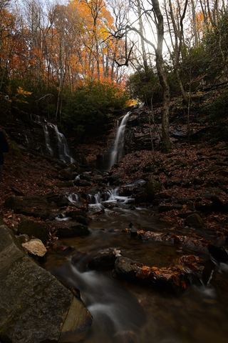 Soco FallsShort marked trail from the new EBCI parking areaJackson County, NC
- Big Beartrap FallsDocumented wilderness approach; last half mile on a steep unofficial pathHaywood County, NC
- Buck Creek FallsPartial guide: no trail, steep bushwhack from a gated forest roadMacon County, NC
- Wilderness FallsWest-entrance route; old Salt Rock shortcut closedJackson County, NC
- Frolictown FallsMarked Panthertown trails from the Salt Rock Gap accessJackson County, NC
- Horseshoe FallsPartial: no trail to the falls; final approach is a steep bushwhackJackson County, NC
- Little Beartrap FallsGated forest roads; view from the old road crossingHaywood County, NC
- Lichen FallsPartial guide: river wade with no trail; location given by description onlyJackson County, NC
- Buckeye FallsPartial: wilderness trail then an off-trail creek walk66 ft (20 m) · Haywood County, NC
- Berry Branch FallsForest road walk then off-trail; final approach not described in detailHaywood County, NC
- Red Butt FallsNational forest trails; short unofficial path and scrambleJackson County, NC
- Dill FallsShort old-road walk from a seasonal forest road; three firsthand sources agreeJackson County, NC
- Upper Dill FallsShort steep path from the end of a seasonal forest roadJackson County, NC
- Granny Burrell FallsWest-entrance route and parking researchedJackson County, NC
- Upper Middle Prong FallsPartial guide: route is to Middle Prong Falls as a whole; the exact upper drop is not identifiedHaywood County, NC
- Lower Middle Prong FallsPartial guide: steep off-trail finish; sources call this waterfall Middle Prong FallsHaywood County, NC
- Herrin Knob FallsNational forest; short road walk then off-trail bushwhackJackson County, NC
- Elbow FallsPanthertown trails and a defined side path from the Cold Mountain Gap accessJackson County, NC
- Cavern FallsPartial: old road with wades, then a steep bushwhack with no trailJackson County, NC
- Lower Cavern FallsPartial: overgrown old roads, two creek wades and a bushwhack; no trailJackson County, NC
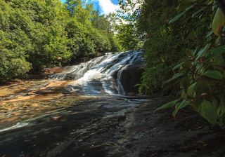 Warden FallsForest trails, then a steep scramble path to the baseJackson County, NC
- Riding Ford FallsBackcountry trail route from Cold Mountain GapJackson County, NC
- Jawbone FallsNamed national forest trails, then a short informal path to the baseJackson County, NC
- Tanasee Creek FallsPartial guide: no maintained trail; creek walk and wade described by one sourceJackson County, NC
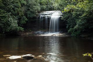 Schoolhouse FallsNational forest trailsJackson County, NC
- Panthertown Creek FallsPartial guide: the last section is an off-trail bushwhack with no pathJackson County, NC
- Rhapsodie FallsUnmaintained but obvious path with a river crossing and a very steep climb66 ft (20 m) · Jackson County, NC
- Lower Rhapsodie FallsUnmaintained trail with a river rock hopJackson County, NC
- Mount Hardy FallsUnblazed wilderness trail and short bushwhack; needs high water98 ft (30 m) · Haywood County, NC
- Cullasaja FallsRoadside viewpoint on a dangerous highway pullout documented by two accounts and the Forest ServiceMacon County, NC
- Pothole FallsShort backcountry trail from Cold Mountain GapJackson County, NC
- Mac's FallsNational forest trail; short side pathJackson County, NC
- Lower Dismal FallsUnmaintained trail with steep sections and a boulder climb at the endJackson County, NC
- Dismal FallsUnofficial, unmaintained route with ropes documented by two accounts; very strenuous131 ft (40 m) · Jackson County, NC
- Little Wildcat FallsRoadside view; needs high waterHaywood County, NC
- Lower Bubbling Spring Branch FallsShort unofficial creekside path with crossingsHaywood County, NC
- Upper Bubbling Spring Branch FallsNational forest; short creekside path with several crossingsHaywood County, NC
- Little Bird FallsWilderness path; very short walk from NC 215Haywood County, NC
- Bubbling Spring Branch CascadesShort roadside scramble documented by two firsthand sourcesHaywood County, NC
- Greenland Creek FallsMarked Panthertown trails from the Cold Mountain Gap accessJackson County, NC
- Lower Wildcat FallsNational forest; steep off-trail descent and river crossing39 ft (12 m) · Haywood County, NC
- Wildcat FallsForest trail to a bridge at the falls197 ft (60 m) · Haywood County, NC
- Double Branch FallsPartial guide: off trail approach with no path; most recent account is from 2017Transylvania County, NC
- Red Rock FallsPartial: FS 140 closed for storm damage; old unmaintained creekside pathTransylvania County, NC
- Sunburst FallsRoadside view from an NC 215 pullout in Pisgah National ForestHaywood County, NC
- Carlton FallsForest Service trails then an unofficial path, documented by two accountsJackson County, NC
- Shower FallsPartial guide: roadside view of private land; almost no parkingJackson County, NC
- Upper Courthouse FallsPartial guide: Courthouse Creek Road is closed to vehicles, so the walk is about 4 miles each wayTransylvania County, NC
- Waterfalls of Flat Laurel CreekPartial: trail to the cascades documented; which cascade this listing marks is not confirmedHaywood County, NC
- Lower Sam Branch FallsNational forest; short scramble path across a landslideHaywood County, NC
- Ranger FallsNational forest trail in a fee recreation areaMacon County, NC
- Wash Hollow FallsShort path with a creek crossing from a highway pull-off49 ft (15 m) · Haywood County, NC
- Short Creek FallsNational forest; short bushwhack up a creekMacon County, NC
- Bernie's FallsDocumented unmarked route on national forest land; route finding neededTransylvania County, NC
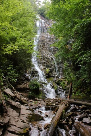 Mingo FallsResearched visit notesAbout 120 ft · Swain County, NC
- Quarry FallsSource-reviewed route and parkingMacon County, NC
- Pinky FallsPartial guide: land trust preserve; exact pull-off and trail length not confirmedMacon County, NC
- Cody FallsPartial guide: Courthouse Creek Road is closed for storm damage and foot access on it is not confirmedTransylvania County, NC
- John Neal FallsForest road and unofficial logging road with six creek crossingsTransylvania County, NC
- Sam Branch FallsPartial guide: no trail; roadside shoulder parking; creek walk for experienced hikers only66 ft (20 m) · Haywood County, NC
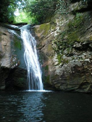 Courthouse FallsApproach road closed due to storm damage; no open parking-to-falls route verified.33 ft (10 m) · Transylvania County, NC
- Flat Creek FallsPartial guide: trail reaches only the brink; no safe viewpoint and the park discourages visitsHaywood County, NC
- Little East Fork FallsPartial: wilderness trail; sources give different distances to the fallsHaywood County, NC
- Chestnut FallsPartial guide: FR 140 closed for storm damage; long road walk and faint pathTransylvania County, NC
- Lower Chestnut FallsPartial guide: access road closed for storm damage; bushwhack and creek walkTransylvania County, NC
- Summey Cove FallsPartial: FS 140 closed for storm damage; view mostly blocked by treesTransylvania County, NC
- Upper Beetree Fork FallsShort road walk and bank scramble from a national forest pull-offTransylvania County, NC
- Scandin FallsSteep, dangerous path from a tiny highway pulloutMacon County, NC
- Beetree Fork FallsDocumented road walk and bank scramble on national forest land33 ft (10 m) · Transylvania County, NC
- Kiesee FallsPartial guide: access road closed for storm damage; bushwhack with an exposed rock faceTransylvania County, NC
- Upper Kiesee FallsPartial guide: the access road is closed and the path may have changed since loggingTransylvania County, NC
- Highlands FallsDistant roadside view only; the falls itself is on private club landMacon County, NC
- Cashiers Sliding RockShort trail from a small roadside lot at the Chattooga River bridgeJackson County, NC
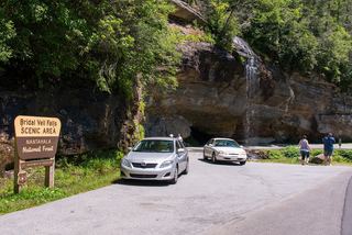 Bridal Veil FallsPull-off verified; pedestrian approach unspecified60 ft (18.3 m) · Macon County, NC
- Ray Cove FallsVery short walk on the Bartram TrailMacon County, NC
- Sequoah FallsRoadside view of a dam spillwayMacon County, NC
- Kalakaleskies FallsRoadside pullout; short path to the top of the fallsMacon County, NC
- Little Creek FallsNational park trails; long day hike; parking tag requiredSwain County, NC
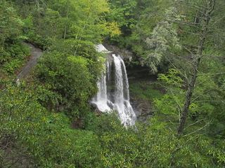 Dry FallsResearched visit notesMacon County, NC
- Upper FallsNational forest trails from Blue Ridge Parkway overlooks; busy area49 ft (15 m) · Haywood County, NC
- Naiad FallsBoat access only; private land at the fallsMacon County, NC
- Tucker Creek FallsNational forest; steep bank and creek walkTransylvania County, NC
- Tom Branch FallsEasy national park trail; parking tag required49 ft (15 m) · Swain County, NC
- Shuck Ridge Creek FallsLong Forest Service trail hike with a steep scramble to the baseTransylvania County, NC
- Indian Creek FallsOfficial park trail; parking tag required11 ft (3.5 m) · Swain County, NC
- Juney Whank FallsOfficial park trail; parking tag requiredSwain County, NC
- Coyote FallsShort unofficial path from a highway pullout; two firsthand sources agreeJackson County, NC
- Laurel Fork FallsPartial: no trail for the last half mile; difficult bushwhack52 ft (16 m) · Transylvania County, NC
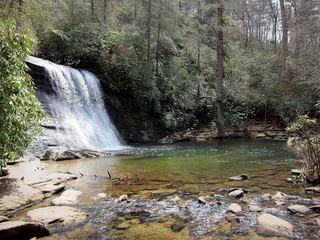 Upper Silver Run FallsShort trail, then a steep root climb and informal pathJackson County, NC
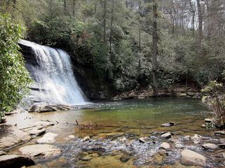 Silver Run FallsResearched walking route26 ft (8 m) · Jackson County, NC
- Gemini FallsPartial guide: unofficial path then a difficult trail-less climb; experienced off-trail hikers onlyTransylvania County, NC
- Twin Boulder FallsLong national forest hike; last half mile on an unofficial path66 ft (20 m) · Transylvania County, NC
- Second FallsResearched visit notes66 ft (20 m) · Haywood County, NC
- Lower Laurel Fork FallsUnofficial creekside path with a rock ledge; short scramble to the creekTransylvania County, NC
- Twin FallsPartial guide: private land; only a view of the top from a public road bridge; no parking describedTransylvania County, NC
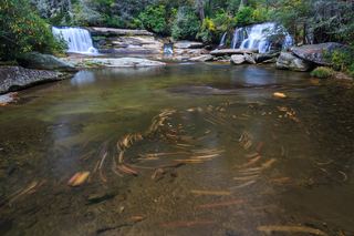 French Broad FallsPrivate land with permitted public access; short path documented by three accountsTransylvania County, NC
- Pulpit FallsPartial guide: private ministry land; access allowed per a visitor guide, owner policy not confirmedTransylvania County, NC
- Bird Rock FallsPrivate land with permitted public access; short riverside path documented by two accountsTransylvania County, NC
- Joe Pack FallsPartial: off-trail river route; parking and distance not statedTransylvania County, NC
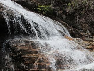 Yellowstone FallsNational forest trails, then a steep scramble path; base not recommended98 ft (30 m) · Haywood County, NC
- Toxaway FallsRoadside view from the US 64 bridge catwalks246 ft (75 m) · Transylvania County, NC
- Drift FallsPublic trail to a boundary view; falls on private land33 ft (10 m) · Transylvania County, NC
- White Owl FallsShort roadside scramble path in national forest; wade for the best view13 ft (4 m) · Transylvania County, NC
- Lemon FallsRoadside pullout and short steep scrambleTransylvania County, NC
- Skinny Dip FallsShort trail from a Blue Ridge Parkway overlook; creek crossing without a bridgeHaywood County, NC
- Walkingstick FallsPartial guide: roadside view only; private land and no parking spot describedMacon County, NC
- Upper Toms Spring FallsNational forest loop on a forest road and trailTransylvania County, NC
- Turtleback FallsState park trailhead; national forest trail13 ft (4 m) · Transylvania County, NC
- DEW FallsNational forest; very short walk from a roadside gateTransylvania County, NC
- Cane Creek FallsPartial guide: no trail, steep bushwhack from a gated forest roadMacon County, NC
- Rainbow FallsMarked trail from Gorges State Park; steep, popular hike128 ft (39 m) · Transylvania County, NC
- Twin FallsPartial guide: off-trail route with a rope descent; park approval of the route not confirmed16 ft (5 m) · Transylvania County, NC
- John's JumpShort unofficial path from a roadside pull-off; two firsthand sources agreeTransylvania County, NC
- Nasty FallsPartial guide: no trail; creek walk, informal parking, distance not publishedTransylvania County, NC
- Satulah FallsSafe stopping location unconfirmedMacon County, NC
- Hornet FallsPartial: unofficial paths and a creek-walk; 2017 report onlyTransylvania County, NC
- Upper Bearwallow FallsState park trail; short steep walk to an overlook98 ft (30 m) · Transylvania County, NC
- High FallsGated old road and unofficial side trail; river wade for the best view49 ft (15 m) · Transylvania County, NC
- Brooks Creek FallsRoadside waterfall on a gravel forest roadMacon County, NC
- Rattlesnake FallsRoadside view from above; one-car pull-off; no path to the baseSwain County, NC
- Toms Spring FallsNational forest gated road; easy walkTransylvania County, NC
- Glen FallsParking and overlook approach researchedMacon County, NC
- Merge Lane FallsPartial: unofficial paths; 2017 report onlyTransylvania County, NC
- Reid Branch FallsNational forest old road; steep side path20 ft (6 m) · Transylvania County, NC
- Long Branch FallsGated forest road walk with a short steep side path; two firsthand sources agreeTransylvania County, NC
- Lower Satulah FallsDistant roadside view from an overlook; no access closerMacon County, NC
- Little Creek FallsPartial guide: steep bushwhack finish, parking spot not describedMacon County, NC
- Bent Field FallsShort path and deep river wade; low water onlyTransylvania County, NC
- Stairway FallsState park trailhead; unofficial side path in the national forest39 ft (12 m) · Transylvania County, NC
- Boxcar FallsEstablished path with a river ford; distant view of a small fallsTransylvania County, NC
- Stick FallsNational forest; short bushwhack with a cliffMacon County, NC
- Sidepocket FallsPartial guide: rough unmaintained path below Stairway Falls; route last described in detail in 200349 ft (15 m) · Transylvania County, NC
- Cove Creek FallsForest Service trails documented by two recent accountsTransylvania County, NC
- Simon FallsNational forest old road; river ford requiredTransylvania County, NC
- Chasteen Creek CascadeNational Park Service route, distance and parking rules documentedSwain County, NC
- Lower Stick FallsPartial: short but steep bushwhack near cliffs; no trailMacon County, NC
- Slick Stick FallsPartial guide: no trail; bushwhack and creekwalk onlyMacon County, NC
- Upper Logging Road FallsNational forest; forest road then a short off-trail climbTransylvania County, NC
- Whaleback FallsNational forest; short path and a steep scramble to the riverTransylvania County, NC
- Caney Bottom FallsTrailside view on a Forest Service trail; no safe path to the baseTransylvania County, NC
- Upper Wintergreen FallsPartial guide: the last part is a long off-trail route that needs navigation skills66 ft (20 m) · Transylvania County, NC
- Barbara FallsRoadside bushwhack; private land on the far bankTransylvania County, NC
- Indian Camp FallsPartial: state park trails, a creek ford and an unmeasured bushwhack; no published distanceTransylvania County, NC
- Split Rock FallsPartial: state park trails, a creek ford and a bushwhackTransylvania County, NC
- Hidden Dome FallsNational forest; river ford and off-trail route, very difficultTransylvania County, NC
- Wintergreen FallsState park trails, then a faint riverside path for the last half mile164 ft (50 m) · Transylvania County, NC
- Logging Road FallsEasy walk on a gated forest roadTransylvania County, NC
- Paw Paw FallsPartial guide: off-trail route only loosely described and the exact waterfall position is not publishedTransylvania County, NC
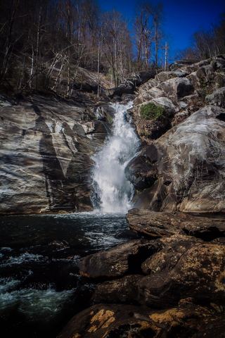 Windy FallsPartial guide: unofficial route to the top of a dangerous falls; trail name not in the current park trail list197 ft (60 m) · Transylvania County, NC
- Upper Scotsman Creek FallsNational forest; roadside parking and a short off-trail descentJackson County, NC
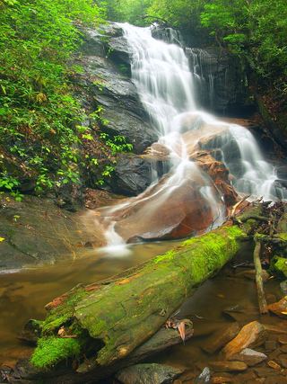 Upper Log Hollow FallsForest road walk and steep side path in Pisgah National ForestTransylvania County, NC
- Discovery FallsNational forest; forest road and unofficial pathTransylvania County, NC
- Pothole FallsRoadside bridge view; scramble to the baseMacon County, NC
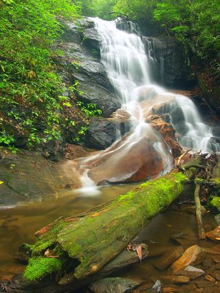 Log Hollow FallsGated forest road walk; easyTransylvania County, NC
- Scotsman Creek FallsPartial: no real trail; very steep unofficial path from the roadJackson County, NC
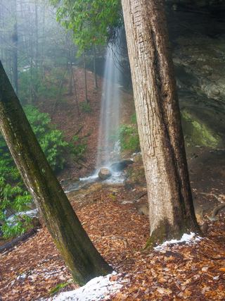 Picklesimer Rock House FallsEasy walk on a gated forest road in Nantahala National ForestMacon County, NC
- Cherry Cove FallsDetailed firsthand route on unofficial paths from a Forest Service roadTransylvania County, NC
- Grogan Creek FallsForest Service trails with a short scramble; two firsthand sources agreeTransylvania County, NC
- Cliff Branch FallsRoadside view on Newfound Gap Road with a narrow pulloutSwain County, NC
- Lower Scotsman Creek FallsPartial guide: no trail below Scotsman Falls; wading and bushwhacking from 2005 directionsJackson County, NC
- Bennett Cove FallsPublished route on national forest land; informal side pathsTransylvania County, NC
- Enloe Creek FallsPartial guide: the final quarter mile is off trail with no path, and which of two Enloe Creek falls the point marks is not confirmedSwain County, NC
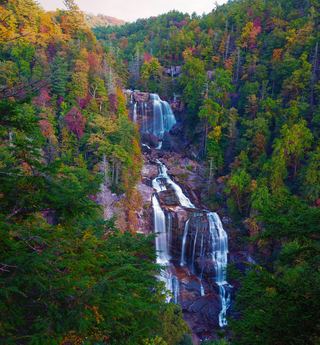 Upper Whitewater FallsResearched visit notes410 ft (125 m) · Transylvania County, NC
- Lower Rockhouse Creek FallsRoadside view with a short path; very small pull-offTransylvania County, NC
- Rich FallsOld logging road, river wade and very steep side pathTransylvania County, NC
- Middle Rockhouse Creek FallsPartial guide: 2014 description, no defined parking, steep informal pathTransylvania County, NC
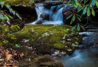 Lower Slick Rock FallsNational forest; short informal pathTransylvania County, NC
- Indian Camp Creek FallsNational forest; unmaintained path with creek fordsMacon County, NC
- Big Bearwallow FallsInformal roadside pullout and steep scramble pathTransylvania County, NC
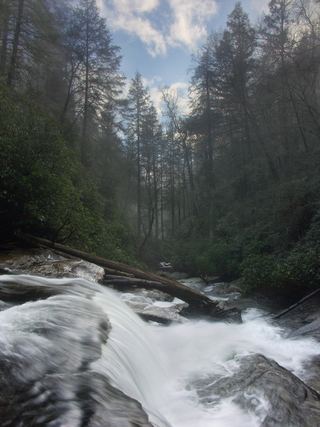 Secret FallsForest Service trail with steps to the base; road gated in winterMacon County, NC
- Upper Cedar Rock FallsNational forest trail with a short scramble at the endTransylvania County, NC
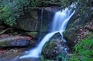 Cedar Rock FallsEstablished Forest Service trail with an unsigned side path; two firsthand sources agreeTransylvania County, NC
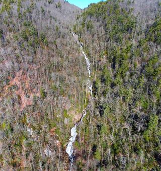 Corbin Creek FallsFee recreation area; maintained trail reaches only the lowest section of a long cascadeTransylvania County, NC
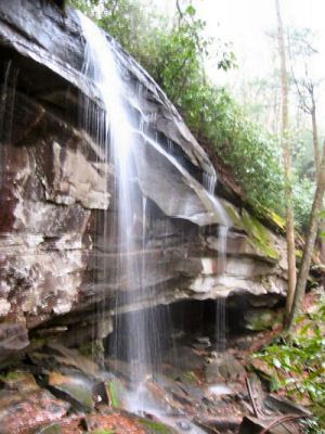 Slick Rock FallsPossible road-access closure: confirm FS 475B access and parking before visiting.Transylvania County, NC
- Chasm FallsShort but difficult; creek crossing for the base viewMacon County, NC
- Hilliard FallsLong backcountry trail hike; about 12 miles returnTransylvania County, NC
- Big FallsPartial guide: unofficial trail, dangerous ford and scramble; parking and land permission details unconfirmed197 ft (60 m) · Transylvania County, NC
- No-Name Cove FallsSide path and faint path; scramble to the upper baseTransylvania County, NC
- Double Drop FallsPartial guide: trail to the area, then an unmarked off-trail descentTransylvania County, NC
- Fowler Creek FallsPartial: wilderness trail then an extremely steep bushwhackJackson County, NC
- Little Looking Glass FallsRoadside pullout; short steep pathsTransylvania County, NC
- Poundingmill Branch FallsForest road and unofficial path in Pisgah National ForestTransylvania County, NC
- Cathey's Creek FallsShort steep path from a forest road pullout; wading for the open viewTransylvania County, NC
- Bear Canyon FallsState park trail then a very steep off-trail bushwhackTransylvania County, NC
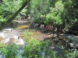 Sliding RockSource-reviewed route and parkingTransylvania County, NC
- Maple Spring Branch FallsPartial guide: faint unofficial descent and scramble from the trailTransylvania County, NC
- Chub Line FallsPartial: state park trail then an unmarked very steep descentTransylvania County, NC
- Lower Bearwallow FallsPartial guide: no trail for the final descent; park position on access unclearTransylvania County, NC
- Pigeon Branch FallsPartial guide: off-trail route; the waterfall position is not publishedTransylvania County, NC
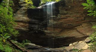 Upper Little Moore Cove FallsPartial guide: off-trail Class III bushwhack on an unofficial path beyond the Forest Service trailTransylvania County, NC
- Kuykendall FallsLong forest-road walk and steep bushwhack; route from a 2014 trekTransylvania County, NC
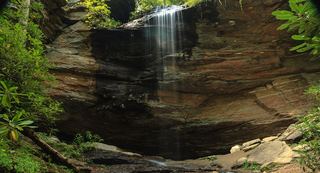 Little Moore Cove FallsNational forest trail and short informal side path; post-Helene condition unverified26 ft (8 m) · Transylvania County, NC
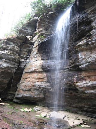 Moore Cove FallsResearched visit notes49 ft (15 m) · Transylvania County, NC
- Dome FallsPartial: no trail; extremely difficult bushwhackMacon County, NC
- Upper Sloan Bridge FallsPartial guide: steep scramble path; which drop the sources describe is not confirmedOconee County, SC
- Middle Creek FallsNational forest; unofficial path, very difficultMacon County, NC
- Bearcamp Creek FallsPartial guide: route source is from 2006 and the match to this waterfall is probableTransylvania County, NC
- Upper Middle Creek FallsShort path from a small highway pull-off to an overlookMacon County, NC
- Hiker's Peril FallsOfficial long-distance trail and picnic area parking documentedOconee County, SC
- Camp Branch FallsShort old-road walk from a gated forest roadMacon County, NC
- Upper Camp Branch FallsShort old-road walk in Nantahala National ForestMacon County, NC
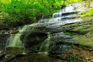 Little Barnett Branch Trail FallsPartial: maintained trail; the sources do not name this upper fallsTransylvania County, NC
- Lower Whitewater FallsResearched visit notesOconee County, SC
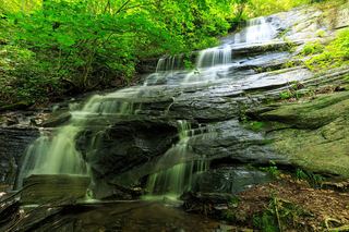 Barnett Branch Trail FallsShort national forest trail walk to fallsTransylvania County, NC
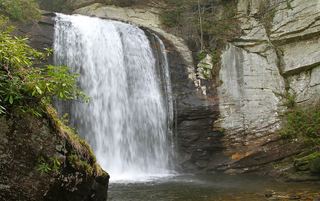 Looking Glass FallsResearched visit notes59 ft (18 m) · Transylvania County, NC
- Upper Avery Creek FallsPartial guide: forest trail route described; vehicle access on FR 477 was limited and current status is unknownTransylvania County, NC
- Townhouse FallsPartial guide: no turn-by-turn route; parking permission and railroad tunnel access not confirmedSwain County, NC
- Twin FallsPartial: forest trail documented; road gate status near the trailhead not confirmedTransylvania County, NC
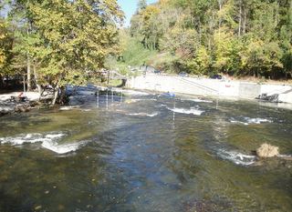 Nantahala FallsShort walk to a riverside view at an outfitter; main deck reservedSwain County, NC
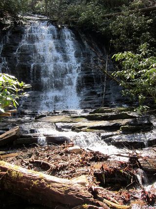 Spoonauger FallsSource-reviewed route and parkingOconee County, SC
- Avery Creek FallsNational forest trail route documentedTransylvania County, NC
- Wright Creek FallsPartial guide: boat access only; lake route not publishedOconee County, SC
- Sweat Heifer CascadesNational park trails; 7.4-mile return with a long climb back; parking tag requiredSwain County, NC
- Rufus Morgan WaterfallNational forest loop trail; seasonal forest road60 ft (18.3 m) · Macon County, NC
- Clawhammer FallsPartial guide: short off-trail finish and the FR 477 vehicle closure status is unverifiedTransylvania County, NC
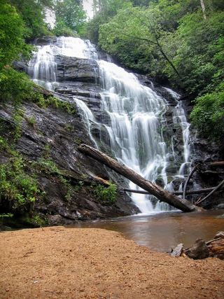 King Creek FallsResearched visit notes66 ft (20 m) · Oconee County, SC
- Bee Cove FallsPartial guide: final approach off-trail; listing match probableOconee County, SC
- Rock Slab FallsNational park trails; strenuous 6-mile return; parking tag requiredSwain County, NC
- Shot Pouch FallsShort walk on a gated forest roadMacon County, NC
- Bear Creek FallsPartial guide: the final 0.2-mile descent has no trailSwain County, NC
- Billy Branch FallsGated forest road and riverside trail; unmarked side path at the endTransylvania County, NC
- Upper Bear Creek FallsPartial: long park trail, then a steep off-trail descent to the fallsSwain County, NC
- High FallsPartial guide: unofficial path and river wade; trail beyond Billy Branch not checked since HeleneTransylvania County, NC
- Big Bend FallsNational forest trail route documented; steep final descent to the riverOconee County, SC
- Laurel Fork FallsLong Foothills Trail route to the falls overlook documentedPickens County, SC
- Bradley Creek FallsPartial guide: the last stretch is off trail with no marked path, and road access to the trailhead may be closedTransylvania County, NC
- Virginia Hawkins FallsPreserve trail route and trailhead documented; very limited parkingPickens County, SC
- Gunter Fork CascadesPartial: route closed beyond Mouse Creek Falls by storm damage; long park trail with a deep fordHaywood County, NC
- Whiteoak FallsNational forest; roadside parking and a very short pathMacon County, NC
- Nantahala CascadesRoadside parking; short steep pathMacon County, NC
- Jagged Rock FallsRoadside view near a forest road pull-offMacon County, NC
- Licklog FallsNational forest trail route and trailhead documentedOconee County, SC
- Pigpen FallsFoothills Trail and Chattooga Trail from Nicholson Ford RoadOconee County, SC
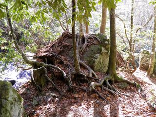 Mooney FallsResearched visit notesMacon County, NC
- The Cascades on NantahalaRoadside pull-off with a short paved pathMacon County, NC
- Laughing FallsPartial guide: informal parking at gates, no trail to the base, private land beyondTransylvania County, NC
- Miuka FallsNational forest trail from SC 107 near Cherry HillOconee County, SC
- Bee Branch FallsNational forest trail plus a short off-trail sectionHenderson County, NC
- Trickling FallsPartial guide: unofficial side path to the base; no distance givenSevier County, TN
- Beech Bottom FallsBuilt state trail with signed parking and observation deckPickens County, SC
- Crane Creek FallsPartial guide: off-trail bushwhack of about half a mile; no trailOconee County, SC
- Batson Creek FallsPublic park overlook; falls on private landTransylvania County, NC
- Ira Branch FallsPartial guide: no trail beyond the Ira Branch footbridge; winter recommendedOconee County, SC
- Connestee FallsCounty park boardwalk viewpoint; base closed to visitorsTransylvania County, NC
- Camp Branch FallsRoadside view across the river documented; winter viewing recommendedMacon County, NC
- Secret FallsPartial guide: final 300 yards are cross-country with no trail markingsOconee County, SC
- Crane FallsPartial guide: no published distance; informal creek pathOconee County, SC
- Big Laurel FallsTrailhead parking identified; seasonal road closure appliesMacon County, NC
- Slate Rock Creek FallsPartial guide: road to the trailhead listed as closed after Hurricane HeleneHenderson County, NC
- East Fork FallsVery short path from a small state forest pulloutTransylvania County, NC
- Cheohee Road FallsPartial guide: roadside falls; no parking describedOconee County, SC
- Williamson Creek FallsPartial guide: roadside view only; private land and no parking spot describedTransylvania County, NC
- Inside Passage FallsPartial: faint path and creekwalk; railroad crossing permission not statedGraham County, NC
- Graveley FallsState forest old-road walk; two firsthand sources agree, roadside parking onlyTransylvania County, NC
- Key FallsPartial guide: private land, roadside view only, parking spot not confirmedTransylvania County, NC
- Bartram FallsNational forest trail with creek crossingsGraham County, NC
- Handpole Branch FallsPartial: very difficult, trail ends above the fallsGraham County, NC
- High FallsWilderness trail; creek crossingsClay County, NC
- Ramsey CascadesNational park trail route and trailhead documented; strenuousSevier County, TN
- Twin FallsPartial guide: private nature preserve; the listing says hikers go at their own riskPickens County, SC
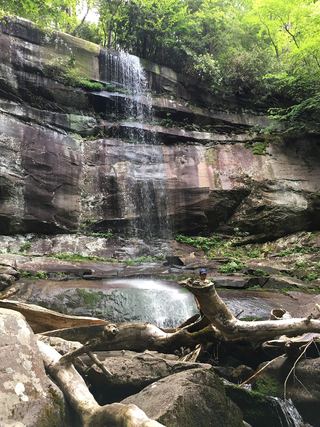 Rainbow FallsResearched visit notesSevier County, TN
- Mouse Creek FallsNational park trail; easy walk; parking tag requiredHaywood County, NC
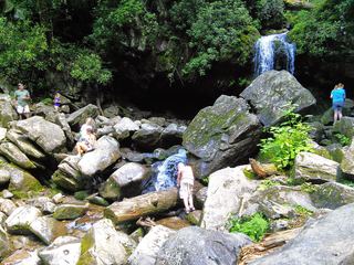 Grotto FallsResearched visit notesSevier County, TN
- Lee FallsPartial guide: no official trail; old fields and an unofficial creekside pathOconee County, SC
- Clear Creek FallsPartial: rough road and gate; permission not stated; lake route alternativeClay County, NC
- Reece Place FallsState forest trail and old roads; creek crossing near the fallsTransylvania County, NC
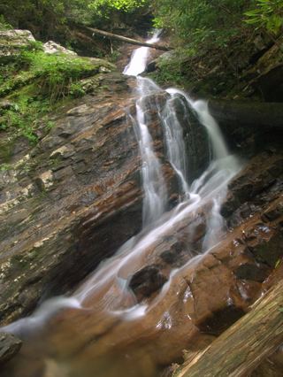 Bull Cove FallsWilderness trail with a creek crossing from a forest road trailheadClay County, NC
Closest with a photo
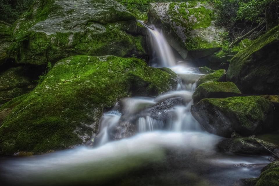
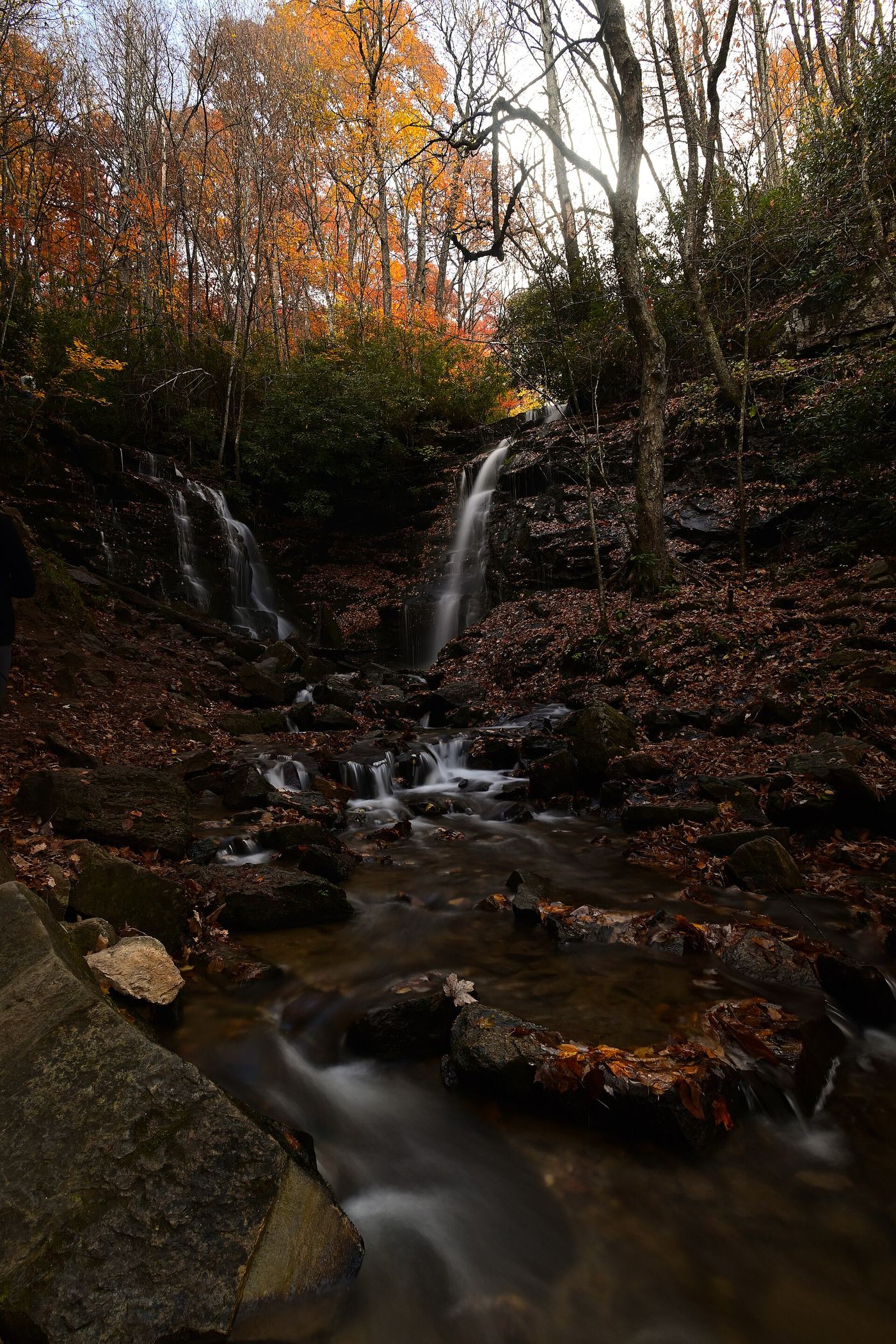
All 604 waterfalls
- Wolf Creek FallsJackson County, NC4.7 miS
- Sleepy Hollow FallsJackson County, NC4.7 miW
- Moses Creek FallsUnsigned path with creek crossings; wade in high waterJackson County, NC4.9 miNE
- Catamount FallsJackson County, NC5.6 miNE
- Cullowhee Creek FallsJackson County, NC5.7 miS
- Upper Abbs Creek FallsJackson County, NC5.7 miE
- Grassy Creek FallsJackson County, NC5.7 miSE
- Lower Abbs Creek FallsJackson County, NC5.7 miE
- Chastine Creek FallsPartial guide: 2006 roadside account, private land on the lower road, parking unconfirmedJackson County, NC6.5 miE
- Breakbone FallsJackson County, NC7.1 miS
- Betsy FallsJackson County, NC7.1 miS
- Hatcher FallsPartial guide: distant view only from an unofficial trail on private land; the falls are on private property33 ft (10 m) · Jackson County, NC7.5 miS
- Onion Cliff FallsJackson County, NC7.5 miSE
- High FallsBuilt trail with stairs from Pines Recreation Area; flow depends on dam releases98 ft (30 m) · Jackson County, NC7.7 miS
- First FallsJackson County, NC7.7 miS
- Dryland Laurel Branch FallsJackson County, NC7.9 miE
- Sugar Creek FallsNational forest old road; creek crossingJackson County, NC7.9 miE
- Lower Buff Creek FallsJackson County, NC7.9 miN
- Upper Buff Creek FallsPartial guide: long unmarked route with an off-trail finish; current conditions unknownJackson County, NC8.0 miN
- Upper Sugar Creek FallsPartial guide: informal flagged path; road status beyond the bridge not statedJackson County, NC8.0 miE
- Fisher FallsTown park trail with free trailhead permit; trailside viewJackson County, NC8.0 miN
- Onion FallsJackson County, NC8.1 miS
- 10,000 Trillium FallsJackson County, NC8.4 miN
- Dark Hollow FallsJackson County, NC8.5 miN
- Gladie Creek FallsJackson County, NC8.5 miE
- Rough Butt Creek FallsPartial: wet fords, faint path, and land status of the access drive not confirmedJackson County, NC8.7 miE
- Gina FallsPartial guide: no trail to the falls, difficult bushwhack from the West Fork TrailJackson County, NC8.7 miN
- Katies FallsRoadside view of a waterfall on private landMacon County, NC9.0 miSW
- Big Branch FallsJackson County, NC9.2 miSE
- Upper Sols Creek FallsPartial guide: unofficial path, and land ownership along the first part of the path is not confirmedJackson County, NC9.5 miE
- Roy Taylor FallsPartial guide: no maintained trail; final approach is a short bushwhack described by one sourceJackson County, NC9.5 miE
- Sols Creek FallsPartial guide: falls on private land; legal view only by boat from Bear Creek LakeJackson County, NC9.6 miSE
- Laurel FallsMacon County, NC9.6 miSW
- Mill Creek FallsPartial: boat-only waterfall; launch point and current cruise details not confirmedJackson County, NC9.6 miS
 Verde FallsJackson County, NC9.7 miSE
- Tiger Rock FallsJackson County, NC9.7 miSE
- Hidden FallsPartial guide: boat access only; marina parking and boating distance not publishedJackson County, NC9.8 miS
- Confluence FallsJackson County, NC9.8 miE
 Robinson Creek FallsJackson County, NC9.9 miSE
- Lower Bearwallow FallsJackson County, NC9.9 miE
- Bearwallow FallsJackson County, NC9.9 miE
- Piney Mountain FallsJackson County, NC10.0 miE
- Washington Creek FallsJackson County, NC10 miN
- Big Falls of Beechflat CreekJackson County, NC10 miE
- Slatten FallsJackson County, NC10 miSE
Show the other 559 waterfalls, 10 mi to 30 mi away
- Woodfin FallsJackson County, NC10 miNE
- Flat Creek FallsJackson County, NC10 miSE
- Woodfin CascadesBlue Ridge Parkway overlook; roadside view and short scrambleJackson County, NC10 miNE
- Laurel FallsJackson County, NC10 miSE
- Great FallsJackson County, NC11 miSE
- Rocky Knob FallsJackson County, NC11 miE
- Norton FallsPartial guide: boat access only; launch point and parking not identifiedJackson County, NC11 miS
- Julie FallsJackson County, NC11 miSE
- Charley Creek FallsJackson County, NC11 miE
- Alarka FallsPartial guide: parking is a road-end turnaround beside a private drive; parking permission unconfirmedSwain County, NC11 miW
- Charlie FallsJackson County, NC11 miSE
- Will FallsJackson County, NC11 miSE
- Nellies FallsUnofficial trail with creek crossingsJackson County, NC11 miSE
- Charley Bridge FallsRoadside falls with a very steep scramble to the base, one firsthand accountJackson County, NC11 miE
- Grandmas Kitchen FallsJackson County, NC11 miSE
- Twin FallsJackson County, NC11 miSE
- Paradise FallsNational forest; steep unofficial paths and dam-controlled flowJackson County, NC11 miSE
- Gage Creek FallsShort old-road walk documented by one firsthand source with GPSJackson County, NC11 miE
- Alyssa FallsHaywood County, NC12 miN
- Lyn Lowry FallsHaywood County, NC12 miN
- Campbell Creek FallsHaywood County, NC12 miN
- Glassyrock Creek FallsJackson County, NC12 miS
- Bonas Defeat FallsJackson County, NC12 miSE
- Plott Hound FallsHaywood County, NC12 miN
- Doe Branch FallsJackson County, NC12 miSE
- Slickens Creek FallsJackson County, NC12 miSE
- Pittypat FallsJackson County, NC12 miSE
- Upper Wolf Mountain FallsJackson County, NC12 miE
- Packs FallsJackson County, NC12 miSE
- Wolf Mountain FallsPartial: forest road, then a steep off-trail descentJackson County, NC12 miE
- Patricia FallsDifficult unofficial creek paths from a Forest Service recreation areaJackson County, NC12 miE
- Balsam FallsPublished route on national forest land; unofficial final pathJackson County, NC12 miE
- Lower Balsam FallsUnofficial path with a creek crossing; difficultJackson County, NC12 miE
- Lauren FallsDifficult unofficial creek paths from a Forest Service recreation areaJackson County, NC12 miE
- Yellow Patch FallsPartial guide: the last part is an off-trail descent near cliffsJackson County, NC12 miE
- Kindling FallsMacon County, NC12 miSW
- Soco FallsShort marked trail from the new EBCI parking areaJackson County, NC12 miN
- Anvil Horn FallsJackson County, NC12 miSE
- Hurricane FallsJackson County, NC13 miS
- Tuckasegee River FallsJackson County, NC13 miSE
- Boomer Inn FallsHaywood County, NC13 miE
- Big Beartrap FallsDocumented wilderness approach; last half mile on a steep unofficial pathHaywood County, NC13 miE
- Buck Creek FallsPartial guide: no trail, steep bushwhack from a gated forest roadMacon County, NC13 miS
- Wilderness FallsWest-entrance route; old Salt Rock shortcut closedJackson County, NC13 miSE
- Frolictown FallsMarked Panthertown trails from the Salt Rock Gap accessJackson County, NC13 miSE
- Horseshoe FallsPartial: no trail to the falls; final approach is a steep bushwhackJackson County, NC13 miSE
- Coolidge FallsJackson County, NC13 miSE
- Little Beartrap FallsGated forest roads; view from the old road crossingHaywood County, NC13 miE
- Lichen FallsPartial guide: river wade with no trail; location given by description onlyJackson County, NC13 miSE
- Buckeye FallsPartial: wilderness trail then an off-trail creek walk66 ft (20 m) · Haywood County, NC13 miE
- Berry Branch FallsForest road walk then off-trail; final approach not described in detailHaywood County, NC13 miE
- Red Butt FallsNational forest trails; short unofficial path and scrambleJackson County, NC13 miSE
- Dill FallsShort old-road walk from a seasonal forest road; three firsthand sources agreeJackson County, NC13 miE
- Upper Dill FallsShort steep path from the end of a seasonal forest roadJackson County, NC13 miE
- Granny Burrell FallsWest-entrance route and parking researchedJackson County, NC13 miSE
- Upper Middle Prong FallsPartial guide: route is to Middle Prong Falls as a whole; the exact upper drop is not identifiedHaywood County, NC13 miE
- Lower Middle Prong FallsPartial guide: steep off-trail finish; sources call this waterfall Middle Prong FallsHaywood County, NC13 miE
- Cathey Gap FallsJackson County, NC13 miE
- Rainbow FallsJackson County, NC13 miS
- Herrin Knob FallsNational forest; short road walk then off-trail bushwhackJackson County, NC14 miE
- Elbow FallsPanthertown trails and a defined side path from the Cold Mountain Gap accessJackson County, NC14 miSE
- Sheephead FallsHaywood County, NC14 miE
- Cavern FallsPartial: old road with wades, then a steep bushwhack with no trailJackson County, NC14 miE
- Middle Cold Creek FallsJackson County, NC14 miSE
- Lower Cavern FallsPartial: overgrown old roads, two creek wades and a bushwhack; no trailJackson County, NC14 miE
- Havilah FallsJackson County, NC14 miSE
- Upper Buckeye FallsHaywood County, NC14 miE
- Warden FallsForest trails, then a steep scramble path to the baseJackson County, NC14 miSE
- Riding Ford FallsBackcountry trail route from Cold Mountain GapJackson County, NC14 miSE
- Jawbone FallsNamed national forest trails, then a short informal path to the baseJackson County, NC14 miSE
- Tributary Three FallsJackson County, NC14 miE
- Banded Rock FallsJackson County, NC14 miE
- Tanasee Creek FallsPartial guide: no maintained trail; creek walk and wade described by one sourceJackson County, NC14 miE
- Lower Bald Knob FallsJackson County, NC14 miE
- Maidenhair FallsJackson County, NC14 miSE
- Schoolhouse FallsNational forest trailsJackson County, NC14 miSE
- Lower Rockyface FallsJackson County, NC14 miE
- Upper Bald Knob FallsJackson County, NC14 miE
- Twin FallsJackson County, NC14 miSE
- Upper Rockyface FallsTransylvania County, NC14 miE
- Parker Creek FallsJackson County, NC14 miSE
- Panthertown Creek FallsPartial guide: the last section is an off-trail bushwhack with no pathJackson County, NC14 miSE
- Rhapsodie FallsUnmaintained but obvious path with a river crossing and a very steep climb66 ft (20 m) · Jackson County, NC14 miSE
- Lower Rhapsodie FallsUnmaintained trail with a river rock hopJackson County, NC14 miSE
- Mount Hardy FallsUnblazed wilderness trail and short bushwhack; needs high water98 ft (30 m) · Haywood County, NC14 miE
- Fairfield FallsJackson County, NC15 miSE
- Cullasaja FallsRoadside viewpoint on a dangerous highway pullout documented by two accounts and the Forest ServiceMacon County, NC15 miS
- Pothole FallsShort backcountry trail from Cold Mountain GapJackson County, NC15 miSE
- Mac's FallsNational forest trail; short side pathJackson County, NC15 miSE
- Lower Dismal FallsUnmaintained trail with steep sections and a boulder climb at the endJackson County, NC15 miSE
- Dismal FallsUnofficial, unmaintained route with ropes documented by two accounts; very strenuous131 ft (40 m) · Jackson County, NC15 miSE
- Little Wildcat FallsRoadside view; needs high waterHaywood County, NC15 miE
- Aunt Sallys Falls33 ft (10 m) · Jackson County, NC15 miSE
- Crow Creek FallsMacon County, NC15 miSW
- Big Pisgah FallsJackson County, NC15 miSE
- Upper Crow Creek FallsMacon County, NC15 miSW
- Lower Bubbling Spring Branch FallsShort unofficial creekside path with crossingsHaywood County, NC15 miE
- Upper Bubbling Spring Branch FallsNational forest; short creekside path with several crossingsHaywood County, NC15 miE
- Diamond FallsJackson County, NC15 miSE
- Laurel Blossom FallsJackson County, NC15 miSE
- Little Bird FallsWilderness path; very short walk from NC 215Haywood County, NC15 miE
- Upper Mill ShoalsTransylvania County, NC15 miSE
- Bubbling Spring Branch CascadesShort roadside scramble documented by two firsthand sourcesHaywood County, NC15 miE
- Greenland Creek FallsMarked Panthertown trails from the Cold Mountain Gap accessJackson County, NC15 miSE
- Lower Wildcat FallsNational forest; steep off-trail descent and river crossing39 ft (12 m) · Haywood County, NC15 miE
- Silver Slip FallsJackson County, NC15 miS
- Split FallsHaywood County, NC15 miE
- Middle Wildcat FallsHaywood County, NC15 miE
- Little Sam FallsHaywood County, NC15 miE
- Wildcat FallsForest trail to a bridge at the falls197 ft (60 m) · Haywood County, NC15 miE
- Halfway FallsJackson County, NC15 miSE
- Double Branch FallsPartial guide: off trail approach with no path; most recent account is from 2017Transylvania County, NC15 miSE
- Raven Rock FallsJackson County, NC15 miSE
- Mill ShoalsTransylvania County, NC15 miSE
- Red Rock FallsPartial: FS 140 closed for storm damage; old unmaintained creekside pathTransylvania County, NC15 miE
- Sunburst FallsRoadside view from an NC 215 pullout in Pisgah National ForestHaywood County, NC15 miE
- Skitty Creek FallsMacon County, NC16 miS
- Carlton FallsForest Service trails then an unofficial path, documented by two accountsJackson County, NC16 miSE
- Shower FallsPartial guide: roadside view of private land; almost no parkingJackson County, NC16 miSE
- Johnnies Creek FallsTransylvania County, NC16 miE
- Mount Toxaway FallsJackson County, NC16 miSE
- Upper Courthouse FallsPartial guide: Courthouse Creek Road is closed to vehicles, so the walk is about 4 miles each wayTransylvania County, NC16 miE
- Waterfalls of Flat Laurel CreekPartial: trail to the cascades documented; which cascade this listing marks is not confirmedHaywood County, NC16 miE
- Lower Sam Branch FallsNational forest; short scramble path across a landslideHaywood County, NC16 miE
- Ranger FallsNational forest trail in a fee recreation areaMacon County, NC16 miS
- Bruce Knob FallsTransylvania County, NC16 miE
- Wash Hollow FallsShort path with a creek crossing from a highway pull-off49 ft (15 m) · Haywood County, NC16 miE
- John Fisher FallsTransylvania County, NC16 miSE
- The FallsSwain County, NC16 miW
- Dove FallsTransylvania County, NC16 miSE
- Devil's Canyon FallsTransylvania County, NC16 miSE
- Stillhouse FallsTransylvania County, NC16 miSE
- Short Creek FallsNational forest; short bushwhack up a creekMacon County, NC16 miS
- Elmo FallsTransylvania County, NC16 miSE
- Cleft FallsTransylvania County, NC16 miSE
- Emily's CascadeTransylvania County, NC16 miSE
- Mossy Cave FallsTransylvania County, NC16 miSE
- Bernie's FallsDocumented unmarked route on national forest land; route finding neededTransylvania County, NC16 miSE
- Mingo FallsResearched visit notesAbout 120 ft · Swain County, NC16 miN
- Quarry FallsSource-reviewed route and parkingMacon County, NC16 miS
- Pinky FallsPartial guide: land trust preserve; exact pull-off and trail length not confirmedMacon County, NC16 miS
- Cody FallsPartial guide: Courthouse Creek Road is closed for storm damage and foot access on it is not confirmedTransylvania County, NC16 miE
- John Neal FallsForest road and unofficial logging road with six creek crossingsTransylvania County, NC16 miSE
- Sam Branch FallsPartial guide: no trail; roadside shoulder parking; creek walk for experienced hikers only66 ft (20 m) · Haywood County, NC16 miE
- Courthouse FallsApproach road closed due to storm damage; no open parking-to-falls route verified.33 ft (10 m) · Transylvania County, NC16 miE
- Flat Creek FallsPartial guide: trail reaches only the brink; no safe viewpoint and the park discourages visitsHaywood County, NC16 miN
- Little East Fork FallsPartial: wilderness trail; sources give different distances to the fallsHaywood County, NC16 miE
- Chestnut FallsPartial guide: FR 140 closed for storm damage; long road walk and faint pathTransylvania County, NC16 miE
- Lower Chestnut FallsPartial guide: access road closed for storm damage; bushwhack and creek walkTransylvania County, NC17 miE
- Summey Cove FallsPartial: FS 140 closed for storm damage; view mostly blocked by treesTransylvania County, NC17 miE
- Upper Beetree Fork FallsShort road walk and bank scramble from a national forest pull-offTransylvania County, NC17 miE
- Scandin FallsSteep, dangerous path from a tiny highway pulloutMacon County, NC17 miS
- Mill Creek FallsTransylvania County, NC17 miSE
- Laurel FallsMacon County, NC17 miS
- Beetree Fork FallsDocumented road walk and bank scramble on national forest land33 ft (10 m) · Transylvania County, NC17 miE
- Shut In FallsMacon County, NC17 miS
- Kiesee FallsPartial guide: access road closed for storm damage; bushwhack with an exposed rock faceTransylvania County, NC17 miE
- Upper Kiesee FallsPartial guide: the access road is closed and the path may have changed since loggingTransylvania County, NC17 miE
- Highlands FallsDistant roadside view only; the falls itself is on private club landMacon County, NC17 miS
- Cashiers Sliding RockShort trail from a small roadside lot at the Chattooga River bridgeJackson County, NC17 miS
- Narrows FallsJackson County, NC17 miSE
- Bridal Veil FallsPull-off verified; pedestrian approach unspecified60 ft (18.3 m) · Macon County, NC17 miS
- Pinkerton Pool FallsMacon County, NC17 miS
- Boulderfield Falls164 ft (50 m) · Haywood County, NC17 miE
- Split Rock FallsTransylvania County, NC17 miSE
- Ray Cove FallsVery short walk on the Bartram TrailMacon County, NC17 miSW
- Sequoah FallsRoadside view of a dam spillwayMacon County, NC17 miS
- Kalakaleskies FallsRoadside pullout; short path to the top of the fallsMacon County, NC17 miS
- Fulfillment FallsJackson County, NC17 miSE
- Little Creek FallsNational park trails; long day hike; parking tag requiredSwain County, NC17 miNW
- Dry FallsResearched visit notesMacon County, NC17 miS
- Rockhouse FallsTransylvania County, NC17 miSE
- Paris FallsTransylvania County, NC17 miSE
- Avery FallsTransylvania County, NC17 miSE
- Deep Ford FallsTransylvania County, NC17 miSE
- Upper FallsNational forest trails from Blue Ridge Parkway overlooks; busy area49 ft (15 m) · Haywood County, NC17 miE
- Lamance Creek FallsTransylvania County, NC17 miSE
- Little Deep Ford FallsTransylvania County, NC17 miSE
- Naiad FallsBoat access only; private land at the fallsMacon County, NC18 miS
- Tucker Creek FallsNational forest; steep bank and creek walkTransylvania County, NC18 miE
- Tom Branch FallsEasy national park trail; parking tag required49 ft (15 m) · Swain County, NC18 miNW
- Shuck Ridge Creek FallsLong Forest Service trail hike with a steep scramble to the baseTransylvania County, NC18 miE
- Upper Greasy Cove FallsHaywood County, NC18 miE
- Indian Creek FallsOfficial park trail; parking tag required11 ft (3.5 m) · Swain County, NC18 miNW
- Corkscrew FallsJackson County, NC18 miS
- Juney Whank FallsOfficial park trail; parking tag requiredSwain County, NC18 miNW
- Miller FallsTransylvania County, NC18 miSE
- Coyote FallsShort unofficial path from a highway pullout; two firsthand sources agreeJackson County, NC18 miS
- Sassafras Knob FallsTransylvania County, NC18 miE
- Upper Dark Prong FallsHaywood County, NC18 miE
- Doghobble FallsJackson County, NC18 miS
- Laurel Fork FallsPartial: no trail for the last half mile; difficult bushwhack52 ft (16 m) · Transylvania County, NC18 miE
- Upper Silver Run FallsShort trail, then a steep root climb and informal pathJackson County, NC18 miS
- Silver Run FallsResearched walking route26 ft (8 m) · Jackson County, NC18 miS
- Little FallsTransylvania County, NC18 miSE
- Gemini FallsPartial guide: unofficial path then a difficult trail-less climb; experienced off-trail hikers onlyTransylvania County, NC18 miE
- Twin Boulder FallsLong national forest hike; last half mile on an unofficial path66 ft (20 m) · Transylvania County, NC18 miE
- Ivestor Ridge FallsHaywood County, NC19 miE
- Second FallsResearched visit notes66 ft (20 m) · Haywood County, NC19 miE
- Lower Laurel Fork FallsUnofficial creekside path with a rock ledge; short scramble to the creekTransylvania County, NC19 miE
- Twin FallsPartial guide: private land; only a view of the top from a public road bridge; no parking describedTransylvania County, NC19 miSE
- French Broad FallsPrivate land with permitted public access; short path documented by three accountsTransylvania County, NC19 miE
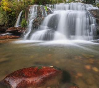 Shoal Creek FallsTransylvania County, NC19 miE
- Aggrandizement FallsTransylvania County, NC19 miSE
- Pulpit FallsPartial guide: private ministry land; access allowed per a visitor guide, owner policy not confirmedTransylvania County, NC19 miE
- GPS FallsHaywood County, NC19 miE
- Bird Rock FallsPrivate land with permitted public access; short riverside path documented by two accountsTransylvania County, NC19 miE
- Joe Pack FallsPartial: off-trail river route; parking and distance not statedTransylvania County, NC19 miSE
- Dana FallsTransylvania County, NC19 miSE
- Yellowstone FallsNational forest trails, then a steep scramble path; base not recommended98 ft (30 m) · Haywood County, NC19 miE
- Bestos FallsTransylvania County, NC19 miSE
- Serpentine FallsHaywood County, NC19 miE
- Democrat Canyon FallsTransylvania County, NC19 miSE
- Lower Greasy Cove FallsHaywood County, NC19 miE
- Toxaway FallsRoadside view from the US 64 bridge catwalks246 ft (75 m) · Transylvania County, NC19 miSE
- Drift FallsPublic trail to a boundary view; falls on private land33 ft (10 m) · Transylvania County, NC19 miSE
- Slippery Witch FallsTransylvania County, NC19 miSE
- White Owl FallsShort roadside scramble path in national forest; wade for the best view13 ft (4 m) · Transylvania County, NC19 miSE
- Lemon FallsRoadside pullout and short steep scrambleTransylvania County, NC19 miSE
- Skinny Dip FallsShort trail from a Blue Ridge Parkway overlook; creek crossing without a bridgeHaywood County, NC19 miE
- Walkingstick FallsPartial guide: roadside view only; private land and no parking spot describedMacon County, NC19 miS
- Upper Toms Spring FallsNational forest loop on a forest road and trailTransylvania County, NC19 miE
- Turtleback FallsState park trailhead; national forest trail13 ft (4 m) · Transylvania County, NC19 miSE
- Dark Prong FallsHaywood County, NC19 miE
- DEW FallsNational forest; very short walk from a roadside gateTransylvania County, NC19 miSE
- Tumblin' Fun FallsTransylvania County, NC19 miSE
- Cane Creek FallsPartial guide: no trail, steep bushwhack from a gated forest roadMacon County, NC19 miS
- Rainbow FallsMarked trail from Gorges State Park; steep, popular hike128 ft (39 m) · Transylvania County, NC19 miSE
- Twin FallsPartial guide: off-trail route with a rope descent; park approval of the route not confirmed16 ft (5 m) · Transylvania County, NC19 miSE
- John's JumpShort unofficial path from a roadside pull-off; two firsthand sources agreeTransylvania County, NC19 miSE
- Nasty FallsPartial guide: no trail; creek walk, informal parking, distance not publishedTransylvania County, NC20 miS
- Big Hole FallsTransylvania County, NC20 miSE
- Entrance FallsTransylvania County, NC20 miS
- Lovers FallsTransylvania County, NC20 miSE
- Satulah FallsSafe stopping location unconfirmedMacon County, NC20 miS
- Exit FallsTransylvania County, NC20 miS
- Hornet FallsPartial: unofficial paths and a creek-walk; 2017 report onlyTransylvania County, NC20 miSE
- Upper Bearwallow FallsState park trail; short steep walk to an overlook98 ft (30 m) · Transylvania County, NC20 miSE
- Bedrock FallsTransylvania County, NC20 miSE
- Fountain Branch FallsSwain County, NC20 miN
- High FallsGated old road and unofficial side trail; river wade for the best view49 ft (15 m) · Transylvania County, NC20 miSE
- Brooks Creek FallsRoadside waterfall on a gravel forest roadMacon County, NC20 miS
- Rattlesnake FallsRoadside view from above; one-car pull-off; no path to the baseSwain County, NC20 miW
- Buckshot FallsSwain County, NC20 miN
- Toms Spring FallsNational forest gated road; easy walkTransylvania County, NC20 miE
- Glen FallsParking and overlook approach researchedMacon County, NC20 miS
- Pleasant Grove Church FallsJackson County, NC20 miS
- Merge Lane FallsPartial: unofficial paths; 2017 report onlyTransylvania County, NC20 miSE
- Reid Branch FallsNational forest old road; steep side path20 ft (6 m) · Transylvania County, NC20 miSE
- Long Branch FallsGated forest road walk with a short steep side path; two firsthand sources agreeTransylvania County, NC20 miE
- Lower Satulah FallsDistant roadside view from an overlook; no access closerMacon County, NC20 miS
- J. Johnson FallsSwain County, NC20 miW
- Little Creek FallsPartial guide: steep bushwhack finish, parking spot not describedMacon County, NC20 miS
- Big Boy FallsSwain County, NC20 miN
- Blue Valley FallsMacon County, NC20 miS
- Bent Field FallsShort path and deep river wade; low water onlyTransylvania County, NC20 miSE
- Stairway FallsState park trailhead; unofficial side path in the national forest39 ft (12 m) · Transylvania County, NC20 miSE
- FR89 FallsJackson County, NC20 miS
- Noisy FallsJackson County, NC20 miS
- Great Blue Heron FallsSwain County, NC20 miN
- Unmentionable FallsTransylvania County, NC20 miSE
- Indian Creek FallsTransylvania County, NC20 miSE
- 55MPH FallsTransylvania County, NC20 miSE
- Island Slide FallsSwain County, NC20 miN
- McCall Mill ShoalsTransylvania County, NC20 miSE
- First FallsTransylvania County, NC20 miSE
- Upper Indian Creek FallsTransylvania County, NC20 miSE
- Middle Indian Creek FallsTransylvania County, NC20 miSE
- Boxcar FallsEstablished path with a river ford; distant view of a small fallsTransylvania County, NC20 miSE
- Whitewater Branch FallsSwain County, NC20 miN
- Lower Indian Creek FallsTransylvania County, NC20 miSE
- Stick FallsNational forest; short bushwhack with a cliffMacon County, NC20 miS
- Sidepocket FallsPartial guide: rough unmaintained path below Stairway Falls; route last described in detail in 200349 ft (15 m) · Transylvania County, NC20 miSE
- Cove Creek FallsForest Service trails documented by two recent accountsTransylvania County, NC20 miE
- Raven FallsSwain County, NC20 miN
- Second FallsTransylvania County, NC20 miSE
- Simon FallsNational forest old road; river ford requiredTransylvania County, NC20 miSE
- Big Ledge FallsJackson County, NC20 miSE
- Plaid FallsTransylvania County, NC20 miSE
- Chasteen Creek CascadeNational Park Service route, distance and parking rules documentedSwain County, NC20 miN
- Lower Stick FallsPartial: short but steep bushwhack near cliffs; no trailMacon County, NC20 miS
- Catstairs FallsMacon County, NC20 miS
- Slick Stick FallsPartial guide: no trail; bushwhack and creekwalk onlyMacon County, NC20 miS
- Upper Logging Road FallsNational forest; forest road then a short off-trail climbTransylvania County, NC20 miE
- Whaleback FallsNational forest; short path and a steep scramble to the riverTransylvania County, NC20 miE
- Caney Bottom FallsTrailside view on a Forest Service trail; no safe path to the baseTransylvania County, NC20 miE
- Upper Wintergreen FallsPartial guide: the last part is a long off-trail route that needs navigation skills66 ft (20 m) · Transylvania County, NC20 miSE
- Barbara FallsRoadside bushwhack; private land on the far bankTransylvania County, NC20 miE
- Indian Camp FallsPartial: state park trails, a creek ford and an unmeasured bushwhack; no published distanceTransylvania County, NC20 miSE
- Wheelchair Accessable FallsJackson County, NC20 miSE
- Grace FallsTransylvania County, NC21 miE
- Split Rock FallsPartial: state park trails, a creek ford and a bushwhackTransylvania County, NC21 miSE
- Portage Left FallsJackson County, NC21 miSE
- Hidden Dome FallsNational forest; river ford and off-trail route, very difficultTransylvania County, NC21 miSE
- Land Bridge FallsTransylvania County, NC21 miSE
- Chute FallsTransylvania County, NC21 miSE
- Waddle Branch FallsTransylvania County, NC21 miSE
- Wintergreen FallsState park trails, then a faint riverside path for the last half mile164 ft (50 m) · Transylvania County, NC21 miSE
- Logging Road FallsEasy walk on a gated forest roadTransylvania County, NC21 miE
- Paw Paw FallsPartial guide: off-trail route only loosely described and the exact waterfall position is not publishedTransylvania County, NC21 miSE
- Windy FallsPartial guide: unofficial route to the top of a dangerous falls; trail name not in the current park trail list197 ft (60 m) · Transylvania County, NC21 miSE
- Batsaw Branch FallsSwain County, NC21 miN
- Upper Scotsman Creek FallsNational forest; roadside parking and a short off-trail descentJackson County, NC21 miS
- Upper Log Hollow FallsForest road walk and steep side path in Pisgah National ForestTransylvania County, NC21 miE
- Discovery FallsNational forest; forest road and unofficial pathTransylvania County, NC21 miE
- Pothole FallsRoadside bridge view; scramble to the baseMacon County, NC21 miS
- Hitchin Post FallsSwain County, NC21 miNW
- Bluet FallsSwain County, NC21 miN
- Hen Tail FallsTransylvania County, NC21 miSE
- Pothole FallsSwain County, NC21 miN
- Log Hollow FallsGated forest road walk; easyTransylvania County, NC21 miE
- Rooster Tail FallsTransylvania County, NC21 miSE
- Scotsman Creek FallsPartial: no real trail; very steep unofficial path from the roadJackson County, NC21 miS
- Picklesimer Rock House FallsEasy walk on a gated forest road in Nantahala National ForestMacon County, NC21 miS
- Bullpen Cove FallsHaywood County, NC21 miE
- Big Rock FallsSwain County, NC21 miN
- Cherry Cove FallsDetailed firsthand route on unofficial paths from a Forest Service roadTransylvania County, NC21 miE
- Grogan Creek FallsForest Service trails with a short scramble; two firsthand sources agreeTransylvania County, NC21 miE
- Cliff Branch FallsRoadside view on Newfound Gap Road with a narrow pulloutSwain County, NC21 miNW
- Lower Scotsman Creek FallsPartial guide: no trail below Scotsman Falls; wading and bushwhacking from 2005 directionsJackson County, NC21 miS
- Lower Enloe Creek FallsSwain County, NC21 miN
- Standing Up Rock FallsTransylvania County, NC21 miSE
- Spice Cove FallsTransylvania County, NC21 miSE
- Indian Camp Branch FallsTransylvania County, NC21 miSE
- Upper Rockhouse Creek FallsTransylvania County, NC21 miE
- Diamond Creek FallsTransylvania County, NC21 miSE
- Bennett Cove FallsPublished route on national forest land; informal side pathsTransylvania County, NC21 miE
- Enloe Creek FallsPartial guide: the final quarter mile is off trail with no path, and which of two Enloe Creek falls the point marks is not confirmedSwain County, NC21 miN
- Indian Branch FallsTransylvania County, NC21 miSE
- Upper Whitewater FallsResearched visit notes410 ft (125 m) · Transylvania County, NC21 miSE
- Lower Rockhouse Creek FallsRoadside view with a short path; very small pull-offTransylvania County, NC21 miE
- Rich FallsOld logging road, river wade and very steep side pathTransylvania County, NC21 miSE
- Middle Rockhouse Creek FallsPartial guide: 2014 description, no defined parking, steep informal pathTransylvania County, NC21 miE
- Transylvania FallsTransylvania County, NC21 miE
- Big Bearpen FallsTransylvania County, NC21 miE
- Lower Slick Rock FallsNational forest; short informal pathTransylvania County, NC21 miE
- Indian Camp Creek FallsNational forest; unmaintained path with creek fordsMacon County, NC21 miW
- Big Bearwallow FallsInformal roadside pullout and steep scramble pathTransylvania County, NC21 miSE
- Cedar Rock FallsTransylvania County, NC21 miE
- Secret FallsForest Service trail with steps to the base; road gated in winterMacon County, NC21 miS
- Upper Cedar Rock FallsNational forest trail with a short scramble at the endTransylvania County, NC21 miE
- Cedar Rock FallsEstablished Forest Service trail with an unsigned side path; two firsthand sources agreeTransylvania County, NC21 miE
- Corbin Creek FallsFee recreation area; maintained trail reaches only the lowest section of a long cascadeTransylvania County, NC21 miSE
- Standing Stone FallsTransylvania County, NC21 miSE
- Slick Rock FallsPossible road-access closure: confirm FS 475B access and parking before visiting.Transylvania County, NC21 miE
- Serenity FallsMacon County, NC21 miS
- Lower Serenity FallsMacon County, NC21 miS
- Chasm FallsShort but difficult; creek crossing for the base viewMacon County, NC21 miS
- Hilliard FallsLong backcountry trail hike; about 12 miles returnTransylvania County, NC21 miSE
- Rudis FallsTransylvania County, NC22 miSE
- Big FallsPartial guide: unofficial trail, dangerous ford and scramble; parking and land permission details unconfirmed197 ft (60 m) · Transylvania County, NC22 miSE
- No-Name Cove FallsSide path and faint path; scramble to the upper baseTransylvania County, NC22 miE
- Taywa Creek CascadeSwain County, NC22 miNW
- Justus Cove FallsTransylvania County, NC22 miE
- Double Drop FallsPartial guide: trail to the area, then an unmarked off-trail descentTransylvania County, NC22 miSE
- Bluff FallsTransylvania County, NC22 miSE
- Mystery FallsTransylvania County, NC22 miE
- Fowler Creek FallsPartial: wilderness trail then an extremely steep bushwhackJackson County, NC22 miS
- Little Looking Glass FallsRoadside pullout; short steep pathsTransylvania County, NC22 miE
- Hidden FallsTransylvania County, NC22 miE
- Poundingmill Branch FallsForest road and unofficial path in Pisgah National ForestTransylvania County, NC22 miE
- Cathey's Creek FallsShort steep path from a forest road pullout; wading for the open viewTransylvania County, NC22 miE
- Bear Canyon FallsState park trail then a very steep off-trail bushwhackTransylvania County, NC22 miSE
- Sliding RockSource-reviewed route and parkingTransylvania County, NC22 miE
- Auger Hole FallsTransylvania County, NC22 miSE
- Teds FallsTransylvania County, NC22 miSE
- Maple Spring Branch FallsPartial guide: faint unofficial descent and scramble from the trailTransylvania County, NC22 miSE
- Chub Line FallsPartial: state park trail then an unmarked very steep descentTransylvania County, NC22 miSE
- Upper Maple Spring Branch FallsTransylvania County, NC22 miSE
- Tranquility FallsTransylvania County, NC22 miE
- Revels Prong FallsTransylvania County, NC22 miE
- Bird FallsSwain County, NC22 miW
- Lower Bearwallow FallsPartial guide: no trail for the final descent; park position on access unclearTransylvania County, NC22 miSE
- Pigeon Branch FallsPartial guide: off-trail route; the waterfall position is not publishedTransylvania County, NC22 miE
- Step Around FallsTransylvania County, NC22 miSE
- Upper Little Moore Cove FallsPartial guide: off-trail Class III bushwhack on an unofficial path beyond the Forest Service trailTransylvania County, NC22 miE
- Kuykendall FallsLong forest-road walk and steep bushwhack; route from a 2014 trekTransylvania County, NC22 miE
- Little Moore Cove FallsNational forest trail and short informal side path; post-Helene condition unverified26 ft (8 m) · Transylvania County, NC22 miE
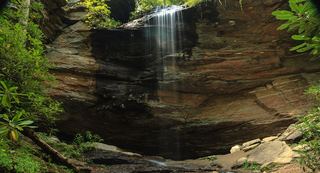 Upper Moore Cove FallsTransylvania County, NC22 miE
- Moore Cove FallsResearched visit notes49 ft (15 m) · Transylvania County, NC22 miE
- Slatten Branch FallsOconee County, SC22 miS
- Cradle FallsTransylvania County, NC23 miE
- Dome FallsPartial: no trail; extremely difficult bushwhackMacon County, NC23 miSW
- Frozen Creek ShoalsTransylvania County, NC23 miSE
- Upper Sloan Bridge FallsPartial guide: steep scramble path; which drop the sources describe is not confirmedOconee County, SC23 miS
- Middle Creek FallsNational forest; unofficial path, very difficultMacon County, NC23 miSW
- Lower Sloan Bridge FallsOconee County, SC23 miS
- Bearcamp Creek FallsPartial guide: route source is from 2006 and the match to this waterfall is probableTransylvania County, NC23 miSE
- Upper Middle Creek FallsShort path from a small highway pull-off to an overlookMacon County, NC23 miS
- Eel Line FallsTransylvania County, NC23 miSE
- Saxifrage FallsTransylvania County, NC23 miE
- Hiker's Peril FallsOfficial long-distance trail and picnic area parking documentedOconee County, SC23 miS
- Camp Branch FallsShort old-road walk from a gated forest roadMacon County, NC23 miSW
- Upper Camp Branch FallsShort old-road walk in Nantahala National ForestMacon County, NC23 miSW
- Whitetail FallsTransylvania County, NC23 miE
- Little Barnett Branch Trail FallsPartial: maintained trail; the sources do not name this upper fallsTransylvania County, NC23 miE
- Lower Whitewater FallsResearched visit notesOconee County, SC23 miSE
- Barnett Branch Trail FallsShort national forest trail walk to fallsTransylvania County, NC23 miE
- Looking Glass FallsResearched visit notes59 ft (18 m) · Transylvania County, NC23 miE
- King Creek FallsTransylvania County, NC23 miE
- Fawn Branch FallsTransylvania County, NC23 miE
- Powerline FallsTransylvania County, NC23 miE
- Bambi FallsTransylvania County, NC23 miE
- Upper Avery Creek FallsPartial guide: forest trail route described; vehicle access on FR 477 was limited and current status is unknownTransylvania County, NC23 miE
- Warrior FallsTransylvania County, NC23 miE
- Townhouse FallsPartial guide: no turn-by-turn route; parking permission and railroad tunnel access not confirmedSwain County, NC23 miW
- Wesser FallsSwain County, NC23 miW
- Mill Creek FallsOconee County, SC23 miSE
- Toxaway ShoalsTransylvania County, NC23 miSE
- Luner FallsTransylvania County, NC24 miSE
- Twin FallsPartial: forest trail documented; road gate status near the trailhead not confirmedTransylvania County, NC24 miE
- Great FallsTransylvania County, NC24 miSE
- Boushell FallsTransylvania County, NC24 miSE
- Taper FallsTransylvania County, NC24 miSE
- Stair Step FallsTransylvania County, NC24 miSE
- Nantahala FallsShort walk to a riverside view at an outfitter; main deck reservedSwain County, NC24 miW
- The ShoalsTransylvania County, NC24 miSE
- Spoonauger FallsSource-reviewed route and parkingOconee County, SC24 miS
- Avery Creek FallsNational forest trail route documentedTransylvania County, NC24 miE
- Wright Creek FallsPartial guide: boat access only; lake route not publishedOconee County, SC24 miSE
- Sweat Heifer CascadesNational park trails; 7.4-mile return with a long climb back; parking tag requiredSwain County, NC24 miNW
- Sky Falls148 ft (45 m) · Transylvania County, NC24 miSE
- Rufus Morgan WaterfallNational forest loop trail; seasonal forest road60 ft (18.3 m) · Macon County, NC24 miSW
- Boren Mill ShoalsTransylvania County, NC24 miSE
- Grassy Branch FallsSwain County, NC24 miW
- Indian Ford Falls98 ft (30 m) · Transylvania County, NC24 miSE
- Clawhammer FallsPartial guide: short off-trail finish and the FR 477 vehicle closure status is unverifiedTransylvania County, NC24 miE
- King Creek FallsResearched visit notes66 ft (20 m) · Oconee County, SC24 miS
- Rock Creek FallsTransylvania County, NC24 miSE
- Crawford Cove FallsMacon County, NC24 miSW
- Claypole Branch FallsTransylvania County, NC24 miSE
- Bearpen FallsTransylvania County, NC24 miSE
- Bee Cove FallsPartial guide: final approach off-trail; listing match probableOconee County, SC24 miS
- Rock Slab FallsNational park trails; strenuous 6-mile return; parking tag requiredSwain County, NC25 miNW
- Eastatoe FallsTransylvania County, NC25 miSE
- Shot Pouch FallsShort walk on a gated forest roadMacon County, NC25 miSW
- Upper Thompson Ridge FallsTransylvania County, NC25 miE
- Double Spring Mountain FallsOconee County, SC25 miSE
- Lower Thompson Ridge FallsTransylvania County, NC25 miE
- Bear Creek FallsPartial guide: the final 0.2-mile descent has no trailSwain County, NC25 miNW
- Steeltrap Creek FallsSwain County, NC25 miNW
- Billy Branch FallsGated forest road and riverside trail; unmarked side path at the endTransylvania County, NC25 miE
- Whitmire FallsTransylvania County, NC25 miSE
- Upper Bear Creek FallsPartial: long park trail, then a steep off-trail descent to the fallsSwain County, NC25 miNW
- High FallsPartial guide: unofficial path and river wade; trail beyond Billy Branch not checked since HeleneTransylvania County, NC25 miE
- Big Bend FallsNational forest trail route documented; steep final descent to the riverOconee County, SC25 miS
- Laurel Fork FallsLong Foothills Trail route to the falls overlook documentedPickens County, SC25 miSE
- Bradley Creek FallsPartial guide: the last stretch is off trail with no marked path, and road access to the trailhead may be closedTransylvania County, NC25 miE
- Pounding Mill FallsTransylvania County, NC25 miSE
- Jonas Creek FallsSwain County, NC26 miNW
- Hog Wild Cave FallsPickens County, SC26 miSE
- Bad Creek FallsOconee County, SC26 miSE
- Shangri-La FallsTransylvania County, NC26 miSE
- Devils Hole Creek FallsPickens County, SC26 miSE
- Bella FallsPickens County, SC26 miSE
- Evil Ducky FallsPickens County, SC26 miSE
- Persistence FallsPickens County, SC26 miSE
- Virginia Hawkins FallsPreserve trail route and trailhead documented; very limited parkingPickens County, SC26 miSE
- Arrowhead FallsTransylvania County, NC26 miSE
- Gunter Fork FallsHaywood County, NC26 miN
- Gunter Fork CascadesPartial: route closed beyond Mouse Creek Falls by storm damage; long park trail with a deep fordHaywood County, NC26 miN
- Whiteoak FallsNational forest; roadside parking and a very short pathMacon County, NC26 miW
- Nantahala CascadesRoadside parking; short steep pathMacon County, NC27 miW
- Yanu Branch CascadeSwain County, NC27 miNW
- Talking FallsSevier County, TN27 miNW
- Jagged Rock FallsRoadside view near a forest road pull-offMacon County, NC27 miW
- Licklog FallsNational forest trail route and trailhead documentedOconee County, SC27 miS
- Pigpen FallsFoothills Trail and Chattooga Trail from Nicholson Ford RoadOconee County, SC27 miS
- Upper Pigpen FallsOconee County, SC27 miS
- Mooney FallsResearched visit notesMacon County, NC27 miSW
- The Cascades on NantahalaRoadside pull-off with a short paved pathMacon County, NC27 miW
- Laughing FallsPartial guide: informal parking at gates, no trail to the base, private land beyondTransylvania County, NC27 miE
- Miuka FallsNational forest trail from SC 107 near Cherry HillOconee County, SC27 miS
- Lower Miuka FallsOconee County, SC27 miS
- Monolith FallsPickens County, SC27 miSE
- Silver Ribbon FallsTransylvania County, NC27 miE
- Bee Branch FallsNational forest trail plus a short off-trail sectionHenderson County, NC27 miE
- Trickling FallsPartial guide: unofficial side path to the base; no distance givenSevier County, TN27 miNW
- Mossy Cove FallsPickens County, SC27 miSE
- William FallsTransylvania County, NC27 miE
- Little Miuka FallsOconee County, SC27 miS
- Beech Bottom FallsBuilt state trail with signed parking and observation deckPickens County, SC27 miSE
- Deadfall FallsOconee County, SC27 miS
- Prospector FallsOconee County, SC27 miS
- Yellow Jacket FallsOconee County, SC27 miS
- Middle Batson Creek FallsTransylvania County, NC27 miE
- Cane Creek FallsPickens County, SC27 miSE
- Crane Creek FallsPartial guide: off-trail bushwhack of about half a mile; no trailOconee County, SC27 miS
- Upper Batson Creek FallsTransylvania County, NC27 miSE
- Batson Creek FallsPublic park overlook; falls on private landTransylvania County, NC27 miE
- Ira Branch FallsPartial guide: no trail beyond the Ira Branch footbridge; winter recommendedOconee County, SC27 miS
- Connestee FallsCounty park boardwalk viewpoint; base closed to visitorsTransylvania County, NC27 miE
- Camp Branch FallsRoadside view across the river documented; winter viewing recommendedMacon County, NC27 miW
- Stick Biscuit FallsTransylvania County, NC27 miE
- Dunns Rock FallsTransylvania County, NC27 miE
- Secret FallsPartial guide: final 300 yards are cross-country with no trail markingsOconee County, SC27 miS
- Deception FallsPickens County, SC27 miSE
- Buttermilk FallsTransylvania County, NC27 miSE
- Crane FallsPartial guide: no published distance; informal creek pathOconee County, SC27 miS
- Sutton FallsTransylvania County, NC27 miE
- Upper Wash Branch FallsOconee County, SC27 miS
- Little River Upper FallsSevier County, TN28 miNW
- Sitton Creek FallsTransylvania County, NC28 miE
- Lower Wash Branch FallsOconee County, SC28 miS
- Big Laurel FallsTrailhead parking identified; seasonal road closure appliesMacon County, NC28 miSW
- Slate Rock Creek FallsPartial guide: road to the trailhead listed as closed after Hurricane HeleneHenderson County, NC28 miE
- Glen Cannon FallsTransylvania County, NC28 miE
- Prince Cove FallsPickens County, SC28 miSE
- Glencannon FallsTransylvania County, NC28 miE
- East Fork FallsVery short path from a small state forest pulloutTransylvania County, NC28 miSE
- Johnny Tiller FallsHenderson County, NC28 miE
- Hazel Creek CascadesSwain County, NC28 miNW
- Cheohee Road FallsPartial guide: roadside falls; no parking describedOconee County, SC28 miS
- Rock Bottom FallsPickens County, SC28 miSE
- Crossland Creek FallsOconee County, SC28 miS
- Maidenhair FallsTransylvania County, NC28 miE
- Factory Branch FallsMacon County, NC28 miSW
- The NarrowsPickens County, SC28 miSE
- Never Ending FallsPickens County, SC28 miSE
- Rocky Bottom Gorge FallsPickens County, SC28 miSE
- Upper Mouse Creek FallsHaywood County, NC28 miN
- Divinity FallsPickens County, SC28 miSE
- Williamson Creek FallsPartial guide: roadside view only; private land and no parking spot describedTransylvania County, NC28 miE
- Rhododendron FallsTransylvania County, NC28 miE
- West Prong Mouse Creek FallsHaywood County, NC28 miN
- Phillips FallsTransylvania County, NC28 miE
- Inside Passage FallsPartial: faint path and creekwalk; railroad crossing permission not statedGraham County, NC28 miW
- Ledbetter Canyon FallsGraham County, NC28 miW
- Graveley FallsState forest old-road walk; two firsthand sources agree, roadside parking onlyTransylvania County, NC28 miSE
- The NotchGraham County, NC28 miW
- Triple FallsPickens County, SC28 miSE
- Euphoria FallsPickens County, SC29 miSE
- Key FallsPartial guide: private land, roadside view only, parking spot not confirmedTransylvania County, NC29 miE
- Bartram FallsNational forest trail with creek crossingsGraham County, NC29 miW
- Handpole Branch FallsPartial: very difficult, trail ends above the fallsGraham County, NC29 miW
- High FallsWilderness trail; creek crossingsClay County, NC29 miSW
- Ramsey CascadesNational park trail route and trailhead documented; strenuousSevier County, TN29 miN
- Firefly FallsPickens County, SC29 miSE
- Twin FallsPartial guide: private nature preserve; the listing says hikers go at their own riskPickens County, SC29 miSE
- Rainbow FallsResearched visit notesSevier County, TN29 miNW
- Camp McCall FallsPickens County, SC29 miSE
- New FallsClay County, NC29 miSW
- War Branch CascadeSevier County, TN29 miNW
- Mouse Creek FallsNational park trail; easy walk; parking tag requiredHaywood County, NC29 miN
- Rock Palace FallsPickens County, SC29 miSE
- Grotto FallsResearched visit notesSevier County, TN29 miNW
- Lee FallsPartial guide: no official trail; old fields and an unofficial creekside pathOconee County, SC29 miS
- Snider FallsOconee County, SC29 miS
- Fish Camp CascadesSevier County, TN29 miNW
- Clear Creek FallsPartial: rough road and gate; permission not stated; lake route alternativeClay County, NC29 miW
- Jane Cantrell FallsGreenville County, SC29 miSE
- Mountain Cat FallsPickens County, SC29 miSE
- Thomas FallsClay County, NC30 miSW
- Poplar Hollow FallsPickens County, SC30 miSE
- Lower Poplar Hollow FallsPickens County, SC30 miSE
- Reece Place FallsState forest trail and old roads; creek crossing near the fallsTransylvania County, NC30 miSE
- Nelsons FallsMacon County, NC30 miW
- Bull Cove FallsWilderness trail with a creek crossing from a forest road trailheadClay County, NC30 miSW
- Palmetto Trail FallsPickens County, SC30 miSE