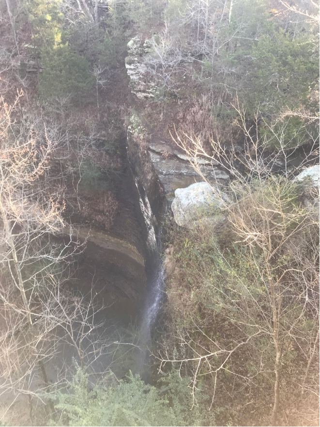
Researched walking route
Arkansas
Bridal Veil Falls
0.6 mile return
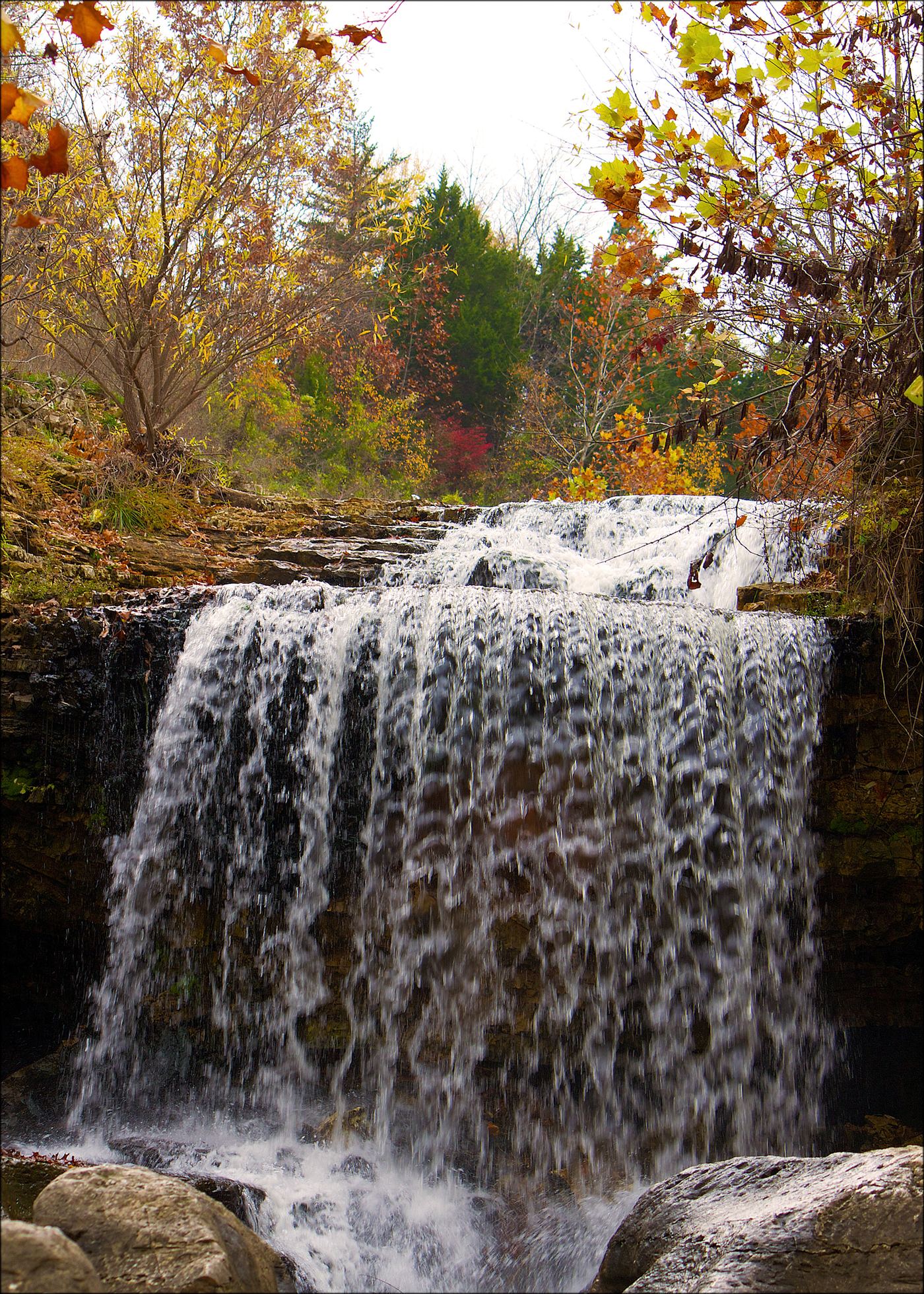
The city provides a waterfall trail, overlook and picnic tables at the signed trailhead south of Heber Springs.
Compare 156 Arkansas waterfall visits by the approach, terrain, and where to start. Some routes have closures or unresolved details; read the individual guide before travelling.
156 visit options
Researched walking route
Arkansas
0.6 mile return
The city provides a waterfall trail, overlook and picnic tables at the signed trailhead south of Heber Springs.
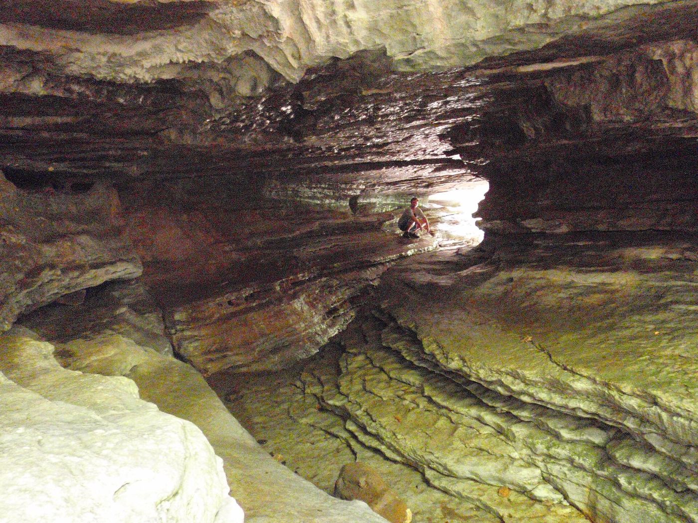
Arkansas
About 2.4 miles round trip
Follow Lost Valley Trail from the parking area, past the Natural Bridge and up stone steps toward Cob Cave and Eden Falls. This visit ends at the outdoor waterfall; the steeper cave spur is a separate extension.
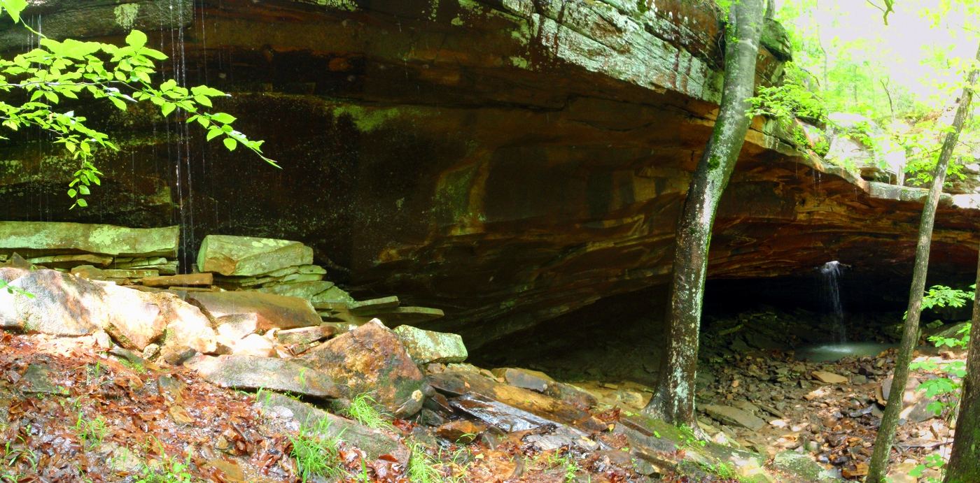
Source-reviewed route and roadside parking limitation
Arkansas
Published hike: 2 miles
Follow the old jeep road downhill toward the creek and the opening in the rock ledge. Keep back from the opening; the local tourism association describes a trail to the right that descends below it. Return uphill.
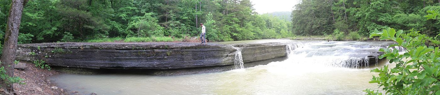
Arkansas
About 100 yards each way
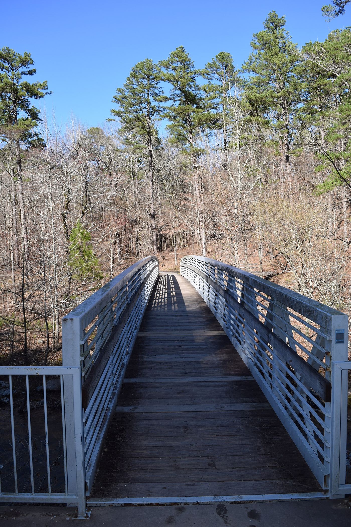
Haw Creek Falls is a small cascading waterfall inside the Forest Service's Haw Creek Falls recreation site. The Forest Service lists an accessible trail to the falls. A firsthand account says to drive counterclockwise around the campground loop and park near the two restrooms, with the falls on the right about 100 yards from the road.
Overlook route verified; parking connection from regional trail guide
Arkansas
Short overlook walk; length unclear
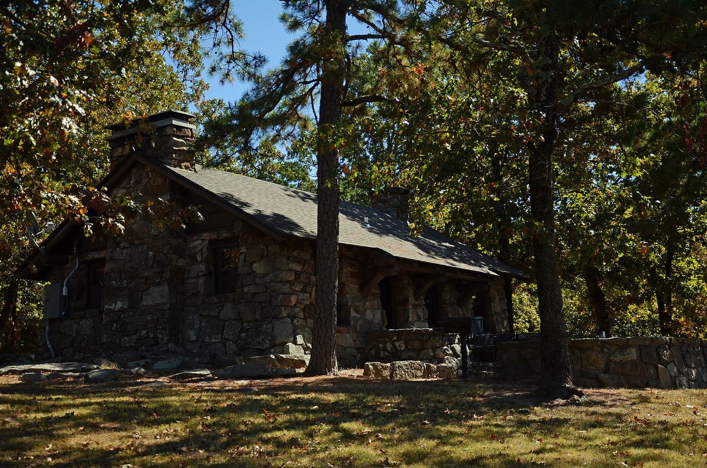
Follow the short path from picnic-area parking to the Little Missouri Falls overlook. USFS confirms the overlook trail; regional guide Explore the Ozarks supplies the parking connection.
Researched walking route
Arkansas
Up to 0.5 mile return via Gum Springs
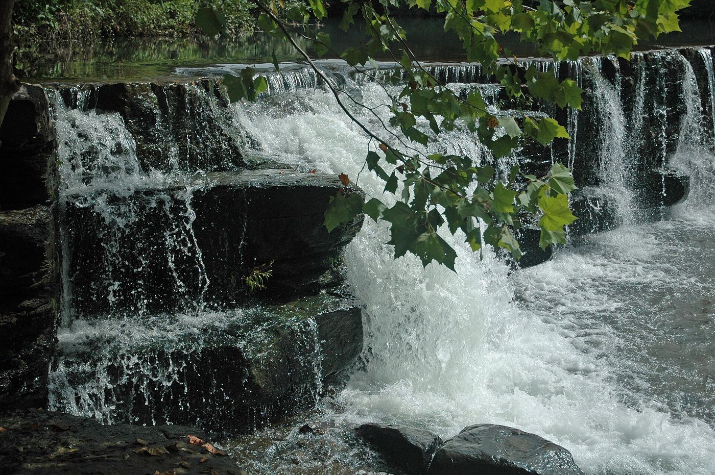
A seasonal waterfall on Mount Nebo’s steep Waterfall/Gum Springs Trail, with stone steps and an uphill return.
Roadside view and adjacent parking documented
Arkansas
Roadside view; measured walking distance unknown
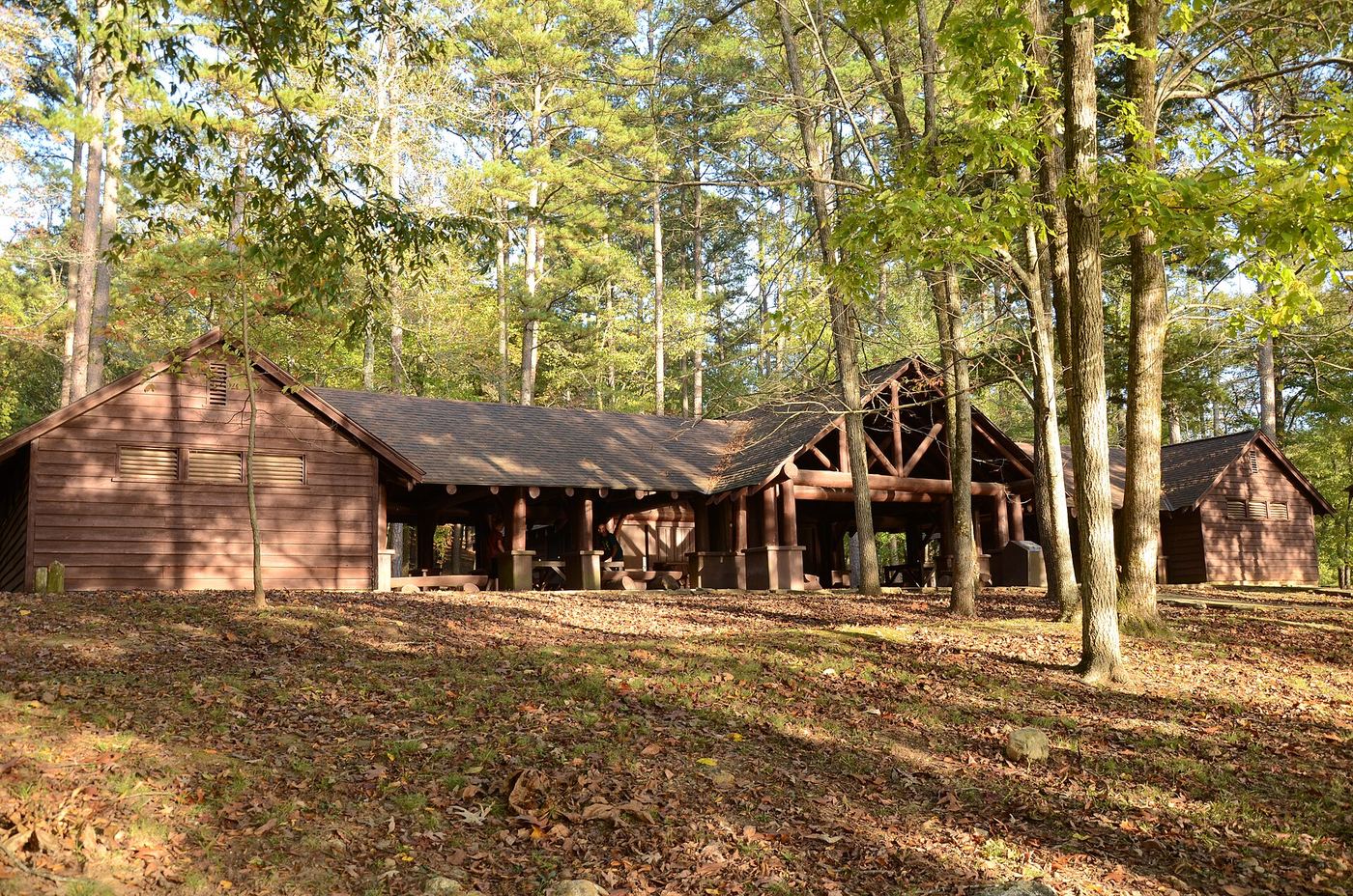
Natural Dam is a broad natural rock ledge across Mountain Fork Creek in Crawford County. Arklahoma Hiker documents viewing directly beside the road with adjacent parking.
Current overlook access unconfirmed
Arkansas
Short reported descent; distance not measured
Bryce Alexander identifies the natural cascade beside Shady Lake’s dam and describes viewing it from the overlook area with a short descent. The exact current permitted viewpoint and walking route need confirmation after changes to the recreation area.
Partial: distance from the parking lot to the falls is not stated
Arkansas
The nature trail is 2.2 miles in two parts; the distance to the falls alone is not stated in the reviewed sources
The trail starts at the parking lot about a mile west of Highway 71 on Lancashire Boulevard (Highway 340). The first quarter mile is paved, then it becomes a maintained dirt trail past a suspension bridge and limestone bluffs. A climb up a hill leads to Tanyard Creek Falls, which has an overlook. The falls are fed by Lake Windsor and flow year round, fullest in spring after rain.
Historic bushwhack; current access unverified
Arkansas
Distance not verified
Historic firsthand directions identify an off-trail waterfall hike. Current approach conditions remain unverified.
Location map; no photo available.
Firsthand route and parking documented; difficult unmarked bushwhack and creek crossing
Arkansas
Approximately 5 miles return
The firsthand route leaves Dahl Memorial parking on an old jeep road, stays straight past the swamp, and turns left at the 0.8-mile T junction. Beyond the field, it descends through woods to the creek and Leaning Log Falls, crosses Adkins Creek, then follows it downstream to the tributary canyon and upper falls. Return the same way.
Location map; no photo available.
Partial: exact final approach remains unresolved
Arkansas
Approximately 0.7–0.75 miles return for Amber Falls only.
Two firsthand accounts describe starting behind the Upper Buffalo Wilderness sign on Cave Mountain Road and descending toward Whitaker Creek. There is no official trail. The accounts reach different points on the creek, so do not assume a single left/right turn at the bottom; navigate specifically to Amber Falls and retrace the descent.
Location map; no photo available.
Arkansas
About 19.8 miles round trip from Highway 298
Ariel Falls lies on the Ouachita Trail near Irons Fork Creek. Friends of the Ouachita Trail identifies the falls at mile 128.9 and Highway 298 trailhead parking at mile 138.8; follow the trail toward decreasing mileposts.
Location map; no photo available.
Closure reported; reopening unverified
Arkansas
About 1.2 miles return
An undated closure note conflicts with older hiking accounts. Confirm reopening with the gift-shop operator before visiting.
Location map; no photo available.
Approach or parking partly unconfirmed
Arkansas
No reliable complete walking distance established.
Firsthand reports place Beagle Point Falls in a side drainage of Whitaker Creek in the Upper Buffalo Wilderness. Michael R visited from Upper Kapark during a three-day backpacking trip but gives no detailed navigable route. Another visitor turned back below the main falls because of steep loose terrain. These accounts do not support a conventional day-hike guide.
Location map; no photo available.
Arkansas
About 3 miles round trip
Follow the Ozark Highlands Trail west from CR-5671, descending into the drainage past Upper Bear Skull Falls. Henry describes continuing beyond the main falls to a lower break in the bluff before using the short side path to the base.
Location map; no photo available.
Partial guide: matching mapped waterfall and system parking; final spur unverified
Arkansas
Walking distance unknown
The Compulsive Hiker’s January 2025 map identifies Bent Tree Falls near the trail between junctions E and F in Stave Mill Hollow. The waterfall lies off the mapped main trail; the reviewed material does not establish the final approach.
Location map; no photo available.
Approach or parking partly unconfirmed
Arkansas
Total route distance not reliably established.
Rick Henry’s firsthand route follows FR 1002 north from the pull-off to an old ATV track climbing east. After the track crosses the larger drainage, his route leaves it uphill toward the bluff and Big Buck Falls. A 2020 firsthand report corroborates the old track and steep final bushwhack. Current road and ford access remain unconfirmed.
Location map; no photo available.
Arkansas
About 2.9 miles round trip
Follow the old driveway beyond the gate, past the collapsed barn and through the creek-side fields. The route continues along Big Creek, then climbs a tributary to the bluff and cave-fed waterfall.
Location map; no photo available.
Partial guide: historical ford location; safe parking and current approach unverified
Arkansas
Verified parking-to-falls walking distance unknown
Rick Henry’s May 2015 visit identifies the main cascade at the old road ford beside Spring Lake Road. The smaller cascade visible from the modern bridge is a separate downstream feature.
Location map; no photo available.
Approach or parking partly unconfirmed
Arkansas
About 0.1 mile downhill to the falls area; longer to reach the base.
Rick Henry’s account starts beside an old logging road immediately beyond a small creek crossing. Cross the road and follow the creek downstream toward Bingham Hollow Falls. To reach the base, the account describes a break in the bluff farther downstream on the right. Arkansas PBS independently filmed the approach around the right-hand bluff.
Location map; no photo available.
Pull-off reported; walking approach unverified
Arkansas
Distance not verified
Firsthand accounts locate the falls beside Blaylock Creek Road, but do not verify a complete walking approach.
Location map; no photo available.
Partial guide: interior-trail reference only; parking and full approach unverified
Arkansas
Verified parking-to-falls walking distance unknown
A 2008 firsthand geocache description identifies Blocker Creek Cascade below a cache near the Ouachita Trail. It provides evidence of a cascade approach from an interior trail area, but the public text does not expose the cache location or connect it to verified parking.
Location map; no photo available.
Approach or parking partly unconfirmed
Arkansas
About 5.7–6 miles for the author’s full loop.
AR Own Backyard describes a 2025 loop from Lindsey Motorway through Grapevine Shelter, then down to an old ATV track beside Hurricane Creek and the Blue Hole cascades. The return bushwhacks upstream toward County Line Falls, climbs to an ATV track and reaches Green Grotto parking, then follows the road back. This route requires the author’s track and off-trail navigation; no marked waterfall trail is established.
Location map; no photo available.
Arkansas
About 4 miles round trip to the top; longer to the base
The route follows an old road into Upper Buffalo Wilderness, then leaves it beside a small creek for the steep final descent toward the top of Bowers Hollow Falls. A base visit requires a separate bluff-line detour.
Location map; no photo available.
Researched walking route
Arkansas
About 0.37 mile return
A short creekside route documented by local hikers.
Location map; no photo available.
Firsthand parking and approach documented; distance conflict unresolved
Arkansas
Short return walk; precise distance unresolved
Scott Hallmark’s 2022 firsthand account describes a short woodland approach to this rain-dependent cascade near Flatside Pinnacle.
Location map; no photo available.
Approach or parking partly unconfirmed
Arkansas
About 0.4 mile return in the 2011 firsthand account.
The Waterfall Record account describes a faint path near the north end of a guardrail, then a short walk into the woods toward Bumpers Falls. A second visitor confirms the correct area is 8.9 miles north of AR 14 on AR 341, and describes initially following the wrong guardrail path. Exact current trail identification needs confirmation.
Location map; no photo available.
Mapped approach; current access unconfirmed
Arkansas
Walking distance unconfirmed
TAKAHIK identifies Cabin Falls as waterfall 1 on its Winter Hollow map. Its marked access route leaves Parking Area A east of Highway 7 and approaches the falls from the west. This is an access route on a historical hiking map, not confirmation of a maintained trail.
Location map; no photo available.
Roadside location; parking and road status unverified
Arkansas
Roadside view
A roadside waterfall with unverified stopping arrangements and current road access.
Location map; no photo available.
Source-reviewed route and parking
Arkansas
Quarter-mile stroll as described by the park; round-trip convention not specified.
Start at the Cedar Falls Overlook parking area and follow the accessible walkway to the overlook. Current park interpreter listings explicitly identify this parking start and view of Cedar Falls. The separate Cedar Falls Trail from Mather Lodge descends into the canyon and is a strenuous two-mile return hike, not this overlook stroll.
Location map; no photo available.
Arkansas
About 0.5 mile round trip
The regional route guide places China Falls below Rand Road along the Leatherwood Wilderness boundary. From the roadside start, descend right into the woods; the source describes following the bluff right or the creek left to the falls.
Location map; no photo available.
Researched walking route
Arkansas
Waterfall-only distance unverified
A creekside cascade reached from the signed Hatchery Road trailhead.
Location map; no photo available.
Firsthand approach and roadside parking documented; steep terrain and creek crossing
Arkansas
Return hike; falls-only distance unknown
Lost in the Ozarks documents an approach from Cave Mountain Road in the Upper Buffalo Wilderness. Follow the downhill path to the bluff line, then continue along the bluff with the creek on the right, crossing a side drainage to reach the falls area. Return the same way.
Location map; no photo available.
Partial: current unmaintained approach conditions unverified
Arkansas
About 4.4 miles round trip to Copperhead Falls in the 2014 firsthand account.
Start on the Buffalo River Trail toward Steele Creek from Kyles Landing, then take the signed Indian Creek junction. Beyond that junction the route is unmaintained. The firsthand accounts describe three creek crossings and a steep bypass above the creek before reaching Copperhead Falls. This is a strenuous canyon route with slippery rocks and exposed bluff sections, not an easy maintained waterfall trail. Turn back at Copperhead; the later cave and rope-climbing sections described in the longer accounts are not part of this itinerary.
Location map; no photo available.
Partial notes: seasonal waterfall confirmed; specific viewing approach unverified.
Arkansas
Distance unknown
Heber Springs confirms Cornelius Falls as a seasonal feature near Bridal Veil Falls.
Location map; no photo available.
Arkansas
About 0.33 mile along the falls; return the same way
Start at the Cossatot Falls Access parking area. The short riverside route follows the six rocky drops across gravel bars and uplifted sandstone, ending near the final rapid.
Location map; no photo available.
Bushwhack documented; parking unverified
Arkansas
About 0.6 mile return
An unmaintained bushwhack with unresolved roadside parking.
Location map; no photo available.
Published roadside parking and view; no developed walking route verified
Arkansas
Roadside viewpoint; walking distance unknown
Explore the Ozarks documents this roadside waterfall near Little Missouri Falls. Coming from Norman, take Highway 8 west for 12.7 miles, turn left onto Forest Road 43 and continue 3.3 miles; the waterfall is below the road on the left.
Location map; no photo available.
Approach or parking partly unconfirmed
Arkansas
About 0.3 mile one way; about 0.6 mile return.
Explore the Ozarks describes an off-trail descent from Rand Road into the drainage, following the creek to the top of Crosscut Falls. OHTA independently identifies Crosscut as a bushwhack option in Leatherwood Wilderness and says the area has no maintained trail. No base descent is established here.
Location map; no photo available.
Area access documented; exact waterfall identity unresolved
Arkansas
Distance to this specific waterfall unconfirmed
TAKAHIK documents a Cub Creek waterfall group reached from Highway 7 by old logging roads and off-trail access routes. Its survey distinguishes Momma, Pappa, Baby, Twin and Fuzzy Cub falls. The precise waterfall meant by the general name Cub Hollow Falls has not been matched to one of those surveyed drops.
Location map; no photo available.
Historic approach; current road access unverified
Arkansas
Distance from parking unknown
Historic creekside directions; current rough-road access remains unverified.
Location map; no photo available.
Partial guide: private-gate permission and current parking access unverified
Arkansas
Verified parking-to-falls walking distance unknown
TAKAHIK River Valley Hikers documents the main Devil’s Canyon Falls separately from Devil’s Canyon Jr. Falls. Its route uses Forest Road 95554J and canyon access points; a base descent is described as very steep.
Location map; no photo available.
Partial: parking authorization and current route condition unresolved
Arkansas
No reliable Jr. Falls-only walking distance established.
TAKAHIK documents an approach along Forest Road 95554J past several canyon viewpoints to the rock-cairn spur at 35.63396,-94.03097. Its photo itinerary follows that spur to Devil’s Canyon Jr. Falls at 35.63470,-94.03095. The larger Devil’s Canyon Falls and its very steep descent are separate later stops. Use the club itinerary as historical route evidence; current entrance permission and road access still need confirmation.
Location map; no photo available.
River identity confirmed; walking approach unconfirmed
Arkansas
No verified walking distance to this drop
Ouachita Maps identifies Devils Hollow Falls downstream of Devil Hollow Rapid on the Cossatot River. Its whitewater description treats the falls as a separate Class IV drop. The nearby River Corridor Trail does not by itself establish a walking route to the drop.
Location map; no photo available.
Historic route; roadside parking unverified
Arkansas
About 0.4 mile return (historic)
Historic photographs and route notes confirm the falls, but roadside parking remains unresolved.
Location map; no photo available.
Partial guide: unsafe historical ledge approach; no verified safe current route
Arkansas
Complete walking distance unknown
Rick Henry’s May 2014 visit confirms Diamond Falls near Hemmed-in Hollow, but explicitly rejects the eroded ledge behind Hemmed-in Hollow as unsafe. No safe current connecting route is verified.
Location map; no photo available.
Arkansas
About 3 miles round trip to the main falls
The firsthand account starts at a sharp bend on Hurricane Creek Road and reaches Dockery Gap Falls through the hollow. No maintained trail is described; the account discusses alternative routes along the creek and bluff benches.
Location map; no photo available.
Off-trail route; parking unverified
Arkansas
About 1.2 miles return
A steep off-trail approach; an authorized parking place was not verified.
Location map; no photo available.
Partial guide: historical parking documented; current off-trail approach unverified
Arkansas
Complete walking distance unknown
Rick Henry’s May 2015 firsthand account identifies Doppelganger Falls, also called Butt’s Hollow Twin Falls, where two separate creeks drop into one pool. The route leaves an old jeep road for a steep creek-side bushwhack.
Location map; no photo available.
Source-reviewed route and parking
Arkansas
Just under one mile return in the 2019 firsthand report.
From the King’s River Overlook parking area, the firsthand account follows the old road behind the gate, crossing several small creeks to a clearing and an informal path descending toward Eagle’s Nest Falls. The waterfall spur is not the overlook trail itself. The base route follows bluffs and a creek break; stay outside caves, which AGFC closes to public access.
Location map; no photo available.
Researched walking route
Arkansas
About 1.6 miles return
A downhill woodland walk with a substantial climb back to the entrance.
Location map; no photo available.
Partial guide: club-documented parking and falls identity; connecting approach unverified
Arkansas
Walking distance unknown
TAKAHIK identifies Estep Creek Falls separately from Estep Quads and marks a parking area south of Forest Road 1548. Its public text does not provide a continuous walking approach or enough junction detail for a complete guide.
Location map; no photo available.
Partial notes: roadside view confirmed; parking and walking approach unverified.
Arkansas
Distance unknown
The state tourism guide confirms that Falling Water Falls is visible from the road near Ben Hur.
Location map; no photo available.
Source-reviewed route and parking
Arkansas
2 miles for the loop according to the current park trail page.
Follow the red-blazed Falls Branch loop from the trailhead near the amphitheater. It crosses Little Canyon Creek, reaches Falls Creek Falls and returns along the lake. The firsthand account recommends following signs counterclockwise. Stay on the Falls Branch route rather than continuing onto the longer Dam Mountain or Horseshoe Mountain trails.
Location map; no photo available.
Route documented; permitted parking unconfirmed
Arkansas
About 1.4 miles round trip
The unmarked route begins behind the Scenic 7 Byway sign just over eleven miles south of Jasper. It descends an old road trace to Shop Creek and the falls. The current guide reports a nearby no-parking sign, so the older roadside-parking advice is not treated as permission.
Location map; no photo available.
Creek approach documented; current parking unverified
Arkansas
Less than 0.5 mile return (reported)
A short but steep creek approach documented by local hikers.
Location map; no photo available.
Partial guide: historical trailhead documented; off-trail junction and bluff descent unverified
Arkansas
Verified parking-to-falls walking distance unknown
A March 2020 firsthand account reaches Fishtrap Hollow from the Hemmed-in Hollow trailhead via Bench Trail, then leaves the trail for a steep bushwhack. The account establishes a historical approach but not a sufficiently identified off-trail junction or safe bluff descent for a complete route.
Location map; no photo available.
Approach or parking partly unconfirmed
Arkansas
Complete waterfall-specific walking distance not established.
Henry’s firsthand route leaves Graves Creek Road on an old trace heading north, then follows a drainage northwest toward Graves Creek and Forever Falls. He describes moving upstream along the bluff to a break for reaching creek level. Another firsthand report corroborates the steep Graves Canyon descent, but neither establishes current road conditions.
Location map; no photo available.
Arkansas
About 1.6–2 miles round trip on the old road route
From the parking area at the end of FR 793, walk beyond the gate along the old road. Explore the Ozarks describes a right-hand road trace near 0.7 mile leading to the falls. The separate Cedar Creek route is unmarked and harder to follow.
Location map; no photo available.
Published visitor route and parking documented; creek crossings
Arkansas
Approximately 1.7 miles return
Sony Hocklander’s May 2026 visitor account describes walking back over the road bridge to the horse trail on the right. Follow the trail along Falling Water Creek; when it descends to creek level, turn sharply left up the feeder creek for about 200 feet to the grotto. Return the same way.
Location map; no photo available.
Current parking access unconfirmed
Arkansas
About 0.2 mile round trip along the road, plus the short descent
Rick Henry describes walking back along CR 1230 from the Madison WMA sign to the creek and taking a short descent on the left to the waterfall base. This is a roadside walk with traffic, not a separate developed footpath.
Location map; no photo available.
Historical bushwhack; current road access unverified
Arkansas
Distance to this fall unverified
Historical firsthand directions identify this as Upper Graves Canyon Falls on a tributary entering the canyon. Current access remains unverified.
Location map; no photo available.
Partial guide: historical clearing parking lacks verified authorization
Arkansas
Return walk; falls-only distance unknown
The 2022 firsthand account starts on the ATV track at the clearing’s right edge. For the shorter approach, stay on that track beyond the first creek, then leave it at the published junction, 35.52718,-92.86755, for an approximately 300-yard bushwhack to Green Grotto. This describes the historical approach, whose parking authorization remains unverified.
Location map; no photo available.
Partial: stated limitations remain
Arkansas
Exact Hadlock-only distance unknown; 2025 account reports 3.6 miles for all four waterfalls
Start on the old road at the NC 9050 wilderness access. Follow the established approach past the stone wall and Magnolia turnoff, continuing down to the bluff break near 35.86889, -93.40050. Turn left along the foot of the bluff toward Woods Boys Falls. Hadlock is downstream of Woods Boys. The 2025 firsthand party left the bluff near 35.86649, -93.40036, descended a steep unmarked hillside, then waded upstream about 200 feet. Return by the approach. This is a difficult off-trail extension; no maintained final path is established.
Location map; no photo available.
Current parking access unconfirmed
Arkansas
Walking distance not confirmed
Lost in the Ozarks documents an old road trace descending from a pull-off toward Hamilton Falls. The trace fades into off-trail terrain. Its author warns against following the small tributary all the way down because it ends at an impassable bluff; the described approach crosses it farther upstream.
Location map; no photo available.
Researched walking route
Arkansas
About 0.7–1 mile return
An informal route to a waterfall in the upper Indian Creek drainage. The rim approach is easier than the steep descent to the base.
Location map; no photo available.
Partial guide: safe authorized parking on the highway curve is unverified
Arkansas
Roadside viewpoint; measured walking distance unknown
Explore the Ozarks identifies a small waterfall aligned with a historic stone road culvert. The City of Booneville lists Hardy Falls among local hiking destinations. No separate developed walking trail is established.
Location map; no photo available.
Researched walking route
Arkansas
About 5 miles return
A demanding descent into Ponca Wilderness followed by a long climb back. Flow depends on substantial recent rain.
Location map; no photo available.
Partial guide: historical canyon viewpoint; current parking and individual falls approach unverified
Arkansas
Walking distance unknown
A firsthand 2007 Waymarking account names Heuston among three waterfalls viewed in Dewey Canyon. It describes following a downhill path or drainage from Highway 341 to the canyon rim, but does not identify a complete approach to Heuston Falls itself.
Location map; no photo available.
Source-reviewed route and parking
Arkansas
About 2 miles round trip to the bluff and waterfall
Follow Hideout Hollow Trail from Schermerhorn Trailhead to the waterfall and box canyon, then return on the same trail. The Ozark Society describes a one-mile outward walk. Its optional ledge scramble below the falls is not part of this standard trail description. Stay within the park boundary; private land borders the route.
Location map; no photo available.
Arkansas
About 0.6 mile out and back on the waterfall path, plus road approach
Park at High Bank Canoe Launch, walk toward the small highway bridge and carefully cross Highway 215 to the unmarked path. Follow the stream uphill to the twin falls; the final section requires scrambling over rocks.
Location map; no photo available.
Researched walking route
Arkansas
About 0.2 mile return
A short informal creek approach with some scrambling, reached directly across Highway 123 from a large pull-off.
Location map; no photo available.
Published parking and approach verified; creek crossing and canyon spur
Arkansas
Return hike; East Falls-only distance not separately measured
From parking, follow the OHT west downhill beside Cedar Creek. After the creek crossing, leave the trail right into the side canyon, then take the smaller right-hand hollow to East Falls. Return the same way.
Location map; no photo available.
Source-reviewed route and parking
Arkansas
About 3 to 3.6 miles round trip, according to two firsthand accounts
From the CR 5741/FR 1003 trailhead, descend on the Ozark Highlands Trail to Cedar Creek. Follow the creek downstream past Cedar Creek Pool to the crossing. Across the creek, leave the OHT and follow the creek bed into the canyon on the right. Pass the side hollow containing Hobo East; continue around the right bend for roughly another 100 yards to Hobo West at the canyon end. Retrace the route, including the uphill return.
Location map; no photo available.
Historical route; current parking unconfirmed
Arkansas
Walking distance not confirmed
Bryce Alexander’s 2016 account reaches Horsehead Creek Falls by following a closed jeep road to a food plot, then descending steep wooded slopes beside a tributary. The main falls are upstream from a separate unnamed tributary waterfall. This requires off-trail navigation around bluffs.
Location map; no photo available.
Approach documented; current roadside parking unverified
Arkansas
Distance to lower falls unverified
A creekside detour from the horse trail reaches Lower Horsetail Falls. The source distinguishes it from the upper waterfall farther upstream.
Location map; no photo available.
Partial guide: informal roadside parking authorization unverified
Arkansas
Approximately 0.7 mile return
From parking, walk about 50 feet along the ATV track to the footpath. Follow it downhill to the creek, turn right downstream and follow the creek-side path to the falls. Lower viewpoints involve further ledge and boulder scrambling. Return the same way.
Location map; no photo available.
Partial: stated limitations remain
Arkansas
About a quarter-mile upstream from Six Finger Falls, then return; total parking distance unmeasured
Descend from Six Finger Falls parking to Falling Water Creek. Follow the creek upstream to Intersection Falls, which drops from a side ridge into the creek. Toellner describes about a quarter-mile of unmarked bushwhacking. Return by the same route. Henry independently identifies the falls but uses a different roadside descent, which is not combined with this itinerary.
Location map; no photo available.
Roadside parking permission unconfirmed
Arkansas
Approximately 1.4-mile loop described in the firsthand account
Scott Hallmark describes entering the woods west of Wilderness Trail Road, meeting Brock Creek Trail 23 at the creek, then following the drainage to Iris Falls. A bluff break to the right leads down an adjacent creek to the base. The return follows that creek uphill before rejoining Trail 23.
Location map; no photo available.
Historical route; current parking access unverified
Arkansas
About 4.6-mile historical loop
A photographed historical route to Jack White Falls; current backroad and parking conditions are not verified.
Location map; no photo available.
Partial guide: route documented; parking and permitted access beside the private gate unverified
Arkansas
Return hike; John Mountain-only distance unknown
Scott Hallmark’s 2024 account follows the ATV track left of the private gate, takes the first two forks right, then leaves the track at 35.55230,-92.79386. The base approach crosses the creek and uses a steep bluff break. This describes the historical outing; public permission for the full approach remains unverified.
Location map; no photo available.
Source-reviewed route and parking
Arkansas
About 3.8 to 3.9 miles one way to the junction, plus the short falls spur; return the same way
Follow Caney Creek Trail west from its eastern trailhead. After crossing Katy Creek, turn right onto Buckeye Trail. Soon take the right-hand spur to Katy Falls. Retrace the route to parking. This itinerary does not include the full Buckeye Mountain loop and road walk. The official map confirms the valley route; the firsthand report supplies the falls spur.
Location map; no photo available.
Arkansas
Approximately 1.1 miles out and back
From Falling Water Road, take the path across the Ozark Highlands Trail and continue beside the creek toward the tall grotto. The route passes a high bluff before descending toward the creek; do not turn onto the OHT or confuse it with nearby side routes.
Location map; no photo available.
Upper-drop identity documented; approach and parking incomplete
Arkansas
Distance to this drop unverified
Firsthand visits describe a well-worn path from the Kapark trailhead to Ken Smith Falls and McClure Falls. The approach to the upper drop and the current parking are incomplete.
Location map; no photo available.
Official parking directions and two-mile return trail verified
Arkansas
2 miles return
Follow the blue-blazed trail from the natural-area parking. It follows Mitchell Creek briefly, turns north beside the Kings River and crosses a small bridge before reaching the falls. Return along the same trail.
Location map; no photo available.
Source-reviewed route and parking
Arkansas
About 1.7 to 1.9 miles for the loop
Start behind the trailhead toilet, cross the small bridge and take the right branch for Kings Bluff. Descend the switchbacks to the bluff and waterfall viewpoint. Continue around the loop and turn left at the four-way junction to return to parking. Stay on the established trail; the informal descent below the bluff is not included.
Location map; no photo available.
Route documented; current parking permission unverified
Arkansas
About 5 miles return
A remote ATV-track approach becomes a steep bushwhack through a creek canyon. Stay away from the private gate and property.
Location map; no photo available.
Partial: one visitor account, no trail, and no single-fall distance
Arkansas
No single-fall distance is given; the visitor logged 5.9 miles in over six hours for a larger bushwhack visiting many falls on Adkins Creek
Leaning Log Falls is in the Upper Buffalo Wilderness near Adkins Creek. From the Dahl Memorial Trailhead, walk east on the old road past a pond and ridge top to an old homesite where the road ends. No trail leads down; a 2024 visitor bushwhacked down a steep hillside to the top of the falls, then crossed a faint ledge trail to the base. The visitor rated the full outing a difficult bushwhack.
Location map; no photo available.
Researched walking route
Arkansas
About 0.5 mile return
A short OHT walk reaches a view of Lichen Falls without descending the steep slope to its base.
Location map; no photo available.
Partial guide: permitted approach under NPS trail restrictions unconfirmed
Arkansas
Short return walk; published total is inconsistent
Harrison tourism describes a roadside walk to drainage pipes followed by a woodland approach to the waterfall top. NPS prohibits social trails but permits minimal-impact cross-country travel. The reviewed sources do not establish whether this specific approach qualifies; it is not presented as an approved trail.
Location map; no photo available.
Partial: informal roadside parking and an untrailed approach from one main guide listing
Arkansas
About 0.3 mile one way by the guide listing (easy bushwhack); the nearby road walk between falls is a separate, longer option
From Big Flat on Highway 14, go east 3.8 miles, turn left on Highway 341 (Push Mountain Road) for 2.3 miles, then left on gravel Rand Road (FR 1118). Park along the side of the road about 2.1 miles down Rand Road. Drop down the steep drainage and follow the creek to the 18 foot waterfall, which has worn a hole in the overhanging bluff like the larger Glory Hole. The area borders the Leatherwood Wilderness. Save the visit for after a good amount of rain.
Location map; no photo available.
Arkansas
About 5 miles round trip for the Trail 23 approach
From the clearing on Wilderness Trail Road, follow the ATV path to Trail 23. The longer approach follows Trail 23 beyond its creek crossing before leaving it for a bluff break and descending to the creek below Lizard Log Falls. Return by the same route.
Location map; no photo available.
Historical approach; current roadside parking unverified
Arkansas
About 1.1 miles return
Two firsthand visits describe this short bluffside approach. Current roadside access remains unverified.
Location map; no photo available.
Parking and approach documented; distance limitations stated
Arkansas
Approximately 1.1 miles return, attributed to Jeff Rose
From parking, walk through Loop B camping area onto the old roadbed, pass the water tank and continue to the creek. After the smaller lower cascade, a rocky scramble along the creek reaches the larger waterfall. Return the same way.
Location map; no photo available.
Location only: waterfall tier mismatch
Arkansas
No confirmed walk to the mapped tier
The mapped point does not match the firsthand source’s Lower Armadillo tier. It lies nearer that source’s Upper/Middle tier. This entry provides location research only, not a confirmed walking route.
Location map; no photo available.
Partial: only the upper-falls approach is documented; lower-base descent unverified
Arkansas
Distance to the lower base is not verified
The lower drop of the Haley pair in Upper Buffalo Wilderness. A regional account documents the approach to the upper falls only. A verified route down to the lower base is not available.
Location map; no photo available.
Source-reviewed route and parking
Arkansas
About 1.0 mile one way from the roadside parking (about 2.0 miles round trip)
Park at the widened roadside access on NC 9050 and follow the old road northwest. About a quarter mile in, take the well-defined trail at the branch (one account describes the old road bending left past a stream crossing). Pass a stone wall, and at a small creek about 0.9 mile from the start leave the trail and follow the creek downstream a couple hundred yards to Magnolia Falls, which has a grotto and pool at its base. The route is inside the Upper Buffalo Wilderness. Return the way you came.
Location map; no photo available.
Current parking and safe approach unconfirmed
Arkansas
Walking distance not confirmed
Rick Henry’s 2014 account reaches Maidenhair Falls upstream from the Cabin Falls Creek junction, then climbs out of the steep north side of the hollow. TAKAHIK independently labels the same waterfall. This is an off-trail approach through bluffs, not a maintained walking trail.
Location map; no photo available.
Tourism route and firsthand parking documented; exposed bluff viewpoint
Arkansas
About 1 mile one way; about 2 miles return, derived
Follow the Buffalo River Trail roughly southeast from its South Maumee Road crossing. The firsthand account describes an initially level trail followed by descent toward the bluff and waterfall viewing area. Return the same way.
Location map; no photo available.
Partial: one visitor account; walking distance and exact parking not confirmed
Arkansas
Distance not established; the visitor says both falls are right on the Buffalo River Trail near the access
Maumee Falls West and East are two wet-weather falls just inside the Buffalo National River boundary near the South Maumee Campground and Access. A 2011 visitor says both are right on the Buffalo River Trail and he went to the bottom of both. Use the marked trail and keep to established paths; the park limits social trails.
Location map; no photo available.
Current road and parking access unconfirmed
Arkansas
6.4 miles for the reported multi-waterfall outing
Two firsthand accounts reach McClure Falls from the Kapark area by way of Ken Smith Falls. Lost in the Ozarks describes a steep descent below the bluffs; its 2022 trip included both waterfalls. A maintained, signed final approach is not established.
Location map; no photo available.
Researched walking route
Arkansas
About 1.6 miles return
A Lake Alma waterfall reached from the city park through woodland and a signed spur. Distance comes from an attributed firsthand trail description.
Location map; no photo available.
Partial guide: hazardous historical off-trail approach; NPS advises designated trails
Arkansas
Complete parking-to-viewpoint distance unknown
Scott Hallmark’s 2023 visit documents a view of Middle Armadillo above Lower Armadillo Falls. The approach leaves Lost Valley Trail, crosses Clark Creek and climbs Armadillo Creek through steep terrain to a narrow shelf. NPS asks Lost Valley visitors to stay on designated trails; this off-trail approach is not verified as currently appropriate visitor access.
Location map; no photo available.
Current parking access unconfirmed
Arkansas
Less than 0.5 mile out and back by the reported direct route
Rick Henry describes a faint path downstream on the left bank to Mitchell Branch Falls. The reported descent is on that side of the creek; the opposite-bank detour is much rougher. This waterfall is distinct from the small Mitchell Branch swimming-hole waterfall farther east, despite conflicting names in some listings.
Location map; no photo available.
Partial guide: falls approach segment documented; permitted parking and full route unverified
Arkansas
Complete walking distance unknown
Explore the Ozarks documents Mountain Fork Creek Falls upstream of the Welcave Hollow confluence, reached during a difficult descent from Highway 23. The author returned through Mulberry Mountain Lodge property and advised checking with the lodge before a future visit. The lodge advertises Mountain Creek waterfall hiking but does not publish a complete route or day-visitor parking permission.
Location map; no photo available.
Current off-trail approach unconfirmed
Arkansas
Approximately 0.7 mile out and back
Explore the Ozarks describes leaving the last pull-off on the one-way Cameron Bluff Overlook Drive, descending through woods beside a bluff and following the creek downstream to the falls. The route is a bushwhack, not a marked park trail; current off-trail access has not been confirmed.
Location map; no photo available.
Published parking and top-of-falls approach; off-trail creek section
Arkansas
Approximately 0.8 mile one way; 1.6 miles return, derived
Cross Cave Mountain Road from parking to the Hawksbill Crag trail. At the creek crossing about 0.4 mile in, turn right and follow the creek downstream to the top of Mule Trail Falls. Return the same way; no base descent included.
Location map; no photo available.
Current parking access unconfirmed
Arkansas
Approximately 1.3 miles out and back
Two firsthand accounts describe a path from the highway clearing that descends to a creek, crosses it and continues downstream to the waterfall top. The route is unofficial. Reaching the base adds a difficult bluff detour and scramble.
Location map; no photo available.
Named creek feature; NPS does not confirm it is a waterfall
Arkansas
3.5-mile loop
Natural Bathtub is a named creek feature on the Indian Rockhouse loop. Its classification as a waterfall is unconfirmed. NPS maps a separate waterfall elsewhere on the trail.
Location map; no photo available.
Current roadside parking unconfirmed
Arkansas
Roadside view; descent distance not measured
Historical firsthand accounts describe seeing the top of South Falls from North Fork Road when foliage is sparse. A break on the north side leads toward the base, but it is steep and informal. This is the southern waterfall, not the taller falls farther north.
Location map; no photo available.
Researched walking route
Arkansas
About 0.5–0.6 mile return
A short but rugged creek approach from Haw Creek’s campground to a separate waterfall in a narrow canyon.
Location map; no photo available.
Parking and short approach documented by hiking sources
Arkansas
Short out-and-back; measured distance unknown
Scott Hallmark describes walking downhill along the road from parking to the cascades on the right. Follow the water to the top of Paige Falls; paths among the rocks on the left connect with the main path to its base. Return the same way.
Location map; no photo available.
Source-reviewed route and parking
Arkansas
About 1 mile round trip (2013 firsthand report); a 2025 report says about half a mile each way
Park at the small pull-off beside Haw Creek on Highway 123, about 0.5 mile north of Haw Creek Falls Campground. Cross the highway and climb the embankment onto a well-worn path that climbs steeply to the climbing bluffs. Turn left at the split about 0.25 mile in and follow the bluff line, then scramble down loose rock into the grotto, where a 37 foot waterfall drops into a small pool. Return the same way.
Location map; no photo available.
Parking and current approach unconfirmed
Arkansas
Walking distance not confirmed
Arkansas public television documented Panther Bluff Falls near Dierks and the Saline River, just below the road. The visit shows that short distance does not mean easy footing: the presenters describe a steep, slippery descent. Current permitted parking and a safe walking approach remain unconfirmed.
Location map; no photo available.
Bushwhack approach and parking not currently verified
Arkansas
About 2.4 miles return; regional estimate
A remote Upper Buffalo waterfall reached on historical bushwhacking trips. Current parking authorization and an exact safe approach remain unverified.
Location map; no photo available.
Partial guide: historical parking documented; final bluff descent and creek route unverified
Arkansas
Penhook-only distance unknown
The December 2022 firsthand account reaches Penhook Falls by leaving an ATV/horse trail for a drainage and descending through a bluff break to the creek. The exact bluff break and final creek junction are not identified well enough for a complete route.
Location map; no photo available.
Safe parking location unconfirmed
Arkansas
Roadside view; no measured walk
Waterfall Valley documents Pig Trail Falls beside Highway 23 at the point shown here. It is separate from Turner Bend Falls farther north. A roadside view is reported, but a safe, permitted stopping location has not been established.
Location map; no photo available.
Historical bushwhack; current road and parking unknown
Arkansas
Distance not verified
A documented Piney Creek waterfall in rugged Newton County terrain. The useful evidence is a historical firsthand access account, not a verified current trail.
Location map; no photo available.
Partial guide: trailhead and OHT exit documented; final bluff descent unverified
Arkansas
Source reports a little over 7 miles return
The firsthand account follows the OHT from Stackrock parking, then leaves it before the creek crossing at N35°52.122′ W92°56.653′. An old road trace continues about half a mile toward a bluff descent. The final descent relies on informal marker ribbons and is not sufficiently verified for complete directions.
Location map; no photo available.
Arkansas
Approximately 5 miles out and back
Start past the gate at the end of the recreation-area access road and follow the informal upstream route beside Richland Creek. At the major creek junction, continue left with Richland Creek, climb over the hillside and descend to Richland Falls. Twin Falls is a different branch.
Location map; no photo available.
Researched walking route
Arkansas
Short walk; distance not measured
Roadside waterfall with a short informal approach, corroborated by two firsthand visitors. Current WMA visitor-permit rules apply.
Location map; no photo available.
Partial guide: historical Ragtown clearing parking authorization unverified
Arkansas
2.53 miles return for the source outing
Cross the road from parking and follow the OHT west downhill. At about 1.04 miles, take the right spur toward the campsite above Spirits Creek Falls. The Robinson tributary enters from the left upstream of those falls. Cross only in safe conditions, then follow the tributary about 100 yards to Lower Robinson and a shorter distance onward to Upper Robinson.
Location map; no photo available.
Current lower parking access unconfirmed
Arkansas
Less than 1 mile out and back from the reported lower clearing
Rick Henry describes walking the ATV track downhill, crossing the creek and following the informal path downstream past the upper waterfall. Continue beside the bluff until the slope reaches creek level, then return upstream to the main falls; the earlier narrow crack is unnecessary.
Location map; no photo available.
Historical approach; current gate and descent unverified
Arkansas
Distance to falls not verified
The named waterfall has a confirmed coordinate match and a historical firsthand approach. Current gate access, parking and safe canyon descent remain unknown.
Location map; no photo available.
Partial guide: trailhead documented; final creek crossing and bluff descent unverified
Arkansas
Senyard-only distance unknown
Published accounts identify Cherry Bend as the starting point. Explore the Ozarks describes an informal descent behind the registration board toward Murray Falls, then a creek crossing toward Senyard. The source leaves the final descent unspecified, so a complete safe route is not established.
Location map; no photo available.
Source-reviewed route and parking
Arkansas
About 2.1 miles along the loop to the spur, plus about 0.1 mile on the spur (about 4.4 miles round trip by the same way)
Start at the Seven Hollows trailhead on Highway 154 in Petit Jean State Park and take the loop clockwise, following the light blue blazes. At about mile 2.1, after a small stream, a signed spur on the right runs along the base of the bluff, with a couple of boulders to cross, for about 0.1 mile to the grotto. A seasonal waterfall drops into a pool below a large bluff overhang. It may be dry in summer.
Location map; no photo available.
Partial: 2013 driving directions; parking, road condition and walking distance unconfirmed
Arkansas
Short walk down to the base; distance not stated
A forest waterfall north of Ozark, named by the photographer Brian Emfinger. The 2013 television segment gives driving directions and a short walk down to the base.
Location map; no photo available.
Informal approach documented; individual waterfall distance unknown
Arkansas
Sidewinder-only distance unknown
Rick Henry describes parking beside Meadows Knob Road and walking logging road 93179A to the food plot. At its far west side, follow the informal path down the tributary, starting on the right side of the creek. It passes Halfway Falls and reaches Sidewinder on Bear Creek. Return the same way; the described base scramble and additional waterfalls are excluded.
Location map; no photo available.
Source-reviewed route and parking
Arkansas
A few yards from the parking area (2013 visit); the west-side horse trail route is about 2 miles round trip but also covers Fuzzybutt Falls
From Highway 7 at Pelsor, go east on Highway 16 for 10 miles, then turn left onto Forest Road 1205, signed only for Falling Water Horse Camp. Follow it 5.3 miles, cross the bridge over Falling Water Creek, and park at the small lot with a sign board about a half mile beyond the bridge. The falls are a few yards down the hill. Six small drops spill across a ledge; at high water they merge into one. Other falls nearby need a creek crossing or a trailless walk.
Location map; no photo available.
Current road access and approach unconfirmed
Arkansas
Walking distance not confirmed
Rick Henry’s 2015 outing followed old vehicle tracks toward Left Prong Mountain Creek, then turned up the waterfall’s tributary. It required route finding and backtracking. Current road access and a continuous walking route from an authorized parking point remain unconfirmed.
Location map; no photo available.
Partial: off-trail route from older sources; exact parking and road condition unconfirmed
Arkansas
About 4.6 to 5 miles return
The tallest waterfall in the Ouachita Mountains, in the Poteau Mountain Wilderness. The route follows an old road, then drops off-trail down a steep slope.
Location map; no photo available.
Partial guide: historical interior route only; parking and current access unverified
Arkansas
Waterfall-only distance unknown
The uploaded route follows the OHT from County Road 5671 past Bear Skull Falls, then takes the logging road upstream before the creek crossing. Slot Rock is described about a quarter mile along that road. This is historical contributor evidence, not a verified current visitor route.
Location map; no photo available.
Current parking access unconfirmed
Arkansas
About 2.1 miles out and back on the OHT, plus a short spur
Rick Henry describes following the OHT west from Ragtown Road, then taking a right-hand spur to a campsite above Spirit Creek Falls. An informal path continues to a bluff break downstream and back upstream to the base. Follow current OHT markings because older maps differ.
Location map; no photo available.
Partial: trailless bushwhack from an unspecified roadside spot; land status and parking unconfirmed
Arkansas
About 1 mile one way by bushwhack, per the author
A waterfall in the Welcave Hollow drainage above Mountain Fork Creek, reached only by a steep trailless bushwhack.
Location map; no photo available.
Parking and trail-side approach documented; view may be obscured
Arkansas
Out-and-back; waterfall-only distance unknown
From the campground river-access parking, find the signed trail across the road from the bathhouse. Follow the connecting spur to the loop, turn right onto its east side and cross Highway 215. Continue uphill past the smaller Redding Loop Falls to Spy Rock Falls. View from the trail and return the same way; no base scramble is verified.
Location map; no photo available.
Roadside parking authorization unconfirmed
Arkansas
Distance to Stahle alone not confirmed
Stahle Falls drops from a tributary in Boen Gulf. Rick Henry describes reaching its base from Woods Boys Falls along a narrow shelf beneath the bluff. His 2015 account is historical route evidence.
Location map; no photo available.
Researched walking route
Arkansas
About 3.5 miles return
A signed approach on Moccasin Gap’s shared trail network, with an uphill return. The falls route and parking are documented in a 2025 firsthand account.
Location map; no photo available.
Firsthand parking and complete foot approach documented
Arkansas
Approximately 2.5 miles return
Walk past the green metal gate on the old ATV track. Continue past the first sharp left turn, where the separate Mud Springs Falls lies downhill. Farther down in the hollow, turn right at the signed creek-side footpath; Steele Falls is less than 100 yards along it. Return uphill the same way.
Location map; no photo available.
Complete approach and parking unconfirmed
Arkansas
Walking distance not confirmed
The Compulsive Hiker reached Sunset Falls by following Lick Creek upstream past Slot Rock and entering a tributary. Rick Henry describes an OHT approach from CR 5671 but turned back before the falls. Together these establish the general approach, not a verified complete set of walking directions.
Location map; no photo available.
Partial: user-submitted route; land ownership and legal parking not confirmed
Arkansas
Short, steep bushwhack; distance to this fall not stated
One of five waterfalls in Bear Creek Canyon near Hagarville. Swamp Falls and Sidewinder Falls are the first two reached on a short, steep, marked bushwhack.
Location map; no photo available.
Official trail and current designated parking documented
Arkansas
1.5 miles return, as listed by ANHC
Start at the southwest corner of the designated lot and follow blue blazes. At about half a mile, the trail divides between the bluff-top route and the route to the waterfall base. Follow the marked branch and return to the same parking lot.
Location map; no photo available.
Partial: route is poorly marked and two reviewers reported a private-property problem near the access road
Arkansas
About 3 miles return
A 46-foot waterfall that cuts through a limestone bluff in a small hollow off Warm Fork Creek, inside McIlroy Madison County Wildlife Management Area.
Location map; no photo available.
Partial guide: waterfall location along bluff documented; final approach insufficiently detailed
Arkansas
Distance unknown
Explore the Ozarks identifies Thousand Kisses beyond Mule Trail Falls along the bluff. The final bluff route is described only generally, so a complete parking-to-viewpoint approach is not verified.
Location map; no photo available.
Current final approach unconfirmed
Arkansas
About 4 miles round trip in a 2016 account
Thunder Canyon Falls lies off Cecil Cove near Erbie. Henry followed Cecil Creek before entering the narrow tributary canyon. NPS now warns of continuing landslides on Cecil Cove; the older account does not establish present conditions.
Location map; no photo available.
Partial guide: historical Ragtown clearing parking authorization unverified
Arkansas
Top-only return distance unknown
From the signed OHT crossing near the Ragtown parking clearing, follow the OHT east. The trail eventually descends in switchbacks to the waterfall’s tributary. From that crossing, the firsthand account follows the creek a short distance downstream to the old trestle pillars above the falls. Return the same way; the steep base descent is excluded.
Location map; no photo available.
Source-reviewed route and parking
Arkansas
About 0.5 mile round trip from the Camp Orr Road parking area (Buffalo Outdoor Center); 4.4 miles round trip if you hike the Buffalo River Trail from Kyles Landing
From Highway 74 between Ponca and Jasper, take gravel CR 2300, then CR 2306 down a steep road to a parking area on the right just past a small slab crossing. A short trail leads to the waterfall, which has two spring and creek fed streams and a third stream in wet weather. Camp Orr is a working Boy Scout camp and the land beyond the trailhead parking lot is closed to the public. A longer option follows the Buffalo River Trail from Kyles Landing and reaches the top of the falls; the way down to the base there is steep and needs some scrambling.
Location map; no photo available.
Current approach and parking unconfirmed
Arkansas
About 5.4 miles round trip in a historical account
Tunnel Cave Falls emerges from a bluff-side cave above Indian Creek. Toellner describes leaving the Buffalo River Trail toward Steel Creek for an unmaintained creek approach. This historical account is not confirmation of a currently approved route.
Location map; no photo available.
Official trail and firsthand visitor-center parking approach documented
Arkansas
Official trail length 1.5 miles; firsthand loop measured about 1.2 miles
Start behind the visitor center. The firsthand account descends stone steps, keeps right at the north-trailhead junction and again at the main loop. Follow the red-blazed loop past the rock formations to Twin Falls. After the falls, follow the switchbacks and keep left at the lower junction to rejoin the initial spur.
Location map; no photo available.
Arkansas
Approximately 7 miles out and back
Two Devils Falls matches the waterfall visitors call Twin Falls, on Long Devil Fork in the Richland Creek Wilderness. Follow Richland Creek upstream to the junction with Long Devil Fork, cross the creek, and follow the fork to the falls.
Location map; no photo available.
Published parking and upper-falls approach; exposed edge
Arkansas
Return walk; precise total unknown
Follow the Hawksbill Crag trail from across the parking road to the larger creek crossing and trail junction around one mile in. Turn right alongside the stream to the top of Upper Haley Falls. Return the same way; the exposed lower-falls scramble is excluded.
Location map; no photo available.
Partial: one visitor account, land ownership and parking legality not confirmed
Arkansas
About 2.5 miles round trip with about 600 feet of elevation gain (one visitor account)
From Hagarville, take County Road 1802 off Highway 123 about 2.2 miles and park (listed at 35.68642, -93.17392). Walk west along a wet-weather ravine, following pink markers on trees down into Bear Creek Canyon to Sidewinder and Swamp Falls (listed at 35.68930, -93.18470). V-Slot Falls is further downstream, where the creek cuts a slot in the rock. The visitor recommends a rope to climb into the slot.
Location map; no photo available.
Partial guide: trail-side waterfall identified; parking authorization and connecting directions unverified
Arkansas
Falls #2-only distance unknown
A firsthand account confirms all three Waterfall Hollow falls can be viewed from the OHT. TAKAHIK separately identifies #2 at 35.74573,-93.45912. The sources identify the parking and trail access points, but do not provide sufficient connecting directions for a complete guide.
Location map; no photo available.
Partial: 2013 driving directions; parking and current road condition unconfirmed
Arkansas
About 0.75 mile each way to the top if you walk the old road
A larger bluff-line waterfall on the north branch of White Oak Creek, north of Ozark. The 2013 television segment gives a drive, a short walk to the top, and a bluff descent to the base.
Location map; no photo available.
Partial guide: historical roadside start lacks verified safe parking
Arkansas
Cascade-only return distance unknown
Rick Henry describes joining the Shores Lake–White Rock Mountain trail just right of the Bliss Ridge Road pullout, heading north, crossing the Bliss Spring drainage and continuing upstream beside White Rock Creek. The cascade lies near the Dry Fork crossing. This route is a historical account; safe, authorized roadside parking has not been confirmed.
Location map; no photo available.
Source-reviewed route and parking
Arkansas
About 1.6 miles one way from the roadside parking (about 3.2 miles round trip, derived by doubling the one-way figure)
Park at the NC 9050 wilderness access and follow the old road past the Magnolia turnoff. After the hill near 1.35 miles, the road reaches the bottom of some bluffs. Leave the trail to the left and follow the bluff line, with no trail but thin undergrowth, past small caves for about 0.2 mile to the base of Woods Boys Falls. From Magnolia Falls you can only look over the top of Woods Boys; there is no way down to the base from there. Return by the same route.
Location map; no photo available.