Hobo Falls West
Johnson County, Arkansas
Your visit at a glance
- Waterfall height
- 27 ft (8.2 m)
- Location
- Johnson County, Arkansas
- Access status
- Source-reviewed route and parking
- The walk
- About 3 to 3.6 miles round trip, according to two firsthand accounts
- Ground & access
- Creek crossing, rocky creek bed and informal side-canyon travel. High water can prevent the crossing.
From the CR 5741/FR 1003 trailhead, descend on the Ozark Highlands Trail to Cedar Creek. Follow the creek downstream past Cedar Creek Pool to the crossing. Across the creek, leave the OHT and follow the creek bed into the canyon on the right. Pass the side hollow containing Hobo East; continue around the right bend for roughly another 100 yards to Hobo West at the canyon end. Retrace the route, including the uphill return.
Plan your visit
Ozark Highlands Trail to Cedar Creek, then Hobo Falls side canyon
Sources differ in measured outing length; both include the East and West falls approach.
Creek crossing, rocky creek bed and informal side-canyon travel. High water can prevent the crossing.
Where to start
The 2024 firsthand account identifies the OHT parking area at 35.68913, -93.31722, about 4.7 miles along CR 5741/FR 1003 from Highway 123. Use that documented trailhead, not the waterfall pin.
Timing & water
Waterfall flow varies; winter and early spring generally offer better flow. Do not attempt an unsafe creek crossing.
Before you go
Current fees or reservation requirements were not established.
Visitor informationVisit sources
More waterfalls nearby
Within 40 straight-line miles. Road and trail distances will differ.
- Hobo Falls EastPublished parking and approach verified; creek crossing and canyon spur23 ft (7 m) · Johnson County, AR0.0 miE
- Discovery Falls43 ft (13.1 m) · Johnson County, AR1.1 miW
- Sunset FallsComplete approach and parking unconfirmed70 ft (21.4 m) · Johnson County, AR1.1 miW
- Slot Rock FallsPartial guide: historical interior route only; parking and current access unverified8 ft (2.4 m) · Johnson County, AR1.6 miW
- Bear Skull FallsResearched visit notes22 ft (6.7 m) · Johnson County, AR1.7 miSW
- Pam's GrottoSource-reviewed route and parking37 ft (11.3 m) · Johnson County, AR4.5 miE
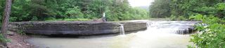 Haw Creek FallsResearched visit notes6 ft (1.8 m) · Johnson County, AR4.5 miE
- Pack Rat FallsResearched walking route24 ft (7.3 m) · Johnson County, AR4.6 miE
- Car Wash FallsRoadside location; parking and road status unverified21 ft (6.4 m) · Johnson County, AR4.8 miE