Pack Rat Falls
Johnson County, Arkansas
Your visit at a glance
- Waterfall height
- 24 ft (7.3 m)
- Location
- Johnson County, Arkansas
- Access status
- Researched walking route
- The walk
- About 0.5–0.6 mile return
- Ground & access
- Unmarked, rocky creek route with slippery footing and stream crossings. A short distance does not make this an accessible path.
A short but rugged creek approach from Haw Creek’s campground to a separate waterfall in a narrow canyon.
Plan your visit
Start at Haw Creek Falls Campground off AR 123. From its east side join the Ozark Highlands Trail briefly, then follow the tributary upstream to the right. The unmarked creek route leads to Pack Rat Falls; return the same way.
Arkansas tourism places Pack Rat Falls about 0.25 mile from the campground. Explore the Ozarks lists 0.3 mile one-way. These imply roughly 0.5–0.6 mile return, with variation by parking position; no exact surveyed length is established.
Unmarked, rocky creek route with slippery footing and stream crossings. A short distance does not make this an accessible path.
Where to start
Use Haw Creek Falls Campground parking off signed AR 123 access. The entry road crosses Haw Creek; do not drive through flooded water. The regional guide documents the walking connection from the back of the campground.
Timing & water
The 2026 USFS schedule lists the area all year. Flash flooding can prevent safe access; this is not a same-day condition report.
Before you go
USFS recreation data lists no camping or day-use fee at Haw Creek; the 2026 schedule also shows free access. A hiking reservation requirement is not stated.
Visitor informationVisit sources
More waterfalls nearby
Within 40 straight-line miles. Road and trail distances will differ.
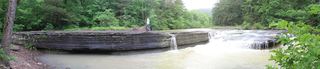 Haw Creek FallsResearched visit notes6 ft (1.8 m) · Johnson County, AR0.4 miN
- Pam's GrottoSource-reviewed route and parking37 ft (11.3 m) · Johnson County, AR0.7 miN
- Car Wash FallsRoadside location; parking and road status unverified21 ft (6.4 m) · Johnson County, AR2.3 miN
- V-Slot FallsPartial: one visitor account, land ownership and parking legality not confirmed10 ft (3.1 m) · Johnson County, AR4.0 miE
- Swamp FallsPartial: user-submitted route; land ownership and legal parking not confirmed19 ft (5.8 m) · Johnson County, AR4.0 miE
- Sidewinder FallsInformal approach documented; individual waterfall distance unknown21 ft (6.4 m) · Johnson County, AR4.0 miE
- Highway 123 FallsResearched walking route47 ft (14.3 m) · Johnson County, AR4.2 miSW
- Hobo Falls EastPublished parking and approach verified; creek crossing and canyon spur23 ft (7 m) · Johnson County, AR4.6 miW
- Hobo Falls WestSource-reviewed route and parking27 ft (8.2 m) · Johnson County, AR4.6 miW