Pam's Grotto
Johnson County, Arkansas
Your visit at a glance
- Waterfall height
- 37 ft (11.3 m)
- Location
- Johnson County, Arkansas
- Access status
- Source-reviewed route and parking
- The walk
- About 1 mile round trip (2013 firsthand report); a 2025 report says about half a mile each way
- Ground & access
- Unofficial trail with a steep climb, loose rock, and a few spots on the edge of a drop. The last descent into the grotto is a rocky scramble. Not suited to young children.
Park at the small pull-off beside Haw Creek on Highway 123, about 0.5 mile north of Haw Creek Falls Campground. Cross the highway and climb the embankment onto a well-worn path that climbs steeply to the climbing bluffs. Turn left at the split about 0.25 mile in and follow the bluff line, then scramble down loose rock into the grotto, where a 37 foot waterfall drops into a small pool. Return the same way.
Plan your visit
Unofficial trail from the roadside pull-off on Highway 123 near Haw Creek Falls Campground
Both distances come from visitor accounts, not a surveyed trail; they agree on roughly a half mile each way.
Unofficial trail with a steep climb, loose rock, and a few spots on the edge of a drop. The last descent into the grotto is a rocky scramble. Not suited to young children.
Where to start
Small dirt pull-off and flat area between Highway 123 and Haw Creek, about 0.5 mile north of the campground; you must cross the highway on foot, and vehicles come quickly around the curves.
Timing & water
Wet-weather waterfall; the 2013 report advises winter or spring rather than late summer or early fall.
Before you go
No fee is listed for the trail or pull-off in the reviewed accounts; no USFS page for this trail was found.
Visitor informationVisit sources
More waterfalls nearby
Within 40 straight-line miles. Road and trail distances will differ.
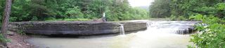 Haw Creek FallsResearched visit notes6 ft (1.8 m) · Johnson County, AR0.4 miS
- Pack Rat FallsResearched walking route24 ft (7.3 m) · Johnson County, AR0.7 miS
- Car Wash FallsRoadside location; parking and road status unverified21 ft (6.4 m) · Johnson County, AR1.5 miN
- V-Slot FallsPartial: one visitor account, land ownership and parking legality not confirmed10 ft (3.1 m) · Johnson County, AR4.0 miE
- Swamp FallsPartial: user-submitted route; land ownership and legal parking not confirmed19 ft (5.8 m) · Johnson County, AR4.0 miE
- Sidewinder FallsInformal approach documented; individual waterfall distance unknown21 ft (6.4 m) · Johnson County, AR4.0 miE
- Hobo Falls EastPublished parking and approach verified; creek crossing and canyon spur23 ft (7 m) · Johnson County, AR4.4 miW
- Hobo Falls WestSource-reviewed route and parking27 ft (8.2 m) · Johnson County, AR4.5 miW
- Rock Creek Bluff Falls47 ft (14.3 m) · Newton County, AR4.5 miN