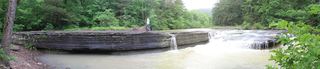
Sidewinder Falls
Johnson County, Arkansas
Your visit at a glance
- Waterfall height
- 21 ft (6.4 m)
- Location
- Johnson County, Arkansas
- Access status
- Informal approach documented; individual waterfall distance unknown
- The walk
- Sidewinder-only distance unknown
- Ground & access
- Unmaintained paths, steep descent and strenuous climb back. Wet rocks, bluffs and rough muddy access road.
Rick Henry describes parking beside Meadows Knob Road and walking logging road 93179A to the food plot. At its far west side, follow the informal path down the tributary, starting on the right side of the creek. It passes Halfway Falls and reaches Sidewinder on Bear Creek. Return the same way; the described base scramble and additional waterfalls are excluded.
Plan your visit
Meadows Knob Road and informal tributary path to Sidewinder Falls
The source’s 3.2-mile return covers multiple Bear Creek waterfalls from the upper clearing. The tributary path reaches Bear Creek after a little over half a mile; walking from lower roadside parking adds an unmeasured road segment.
Unmaintained paths, steep descent and strenuous climb back. Wet rocks, bluffs and rough muddy access road.
Where to start
Documented non-4WD parking is 35.68462,-93.17372 beside Meadows Knob Road, 2.2 miles south of Highway 123 at road 93179A. Walk the rough road to the clearing rather than assuming vehicle access.
Timing & water
Current road and path conditions unknown. Firsthand route documented in 2017 and corroborated by a December 2021 visit published in 2022.
Before you go
Current fees and reservation requirements unknown.
Visitor informationMore waterfalls nearby
Within 40 straight-line miles. Road and trail distances will differ.
- Swamp FallsPartial: user-submitted route; land ownership and legal parking not confirmed19 ft (5.8 m) · Johnson County, AR0.0 miS
- V-Slot FallsPartial: one visitor account, land ownership and parking legality not confirmed10 ft (3.1 m) · Johnson County, AR0.0 miW
- Pam's GrottoSource-reviewed route and parking37 ft (11.3 m) · Johnson County, AR4.0 miW
- Pack Rat FallsResearched walking route24 ft (7.3 m) · Johnson County, AR4.0 miW
 Haw Creek FallsResearched visit notes6 ft (1.8 m) · Johnson County, AR4.0 miW
- Car Wash FallsRoadside location; parking and road status unverified21 ft (6.4 m) · Johnson County, AR4.1 miW
- Native American FallsCurrent parking access unconfirmed41 ft (12.5 m) · Pope County, AR4.8 miE
- Rock Creek Bluff Falls47 ft (14.3 m) · Newton County, AR6.1 miNW
- Graves FallsHistorical bushwhack; current road access unverifiedPope County, AR6.5 miS