Swamp Falls
Johnson County, Arkansas
Your visit at a glance
- Waterfall height
- 19 ft (5.8 m)
- Location
- Johnson County, Arkansas
- Access status
- Partial: user-submitted route; land ownership and legal parking not confirmed
- The walk
- Short, steep bushwhack; distance to this fall not stated
- Ground & access
- Steep trailless descent marked with pink ribbons, in thick undergrowth with thorns and poison ivy in warm weather.
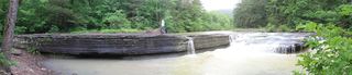
One of five waterfalls in Bear Creek Canyon near Hagarville. Swamp Falls and Sidewinder Falls are the first two reached on a short, steep, marked bushwhack.
Plan your visit
Find County Road 1802 in Hagarville off Arkansas Highway 123, drive about 2.2 miles and park. Hike west, keeping to the right-hand side of a wet-weather ravine, and follow the pink markers hanging from tree branches as you descend toward Bear Creek Canyon. Sidewinder Falls and Swamp Falls are the first two waterfalls reached. If water is low, you can climb down below Swamp Falls.
The Outbound lists 2.5 miles out and back with 600 feet of gain, but that track continues past Swamp Falls to V Slot Falls and Slot Pool Falls. It is not a Swamp Falls only distance.
Steep trailless descent marked with pink ribbons, in thick undergrowth with thorns and poison ivy in warm weather.
Where to start
Roadside parking about 2.2 miles down County Road 1802, at the coordinate given in the source (35.68642, -93.17392). Land ownership and legal parking were not confirmed.
Timing & water
Water was moderate in the reviewed visit. Low water lets you climb below the falls.
Before you go
Unknown.
Visitor informationVisit sources
More waterfalls nearby
Within 40 straight-line miles. Road and trail distances will differ.
- Sidewinder FallsInformal approach documented; individual waterfall distance unknown21 ft (6.4 m) · Johnson County, AR0.0 miN
- V-Slot FallsPartial: one visitor account, land ownership and parking legality not confirmed10 ft (3.1 m) · Johnson County, AR0.0 miW
- Pam's GrottoSource-reviewed route and parking37 ft (11.3 m) · Johnson County, AR4.0 miW
- Pack Rat FallsResearched walking route24 ft (7.3 m) · Johnson County, AR4.0 miW
 Haw Creek FallsResearched visit notes6 ft (1.8 m) · Johnson County, AR4.0 miW
- Car Wash FallsRoadside location; parking and road status unverified21 ft (6.4 m) · Johnson County, AR4.1 miW
- Native American FallsCurrent parking access unconfirmed41 ft (12.5 m) · Pope County, AR4.8 miE
- Rock Creek Bluff Falls47 ft (14.3 m) · Newton County, AR6.1 miNW
- Graves FallsHistorical bushwhack; current road access unverifiedPope County, AR6.5 miS