Collins Creek Cascade
Cleburne County, Arkansas
Your visit at a glance
- Waterfall height
- Not recorded
- Location
- Cleburne County, Arkansas
- Access status
- Researched walking route
- The walk
- Waterfall-only distance unverified
- Ground & access
- The photographed family visit describes an easy path and flat rock areas; accessibility of the complete waterfall approach is not established.
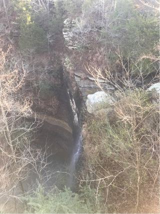
A creekside cascade reached from the signed Hatchery Road trailhead.
Plan your visit
From the signed Collins Creek trailhead parking on Hatchery Road, follow the creekside trail to the cascades and return. The longer trail continues toward the campground.
All About Arkansas reports 1.2 miles down-and-back for the full trail, not solely the waterfall approach. The manager page and map could not be opened successfully, so no official distance is claimed.
The photographed family visit describes an easy path and flat rock areas; accessibility of the complete waterfall approach is not established.
Where to start
Turn from AR 25 onto Hatchery Road. The firsthand guide identifies the signed Collins Creek trailhead with a small lot shortly along this road.
Timing & water
The June 2023 account describes year-round flow supplied by water from Greers Ferry Lake; current conditions unverified.
Before you go
Parking fees and booking requirements not verified.
Visitor informationMore waterfalls nearby
Within 40 straight-line miles. Road and trail distances will differ.
- Cornelius FallsPartial notes: seasonal waterfall confirmed; specific viewing approach unverified.33 ft (10.1 m) · Cleburne County, AR4.2 miSW
 Bridal Veil FallsResearched walking route49 ft (14.9 m) · Cleburne County, AR4.2 miSW
- Steele FallsFirsthand parking and complete foot approach documented66 ft (20.1 m) · Stone County, AR36 miN