Middle Armadillo Falls
Newton County, Arkansas
Your visit at a glance
- Waterfall height
- 18 ft (5.5 m)
- Location
- Newton County, Arkansas
- Access status
- Partial guide: hazardous historical off-trail approach; NPS advises designated trails
- The walk
- Complete parking-to-viewpoint distance unknown
- Ground & access
- Steep unmaintained creek terrain, exposed ledges and narrow shelf. No continuation above Middle Falls is recommended.
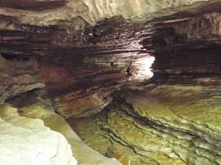
Scott Hallmark’s 2023 visit documents a view of Middle Armadillo above Lower Armadillo Falls. The approach leaves Lost Valley Trail, crosses Clark Creek and climbs Armadillo Creek through steep terrain to a narrow shelf. NPS asks Lost Valley visitors to stay on designated trails; this off-trail approach is not verified as currently appropriate visitor access.
Plan your visit
Historical off-trail Armadillo Creek approach from Lost Valley
The firsthand account’s half-mile return is the creek spur only. It excludes the main-trail approach from Lost Valley parking and is not a full walk distance.
Steep unmaintained creek terrain, exposed ledges and narrow shelf. No continuation above Middle Falls is recommended.
Where to start
NPS confirms the signed Lost Valley trailhead parking reached from Highway 43 south of Ponca. That parking serves the designated trail; it does not establish approval of an Armadillo off-trail route.
Timing & water
Lost Valley is listed for year-round day use; this does not verify the Armadillo spur or current water conditions.
Before you go
NPS requires no reservation for the designated Lost Valley day hike. Requirements for this off-trail approach remain unverified.
Visitor informationMore waterfalls nearby
Within 40 straight-line miles. Road and trail distances will differ.
- Lower Armadillo FallsLocation only: waterfall tier mismatch24 ft (7.3 m) · Newton County, AR0.0 miSE
- Upper Armadillo FallsNewton County, AR0.0 miN
 Eden FallsResearched visit notes53 ft (16.2 m) · Newton County, AR0.4 miW
- Hammerschmidt FallsResearched walking route43 ft (13.1 m) · Newton County, AR5.2 miE
- Hedges Pouroff113 ft (34.5 m) · Newton County, AR5.3 miS
- Tunnel Cave FallsCurrent approach and parking unconfirmed31 ft (9.5 m) · Newton County, AR5.3 miE
- Copperhead FallsPartial: current unmaintained approach conditions unverified13 ft (4 m) · Newton County, AR5.3 miE
- Sweden Creek FallsOfficial trail and current designated parking documented81 ft (24.7 m) · Madison County, AR5.3 miSW
- Elise FallsResearched walking route21 ft (6.4 m) · Newton County, AR5.4 miS