Leaning Log Falls
Newton County, Arkansas
Your visit at a glance
- Waterfall height
- 27 ft (8.2 m)
- Location
- Newton County, Arkansas
- Access status
- Partial: one visitor account, no trail, and no single-fall distance
- The walk
- No single-fall distance is given; the visitor logged 5.9 miles in over six hours for a larger bushwhack visiting many falls on Adkins Creek
- Ground & access
- Steep, trailless, rocky and wet; rated a difficult bushwhack by the visitor. Stream crossings on Adkins Creek were knee deep after rain.
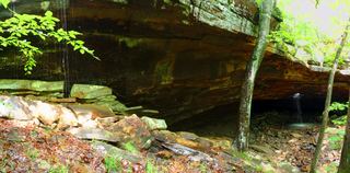
Leaning Log Falls is in the Upper Buffalo Wilderness near Adkins Creek. From the Dahl Memorial Trailhead, walk east on the old road past a pond and ridge top to an old homesite where the road ends. No trail leads down; a 2024 visitor bushwhacked down a steep hillside to the top of the falls, then crossed a faint ledge trail to the base. The visitor rated the full outing a difficult bushwhack.
Plan your visit
Dahl Memorial Trailhead, east along an old road to the end of the ridge, then a trailless bushwhack down to Leaning Log Falls
The 5.9 mile figure covers a multi-waterfall off-trail outing and must not be read as the distance to Leaning Log Falls.
Steep, trailless, rocky and wet; rated a difficult bushwhack by the visitor. Stream crossings on Adkins Creek were knee deep after rain.
Where to start
Dahl Memorial Trailhead has a large parking area about 100 feet past the memorial (35.81644, -93.44982), reached from Dixon Ridge Road (NC 9100) and then NC 9101.
Timing & water
Visited after rain; the falls need recent rain.
Before you go
No fee is listed in the reviewed account.
Visitor informationMore waterfalls nearby
Within 40 straight-line miles. Road and trail distances will differ.
- Adkins Canyon FallsFirsthand route and parking documented; difficult unmarked bushwhack and creek crossing42 ft (12.8 m) · Newton County, AR0.2 miE
- Ken Smith FallsUpper-drop identity documented; approach and parking incompleteNewton County, AR1.5 miN
- McClure FallsCurrent road and parking access unconfirmedNewton County, AR1.6 miN
 Glory HoleSource-reviewed route and roadside parking limitation31 ft (9.5 m) · Newton County, AR1.9 miE
- Bowers Hollow FallsResearched visit notes56 ft (17.1 m) · Newton County, AR2.3 miN
- Stahle FallsRoadside parking authorization unconfirmed63 ft (19.2 m) · Newton County, AR3.3 miNE
- Hadlock CascadePartial: stated limitations remain27 ft (8.2 m) · Newton County, AR3.4 miNE
- Woods Boys FallsSource-reviewed route and parking33 ft (10.1 m) · Newton County, AR3.4 miNE
- Magnolia FallsSource-reviewed route and parking26 ft (7.9 m) · Newton County, AR3.4 miNE