Adkins Canyon Falls
Newton County, Arkansas
Your visit at a glance
- Waterfall height
- 42 ft (12.8 m)
- Location
- Newton County, Arkansas
- Access status
- Firsthand route and parking documented; difficult unmarked bushwhack and creek crossing
- The walk
- Approximately 5 miles return
- Ground & access
- Difficult wilderness bushwhack with dense vegetation, steep slopes, slippery rock and a substantial creek crossing. The return climbs nearly 1,000 feet. No marked continuous trail; high water can prevent passage.
The firsthand route leaves Dahl Memorial parking on an old jeep road, stays straight past the swamp, and turns left at the 0.8-mile T junction. Beyond the field, it descends through woods to the creek and Leaning Log Falls, crosses Adkins Creek, then follows it downstream to the tributary canyon and upper falls. Return the same way.
Plan your visit
Dahl Memorial Trailhead via Leaning Log Falls and Adkins Creek
Lost in the Ozarks explicitly gives five miles round trip for its Leaning Log and Adkins Canyon outing. Off-trail choices can change the distance.
Difficult wilderness bushwhack with dense vegetation, steep slopes, slippery rock and a substantial creek crossing. The return climbs nearly 1,000 feet. No marked continuous trail; high water can prevent passage.
Where to start
Use the Dahl Memorial Trailhead parking described by both Gary Davis and TAKAHIK. From Highway 16/21 east of Fallsville, take Newton County 9100 about two miles to the signed Dahl access road. TAKAHIK places parking 0.1 mile along that road at 35.81639,-93.45005.
Timing & water
The firsthand account favors winter or early spring for waterfall flow. Its observed crossing depth is not a current safety assessment; current water and road conditions unknown.
Before you go
Current fees and permit requirements unknown.
Visitor informationMore waterfalls nearby
Within 40 straight-line miles. Road and trail distances will differ.
- Leaning Log FallsPartial: one visitor account, no trail, and no single-fall distance27 ft (8.2 m) · Newton County, AR0.2 miW
- Ken Smith FallsUpper-drop identity documented; approach and parking incompleteNewton County, AR1.4 miN
- McClure FallsCurrent road and parking access unconfirmedNewton County, AR1.5 miN
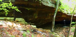 Glory HoleSource-reviewed route and roadside parking limitation31 ft (9.5 m) · Newton County, AR1.6 miE
- Bowers Hollow FallsResearched visit notes56 ft (17.1 m) · Newton County, AR2.2 miN
- Stahle FallsRoadside parking authorization unconfirmed63 ft (19.2 m) · Newton County, AR3.1 miN
- Hadlock CascadePartial: stated limitations remain27 ft (8.2 m) · Newton County, AR3.2 miNE
- Woods Boys FallsSource-reviewed route and parking33 ft (10.1 m) · Newton County, AR3.2 miNE
- Magnolia FallsSource-reviewed route and parking26 ft (7.9 m) · Newton County, AR3.2 miNE