Deer Trail Falls
Newton County, Arkansas
Your visit at a glance
- Waterfall height
- 55 ft (16.8 m)
- Location
- Newton County, Arkansas
- Access status
- Historic approach; current road access unverified
- The walk
- Distance from parking unknown
- Ground & access
- Uneven creekside terrain; vehicle access included fords.
Historic creekside directions; current rough-road access remains unverified.
Plan your visit
Henry’s 2014 visit walks south from the pull-off around the bend to the tributary mouth, then follows its left bank upstream to Deer Trail Falls.
The account gives about 0.1 mile upstream from the road turn-off, not the full walk from parking.
Uneven creekside terrain; vehicle access included fords.
Where to start
Historic pull-off at 35.75620, -93.27557 on FR 1002. Current reachability and parking status unknown.
Timing & water
No current road or ford assessment; do not treat the 2014 visit as confirmation of access.
Before you go
Current access terms unknown.
Visitor informationVisit sources
More waterfalls nearby
Within 40 straight-line miles. Road and trail distances will differ.
- Big Buck FallsApproach or parking partly unconfirmed62 ft (18.9 m) · Newton County, AR0.2 miNE
- Piney Bowl FallsHistorical bushwhack; current road and parking unknown64 ft (19.5 m) · Newton County, AR0.5 miSW
- Rock Creek Bluff Falls47 ft (14.3 m) · Newton County, AR0.6 miS
- Car Wash FallsRoadside location; parking and road status unverified21 ft (6.4 m) · Johnson County, AR3.6 miS
- Pam's GrottoSource-reviewed route and parking37 ft (11.3 m) · Johnson County, AR5.1 miS
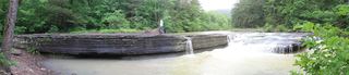 Haw Creek FallsResearched visit notes6 ft (1.8 m) · Johnson County, AR5.4 miS
- Pack Rat FallsResearched walking route24 ft (7.3 m) · Johnson County, AR5.8 miS
- Hobo Falls EastPublished parking and approach verified; creek crossing and canyon spur23 ft (7 m) · Johnson County, AR6.2 miSW
- Hobo Falls WestSource-reviewed route and parking27 ft (8.2 m) · Johnson County, AR6.2 miSW