WaterfallNear Me

South Carolina waterfall visits

Compare 97 South Carolina waterfall visits by the approach, terrain, and where to start. Some routes have closures or unresolved details; read the individual guide before travelling.

97 visit options

Isaqueena Falls, SC

City park trail to the viewing platform documented; vehicle fee

South Carolina

Isaqueena Falls

0.40 mile round trip (SC Trails)

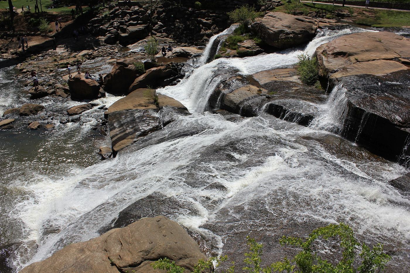
Issaqueena Falls is a 100-foot cascade of Cane Creek in Stumphouse Tunnel Park, run by the City of Walhalla. From Walhalla, drive west on SC 28 for 6.9 miles and turn right into the park. Pass through the gate and follow the road to the parking lot and picnic area on the right. Walk across the footbridge on the west side of the parking lot and follow the path that curves to the right side of the falls to the viewing platform. A visitor guide from Discover South Carolina says a wide dirt and gravel path also leads down toward the base of the falls. The unfinished Stumphouse Tunnel is nearby in the same park.
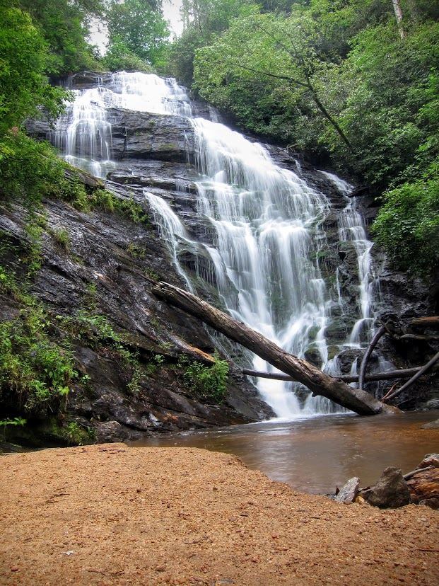
Photo creditPhoto: Csab, Public domain, via Wikimedia Commons
Spoonauger Falls, SC.

Source-reviewed route and parking

South Carolina

Spoonauger Falls

About 0.45 mile outward; return the same way

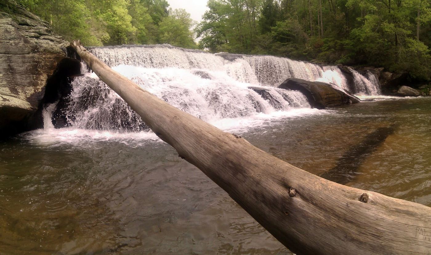
From the Chattooga trailhead on Burrells Ford Road, walk north along the river for 0.25 mile, cross Spoonauger Creek, and turn right at the trail sign. Continue 0.1 mile to the first switchback and another 0.1 mile uphill to the base.

Photo creditPhoto: Dallas Epperson, CC BY-SA 3.0, via Wikimedia Commons

Partial guide: short unofficial scramble path from a forest road

South Carolina

Andrew Ramey Falls

About 100 feet to a few hundred feet from the road

Andrew Ramey Falls (also called North Fork Fall Creek Falls, or the First Waterfall on Fall Creek) is a 30-foot cascade on a tributary of Fall Creek in Sumter National Forest. From Walhalla, take SC 28 and Whetstone Road to Chattooga Ridge Road, turn right on Fall Creek Road, bear left onto FS 722, and drive 0.5 mile to the culvert. From the pull-off, a path heads toward the sound of the falls past the upper cascades; after about 100 feet a steep path on the left drops to the base. This partial guide relies on visitor accounts; there is no official trail.

Location map; no photo available.

City park paths to the falls documented

South Carolina

Arboretum Falls

About 0.2 mile (Waterfall Hero hike length)

Arboretum Falls is a 10-foot falls on a small tributary of the Reedy River inside Falls Park on the Reedy in downtown Greenville, near the South Carolina Governor's School for the Arts and Humanities. It is in the old arboretum that the Greenville Garden Club developed on land then owned by Furman University. From the park parking, cross the bridge and turn left to follow the closed road down toward the river; the falls are on the left, and a couple of paths lead down to the base. One visitor reached it from the West End parking area by descending stone steps. Reedy Falls, the park's main falls, is a short distance away.

Location map; no photo available.

Preserve trail to a distant view from the Lake Wattacoo dam

South Carolina

Ashmore Falls

Distance to the dam is not given; the full Wattacoo Pond Loop is 1.5 miles

Ashmore Falls drops into Wattacoo Creek above Lake Wattacoo in Ashmore Heritage Preserve, part of the Mountain Bridge Wilderness. From the parking area, walk about 200 feet up the gravel road to a trail signed for the preserve. Follow it across shallow West Fork Creek, keep right past the trail to the left, continue uphill, then turn right onto broken pavement. It bends sharply left to the dam of Lake Wattacoo, where the falls come into view across the water. Return the same way or continue around the pink-purple blazed loop. The view is distant and partly hidden by vegetation in the leafy months; one visitor bushwhacked toward the base and found no better view.

Location map; no photo available.

Partial guide: final approach off-trail; listing match probable

South Carolina

Bee Cove Falls

2.1 miles one way, per SC Trails

Bee Cove Falls is a remote multi-tier waterfall, one steep cascade and four smaller ones, in Sumter National Forest. From Walhalla, take SC 28 north to SC 107 and bear right; FS 702 is the second paved road on the right after Fish Hatchery Road. Park and walk east down FS 702 about 1 mile; just after crossing Bee Cove Creek take the right fork. In about 0.3 mile at a three-way intersection take the right path over a dirt barrier; in another 0.1 mile, where the road curves left, take the less defined path to the right. The path fades within 0.1 mile; from there, work down the steep slope and follow the sound to the first cascade. This partial guide follows SC Trails; the final approach is off-trail, and this listing's match is probable.

Location map; no photo available.

Built state trail with signed parking and observation deck

South Carolina

Beech Bottom Falls

About 1.7 miles round trip (Kidding Around Greenville); SC Trails lists about 1 mile one way

Beech Bottom Falls, formerly called Pinnacle Falls, is a tall multi-tiered falls in the Jocassee Gorges area near Sunset, reached by a nature trail built by the SC Department of Natural Resources. From the parking area, walk north on the old roadbed and gravel road past the gate; the trail heads west on the old roadbed about 400 feet north of the lot. After about half a mile it crosses Abner Creek on a footbridge, then turns left onto another old roadbed following signs to Beech Bottom Falls, recrosses the creek on a second footbridge, and descends to the observation deck. Stay on the trail. Return the same way.

Location map; no photo available.

Partial guide: the position of Ben's Sluice beyond Jones Gap Falls comes from one visitor account

South Carolina

Ben's Sluice

About 1 mile to the river bridge near Jones Gap Falls (SC Trails), then about a third of a mile beyond Jones Gap Falls (visitor account)

Ben's Sluice is a small falls on the Middle Saluda River beside the Jones Gap Trail in Jones Gap State Park. From the parking area, take the footpath across the footbridge over the Middle Saluda, follow the paved path past the park headquarters, turn left on the service road and cross the bridge to the Jones Gap Trail board, where hikers must fill out a registration card. Follow the Jones Gap Trail upstream. At about 1 mile it crosses the river on the John Reid Clonts Memorial Bridge; the short spur to Jones Gap Falls is just past Campsite 11. Continue on the Jones Gap Trail along the river to Ben's Sluice, before the junction with the Coldspring Branch Trail. Return the same way.

Location map; no photo available.

National forest trail route documented; steep final descent to the river

South Carolina

Big Bend Falls

3.4 miles one way, per Discover Upcountry Carolina

Big Bend Falls is a 30-foot drop, including a 15-foot block falls, on the Chattooga Wild and Scenic River at a hairpin bend, in Sumter National Forest. From Walhalla, take SC 28 north and SC 107 north 10.4 miles, then turn left on Burrells Ford Road (FS 708) and drive about 3 miles to the parking area on the left. Walk down to the Burrells Ford campground and continue south; the Chattooga Trail (black blazes) and Foothills Trail (white blazes) run together along the river. Pass the Big Bend Trail junction at 2.5 miles and continue about 0.5 mile until you hear the falls, then take one of the rugged paths down the laurel-covered bank.

Location map; no photo available.

Parking location and current route condition unconfirmed

South Carolina

Blue Hole Falls

Approximately half a mile from road; parking start unconfirmed

HD Carolina’s visit describes an unmarked forest-road approach, then a descent to Cedar Creek and an unbridged crossing before reaching Blue Hole Falls. Parking authorization remains unconfirmed.

Location map; no photo available.

Partial guide: preserve trail to a waterfall view; exact match to this listing not confirmed

South Carolina

Blue Wall Falls

About 3.5 miles for the full Waterfall Loop out and back from the parking lot, per Kidding Around Greenville

Blue Wall Preserve is a Nature Conservancy preserve west of Landrum, open to the public in daylight hours. Park at the Pennell Road parking area and walk down the paved road past the gate; it turns to gravel near the bridge over Vaughn Creek. Follow the Palmetto Trail (Blue Wall Passage) about 1 mile, then take the 0.7-mile Waterfall Trail around the north side of the pond for a view of a waterfall. It rejoins the Palmetto Trail at the south end of the pond; return to the parking area. The preserve sources describe a waterfall on this loop but do not give its exact position, so the match to this listing is probable but not confirmed.

Location map; no photo available.

Lower trail closed; visit first viewing platform only

South Carolina

Brasstown Falls

0.4 mile one-way; 0.8 mile return calculated

From the trailhead, walk to the fork and take the right branch to the first viewing platform. Stop there; the trail below the first platform is closed.

Location map; no photo available.

Partial guide: heard from the trail; view and base access not confirmed

South Carolina

Camp Branch Falls

About 1.1 miles one way to the falls area, per Discover Upcountry Carolina

Camp Branch Falls is a 20-foot waterfall on Camp Branch, a tributary of the Chattooga River, in Sumter National Forest. From Westminster, take US 76 west 13.3 miles, Damascus Church Road, Battle Creek Road and Turkey Ridge Road (FS 755) 2.3 miles to the pull-off just past the Opossum Creek trailhead. The trail drops quickly on steps and switchbacks, then follows Camp Branch downstream. At about 1.1 miles you hear the falls off to the left, and may see them when the leaves are down. This partial guide relies on visitor sources: a clear view from the trail is not confirmed, and reaching the base is a steep bushwhack through briers.

Location map; no photo available.

State park trail to an observation deck near the trailhead

South Carolina

Carrick Creek Falls

Less than 100 yards up the trail to the observation deck, per South Carolina State Parks; the full Carrick Creek Trail loop is 2 miles

Carrick Creek Falls is on Carrick Creek in Table Rock State Park, near the start of the green-blazed Carrick Creek Trail. From the Nature Center trailhead, walk less than 100 yards up the trail to the observation deck at the falls. The trail continues as a 2-mile loop, about an hour, past more cascades. Park advisories can move the trailhead access point and hiker registration location during work at the Nature Center; follow posted signs.

Location map; no photo available.

Partial guide: informal side path from an old forest road; position matched by description

South Carolina

Cedar Creek Falls

About 0.3 mile on old forest roads, then 50 feet on a side path, per Upcountry SC

Cedar Creek Falls is a small 10-foot falls on Cedar Creek just upstream of 75-foot Blue Hole Falls in Sumter National Forest. From Walhalla, drive west on SC 28 and turn left on Whetstone Road just before the Mountain Top Trading Post, then left on Cassidy Bridge Road, left on gravel Rich Mountain Road (FS 744) and right on Cedar Creek Road (FS 744C). After 2.5 miles, park by the earth mound that blocks FS 2658 on the right. Walk down FS 2658 to a T intersection and turn right. Pass the first trail on the left, which goes to an overlook of Blue Hole Falls, and take the second trail on the left; the falls are visible after about 50 feet. Return the same way.

Location map; no photo available.

County park with an accessible waterfall view near parking

South Carolina

Chau Ram Falls

Short walk from the parking area; no distance is published

Chau Ram Falls, also called Ramsey Creek Falls, is a 40-foot falls where Ramsey Creek cascades over large boulders into the Chauga River in Chau Ram County Park, run by Oconee County. From Westminster, take US 76 west, keep right at the fork with US 123 for another 2.5 miles, and turn left on Chau Ram Park Road to the park entrance. Pay at the fee booth; parking is just beyond it. The falls are a short, accessible walk from parking. The park also has a 160-foot suspension bridge over the Chauga River and steeper hiking-only trails.

Location map; no photo available.

National forest path route and parking documented; slippery rock at the end

South Carolina

Chauga Narrows

About 0.6 mile one way, per SC Trails

Chauga Narrows is a 25-foot chute where the Chauga River squeezes through a 200-foot run, a Class VI rapid, in Sumter National Forest. From Walhalla, drive west on SC 28 about 6.6 miles and turn left on Whetstone Road just before the Mountain Top Trading Post. Drive 3.8 miles to Blackwell Bridge over the Chauga River and park beyond the bridge on the left. Cross Whetstone Road to the trailhead, follow an old roadbed about 0.3 mile, then a narrow, faint path downstream beside the river. At about 0.5 mile the river curves right and the path turns to rock. For the best view, some climbing over rocks is needed.

Location map; no photo available.

Partial guide: roadside falls; no parking described

South Carolina

Cheohee Road Falls

Roadside view; no walk

Cheohee Road Falls is a small roadside falls on Cheohee Road (FS 710, also called Tamassee Road or Winding Stairs Road) in Sumter National Forest, Oconee County. From Walhalla, drive west on SC 28 for 8.1 miles, bear right onto SC 107, drive about 6.1 miles, and turn onto Cheohee Road. The falls are on the right about 0.4 mile along the road. Crane Falls, a separate falls with its own short hike, is about 3.2 miles along the same road. No place to stop at Cheohee Road Falls is described.

Location map; no photo available.

State park trail route and parking documented; trail fee

South Carolina

Cliff Falls

0.8 mile one way, per Discover Upcountry Carolina

Cliff Falls is a tiered waterfall in Caesars Head State Park, part of the Mountain Bridge Wilderness. From the visitor center on US 276 (12.5 miles north of the Cleveland post office), walk across US 276 to the Frank Coggins Trail (#15) and follow it 0.8 mile to a footbridge at the top of Cliff Falls, where it meets The Gap Trail (#6). Turn left on the Gap Trail for about 100 feet, then take the side trail on the left to see the upper tiers.

Location map; no photo available.

Partial guide: camp permission needed by phone; last section is an unmarked path

South Carolina

Confusion Falls

No single total distance is published; the last section is 0.4 mile beyond Moonshine Falls

Confusion Falls is a small double waterfall where two streams meet, just downstream of Moonshine Falls on a tributary of Matthews Creek in the Mountain Bridge Wilderness Area. The Upcountry South Carolina listing starts at Asbury Hills Camp and asks hikers to call the camp for permission first. Follow the Asbury Trail to the cable crossing of Matthews Creek, turn right on the pink-blazed Naturaland Trust Trail, then take the side trail past an old kiosk to a rock pile with red paint that marks the Moonshine Falls spur. The path to Confusion Falls leaves from the top of the ridge above Moonshine Falls. A visitor account describes losing the faint path and descending a steep slope to the creek. Return the same way.

Location map; no photo available.

Partial guide: off-trail bushwhack of about half a mile; no trail

South Carolina

Crane Creek Falls

About half a mile one way off-trail, per the Oconee County waterfalls site

Crane Creek Falls is a waterfall of about 30 to 35 feet on Crane Creek, upstream of Secret Falls and just below Yellow Jacket Falls, in Sumter National Forest. The Oconee County waterfalls site describes parking along Cheohee Road at 34.92439, -83.08881 and bushwhacking to the falls, about half a mile one way. There is no trail and no marked line. A visitor account reached the falls from the other direction, from the Winding Stairs Trail and Secret Falls, by climbing the steep bank on the right side of the creek, then crossing below the falls to view it from the left side. This partial guide is for experienced off-trail hikers with map skills.

Location map; no photo available.

Partial guide: no published distance; informal creek path

South Carolina

Crane Falls

No distance stated

Crane Falls is a small, 12-foot waterfall on Crane Creek that splits at the top and rejoins in a small, tree-filled pool. From the small parking area on the left before the Crane Creek bridge on Cheohee Road, follow an old roadbed past large barricading rocks and some primitive campsites. At about the halfway point, rock-hop across Crane Creek and follow the path upstream to the falls. Return the same way. No distance is published, and the path is not described as a marked trail.

Location map; no photo available.

Partial guide: small falls beside the Hidden Falls Trail; the route source does not use this name

South Carolina

Disappearing Falls

About 1.6 miles one way, per NC Waterfalls

This listing marks a small falls, under 10 feet high, on the same stream as Hidden Falls in Oconee State Park, where the creek drops and then goes underground before reappearing downstream. From the trailhead across the road from the small Foothills Trail parking area, register and follow the Foothills Trail, then the yellow-blazed Hidden Falls Trail. NC Waterfalls says that at about 1.6 miles you may hear a small falls on the right if flow is good. That account does not use the name Disappearing Falls, so the match rests on its description. Hidden Falls is farther along the same trail. Return the same way.

Location map; no photo available.

Partial guide: roadside falls; the small pull-off is on a highway curve

South Carolina

Drip Rock Falls

Roadside viewpoint; no walking distance is published

Drip Rock Falls is a small roadside waterfall on the left side of US 276 when driving up toward Caesars Head State Park. A visitor account describes it as water dripping slowly off a large rock, so it is best after rain. The listing describes a small pull-off on the right side of the road.

Location map; no photo available.

State park trail route and trailhead documented; small parking area

South Carolina

Eastern Stream Falls

About 4 miles round trip including Oil Camp Falls, per NC Waterfalls

Eastern Stream Falls is a multi-section waterfall with more than 100 feet of falling water on Eastern Stream, about 400 feet higher than Oil Camp Falls, in Jones Gap State Park. From the gate, walk the old road about half a mile and cross a concrete bridge over Oil Camp Creek, then about another tenth of a mile to a second bridge at a red gate. Shortly after, turn hard right onto the Pinnacle Pass Trail (#20, white blazes), which climbs steeply with switchbacks. After about half a mile it bears left and levels; cross a small stream and continue less than a quarter mile to the falls, where the trail crosses the creek with a thin cable. Return the same way.

Location map; no photo available.

Partial guide: no official trail; old road and an overgrown logging grade

South Carolina

Evans Falls

No distance is published

Evans Falls is on Oil Camp Creek in the Mountain Bridge Wilderness Area, a short distance from Misty Falls beside an old logging road. A visitor account describes parking at a pull-off near where old Oil Camp Creek Road leaves US 276, walking down the old road past a green gate and down its switchbacks, then following a hard-to-see old logging road to Misty Falls and on to Evans Falls. A second visitor account reached Oil Camp Creek and followed it to Evans Falls. No official trail reaches the falls. Return the same way.

Location map; no photo available.

Partial guide: unofficial, unmarked path through national forest

South Carolina

Fall Creek Falls

About 1.75 miles one way; 3.2 miles round trip (Hiking the Appalachians)

Fall Creek Falls is a 40-foot, two-step waterfall on Fall Creek in Sumter National Forest, a short distance above the Chattooga River. Hiking the Appalachians and Waterfall Hero call it the second waterfall on Fall Creek and give positions that match this listing. There is no official trail. From the pull-off, take the faint path on the north side of the culvert down past Andrew Ramey Falls and follow it through rhododendron to the bottomlands along Fall Creek. Keep going downstream past an old chimney. At about 1.65 miles the path reaches the top of the falls; follow it in a broad arc to the right along a cliff base, then turn sharply left at a switchback to reach the base. Return the same way.

Location map; no photo available.

Partial guide: boat access only; listing match probable

South Carolina

Fall Creek Falls

Boat or kayak access only; no paddling distance stated

Fall Creek Falls drops into a cove of Lake Keowee and is seen from the water. A paddler's account launches at the southern of the two Fall Creek ramps, which sit on either side of a peninsula, and paddles south to the Fall Creek cove. The falls are around a corner to the left inside the cove, with rocky banks and a large sandy shallow area for wading. The ridges around the cove are lined with private homes, so stay on the water. The cove is very popular with boaters in summer, especially on weekends. No walking route is described.

Location map; no photo available.

Mountain Bridge Wilderness trail from the Falls Creek trailhead

South Carolina

Falls Creek Falls

About 1.5 to 1.7 miles one way; sources differ

Falls Creek Falls is a large multi-tier waterfall in the Jones Gap State Park part of the Mountain Bridge Wilderness Area. The trailhead is outside the main park on Falls Creek Road, just past the Palmetto Bible Camp entrance. Register at the trailhead kiosk, then climb the Falls Creek Trail along an old road, crossing several small streams, to the falls. The trail continues across the creek as the Hospital Rock Trail. Return the same way.

Location map; no photo available.

State park trail passes the falls; trail access fee

South Carolina

Firewater Falls

About a quarter mile past the footbridge at the top of Cliff Falls on the Frank Coggins Trail (visitor account)

Firewater Falls is a 20-foot waterfall over a large rock face beside the Frank Coggins Trail in Caesars Head State Park. Park at the visitor center on US 276 and cross the highway to the purple-blazed Frank Coggins Trail. It starts as a gravel drive, becomes a dirt path after about a quarter mile and descends to the Coldspring Connector junction; turn right and keep following the purple blazes. Where purple blazes go both left and right, stay left to the wooden footbridge at the top of Cliff Falls. Cross the bridge and continue on the purple-blazed Frank Coggins Trail through rhododendron and laurel for about a quarter mile; the trail passes beside Firewater Falls. Return the same way.

Location map; no photo available.

Partial guide: view from the Table Rock Trail; name and exact drop from one visitor account

South Carolina

Green Creek Falls

About half a mile one way, an estimate per NC Waterfalls

This listing is the waterfall on Green Creek beside the Table Rock Trail in Table Rock State Park. From the trailhead, pass the small falls near the start and take the red-blazed Table Rock Trail to the right where the trails split. About half a mile up, after the trail crosses Green Creek, the falls are on the left and visible through the trees. A closer look needs a scramble down the bank. Return the same way. This partial guide relies on one visitor account, which calls it a waterfall on Green Creek without a formal name. Park advisories can move the trailhead access point during work at the Nature Center; follow posted signs.

Location map; no photo available.

Heritage preserve loop trail to the top of the falls

South Carolina

Heritage Falls

About 0.5 mile for the loop, per HD Carolina

Heritage Falls, also called Slickum Falls, is Slickum Creek sliding down a steep granite outcrop in the Eva Russell Chandler Heritage Preserve, managed by the SC Department of Natural Resources. From the gate by the preserve sign, follow the dirt path a short way and turn left at the wooden steps. The path passes an old homesite and comes out on the open rock, where Slickum Creek spills down the rock face and there are wide views to the southeast. The loop continues beside the creek back to Persimmon Ridge Road. The trail does not go to the base of the falls.

Location map; no photo available.

Signed state park trail and trailhead documented

South Carolina

Hidden Falls

4.6 miles out and back, per South Carolina State Parks

Hidden Falls is a waterfall of about 50 to 60 feet on a small tributary of Tamassee Creek, in Sumter National Forest just east of Oconee State Park. Start at the kiosk across the road from the Foothills Trail parking area inside the park, where the yellow-blazed Hidden Falls Trail, the white-blazed Foothills Trail and the black-blazed Tamassee Knob Trail begin together. Turn left with the yellow and white blazes where the Tamassee Knob Trail goes right. After about 1.25 miles, take the steps down to a dirt road, turn right and then bear left at the Hidden Falls sign. The trail descends past a small disappearing falls on the same creek and reaches the base of Hidden Falls. Return the same way.

Location map; no photo available.

Official long-distance trail and picnic area parking documented

South Carolina

Hiker's Peril Falls

About 0.3 mile to the Sloan Bridge Falls side trail, then about a quarter mile more (NCWaterfalls figures)

Hiker's Peril, also called Hemlock Falls, is a 30- to 50-foot waterfall on a small unnamed creek that spills down the mountain beside the Foothills Trail in Sumter National Forest. From the south end of the Sloan Bridge picnic area parking lot, follow the Foothills Trail along the East Fork of the Chattooga River. Pass the steep side trails to Sloan Bridge Falls at about 0.3 mile and a 10-foot cascade on the East Fork, then continue about a quarter mile to a wooden footbridge. The falls are on the left at the bridge. Return the same way. In dry weather the falls can be a trickle, and rhododendron and fallen trees can block the view.

Location map; no photo available.

Partial guide: unofficial trail and a very steep scramble path

South Carolina

Homer's Falls

About 1.15 miles one way, per Hiking the Appalachians

Homer's Falls is a 20-foot cascade on Pinckney Branch just above the Chattooga River in Sumter National Forest. From the turnaround at the end of FS 755, walk down FS 755I past the Primitive Road sign to its end at 0.6 mile, then follow the single-track path. At about 1.0 mile, at a junction that may be marked by a rock arrow and cairn, the main path to Long Creek Falls bears right and the steep, obscure side path to Homer's Falls bears left. The side path drops 200 feet in 0.15 mile over rock outcrops where hands are needed. Return the same way.

Location map; no photo available.

Partial guide: no trail; off-trail approach along or down to Horse Bone Branch

South Carolina

Horse Bone Falls

No trail; distance not published

Horse Bone Falls is a waterfall of about 40 feet on Horse Bone Branch near Oconee State Park, largely covered in fallen trees. There is no trail. The Oconee County waterfalls site says it is much easier to reach from below, following Horse Bone Branch upstream, and gives parking at 34.88813, -83.08868. Upcountry SC gives the guidebook route from above: from the barricade at the end of a short road off FS 716, follow the old roadbed and Hidden Falls signs 0.3 miles, turn left between two trees onto a small overgrown trail, then bushwhack down to Horse Bone Branch about 550 feet below. This partial guide is for experienced off-trail hikers with map skills.

Location map; no photo available.

State historic site walkway to the falls overlook documented; admission fee

South Carolina

Horseshoe Falls

0.1 mile one way on a paved accessible walkway (South Carolina State Parks)

Horseshoe Falls is a natural feature of Musgrove Mill State Historic Site, on the Spartanburg County side of the park. Park in the lot on Horseshoe Falls Road where the Battlefield Trail begins and follow the paved walkway 0.1 mile to the overlook. To continue, the green-blazed Battlefield Trail becomes a natural foot trail through the battlefield of August 19, 1780 and returns to the same parking lot.

Location map; no photo available.

State park trail from the Jones Gap State Park office area

South Carolina

Hospital Rock Falls

About 1 mile one way, per the listing

Hospital Rock Falls is beside the Hospital Rock Trail in Jones Gap State Park. From the main parking area, follow the path to the visitor center, continue on the paved path around the trout hatchery pond and follow signs for campsites 1 to 4. The Hospital Rock Trail starts past campsite 4 and climbs northeast on an old roadbed. After about a mile, most of the falls can be seen to the left, with the tallest part farther off the trail. Hospital Rock itself is about 0.5 mile farther. Other small falls on Rocky Branch lie close by. Return the same way.

Location map; no photo available.

Partial guide: no trail beyond the Ira Branch footbridge; winter recommended

South Carolina

Ira Branch Falls

About 4.4 miles round trip, per the Oconee County waterfalls site

Ira Branch Falls is a waterfall of about 25 feet on Ira Branch. Start at the Foothills Trail parking at the end of Nicholson Ford Road, the same as for Pigpen and Licklog Falls. The Oconee County waterfalls site says to hike about 2 miles on the trail it calls the Chattooga Ridge Trail to the footbridge over Ira Branch, then bushwhack and creek-walk up the branch to the falls. There is no trail beyond the footbridge. The source recommends going in winter because dog hobble makes summer travel extremely difficult. This partial guide relies on one source.

Location map; no photo available.

Partial guide: unmarked cross-country route next to private land

South Carolina

Jim Lee Falls

Around 2 miles round trip, a rough estimate per the Oconee County waterfalls site

Jim Lee Falls is a waterfall of about 25 feet on Lee Branch near Mountain Rest, surrounded by private property. The Oconee County waterfalls site says it can be reached without trespassing by following old logging roads. Start along the road on the left side of the dove fields, then go cross-country, sometimes on old logging roads. At about 34.84333, -83.09849, angle slightly right and down to pick up the logging road that runs to the creek and the falls. Approach on the right bank (facing downstream); the left bank is a rock wall that leads onto private property. This partial guide relies on one source; the route is unmarked and needs map skills.

Location map; no photo available.

State park trail route and parking documented; admission fee

South Carolina

Jones Gap Falls

About 1 mile one way from near the park headquarters (SC Trails)

Jones Gap Falls is a 50-foot waterfall that falls down a rocky stone staircase on a tributary of the Middle Saluda River in Jones Gap State Park. From the parking area, take the footpath across the footbridge over the Middle Saluda and follow the paved path past the picnic area and the park headquarters. Turn left on the service road and cross a bridge to the board that marks the start of the Jones Gap Trail, and fill out a registration form. Follow the blue-blazed Jones Gap Trail upstream and keep left where the Rainbow Falls Trail goes right. At about 1 mile the trail crosses the river on the John Reid Clonts Memorial Bridge. Just past Campsite 11, cross the small tributary on stepping stones and turn right onto the short spur to the falls. Return the same way.

Location map; no photo available.

Partial guide: informal fishermen's paths; one source

South Carolina

Land Bridge Falls

About 1 mile round trip, per the Oconee County waterfalls site

Land Bridge Falls is a 15 to 20 foot waterfall on the Chauga River. Park beside the Land Bridge Road bridge and follow the fishermen's paths along the river that lead to the falls. This partial guide relies on one source; the paths are informal and not marked.

Location map; no photo available.

Partial guide: highway-shoulder parking and an unmarked informal path

South Carolina

Last Falls on Slickum

About 100 feet from the road (HD Carolina estimate)

Last Falls on Slickum is a short, multi-tiered cascade under 10 feet high that flows into a sandy pool on Slickum Creek, just above the highway. There are no signs or parking areas. Find Slickum Creek where it passes under US 276/SC 11 just before it enters the Saluda River, then take the unmarked path that starts on the left (west) side of the culvert into the forest. The falls are very close to the road. The path is informal, and the land manager is not named in the sources.

Location map; no photo available.

Long Foothills Trail route to the falls overlook documented

South Carolina

Laurel Fork Falls

8.4 miles one way from the Laurel Valley access (SC Trails); about four miles one way from Laurel Fork Gap (Discover South Carolina)

Laurel Fork Falls is an 80-foot waterfall where Laurel Fork Creek drops into a narrow cove of Lake Jocassee in the Laurel Fork Heritage Preserve. From Pickens, drive north on US 178 about 16.5 miles, turn left onto Laurel Valley Road, take the gravel road to the right and drive 0.5 mile to the Foothills Trail Laurel Valley Access parking lot. Walk up the road to the Foothills Trail and follow it along Laurel Fork Creek, crossing the creek several times on footbridges and once on a suspension bridge. Past a large designated campsite, continue about 0.2 mile beyond it to the overlook of the falls. A 900-foot spur leads down to the lake shore and the Laurel Fork boat access. The shorter start is a small cleared area on Horsepasture Road at Laurel Fork Gap, across from a heritage preserve map; walk the old Laurel Fork Creek Road, closed to vehicles, about a mile to the Foothills Trail. The falls can also be seen from a boat on Lake Jocassee.

Location map; no photo available.

Partial guide: no official trail; old fields and an unofficial creekside path

South Carolina

Lee Falls

About 1.5 miles one way, per SC Trails

Lee Falls is a 75-foot waterfall on Tamassee Creek in Oconee County with a spray cliff that supports rare plants. SC Trails says there is no official trail. From the north end of the parking area, cross three old fields, crossing creeks as you reach them, then enter the woods. After about 0.3 mile take the left fork across a creek toward the larger branch of Tamassee Creek, then follow the creek upstream until the path becomes rocky and obstructed, less than 0.2 mile from the falls. The best view is from the south side. Return the same way.

Location map; no photo available.

National forest trail route and trailhead documented

South Carolina

Licklog Falls

About 0.9 miles one way, per SC Trails

Licklog Falls is a two-level waterfall where Licklog Creek drops into the Chattooga River, in Sumter National Forest. From the parking area, walk west on the white-blazed Foothills Trail for half a mile and turn left onto the Chattooga Trail. Pigpen Falls is on the left after 0.2 mile. Cross the footbridge over Licklog Creek and continue 0.2 mile; the first level of Licklog Falls is to the right of the trail. The second level is about 50 yards downstream and reaches the river. Return the same way.

Location map; no photo available.

Nearby lower Brasstown route closed; Little Brasstown spur described

South Carolina

Little Brasstown Falls

0.2 mile to fork plus 0.1-mile spur: 0.3 mile one way; 0.6 mile out and back.

At the first fork turn left and cross the bridge to Little Brasstown Falls.

Location map; no photo available.

Partial guide: unofficial, unmarked path in the national forest

South Carolina

Long Creek Falls

About 3.5 miles round trip (Take a Hike figure)

Long Creek Falls drops about 25 to 50 feet in tiers on Long Creek, about 30 yards before the creek enters the Chattooga River, inside the Chattooga Wild and Scenic River corridor. From the grassy turnaround at the end of FS 755, walk down the gravel road to the right on FS 755I to a road-end circle, then continue on the old logging road beyond it. Take the right fork at the junction SC Trails describes. Near the end, a steep side path on the left drops about 125 yards to the river; the falls are just upstream. To reach the base, cross the creek and go upstream on the far side. SC Trails says this is not an official Forest Service trail and may not have permanent markings.

Location map; no photo available.

Partial guide: beyond the end of the official trail; scramble path up a side stream

South Carolina

Lower Cave Falls

2.75 miles one way to the river on the official trail, then unmeasured off-trail sections

Lower Cave Falls is the drop below the main drop of Cave Falls on a tributary of the South Pacolet River in Chestnut Ridge Heritage Preserve. The official preserve trail ends at the river. A visitor account describes rock-hopping across, walking west on an old road past Moonshiners Falls to the next major side stream, then following a scramble path up that stream to a cave near the base of Cave Falls. The same account names the drop below the main falls Lower Cave Falls and notes fallen trees around it. There is no official trail beyond the river. Return the same way.

Location map; no photo available.

State park trail route and trailhead documented

South Carolina

Lower Poe Creek Falls

0.8 miles listed hike length, per Waterfall Hero

Lower Poe Creek Falls is a waterfall of about 10 feet on Poe Creek in Keowee-Toxaway State Park. Start on the Natural Bridge Trail behind the park office at the far end of the parking lot. The trail splits in less than 0.1 mile; go right and descend gradually for just over a quarter mile. An obvious path on the left leads a short way to a view of the falls. Return the same way, or continue around the loop.

Location map; no photo available.

South Carolina

Lower Whitewater Falls

3.8 miles round trip

Use Bad Creek’s Foothills Trail access and the Lower Whitewater Falls route to the viewing platform. This is the South Carolina waterfall, separate from Upper Whitewater Falls in North Carolina.

Location map; no photo available.

Roadside falls at a state park service wayside

South Carolina

Lower Wildcat Falls

Roadside view; no walk distance stated

Wildcat Wayside is a small roadside park managed by the South Carolina park service on the Cherokee Foothills Scenic Highway between the Jones Gap and Caesars Head turnoffs. The lower falls on Wildcat Branch, about 20 to 30 feet high, can be seen from the road at the far right side of the parking area, just right of the park sign. Paths lead down to a large, shallow pool at its base. Stairs on the left climb to the middle falls directly above and to a short loop trail toward the upper falls.

Location map; no photo available.

Partial guide: no trail; steep off-trail descent from US 276

South Carolina

Mashbox Falls

About 0.2 mile down the slope from the end of the guardrail, per the listing

Mashbox Falls is an 80-foot waterfall on a tributary of Oil Camp Creek, named for an old moonshine mash box near its base. The listing says there is no trail. Park on a narrow gravel road off US 276, walk back up to the highway and along the guardrail, then head down the mountain toward the sound of the falls on your left. If you reach Oil Camp Creek you are downstream of the falls; keep left and follow the creek upstream. A visitor account says the climb back up directly from the falls is steep and on loose ground, and that returning the way you came is safer.

Location map; no photo available.

Partial guide: steep scramble path for the last 0.2 mile

South Carolina

Maxie Duke Falls

Just over 1.5 miles one way, per the Oconee County waterfalls site

Maxie Duke Falls is a waterfall of about 50 feet on Opossum Creek, also called Upper Opossum Creek Falls. Walk the gated old logging road past wildlife clearings; at about 1 mile bear left at a clearing on the right. After another 0.25 miles the road ends and a narrow trail continues into the woods. Where the trail splits, right goes down to Sids Falls; take the obvious path to the left. It is a very steep, slick scramble path of roughly 0.2 mile to the base. For a clear view you may need to cross over downed trees to the right side and scramble up. This partial guide relies on visitor sources; the last part is a steep user path.

Location map; no photo available.

Forest trail and roadside trailhead documented

South Carolina

Meadow Falls

About 1/2 mile one way (HD Carolina figure)

Meadow Falls is a 15-foot, multi-tiered waterfall in the Clemson Experimental Forest, with the remains of an old grist mill at its base and a pool that is part of Lake Hartwell. Walk around the gate to the signboard. Either take the small trail to the left, which joins a larger trail down to the creek, or stay on the dirt road past an old building, go right around a fenced Clemson facility and follow the trail downhill until it meets the creekside trail. Follow the creek downstream over two footbridges to a marked junction for the Big Hole Loop, turn right, and the falls are about 100 feet farther. Wooden stairs lead down to the base.

Location map; no photo available.

State park trail route and trailhead documented

South Carolina

Middle Poe Creek Falls

1.2 miles listed hike length, per Waterfall Hero

Middle Poe Creek Falls, also called Poe Creek Falls, is a waterfall of about 15 feet on Poe Creek in Keowee-Toxaway State Park. Start on the Natural Bridge Trail behind the park office at the far end of the parking lot. The trail splits in less than 0.1 mile; go right and descend to Poe Creek, reaching a footbridge in just over half a mile. Do not cross; go a short way upstream on the left bank (facing downstream) for a good view of the falls. Return the same way, or continue around the loop.

Location map; no photo available.

Roadside state wayside with stone steps beside the falls

South Carolina

Middle Wildcat Falls

A few steps from the parking area; the whole Wildcat Wayside loop is 0.80 mile round trip (SC Trails)

Middle Wildcat Falls is the small falls beside the stone stairs at the start of the Wildcat Wayside trail, above Lower Wildcat Falls at the roadside. From the parking area, climb the steep set of stone steps right beside the falls. A visitor account says the trail crosses over the top of the middle falls and continues upstream to Upper Wildcat Falls. Return the same way, or follow the short loop.

Location map; no photo available.

Partial guide: unofficial, overgrown path from a forest road

South Carolina

Midway Falls

Less than 0.3 mile from the road, per Hiking the Appalachians

Midway Falls is a small cascade on North Fork Fall Creek in Sumter National Forest, about halfway between Andrew Ramey Falls and the point where North Fork Fall Creek flows into Fall Creek. From the pull-off on FS 722, a path heads down toward the sound of Andrew Ramey Falls; a visitor account describes pink flagging at the start. Past Andrew Ramey Falls the path becomes fainter in a rhododendron thicket and passes Midway Falls and then Rhodo Falls. There is no official trail. Return the same way.

Location map; no photo available.

State park trail and spur documented; very strenuous

South Carolina

Mill Creek Falls

Spur of 0.4 miles; distance to the spur junction not published

Mill Creek Falls is in Table Rock State Park on the steep slopes below Pinnacle Mountain. From the trailhead, follow the yellow-blazed Pinnacle Mountain Trail, which the Foothills Trail shares (white blazes). Pass a small waterfall on the right and go beneath a large rock ledge to the junction with the 0.4-mile spur trail to Mill Creek Falls. The spur ends at a wooden bridge where you can view the falls. Return the same way. Park advisories can move the trailhead access point and hiker registration location during work at the Nature Center; follow posted signs.

Location map; no photo available.

National forest trail from SC 107 near Cherry Hill

South Carolina

Miuka Falls

About 1.2 miles one way from SC 107, per NC Waterfalls

Miuka Falls, also called Cheohee Falls, is a 75-foot waterfall on the West Fork of Townes Creek beside the Winding Stairs Trail in Sumter National Forest. Start at the trailhead to the right of the two yellow posts at the SC 107 pull-off. At 0.2 mile a path from Cherry Hill Recreation Area joins; continue south 0.9 mile and bear left on a short spur to a rock with a view of the falls. Thick foliage limits the view in summer. Reaching the base needs a very steep scramble. Return the same way.

Location map; no photo available.

Partial guide: beyond the end of the official trail; river crossing and short scramble

South Carolina

Moonshiners Falls

2.75 miles one way to the river on the official trail, then a short unmeasured walk

Moonshiners Falls is on a tributary of the South Pacolet River in Chestnut Ridge Heritage Preserve, managed by the SC Department of Natural Resources. The official preserve trail climbs over Squirrel Mountain and descends to the South Pacolet River, where it ends. A visitor account describes rock-hopping across the river to a wide old road on the far side, then walking west a short distance to Moonshiners Falls, which can be seen from the road in winter. A short, easy scramble reaches the base. Return the same way.

Location map; no photo available.

Partial guide: gated old road; land manager and exact drop not confirmed

South Carolina

Oil Camp Falls

About 0.6 mile to the bridge plus about 200 feet, per the listing

Oil Camp Falls is a 70-foot tiered waterfall that drops into Oil Camp Creek from the opposite side. Drive to where Oil Camp Creek Road turns from pavement to dirt and continue about 0.1 mile to a small parking area. Walk around the barricade and follow the old road along Oil Camp Creek to the bridge; the falls is just ahead. A visitor account describes more than one bridge on this road and says the falls can be hard to see when leaves are out or flow is low. Neither source names the land manager for the old road. Another small falls and the Eastern Stream Falls listing are nearby, so check which drop you are viewing. Return the same way.

Location map; no photo available.

Researched route and starting area

South Carolina

Opossum Creek Falls

Official overview describes about 2 miles to the falls; detailed segment lengths conflict. Exact round trip unknown.

Descend to the Chattooga River, turn left toward Opossum Creek, and follow the falls trail upstream.

Location map; no photo available.

Foothills Trail and Chattooga Trail from Nicholson Ford Road

South Carolina

Pigpen Falls

0.5 mile on the Foothills Trail, then 0.2 mile on the Chattooga Trail, per SC Trails

Pigpen Falls is a 25-foot drop on Licklog Creek beside the Chattooga Trail in Sumter National Forest. From the parking area, start on the white-blazed Foothills Trail at the northwest corner of the lot, turn left onto the Chattooga Trail, and reach Pigpen Falls with its sandy pool. Licklog Falls, where Licklog Creek drops into the Chattooga River, is a short way farther past a footbridge. Return the same way.

Location map; no photo available.

County park nature trail to the falls documented

South Carolina

Pleasant Ridge Falls

The Leroy Smith Nature Trail loop is 0.58 mile (Greenville County Rec)

Pleasant Ridge Falls is a small two-tier waterfall in Pleasant Ridge Park, a Greenville County park and former state park at 4232 Highway 11, Marietta. The first tier drops about eight feet, and the second plunges about 15 feet. Start at the trail kiosk at Shelter 1 parking. The Leroy Smith Nature Trail begins next to the playground with steep wooden steps and goes uphill through a section that is always wet. The falls are at a scenic stop off to the right. Walk the loop clockwise, the required direction, back toward the start. A side trail leads to the fishing lake.

Location map; no photo available.

Partial guide: name conflict; Waterfall Hero calls this point Upper Poe Creek Falls

South Carolina

Poe Creek Falls

A short distance on the Natural Bridge Trail loop, which Waterfall Hero lists as 1.2 miles in all

This listing's position matches the point Waterfall Hero gives for Upper Poe Creek Falls, a 6-foot waterfall on Poe Creek in Keowee-Toxaway State Park. Waterfall Hero uses the name Poe Creek Falls for a different 15-foot drop a short way downstream, also called Middle Poe Creek Falls, so the name on this listing may refer to either. The Upcountry South Carolina listing treats Poe Creek Falls as one falls in three parts. To reach the falls at this position, start on the Natural Bridge Trail from the far end of the visitor center parking lot, take the left fork at the split, cross the natural bridge, and shortly after take a path on the left to a rocky area in front of the falls. The loop continues past the other Poe Creek drops back to the lot.

Location map; no photo available.

Partial guide: unofficial path, ford and scramble

South Carolina

Pristine Falls

About 0.8 mile to the base (Hiking the Appalachians figure)

Pristine Falls is a waterfall over 50 feet tall in a secluded grotto on Fall Creek: a steep slide and sheer drop that turns into a curtain-like free-fall. From the pull-off, take the faint path on the north side of the culvert down along North Fork Fall Creek, past Andrew Ramey Falls and small cascades, into overgrown bottomland. At 0.6 mile, almost directly across from where North Fork Fall Creek meets Fall Creek, turn left on a faint path and ford North Fork Fall Creek (ankle-deep). Cross a flat, pick up an old logging road up the ridge, and after one-tenth of a mile take a narrow path angling right. It drops to Fall Creek in a muddy scramble; the falls are visible here, and the base is about 200 feet upstream by rock-hopping and wading. There is no official trail.

Location map; no photo available.

Official state park trail to the base of the falls

South Carolina

Rainbow Falls

2.2 miles one way with a 1,200-foot climb (park figure); SC Trails gives five miles round trip

Rainbow Falls drops about 100 feet over a granite cliff on Cox Camp Creek in the Mountain Bridge Wilderness. From the Jones Gap State Park trailhead, follow the blue-blazed Jones Gap Trail along the Middle Saluda River to the Rainbow Falls Trail junction, then follow the red-blazed Rainbow Falls Trail up to the base of the falls. SC Trails says the falls are on YMCA Camp Greenville property; the official trail reaches them from the park. Return the same way. Hikers must fill out a registration card at the trailhead.

Location map; no photo available.

National forest roadbed walk to the falls documented

South Carolina

Reedy Branch Falls

0.20 mile one way (SC Trails)

Reedy Branch Falls, also called Burson's Falls, is a 30-foot cascade over a wide rock ledge in Sumter National Forest. From Westminster, take US 76 west for 16 miles, pass Chattooga Ridge Road, and continue 0.2 mile to a parking area on the left beside a stone wall and a gate between stone pillars. SC Trails notes that the pillars and iron gate look like private property, but the land is public national forest, as a Forest Service stake inside the gate shows. Walk down the old roadbed about 600 feet. Just before it crosses Reedy Branch, turn left on a spur and follow it about 100 feet to the base of the falls. There is an open area at the base. Return the same way.

Location map; no photo available.

Partial guide: unofficial, overgrown path from a forest road

South Carolina

Rhodo Falls

Less than 0.3 mile from the road, per Hiking the Appalachians

Rhodo Falls is a small cascade on North Fork Fall Creek in Sumter National Forest, just below the point where North Fork Fall Creek flows into Fall Creek. From the pull-off on FS 722, a path heads down toward the sound of Andrew Ramey Falls; a visitor account describes pink flagging at the start. Past Andrew Ramey Falls the path becomes fainter in a rhododendron thicket and passes Midway Falls and then Rhodo Falls. There is no official trail. Return the same way.

Location map; no photo available.

City garden falls reached by stone steps from a small pull-off

South Carolina

Rock Quarry Falls

Short walk down stone steps; no distance is published

Rock Quarry Falls is a 10-foot drop into a pool inside Rock Quarry Garden, a pre-Civil War granite quarry in Greenville's Cleveland Park that the Greenville Garden Club has adopted. Drill marks are still visible on the rocks. Park at the small pull-off on Sherwood Street and follow the stone steps down to the quarry and the falls. Dogwoods and native azaleas bloom in spring.

Location map; no photo available.

Partial guide: distant view only; exact listing match probable

South Carolina

Rocky Branch Falls

About 2½ miles round trip for the published Buckeye Falls outing, which includes this view

Rocky Branch Falls is seen from a distance where Rocky Branch drops over the Blue Ridge Escarpment cliff above Buckeye Falls. From the Jones Gap State Park trailhead, take the Hospital Rock Trail past the old fish hatchery pond and the primitive campsites; the trail then climbs about 400 feet. It crosses Rocky Branch below Buckeye Falls. About 50 yards farther toward Hospital Rock, the trail enters a power line clearing. From the middle of the clearing, look far to the left of the cliff face to see Rocky Branch Falls coming over the edge. Return the same way. This is a distant view only, and the match between this listing and the drop seen from the clearing is probable, not confirmed.

Location map; no photo available.

Partial guide: final 300 yards are cross-country with no trail markings

South Carolina

Secret Falls

About 1.8 miles downhill one way, per SC Trails

Secret Falls ripples down a steep hillside and along a granite slab on Crane Creek, below the Winding Stairs Trail in Sumter National Forest. Follow the Winding Stairs Trail from SC 107 past the Miuka Falls spur, continue about 0.5 mile and begin the switchbacks. At the third turn, where the trail turns sharply left, leave the trail and go cross-country with an obvious ravine on your left. SC Trails says the falls is about 300 yards south of where you leave the trail. Return the same way.

Location map; no photo available.

Partial guide: forest road walk, then an unofficial user path; parking at the gate not described

South Carolina

Sids Falls

About three miles round trip from the red gate (SC Picture Project)

Sids Falls is a 50-foot waterfall on Shoulder Bone Branch, a tributary of Opossum Creek, in the Andrew Pickens Ranger District of Sumter National Forest. It is named for Sid Ballenger Jr., who wrote the first book on Oconee County waterfalls. From the red gate at FS 2616 (Opossum Creek Road) near Damascus Baptist Church, walk the wide, easy forest road past three meadows to its end at the fourth meadow. A rough path cut by a waterfall enthusiast starts at the end of the fourth meadow, often hidden by thick brush but marked with orange tape. It descends gently, then steeply near the end, to the falls. Return the same way.

Location map; no photo available.

State park wilderness trail route and parking documented

South Carolina

Silver Steps Falls

About 4.6 miles round trip, per the SC Native Plant Society

Silver Steps Falls, also known as Dargans Cascade, is a waterfall of about 15 to 20 feet on the Middle Saluda River on the Jones Gap Trail. From the Silver Steps parking area, take the white-blazed Silver Steps Trail to a log bridge over the river and the blue-blazed Jones Gap Trail. Turn right. Cross the river again on a log bridge after about half a mile, then reach a double log bridge at the top of an unnamed cascade. Continue down the Jones Gap Trail; it turns hard right and descends to river level, where a short spur leads to the base of the falls. Return the same way. The falls can also be reached from Jones Gap State Park on the Jones Gap Trail.

Location map; no photo available.

Partial guide: no trail; creek walk below Sids Falls

South Carolina

Sparkle Falls

About 3.5 miles round trip, per the Oconee County waterfalls site

Sparkle Falls is a waterfall of about 25 to 35 feet on Shoulder Bone Branch below Sids Falls. Follow the old logging road and narrow trail toward Sids Falls and take the right fork steeply down to the base of Sids Falls. From there, walk in the creek almost the whole 0.25 miles downstream. Near the brink of Sparkle Falls, leave the creek on the right bank (facing downstream) on an obvious path that climbs up and around and descends steeply to the base. Do not go onto the brink of the falls. This partial guide relies on visitor sources; there is no trail for the creek section.

Location map; no photo available.

Partial guide: state park trail; the park trail description does not name this falls

South Carolina

Spring Bluff Falls

About 2.2 miles one way, per the listing

Spring Bluff Falls is a seasonal waterfall in Table Rock State Park. The Upcountry South Carolina listing says to follow the yellow-blazed Pinnacle Mountain Trail from the park for 2.2 miles to its base. The park describes the Pinnacle Mountain Trail as very strenuous, with creek crossings and small footbridges, a small waterfall to the right and a giant rock ledge before the spur to Mill Creek Falls. The park description does not name Spring Bluff Falls, so its exact place along the trail rests on the listing. Return the same way.

Location map; no photo available.

Researched walking route

South Carolina

Station Cove Falls

About 1 mile return

A short trail reaches the stepped waterfall in an Appalachian cove.

Location map; no photo available.

Partial guide: highway-shoulder parking and an unmarked informal path

South Carolina

Sweet Thing On Slickum

0.2 mile from the culvert (Discover Upcountry Carolina figure)

Sweet Thing on Slickum is a waterfall of about 15 to 18 feet that plunges over a hollowed rock ledge into a deep pool, with a shallow cave behind it. From the culvert where Slickum Creek passes under US 276/SC 11, take the unmarked path on the left side of the creek past Last Falls and continue upstream. HD Carolina says the path is harder above Last Falls and can be overgrown. The path above the creek gives a view of the falls; a steep slope leads down to the creek for a closer view. The path is informal, and the land manager is not named in the sources.

Location map; no photo available.

Partial guide: unmarked path and small roadside pull-off

South Carolina

Todd Creek Falls

About 0.3 mile one way (SC Trails and HD Carolina figure)

Todd Creek Falls is a 20-foot block falls with a large, shallow pool, on a power line right-of-way. SC Trails says the land is owned by Clemson University and Duke Energy; HD Carolina places it in the Clemson Experimental Forest. From the bridge on Brookbend Road, follow the unmarked path downstream along the creek. About halfway, where the creek bends right, some rock-hopping may be needed. Continue just past the falls and take a short, steep side path down to the base. An old spring and a mill dam lie about 0.2 mile farther downstream.

Location map; no photo available.

Partial guide: position from one visitor account; exact match to this listing probable

South Carolina

Toll Road Falls

About 1 mile to the river bridge near Jones Gap Falls (SC Trails); a visitor account puts Ben's Sluice about a third of a mile beyond Jones Gap Falls and Toll Road Falls about a quarter mile beyond Ben's Sluice

Toll Road Falls is a small waterfall on an unnamed creek beside the Jones Gap Trail in Jones Gap State Park. The name recalls the toll road that Solomon Jones built along this route in the 1840s. From the parking area, cross the footbridge over the Middle Saluda, follow the paved path past the park headquarters, turn left on the service road and cross the bridge to the Jones Gap Trail board, and fill out a registration card. Follow the Jones Gap Trail upstream past the Jones Gap Falls spur and Ben's Sluice. At the junction with the Coldspring Branch Trail, the Jones Gap Trail turns away from the river toward Toll Road Falls, which a visitor viewed from a footbridge. This listing sits somewhat farther up the trail than the visitor's quarter-mile estimate suggests, so the match is probable but not confirmed. Return the same way.

Location map; no photo available.

Partial guide: private nature preserve; the listing says hikers go at their own risk

South Carolina

Twin Falls

About 0.25 mile one way, per SC Trails

Twin Falls, also called Reedy Cove Falls or Eastatoe Falls, is a 75-foot waterfall on Reedy Cove Creek where the creek splits into two drops over granite. The Upcountry South Carolina listing says the falls and trail are on a private nature preserve and that you hike at your own risk. From the parking area at the end of Waterfalls Road, walk the old, mostly flat roadbed past a small swimming hole to an observation deck facing the falls. Do not climb the steep bank on the left side of the falls. A separate, longer SC DNR trail from Cleo Chapman Road reaches the top of the falls but gives only a limited view.

Location map; no photo available.

Partial guide: beyond the end of the official trail; steep bushwhack above Cave Falls

South Carolina

Upper Cave Falls

2.75 miles one way to the river on the official trail, then unmeasured off-trail sections

Upper Cave Falls, also called Brenda Falls, is the drop above the main drop of Cave Falls on a tributary of the South Pacolet River in Chestnut Ridge Heritage Preserve. The official trail climbs over Squirrel Mountain and ends at the river. A visitor account describes rock-hopping across, following a forest road west past Moonshiners Falls to the next major side stream, then a scramble path up that stream to a cave near the base of Cave Falls. There are no paths beyond that point: the group crossed at the base, climbed steeply up the left side of the creek as they went upstream, keeping well away from the ledges and cliffs, and came back to the creek at the base of Upper Cave Falls. Return the same way. This partial guide relies on one visitor account.

Location map; no photo available.

Partial guide: upper-section identity and final side path not confirmed

South Carolina

Upper Falls Creek Falls

Hospital Rock Trail is 4.4 miles long and ends at Falls Creek Falls (SC Trails figure); the side path has no stated distance

Falls Creek Falls is a tall multi-tier cascade on Falls Creek in the Mountain Bridge Wilderness, with an upper and a lower section. From the Jones Gap State Park trailhead, the Hospital Rock Trail passes Hospital Rock, climbs 17 switchbacks to the base of Cleveland Cliffs, crosses Headforemost Creek and ends at Falls Creek Falls. HD Carolina says part of the upper falls can be seen from the lower area, and a separate path climbs to the base of the upper section. The shorter eastern approach, the Falls Creek Trail from Falls Creek Road, is reported closed by visitors, and it is not confirmed whether the side path to the upper section is open. This listing is taken to be the upper section; that match is probable, not confirmed.

Location map; no photo available.

Partial guide: steep scramble path; which drop the sources describe is not confirmed

South Carolina

Upper Sloan Bridge Falls

About 0.3 mile on the Foothills Trail to the first side path, per NC Waterfalls

Sloan Bridge Falls is a small falls in three sections, about 25 feet in all, on the East Fork of the Chattooga River beside the Foothills Trail in Sumter National Forest. From the south end of the Sloan Bridge Picnic Area lot, follow the Foothills Trail downstream. At about 0.3 mile a steep side path drops to a small cascade; a very short distance farther, a steeper side path leads down to the falls. NC Waterfalls uses the single name Sloan Bridge Falls, and another visitor note uses the name Upper Sloan Bridge Falls for a falls reached by a steep scramble path. Which of these drops matches this listing, and which matches the separate Lower Sloan Bridge Falls listing about 130 m downstream, is not confirmed. Return the same way.

Location map; no photo available.

Partial guide: no trail above Toll Road Falls; off-trail scramble

South Carolina

Upper Toll Road Falls

About 2.75 miles on the Jones Gap Trail to the Coldspring Branch Trail junction just below Toll Road Falls, then a short off-trail scramble

This listing is the unnamed waterfall of about 20 to 25 feet a short way up the creek from Toll Road Falls, which visitors call upper Toll Road Falls. Follow the blue-blazed Jones Gap Trail from the park. Stay left at the Rainbow Falls Trail fork, pass Jones Gap Falls, and continue about another mile until the trail bears right away from the river. Pass the orange-blazed Coldspring Branch Trail on the left and reach the footbridge at the base of Toll Road Falls. With the leaves off, the upper falls is visible up the creek. There is no trail; the creek below the falls is covered with downed trees and limbs, and the scramble is difficult. This partial guide relies on one visitor's descriptions.

Location map; no photo available.

Partial guide: view only; the path onto the upper falls is closed and the exact closure point is not described

South Carolina

Upper Wildcat Falls

The Wildcat Wayside trail is 0.80 mile round trip (SC Trails)

Upper Wildcat Falls is a tall waterslide on Wildcat Branch, about 130 feet high according to SC Trails. From the parking area, climb the steep stone steps beside the middle falls, then follow the easy, gently sloping trail upstream through rhododendron and laurel. SC Trails says the State Park Service has closed the trail to the upper falls because of many accidents, but that a good view of the upper falls is possible without crossing the dangerous boulders. View the falls from the trail and do not climb on the rocks or the falls. Return the same way.

Location map; no photo available.

Preserve trail route and trailhead documented; very limited parking

South Carolina

Virginia Hawkins Falls

About 3 miles round trip, per NC Waterfalls

Virginia Hawkins Falls, formerly called Double Falls, is a 60-foot cascading waterfall in Laurel Fork Heritage Preserve, right off the Foothills Trail. From Laurel Gap, start behind the sign with the map. The trail descends a short way to a closed logging road; turn right and follow it down and around for a little over a mile to Laurel Fork Creek, with several small stream crossings. Just before the creek, follow the sign on the right toward the trail and primitive campsites, cross the bridge over Laurel Fork Creek, and go a very short distance up the Foothills Trail to the falls. Steps lead down to a viewing area. Return the same way.

Location map; no photo available.

Forest trail and designated trailhead documented

South Carolina

Waldrop Stone Falls

About a quarter mile on a logging road, then about a quarter mile on trail to the base (The Tiger figures); loop about 1.5 miles

Waldrop Stone Falls is a 20- to 50-foot tiered cascade, the tallest waterfall in the Clemson Experimental Forest, on a creek dropping toward the Twelve Mile arm of Lake Hartwell. From the trailhead on Madden Bridge Road, walk up the logging road, then turn right onto the woodland trail down to the base. The last section is steep, with wooden steps, short switchbacks and benches. Return the same way, or continue the official loop up the creek toward Waldrop Stone Road and back on the logging road. The trail was built by a local Boy Scout troop, which helps manage it.

Location map; no photo available.

University forest road walk to the falls documented; access road closed in winter

South Carolina

Wildcat Creek Falls

About 0.3 mile one way; 0.60 mile round trip (SC Trails)

Wildcat Creek Falls is a small waterfall on Wildcat Creek in the Clemson Experimental Forest, managed by Clemson University. From Clemson, take SC 133 to Old Six Mile Road, then turn right onto Issaqueena Lake Road, the forest entry, and drive 2 miles to the Wildcat Creek Picnic Area. Cross the footbridge over Wildcat Creek and follow the path about 80 feet past the outhouses to a dirt and gravel service road. Walk down the road about 0.3 mile; the falls are on the left. A visitor account says a sign on the left points to the waterfall. Return the same way.

Location map; no photo available.

Partial guide: boat access only; lake route not published

South Carolina

Wright Creek Falls

No walk; boat access only

Wright Creek Falls is on Lake Jocassee and can only be reached by boat. Devils Fork State Park is the only public access point to the lake, with boat ramps, boat rentals and lake tours. Visit Oconee advises stopping at the park for a map and directions to the falls. This partial guide does not give the boat route on the lake; the exact location must be obtained from the park.

Location map; no photo available.

Researched route and starting area

South Carolina

Yellow Branch Falls

Directions total 1.5 miles one way, about 3 miles out and back; detailed segments differ slightly.

Walk the nature-trail approach, then take the falls trail to the waterfall base.

Location map; no photo available.

Partial guide: off-trail bushwhack and steep scramble; parking and distance not given

South Carolina

Yucca Falls

No distance to Yucca Falls is published; a visitor's whole outing to Yucca Falls and Rachael Creek Falls was about 5 miles

Yucca Falls is the main drop on Yucca Creek, a small tributary of Rachael Creek in the Jocassee Gorges area, below Upper Yucca Falls. A visitor account describes the approach as entirely on public land: start at the gated Alewine Road on SC 11, walk Alewine Road to the Palmetto Trail, and follow the Palmetto Trail to where it crosses Yucca Creek. Leave the trail there and bushwhack downstream through fairly open forest to Upper Yucca Falls. From Upper Yucca Falls, a very steep scramble leads down to the main drop of Yucca Falls. There is no trail beyond the Palmetto Trail crossing. Return the same way.

Location map; no photo available.

Choose another state All mapped waterfalls in South Carolina