Cedar Creek Falls
Oconee County, South Carolina
Your visit at a glance
- Waterfall height
- Not recorded
- Location
- Oconee County, South Carolina
- Access status
- Partial guide: informal side path from an old forest road; position matched by description
- The walk
- About 0.3 mile on old forest roads, then 50 feet on a side path, per Upcountry SC
- Ground & access
- Gated old forest roads, then a short informal path to the creek. Bedrock and pools below the falls; the creek can be high after rain.
Cedar Creek Falls is a small 10-foot falls on Cedar Creek just upstream of 75-foot Blue Hole Falls in Sumter National Forest. From Walhalla, drive west on SC 28 and turn left on Whetstone Road just before the Mountain Top Trading Post, then left on Cassidy Bridge Road, left on gravel Rich Mountain Road (FS 744) and right on Cedar Creek Road (FS 744C). After 2.5 miles, park by the earth mound that blocks FS 2658 on the right. Walk down FS 2658 to a T intersection and turn right. Pass the first trail on the left, which goes to an overlook of Blue Hole Falls, and take the second trail on the left; the falls are visible after about 50 feet. Return the same way.
Plan your visit
Forest Service roads from Walhalla to FS 2658 on Cedar Creek Road, then the old road and a short side path to Cedar Creek Falls, just upstream of Blue Hole Falls
Upcountry SC gives 0.2 mile down FS 2658 to a T intersection, then 0.1 mile to a second trail on the left, and says Cedar Creek Falls is visible after 50 feet. Return the same way.
Gated old forest roads, then a short informal path to the creek. Bedrock and pools below the falls; the creek can be high after rain.
Where to start
By the earth mound blocking FS 2658, on the right side of Cedar Creek Road (FS 744C), 2.5 miles from Rich Mountain Road. The drive includes several miles of gravel Forest Service road.
Timing & water
No seasonal closure is mentioned. Upcountry SC says you can walk on the bedrock below the falls when the water is low and calm.
Before you go
No fee is mentioned.
Visitor informationVisit sources
More waterfalls nearby
Within 40 straight-line miles. Road and trail distances will differ.
- Blue Hole FallsParking location and current route condition unconfirmed8 ft (2.5 m) · Oconee County, SC0.0 miS
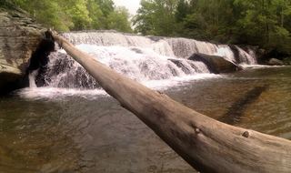 Riley Moore FallsResearched visit notes12 ft (3.6 m) · Oconee County, SC1.6 miS
- Double Branch FallsOconee County, SC2.6 miNW
- Bone Camp Creek FallsOconee County, SC3.0 miN
- Yellow Branch FallsResearched route and starting areaOconee County, SC3.9 miNE
- Lohr's FallsOconee County, SC3.9 miNE
- Chauga NarrowsNational forest path route and parking documented; slippery rock at the endOconee County, SC4.6 miN
- Limestone FallsOconee County, SC4.7 miN
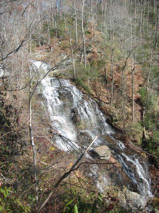 Isaqueena FallsCity park trail to the viewing platform documented; vehicle feeOconee County, SC4.9 miNE