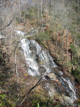
Yellow Branch Falls
Oconee County, South Carolina
Your visit at a glance
- Waterfall height
- Not recorded
- Location
- Oconee County, South Carolina
- Access status
- Researched route and starting area
- The walk
- Directions total 1.5 miles one way, about 3 miles out and back; detailed segments differ slightly.
- Ground & access
- Moderate trail with creek crossings, descending slopes and ravine edges.
Walk the nature-trail approach, then take the falls trail to the waterfall base.
Plan your visit
Yellow Branch Nature Trail to Yellow Branch Falls Trail
Directions give 0.2 mile plus 1.3 miles. Detailed trail description gives about 0.4 plus 1 mile beyond the nature trail; allow for this discrepancy.
Moderate trail with creek crossings, descending slopes and ravine edges.
Where to start
Yellow Branch Picnic Area off SC 28, 6.8 miles west of Walhalla; trailhead lot and uphill overflow lot.
Timing & water
Year-round picnic-area listing; dry spells can reduce the waterfall to a trickle.
Before you go
Reservation requirements and current fees unknown.
Visitor informationMore waterfalls nearby
Within 40 straight-line miles. Road and trail distances will differ.
- Lohr's FallsOconee County, SC0.2 miNW
 Isaqueena FallsCity park trail to the viewing platform documented; vehicle feeOconee County, SC1.1 miNE
- Bone Camp Creek FallsOconee County, SC2.6 miW
- Land Bridge FallsPartial guide: informal fishermen's paths; one sourceOconee County, SC3.0 miNW
- Chauga NarrowsNational forest path route and parking documented; slippery rock at the endOconee County, SC3.1 miNW
- Limestone FallsOconee County, SC3.9 miNW
- Cedar Creek FallsPartial guide: informal side path from an old forest road; position matched by descriptionOconee County, SC3.9 miSW
- Blue Hole FallsParking location and current route condition unconfirmed8 ft (2.5 m) · Oconee County, SC3.9 miSW
- Jim Lee FallsPartial guide: unmarked cross-country route next to private landOconee County, SC4.0 miNE