Chauga Narrows
Oconee County, South Carolina
Your visit at a glance
- Waterfall height
- Not recorded
- Location
- Oconee County, South Carolina
- Access status
- National forest path route and parking documented; slippery rock at the end
- The walk
- About 0.6 mile one way, per SC Trails
- Ground & access
- Old roadbed, then a faint riverside path ending on bare rock that is very slippery when wet. Do not enter the rapid.
Chauga Narrows is a 25-foot chute where the Chauga River squeezes through a 200-foot run, a Class VI rapid, in Sumter National Forest. From Walhalla, drive west on SC 28 about 6.6 miles and turn left on Whetstone Road just before the Mountain Top Trading Post. Drive 3.8 miles to Blackwell Bridge over the Chauga River and park beyond the bridge on the left. Cross Whetstone Road to the trailhead, follow an old roadbed about 0.3 mile, then a narrow, faint path downstream beside the river. At about 0.5 mile the river curves right and the path turns to rock. For the best view, some climbing over rocks is needed.
Plan your visit
Blackwell Bridge on Whetstone Road, then an old roadbed and riverside path downstream to Chauga Narrows
SC Trails gives 0.6 mile downstream from the parking area; the Oconee County guide calls it an easy quarter-mile hike. Return the same way.
Old roadbed, then a faint riverside path ending on bare rock that is very slippery when wet. Do not enter the rapid.
Where to start
Parking just past Blackwell Bridge on Whetstone Road; the Oconee County guide gives N 34.83412, W 83.17474 for the parking area.
Timing & water
No seasonal closure is stated.
Before you go
No fee is mentioned.
Visitor informationVisit sources
More waterfalls nearby
Within 40 straight-line miles. Road and trail distances will differ.
- Land Bridge FallsPartial guide: informal fishermen's paths; one sourceOconee County, SC0.5 miNE
- Limestone FallsOconee County, SC0.9 miW
- Bone Camp Creek FallsOconee County, SC1.6 miS
- Lohr's FallsOconee County, SC2.9 miSE
- Yellow Branch FallsResearched route and starting areaOconee County, SC3.1 miSE
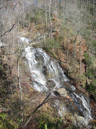 Isaqueena FallsCity park trail to the viewing platform documented; vehicle feeOconee County, SC3.2 miSE
- Double Branch FallsOconee County, SC4.1 miSW
- Jim Lee FallsPartial guide: unmarked cross-country route next to private landOconee County, SC4.4 miE
- Snider FallsOconee County, SC4.5 miN