Jim Lee Falls
Oconee County, South Carolina
Your visit at a glance
- Waterfall height
- Not recorded
- Location
- Oconee County, South Carolina
- Access status
- Partial guide: unmarked cross-country route next to private land
- The walk
- Around 2 miles round trip, a rough estimate per the Oconee County waterfalls site
- Ground & access
- Field edge, then cross-country travel and old logging roads. Unmarked; the source says only experienced off-trail hikers should try it.
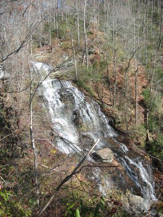
Jim Lee Falls is a waterfall of about 25 feet on Lee Branch near Mountain Rest, surrounded by private property. The Oconee County waterfalls site says it can be reached without trespassing by following old logging roads. Start along the road on the left side of the dove fields, then go cross-country, sometimes on old logging roads. At about 34.84333, -83.09849, angle slightly right and down to pick up the logging road that runs to the creek and the falls. Approach on the right bank (facing downstream); the left bank is a rock wall that leads onto private property. This partial guide relies on one source; the route is unmarked and needs map skills.
Plan your visit
Pull-out on Ross Mountain Road across from the dove fields, road along the left side of the fields, then cross-country and an old logging road down to Lee Branch
The Oconee County waterfalls site says the hike is around two miles round trip, as a rough estimate that depends on the route taken.
Field edge, then cross-country travel and old logging roads. Unmarked; the source says only experienced off-trail hikers should try it.
Where to start
From SC 28, turn right on Tunnel Town Road, then right on Ross Mountain Road after about 0.5 mile. After about 1.8 miles, use the large pull-out on the left across from the dove fields, GPS 34.83875, -83.10667.
Timing & water
No season is stated.
Before you go
No fee is mentioned.
Visitor informationVisit sources
More waterfalls nearby
Within 40 straight-line miles. Road and trail distances will differ.
- Station Cove FallsResearched walking routeOconee County, SC0.7 miNE
- Disappearing FallsPartial guide: small falls beside the Hidden Falls Trail; the route source does not use this nameOconee County, SC2.3 miN
- Hidden FallsSigned state park trail and trailhead documentedOconee County, SC2.4 miN
- Horse Bone FallsPartial guide: no trail; off-trail approach along or down to Horse Bone BranchOconee County, SC2.7 miN
 Isaqueena FallsCity park trail to the viewing platform documented; vehicle feeOconee County, SC3.0 miSW
- Lee FallsPartial guide: no official trail; old fields and an unofficial creekside pathOconee County, SC3.5 miN
- Land Bridge FallsPartial guide: informal fishermen's paths; one sourceOconee County, SC3.9 miW
- Lohr's FallsOconee County, SC4.0 miSW
- Yellow Branch FallsResearched route and starting areaOconee County, SC4.0 miSW