Station Cove Falls
Oconee County, South Carolina
Your visit at a glance
- Waterfall height
- Not recorded
- Location
- Oconee County, South Carolina
- Access status
- Researched walking route
- The walk
- About 1 mile return
- Ground & access
- USFS rates the approach easy; do not climb the waterfall rocks.
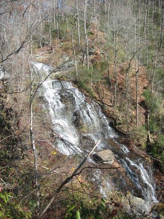
A short trail reaches the stepped waterfall in an Appalachian cove.
Plan your visit
Station Cove Falls Trail from Oconee Station Road
USFS describes a 0.5-mile approach to the falls; return the same way, about 1 mile total.
USFS rates the approach easy; do not climb the waterfall rocks.
Where to start
From SC 11/SC 183, go north 1.5 miles, turn onto Oconee Station Road and continue 2.4 miles. The left-side trailhead holds four cars.
Timing & water
USFS lists all-year use and Site Open, checked October 27, 2026.
Before you go
Fee or reservation requirement not stated on the current visitor page.
Visitor informationVisit sources
More waterfalls nearby
Within 40 straight-line miles. Road and trail distances will differ.
- Jim Lee FallsPartial guide: unmarked cross-country route next to private landOconee County, SC0.7 miSW
- Disappearing FallsPartial guide: small falls beside the Hidden Falls Trail; the route source does not use this nameOconee County, SC2.0 miN
- Hidden FallsSigned state park trail and trailhead documentedOconee County, SC2.1 miN
- Horse Bone FallsPartial guide: no trail; off-trail approach along or down to Horse Bone BranchOconee County, SC2.4 miN
- Lee FallsPartial guide: no official trail; old fields and an unofficial creekside pathOconee County, SC3.3 miN
 Isaqueena FallsCity park trail to the viewing platform documented; vehicle feeOconee County, SC3.6 miSW
- Cheohee Road FallsPartial guide: roadside falls; no parking describedOconee County, SC4.6 miN
- Lohr's FallsOconee County, SC4.6 miSW
- Crossland Creek FallsOconee County, SC4.6 miN