Land Bridge Falls
Oconee County, South Carolina
Your visit at a glance
- Waterfall height
- Not recorded
- Location
- Oconee County, South Carolina
- Access status
- Partial guide: informal fishermen's paths; one source
- The walk
- About 1 mile round trip, per the Oconee County waterfalls site
- Ground & access
- Informal fishermen's paths along the river.
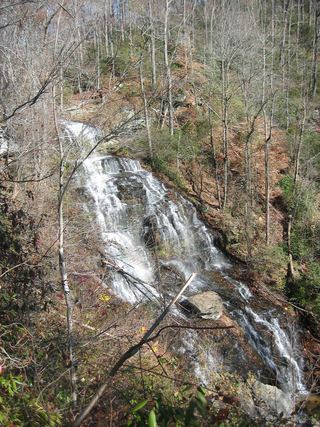
Land Bridge Falls is a 15 to 20 foot waterfall on the Chauga River. Park beside the Land Bridge Road bridge and follow the fishermen's paths along the river that lead to the falls. This partial guide relies on one source; the paths are informal and not marked.
Plan your visit
Land Bridge Road bridge over the Chauga River, then fishermen's paths to Land Bridge Falls
The Oconee County waterfalls site gives approximately 1 mile round trip from the parking at the bridge.
Informal fishermen's paths along the river.
Where to start
From SC 28, turn left onto Whetstone Road, then after about 1 mile turn right onto Land Bridge Road. Follow it about 1.7 miles to the bridge and park on the left, GPS 34.83272, -83.15887.
Timing & water
No season is stated. Avoid the river bank in high water.
Before you go
No fee is mentioned.
Visitor informationVisit sources
More waterfalls nearby
Within 40 straight-line miles. Road and trail distances will differ.
- Chauga NarrowsNational forest path route and parking documented; slippery rock at the endOconee County, SC0.5 miSW
- Limestone FallsOconee County, SC1.3 miW
- Bone Camp Creek FallsOconee County, SC2.0 miSW
- Lohr's FallsOconee County, SC2.8 miSE
 Isaqueena FallsCity park trail to the viewing platform documented; vehicle feeOconee County, SC2.9 miSE
- Yellow Branch FallsResearched route and starting areaOconee County, SC3.0 miSE
- Jim Lee FallsPartial guide: unmarked cross-country route next to private landOconee County, SC3.9 miE
- Snider FallsOconee County, SC4.4 miN
- Double Branch FallsOconee County, SC4.6 miSW