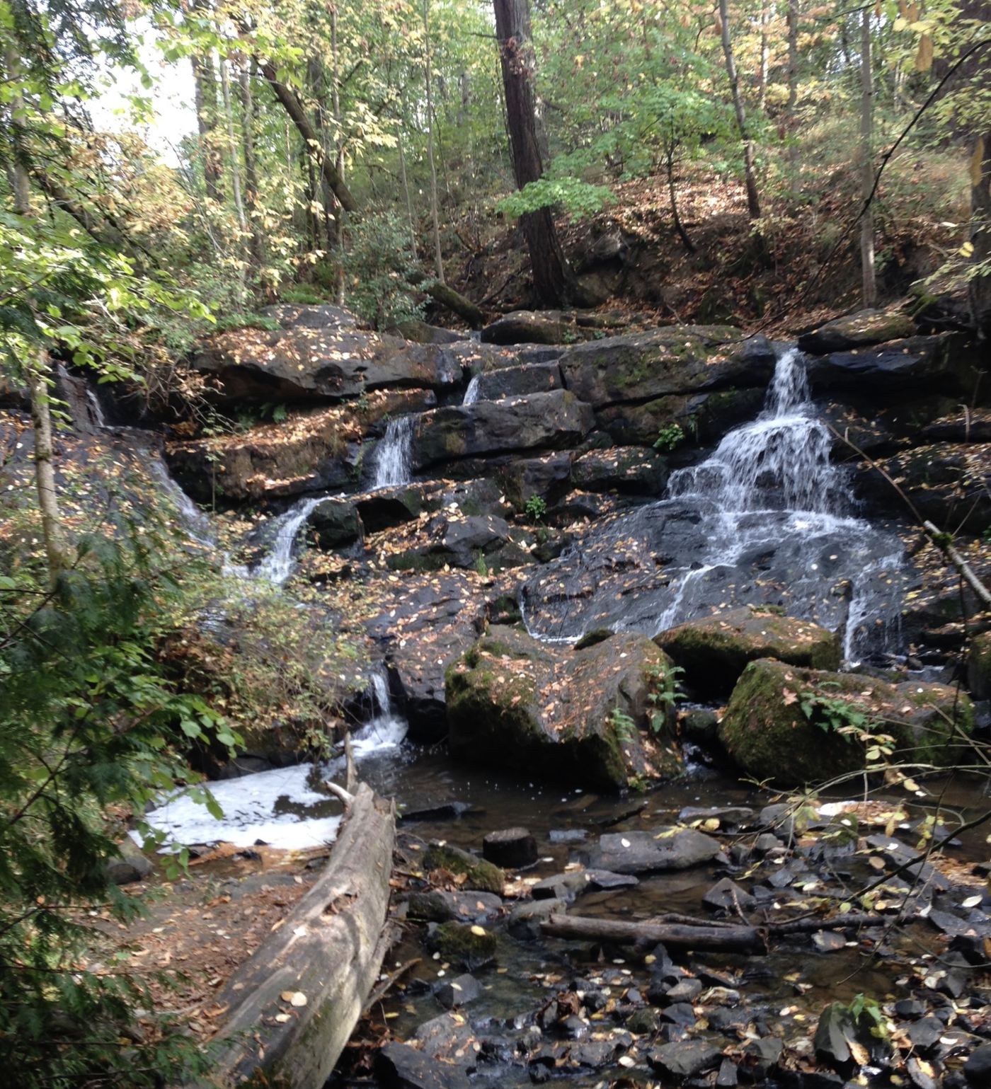
Waterfalls near Portland, OR
69 named waterfalls within 30 miles of Portland, closest first. Distances are straight-line from the town center.
Visits with route details
Read the walking route, starting point and current access notes.
- Jane Martin WaterfallGarden waterfall on paved paths inside a public garden with admissionMultnomah County, OR
 Cedar Mill FallsPartial guide: short boardwalk walk; permission to park in the church lot is not statedWashington County, OR
- Hidden FallsPaved park trail to a bridge view documentedClackamas County, OR
 Singer FallsPartial guide: public stair route documented; parking not describedClackamas County, OR
 Willamette FallsPublic roadside viewpoint with parking documented39 ft (12 m) · Clackamas County, OR
- Tumble Creek FallsGravel park trail to a footbridge below the fallsClackamas County, OR
- Pothole FallsCounty park trail to a fenced viewpoint; view partly blocked by foliage20 ft (6 m) · Clark County, WA
- Lower FallsCounty park trail from the 3rd Avenue trailhead30 ft (9.1 m) · Clark County, WA
- Woodburn FallsPark paths and a short dirt path to a seasonal falls20 ft (6 m) · Clark County, WA
- Upper Latourell FallsState park loop trail to the base of the upper falls120 ft (36.5 m) · Multnomah County, OR
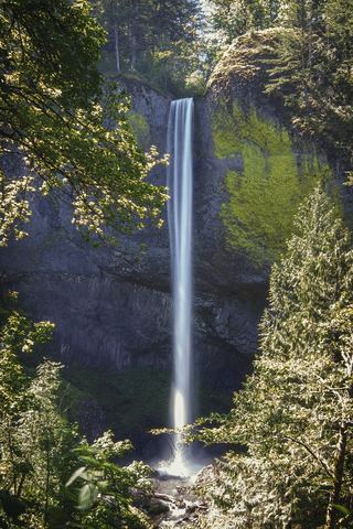 Latourell FallsResearched visit notes224 ft lower falls · Multnomah County, OR
- Bonnie FallsPartial guide: roadside view from the highway right-of-way; land status at the falls is not statedColumbia County, OR
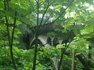 Shepperd's Dell FallsShort paved path from a roadside pullout82 ft (25 m) · Multnomah County, OR
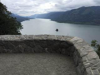 Cape Horn FallsGuide: Gorge loop to a bridge in front of the falls; seasonal falcon closure597 ft (182 m) · Skamania County, WA
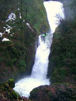 Bridal Veil FallsResearched visit notes118 ft (36 m) · Multnomah County, OR
- Lucia FallsShort path in a county park; no swimming15 ft (4.6 m) · Clark County, WA
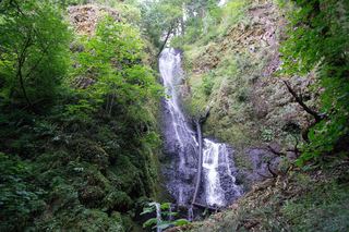 Coopey FallsTrail viewpoint above the falls; the base is on private convent land150 ft (45.7 m) · Multnomah County, OR
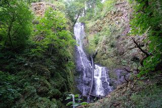 Upper Coopey FallsShort climb on the Angels Rest Trail and side path to the baseMultnomah County, OR
- Moulton FallsCounty park; the falls are a few steps from parking11 ft (3.3 m) · Clark County, WA
- Hidden FallsState forest trail to a bridge view of the fallsClark County, WA
- Yacolt FallsCounty park falls a flight of stairs from a roadside pullout34 ft (10.3 m) · Clark County, WA
- Dalton FallsPartial guide: distant pond-shore view; identity as the historic Dalton Falls is uncertainMultnomah County, OR
- Mist FallsFull view from Benson State Recreation Area; rough optional scramble to base518 ft (158 m) · Multnomah County, OR
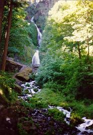 Wahkeena FallsResearched visit notes242 ft (73.7 m) · Multnomah County, OR
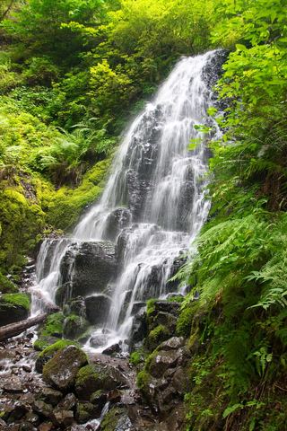 Fairy FallsResearched visit notes20 ft (6.1 m) · Multnomah County, OR
- Horseshoe FallsClosed to public access according to the landowner's 2025 report; no public approach or parking verified.22 ft (6.7 m) · Clark County, WA
- Shady Creek FallsRoadside view from the Multnomah Falls I-84 parking lot177 ft (54 m) · Multnomah County, OR
- Dougan FallsRoadside falls at a state forest day-use site; Discover PassSkamania County, WA
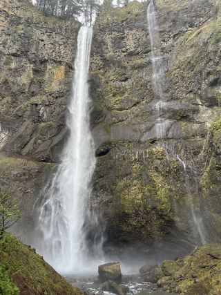 Lower Multnomah FallsPaved viewpoint walk and seasonal permits documented69 ft (21 m) · Multnomah County, OR
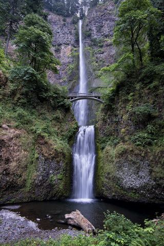 Multnomah FallsResearched visit notes620 ft total · Multnomah County, OR
- Dutchman FallsPaved and dirt trail above Multnomah Falls; summer parking permits33 ft (10 m) · Multnomah County, OR
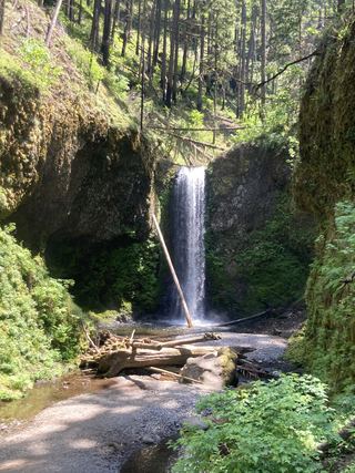 Wiesendanger FallsResearched walking route49 ft (15 m) · Multnomah County, OR
- Ecola FallsBusy trail from Multnomah Falls Lodge past the top of the falls55 ft (16.7 m) · Multnomah County, OR
- Naked FallsPartial guide: private land open for a paid parking pass; trail details not describedSkamania County, WA
- Little Lee FallsPartial guide: no legal parking near the gate is identifiedWashington County, OR
- Sunset FallsSource-reviewed route and parking14 ft (4.2 m) · Clark County, WA
- Quad FallsUser-built trail on public and land trust property to a spur viewpointSkamania County, WA
- Lower Quad FallsPartial guide: user-maintained trail; no distance or close viewpoint for this falls is describedSkamania County, WA
- Triple FallsParking location unconfirmed64 ft (19.5 m) · Multnomah County, OR
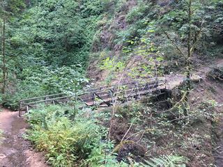 Upper Oneonta FallsPartial guide: only the top of the falls is visible from the trail; no route to the base65 ft (19.8 m) · Multnomah County, OR
- Apron FallsPartial guide: user-maintained trail on public and land trust property; no distance to this fallsSkamania County, WA
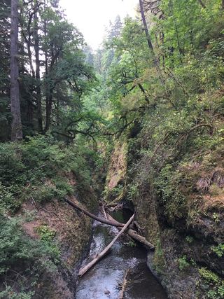 Middle Oneonta FallsGorge trail past Ponytail Falls to a footbridge view24 ft (7.3 m) · Multnomah County, OR
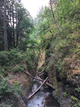 Oneonta FallsPartial guide: only a partial view of the upper falls from the trail; the gorge route to the base is closed98 ft (30 m) · Multnomah County, OR
- Nellie Corser CascadeShort wildlife area loop past the cascades; avoid the posted private parcelSkamania County, WA
- Railcar FallsPartial: user-maintained trail with blocked views; the road above the falls is private timberlandSkamania County, WA
- Duncan Creek FallsShort wildlife area loop past the falls; avoid the posted private parcel48 ft (14.6 m) · Skamania County, WA
- Lee FallsPartial guide: legal parking for the road walk not confirmedWashington County, OR
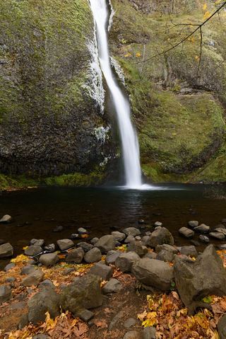 Horsetail FallsResearched walking route214 ft (65.2 m) · Multnomah County, OR
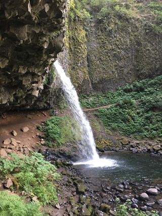 Ponytail FallsResearched visit notes88 ft (26.8 m) · Multnomah County, OR
Closest with a photo
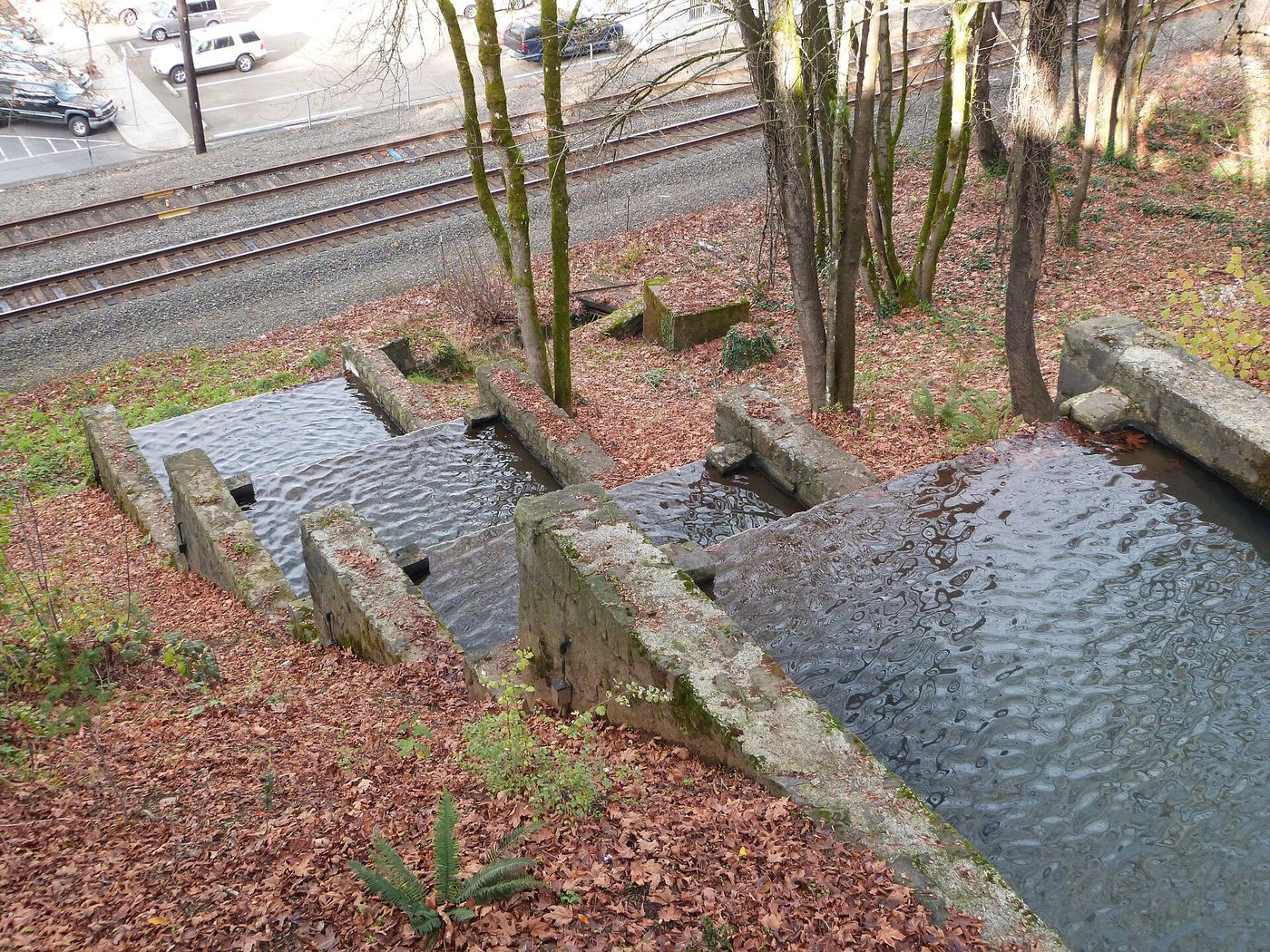
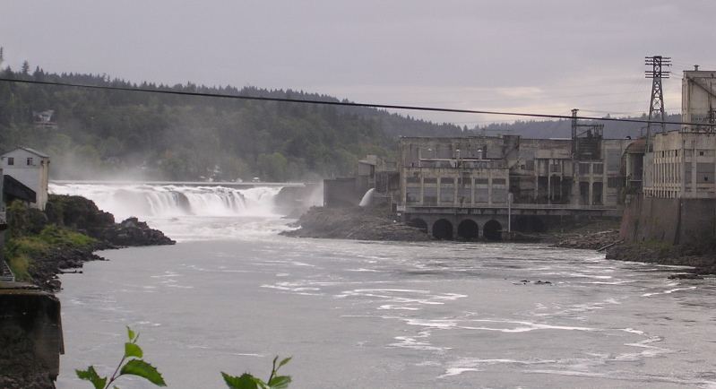
Photo credit
Photo: The original uploader was Cacophony at English Wikipedia., CC BY-SA 3.0, via Wikimedia CommonsAll 69 waterfalls
- Jane Martin WaterfallGarden waterfall on paved paths inside a public garden with admissionMultnomah County, OR3.6 miSE
- Cedar Mill FallsPartial guide: short boardwalk walk; permission to park in the church lot is not statedWashington County, OR6.0 miW
- Knapp FallsMultnomah County, OR6.8 miSE
- Hidden FallsPaved park trail to a bridge view documentedClackamas County, OR11 miSE
- Singer FallsPartial guide: public stair route documented; parking not describedClackamas County, OR12 miS
- Willamette FallsPublic roadside viewpoint with parking documented39 ft (12 m) · Clackamas County, OR12 miS
- Coffee Creek FallsClackamas County, OR13 miS
- Tumble Creek FallsGravel park trail to a footbridge below the fallsClackamas County, OR14 miS
- Pothole FallsCounty park trail to a fenced viewpoint; view partly blocked by foliage20 ft (6 m) · Clark County, WA14 miE
- Jackson FallsWashington County, OR14 miNW
- Lower FallsCounty park trail from the 3rd Avenue trailhead30 ft (9.1 m) · Clark County, WA15 miE
- Woodburn FallsPark paths and a short dirt path to a seasonal falls20 ft (6 m) · Clark County, WA15 miE
- Salmon FallsClark County, WA20 miNE
- Upper Latourell FallsState park loop trail to the base of the upper falls120 ft (36.5 m) · Multnomah County, OR22 miE
- Latourell FallsResearched visit notes224 ft lower falls · Multnomah County, OR22 miE
- Belle Center FallsSkamania County, WA22 miE
- Cedar FallsClark County, WA23 miNE
- Bonnie FallsPartial guide: roadside view from the highway right-of-way; land status at the falls is not statedColumbia County, OR23 miNW
- Shepperd's Dell FallsShort paved path from a roadside pullout82 ft (25 m) · Multnomah County, OR23 miE
- Cape Horn FallsGuide: Gorge loop to a bridge in front of the falls; seasonal falcon closure597 ft (182 m) · Skamania County, WA23 miE
- Teakettle FallsSkamania County, WA24 miNE
- Bridal Veil FallsResearched visit notes118 ft (36 m) · Multnomah County, OR24 miE
- Jenny Creek FallsClark County, WA24 miN
- Upper Bridal Veil Falls80 ft (24.4 m) · Multnomah County, OR24 miE
- Lucia FallsShort path in a county park; no swimming15 ft (4.6 m) · Clark County, WA24 miNE
- Coopey FallsTrail viewpoint above the falls; the base is on private convent land150 ft (45.7 m) · Multnomah County, OR25 miE
- Upper Coopey FallsShort climb on the Angels Rest Trail and side path to the baseMultnomah County, OR25 miE
- Rock Creek FallsClark County, WA25 miNE
- Moulton FallsCounty park; the falls are a few steps from parking11 ft (3.3 m) · Clark County, WA25 miNE
- Hidden FallsState forest trail to a bridge view of the fallsClark County, WA26 miNE
- Foxglove FallsMultnomah County, OR26 miE
- Yacolt FallsCounty park falls a flight of stairs from a roadside pullout34 ft (10.3 m) · Clark County, WA26 miNE
- Dalton FallsPartial guide: distant pond-shore view; identity as the historic Dalton Falls is uncertainMultnomah County, OR26 miE
- Mist FallsFull view from Benson State Recreation Area; rough optional scramble to base518 ft (158 m) · Multnomah County, OR27 miE
- Silver Star FallsSkamania County, WA27 miNE
- Wahkeena FallsResearched visit notes242 ft (73.7 m) · Multnomah County, OR27 miE
- Fairy FallsResearched visit notes20 ft (6.1 m) · Multnomah County, OR27 miE
- Horseshoe FallsClosed to public access according to the landowner's 2025 report; no public approach or parking verified.22 ft (6.7 m) · Clark County, WA27 miNE
- Shady Creek FallsRoadside view from the Multnomah Falls I-84 parking lot177 ft (54 m) · Multnomah County, OR27 miE
- Big Tree Creek Falls58 ft (17.6 m) · Clark County, WA27 miNE
- Dougan FallsRoadside falls at a state forest day-use site; Discover PassSkamania County, WA27 miE
- Lower Multnomah FallsPaved viewpoint walk and seasonal permits documented69 ft (21 m) · Multnomah County, OR27 miE
- Multnomah FallsResearched visit notes620 ft total · Multnomah County, OR27 miE
- Gable Falls192 ft (58.5 m) · Skamania County, WA28 miE
- Dutchman FallsPaved and dirt trail above Multnomah Falls; summer parking permits33 ft (10 m) · Multnomah County, OR28 miE
Show the other 24 waterfalls, 28 mi to 30 mi away
- Wiesendanger FallsResearched walking route49 ft (15 m) · Multnomah County, OR28 miE
- Ecola FallsBusy trail from Multnomah Falls Lodge past the top of the falls55 ft (16.7 m) · Multnomah County, OR28 miE
- Star Creek Falls26 ft (8 m) · Skamania County, WA28 miNE
- Archer Falls218 ft (66.4 m) · Skamania County, WA28 miE
- Naked FallsPartial guide: private land open for a paid parking pass; trail details not describedSkamania County, WA29 miNE
- Indian Mary Falls33 ft (10 m) · Skamania County, WA29 miE
- Little Lee FallsPartial guide: no legal parking near the gate is identifiedWashington County, OR29 miW
- Grist Mill FallsClark County, WA29 miN
- Waespe FallsMultnomah County, OR29 miE
- Sunset FallsSource-reviewed route and parking14 ft (4.2 m) · Clark County, WA29 miNE
- Twin Falls66 ft (20 m) · Clark County, WA29 miNE
- Quad FallsUser-built trail on public and land trust property to a spur viewpointSkamania County, WA29 miE
- Lower Quad FallsPartial guide: user-maintained trail; no distance or close viewpoint for this falls is describedSkamania County, WA29 miE
- Triple FallsParking location unconfirmed64 ft (19.5 m) · Multnomah County, OR29 miE
- Upper Oneonta FallsPartial guide: only the top of the falls is visible from the trail; no route to the base65 ft (19.8 m) · Multnomah County, OR29 miE
- Apron FallsPartial guide: user-maintained trail on public and land trust property; no distance to this fallsSkamania County, WA29 miE
- Middle Oneonta FallsGorge trail past Ponytail Falls to a footbridge view24 ft (7.3 m) · Multnomah County, OR30 miE
- Oneonta FallsPartial guide: only a partial view of the upper falls from the trail; the gorge route to the base is closed98 ft (30 m) · Multnomah County, OR30 miE
- Nellie Corser CascadeShort wildlife area loop past the cascades; avoid the posted private parcelSkamania County, WA30 miE
- Railcar FallsPartial: user-maintained trail with blocked views; the road above the falls is private timberlandSkamania County, WA30 miE
- Duncan Creek FallsShort wildlife area loop past the falls; avoid the posted private parcel48 ft (14.6 m) · Skamania County, WA30 miE
- Lee FallsPartial guide: legal parking for the road walk not confirmedWashington County, OR30 miW
- Horsetail FallsResearched walking route214 ft (65.2 m) · Multnomah County, OR30 miE
- Ponytail FallsResearched visit notes88 ft (26.8 m) · Multnomah County, OR30 miE