Lee Falls
Washington County, Oregon
Your visit at a glance
- Waterfall height
- Not recorded
- Location
- Washington County, Oregon
- Access status
- Partial guide: legal parking for the road walk not confirmed
- The walk
- Oregon Hikers gives 6.6 miles round trip from the Lee Falls Road pullouts; the walk from legal parking may be longer
- Ground & access
- Gravel road with gentle ups and downs along the river.
Lee Falls is a 12- to 15-foot block waterfall on the Tualatin River above Cherry Grove in Washington County, a popular summer swimming hole. It is reached on foot along a gravel road maintained by the City of Hillsboro Municipal Water District. Walk past the gate, signed No Unauthorized Vehicles and No Parking At Any Time, and follow the road up the river; side paths at the first bend lead to Little Lee Falls. Stay on the road and leave no trace. The road reaches Lee Falls, with a fish ladder on the far side. Return the same way. Farther up, a locked yellow gate closes the road to the public.
Plan your visit
SW Lee Falls Road gate near Cherry Grove, walking the City of Hillsboro water district gravel road up the Tualatin River to Lee Falls
Oregon Hikers lists 6.6 miles round trip, out and back, from the Lee Falls Road Trailhead pullouts to Lee Falls. Those pullouts are now signed No Parking, so the walk from a legal parking spot may be longer.
Gravel road with gentle ups and downs along the river.
Where to start
Not confirmed. Oregon Hikers warns not to park at or near the gate on SW Lee Falls Road and reports No Parking signs at all the pullouts along the approach road. It advises parking on a public street and walking in, which may add distance.
Timing & water
All year per Oregon Hikers. In summer the swimming hole is crowded and parking is especially restricted; other months are quieter.
Before you go
No fee is mentioned.
Visitor informationVisit sources
More waterfalls nearby
Within 40 straight-line miles. Road and trail distances will differ.
- Little Lee FallsPartial guide: no legal parking near the gate is identifiedWashington County, OR1.4 miSE
- Haines FallsWashington County, OR1.7 miW
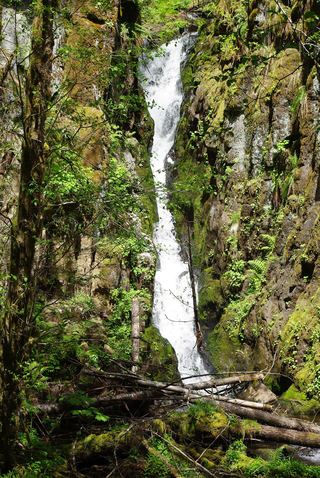 Ki-a-Kuts FallsPartial: historical off-trail route documented; current logging-road permission and access unverifiedWashington County, OR5.0 miW
- University FallsState forest trail to the falls documentedTillamook County, OR11 miNW
- Fern Rock FallsRoadside turnout view documentedTillamook County, OR12 miNW
- Stafford Falls98 ft (30 m) · Tillamook County, OR13 miNW
- Wilson FallsEstablished trail from Footbridge Trailhead; distance to the falls not given200 ft (61 m) · Tillamook County, OR16 miNW
- Bridge Creek FallsShort stone staircase from the highway to the baseTillamook County, OR16 miNW
- Jackson FallsWashington County, OR20 miNE