University Falls
Tillamook County, Oregon
Your visit at a glance
- Waterfall height
- Not recorded
- Location
- Tillamook County, Oregon
- Access status
- State forest trail to the falls documented
- The walk
- About a third of a mile; 0.7 mile round trip
- Ground & access
- Eroded natural-surface trail with roots and rocks, a steep drop into a gully, and two crossings of an ATV track.
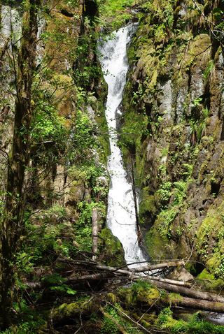
University Falls is a 60-foot falls on Elliott Creek. From the trailhead, take the eroded path up from the left side (not the Powerline Motorcycle Trail just to the west). Cross the ATV track two times, drop across a gully under power lines, and enter forest. Keep straight past the Gravelle Brothers Trail junction to a campsite, then bear left past an old painted sign to the falls.
Plan your visit
University Falls Trailhead to the base of University Falls
Oregon Hikers gives a trail about a third of a mile long and 0.7 mile round trip with 180 feet of gain.
Eroded natural-surface trail with roots and rocks, a steep drop into a gully, and two crossings of an ATV track.
Where to start
Small gravel pullout for about six cars at the signed University Falls Trailhead, reached from the Rogers Camp turnoff on Highway 6 via Beaver Dam Road and University Falls Road. No restrooms or water. Share forest roads with ATVs.
Timing & water
Oregon Hikers lists the trail as open all year. The falls shrink to a trickle by mid-summer; winter and spring are best.
Before you go
No fee is mentioned.
Visitor informationVisit sources
More waterfalls nearby
Within 40 straight-line miles. Road and trail distances will differ.
- Stafford Falls98 ft (30 m) · Tillamook County, OR1.9 miNW
- Fern Rock FallsRoadside turnout view documentedTillamook County, OR2.1 miW
- Wilson FallsEstablished trail from Footbridge Trailhead; distance to the falls not given200 ft (61 m) · Tillamook County, OR8.9 miW
 Ki-a-Kuts FallsPartial: historical off-trail route documented; current logging-road permission and access unverifiedWashington County, OR9.2 miS
- Bridge Creek FallsShort stone staircase from the highway to the baseTillamook County, OR9.6 miW
- Haines FallsWashington County, OR9.9 miS
- Lee FallsPartial guide: legal parking for the road walk not confirmedWashington County, OR11 miSE
- Little Lee FallsPartial guide: no legal parking near the gate is identifiedWashington County, OR12 miSE
- Kilchis FallsPartial guide: roadside falls on rough unmarked forest roads; no parking area describedTillamook County, OR13 miW