Kilchis Falls
Tillamook County, Oregon
Your visit at a glance
- Waterfall height
- Not recorded
- Location
- Tillamook County, Oregon
- Access status
- Partial guide: roadside falls on rough unmarked forest roads; no parking area described
- The walk
- Roadside view; no walk described
- Ground & access
- Rough, steep and often unmarked gravel logging roads. The Survey recommends a good four-wheel-drive vehicle.
Kilchis Falls drops about 100 feet over a dark cliff beside the Kilchis River Forest Road below Cedar Butte. The Survey describes two road approaches: Cedar Creek Road from Highway 6 near the Tillamook Forestry Center, which climbs about 1,500 feet in 2.5 miles on rough gravel before passing the falls on the left, or the flatter but longer Kilchis River Road from Highway 101. Bring maps; the forest roads are often unmarked.
Plan your visit
Kilchis River Forest Road roadside view of Kilchis Falls
Both sources place the falls right beside the Kilchis River Forest Road. Road distances in the sources are driving distances, not a walk.
Rough, steep and often unmarked gravel logging roads. The Survey recommends a good four-wheel-drive vehicle.
Where to start
No parking area is described. The falls are beside the road; pull fully off the road only where it is safe.
Timing & water
The stream is small; the Survey doubts it flows strongly after April. Visit during the rainy season.
Before you go
No fee is mentioned.
Visitor informationMore waterfalls nearby
Within 40 straight-line miles. Road and trail distances will differ.
- Bridge Creek FallsShort stone staircase from the highway to the baseTillamook County, OR4.4 miSE
- Wilson FallsEstablished trail from Footbridge Trailhead; distance to the falls not given200 ft (61 m) · Tillamook County, OR4.5 miSE
- Nehalem FallsShort trail from a state forest campground to the riverside fallsTillamook County, OR10 miNW
- Fern Rock FallsRoadside turnout view documentedTillamook County, OR11 miE
- Stafford Falls98 ft (30 m) · Tillamook County, OR12 miE
- University FallsState forest trail to the falls documentedTillamook County, OR13 miE
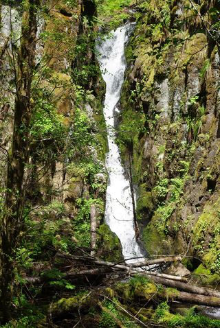 Ki-a-Kuts FallsPartial: historical off-trail route documented; current logging-road permission and access unverifiedWashington County, OR16 miSE
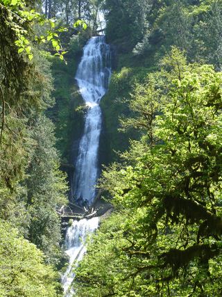 Munson Creek FallsResearched visit notes319 ft (97.2 m) · Tillamook County, OR17 miS
- Haines FallsWashington County, OR19 miSE