Fern Rock Falls
Tillamook County, Oregon
Your visit at a glance
- Waterfall height
- Not recorded
- Location
- Tillamook County, Oregon
- Access status
- Roadside turnout view documented
- The walk
- Roadside view; about 100 feet from the turnout to the falls
- Ground & access
- Roadside turnout on a highway. Watch for traffic.
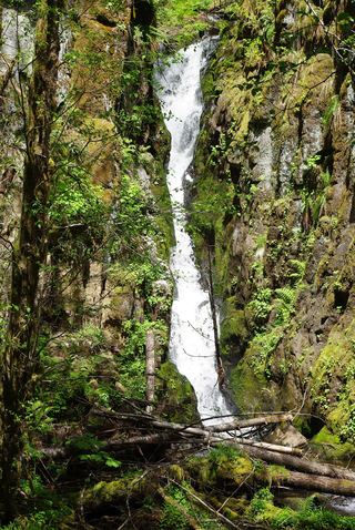
Fern Rock Falls is a small year-round falls in an alcove on the north side of Highway 6 in the Tillamook State Forest. Pull into the large turnout and look back into the alcove. A small sign reading Falls marks the spot.
Plan your visit
Highway 6 turnout view of Fern Rock Falls
The Survey says the falls are about 100 feet back from a large turnout on Highway 6. No walk is needed to see them.
Roadside turnout on a highway. Watch for traffic.
Where to start
Large turnout on the north side of Highway 6, about 29 miles east of Tillamook or 13 miles west of the junction of Highways 6 and 8.
Timing & water
The Survey says the falls seem to flow all year.
Before you go
No fee is mentioned.
Visitor informationVisit sources
More waterfalls nearby
Within 40 straight-line miles. Road and trail distances will differ.
- Stafford Falls98 ft (30 m) · Tillamook County, OR1.5 miNE
- University FallsState forest trail to the falls documentedTillamook County, OR2.1 miE
- Wilson FallsEstablished trail from Footbridge Trailhead; distance to the falls not given200 ft (61 m) · Tillamook County, OR7.1 miW
- Bridge Creek FallsShort stone staircase from the highway to the baseTillamook County, OR7.8 miSW
 Ki-a-Kuts FallsPartial: historical off-trail route documented; current logging-road permission and access unverifiedWashington County, OR10 miS
- Kilchis FallsPartial guide: roadside falls on rough unmarked forest roads; no parking area describedTillamook County, OR11 miW
- Haines FallsWashington County, OR11 miSE
- Lee FallsPartial guide: legal parking for the road walk not confirmedWashington County, OR12 miSE
- Little Lee FallsPartial guide: no legal parking near the gate is identifiedWashington County, OR14 miSE