Scenic site reopened; bridge-route repairs pending
Michigan
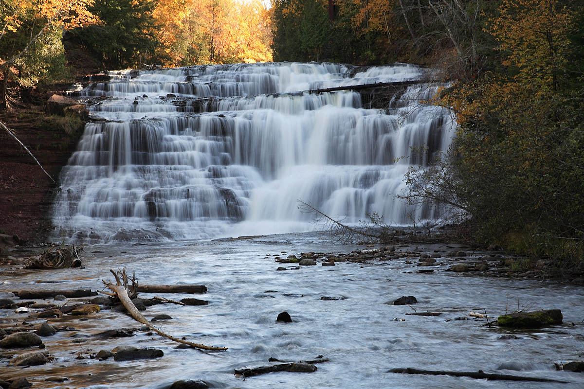
Agate Falls
0.5-mile trail; return basis unclear
The scenic site has reopened. The platform overlooks the crest; the separate ORV and snowmobile bridge routes remain closed through winter.
Compare 79 Michigan waterfall visits by the approach, terrain, and where to start. Some routes have closures or unresolved details; read the individual guide before travelling.
79 visit options
Scenic site reopened; bridge-route repairs pending
Michigan
0.5-mile trail; return basis unclear
The scenic site has reopened. The platform overlooks the crest; the separate ORV and snowmobile bridge routes remain closed through winter.
Roadside falls located; parking not confirmed
Michigan
Roadside; no walk needed
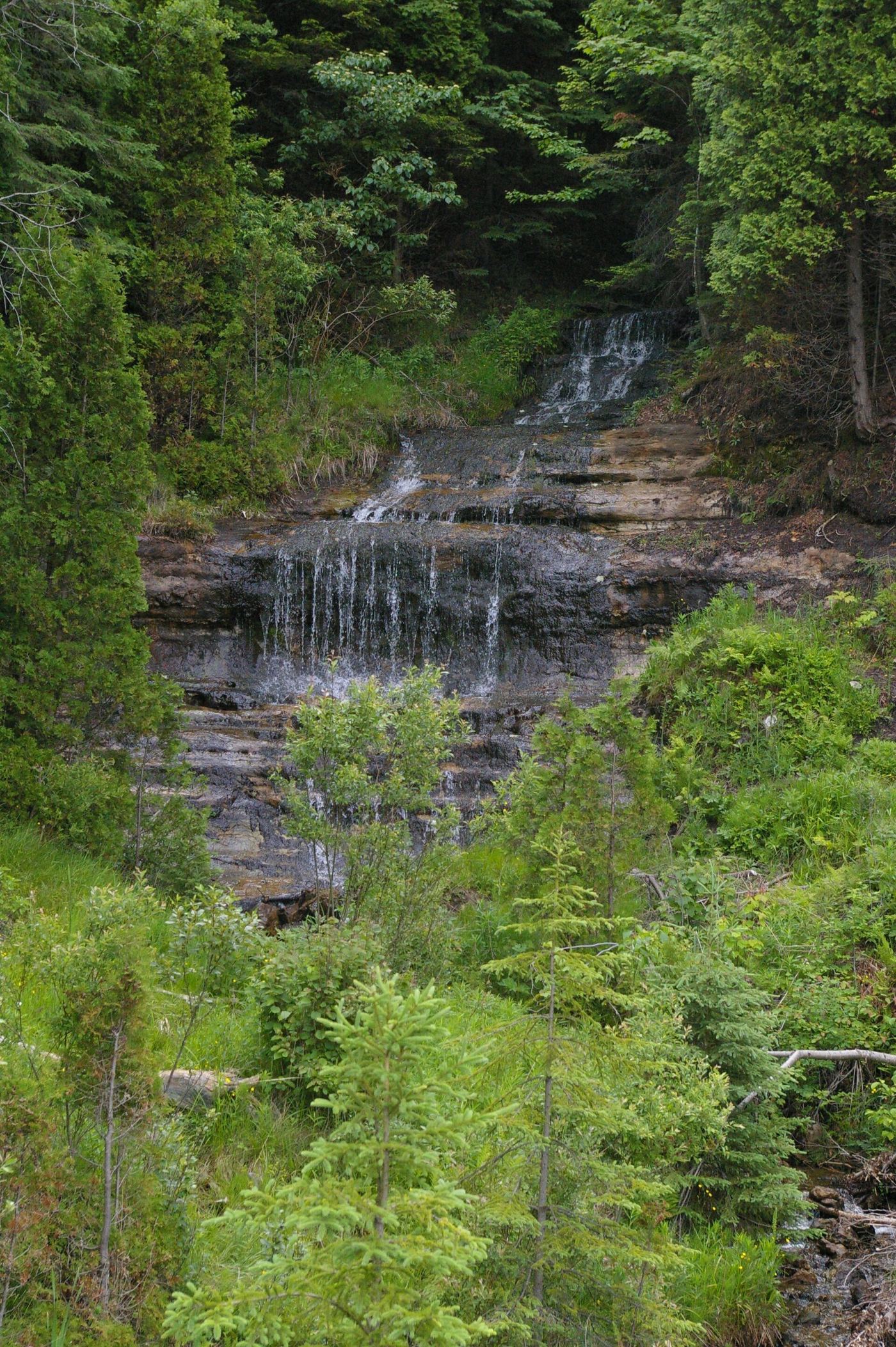
Alger Falls is a small roadside waterfall on Alger Creek beside M-28, just across from the M-94 junction outside Munising. The guide author warns that M-28 comes down a hill around a curve here, with fast traffic and limited sight lines. The flow drops by midsummer.
Source-reviewed route and parking
Michigan
Walk length not stated
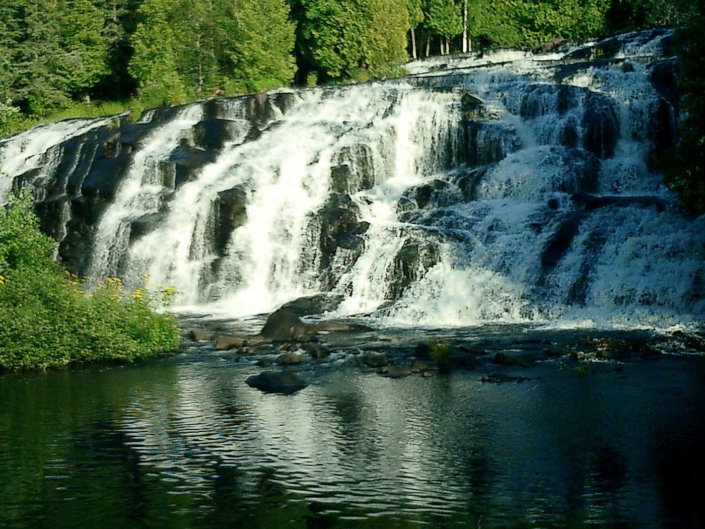
Michigan DNR identifies an accessible boardwalk with six viewing locations at Bond Falls on the middle branch of the Ontonagon River.
Roadside park trail to a gorge falls
Michigan
About 1 mile one way, about 2 miles return
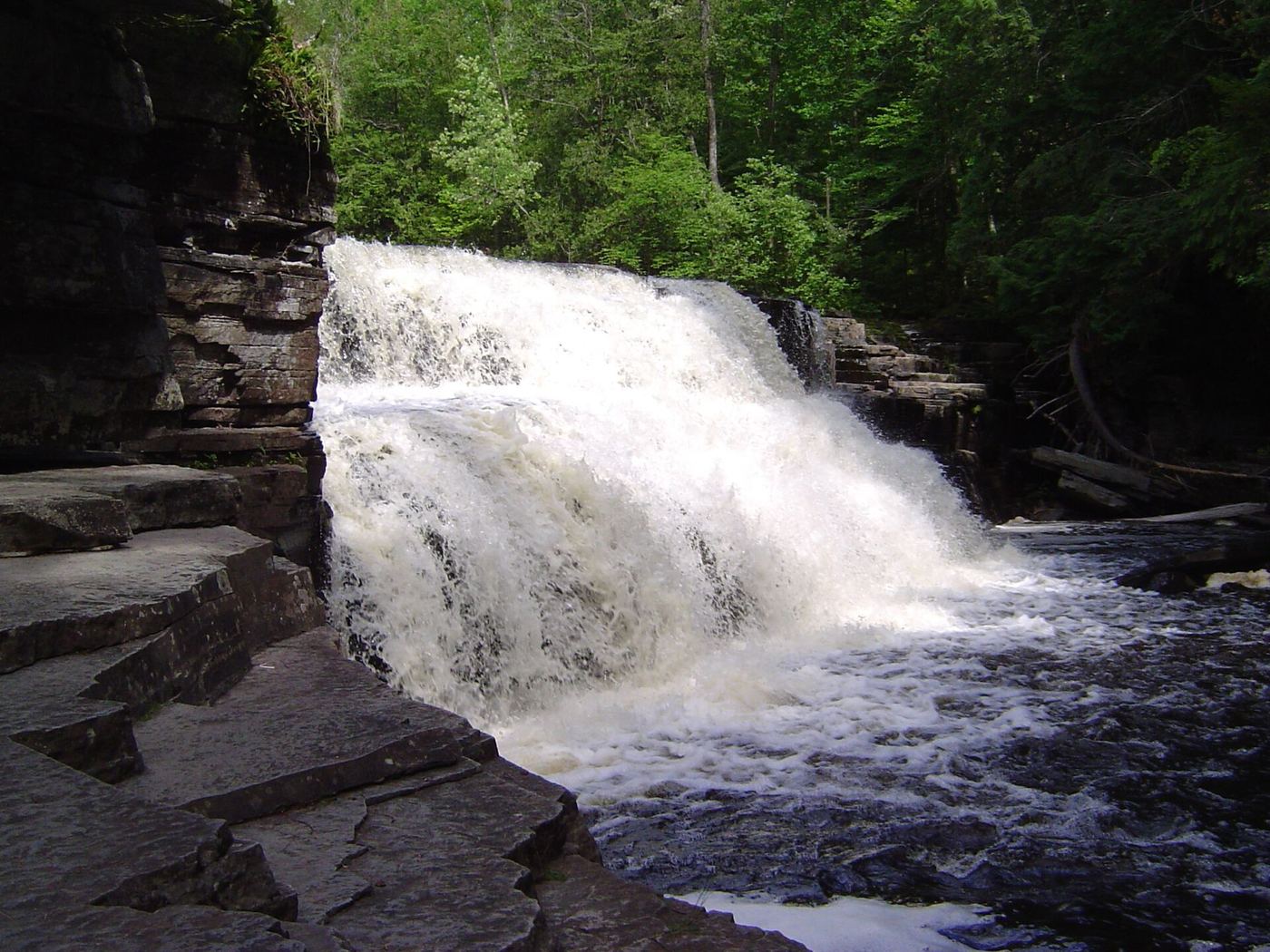
Canyon Falls is a 15-foot drop into a boxy gorge on the Sturgeon River, about 15 miles south of L'Anse. The trail starts at a roadside park on US-41 and runs about a mile to the falls. Beyond the falls an unmaintained trail continues along the gorge rim past more rapids and small drops.
National lakeshore trail; entrance pass required
Michigan
About 1.25 miles one way, 2.5 miles return
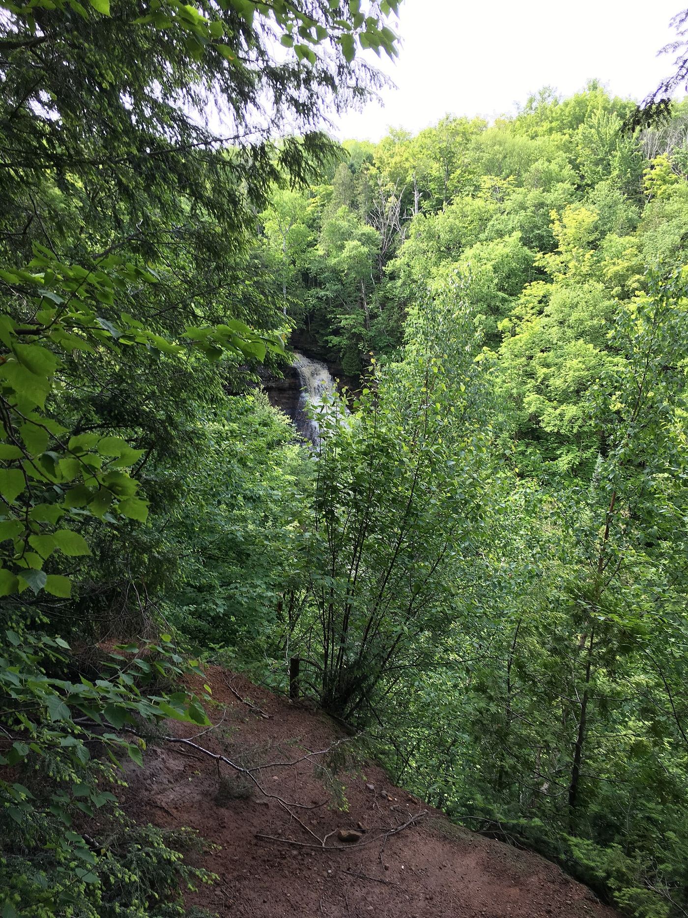
Chapel Falls is a 60-foot waterfall on Section Creek in Pictured Rocks National Lakeshore. From the Chapel parking lot, the trail follows an old roadbed through upland maple forest along the gorge to the falls. The trail crosses the creek just above the falls, and the best view is from a platform on the far side. The trail continues about 2 miles more to Chapel Rock and Chapel Beach.

Roadside bridge viewpoint documented
Michigan
Roadside; a few steps to the pedestrian bridge
Park on the east side of the Eagle River bridge, a short distance off M-26 in the town of Eagle River. The old steel highway bridge is now a pedestrian bridge and serves as a viewing platform for the falls, which slide over a bowl of basalt below an old wooden dam. A small footpath leads down to the river edge.
Official park description of the walk to the falls
Michigan
Short walk plus a couple of hundred yards on the beach
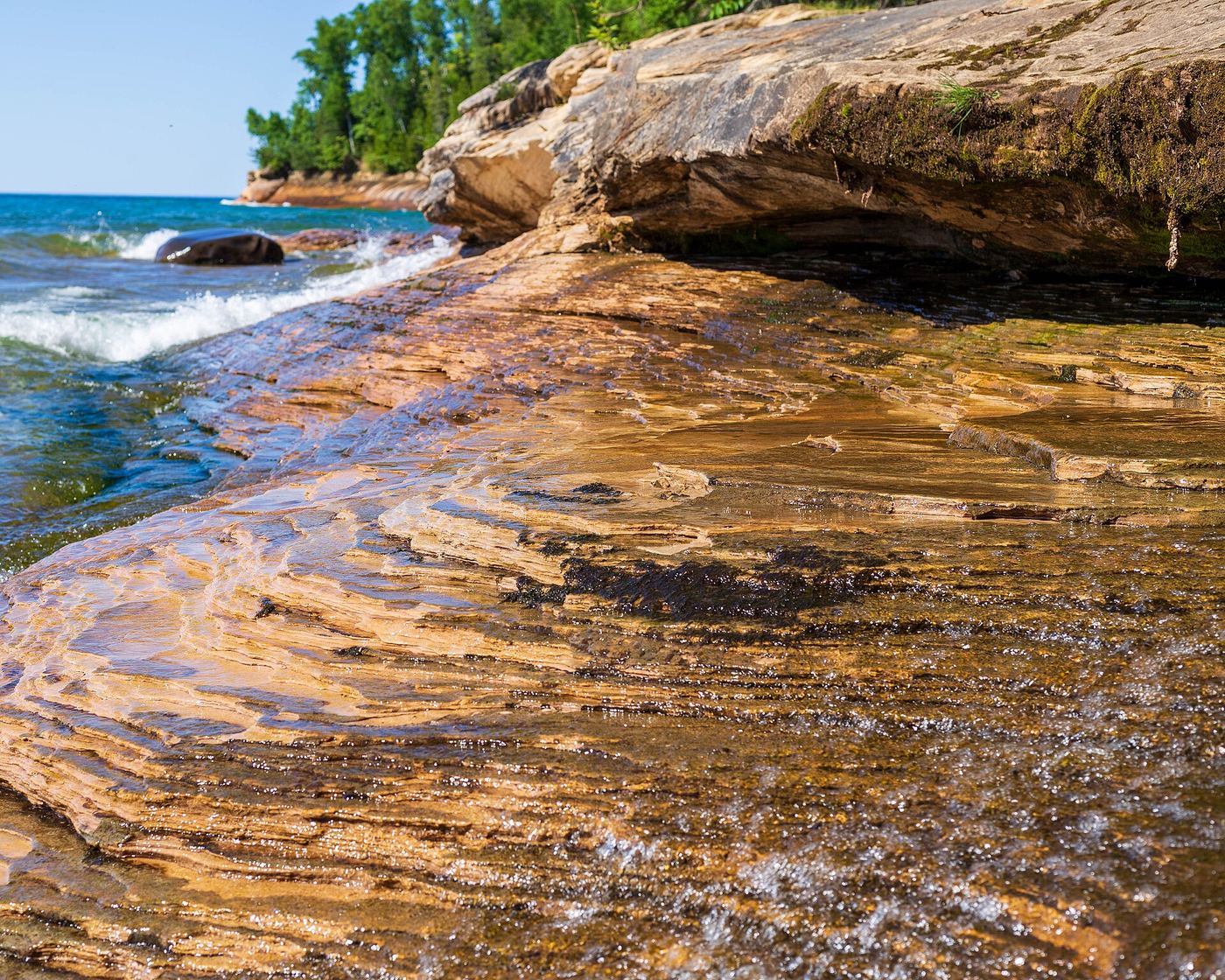
Park at the lot at the east end of Miners Beach Road. A short walk leads to a staircase down to the beach. Turn right and walk a couple of hundred yards to the eastern end of Miners Beach, where Elliot Falls drops where the beach meets the cliffs.
Visitor route described; unmarked route and land permission not confirmed
Michigan
About 0.7 mile one way (straight-line position from the road, per the guide author)
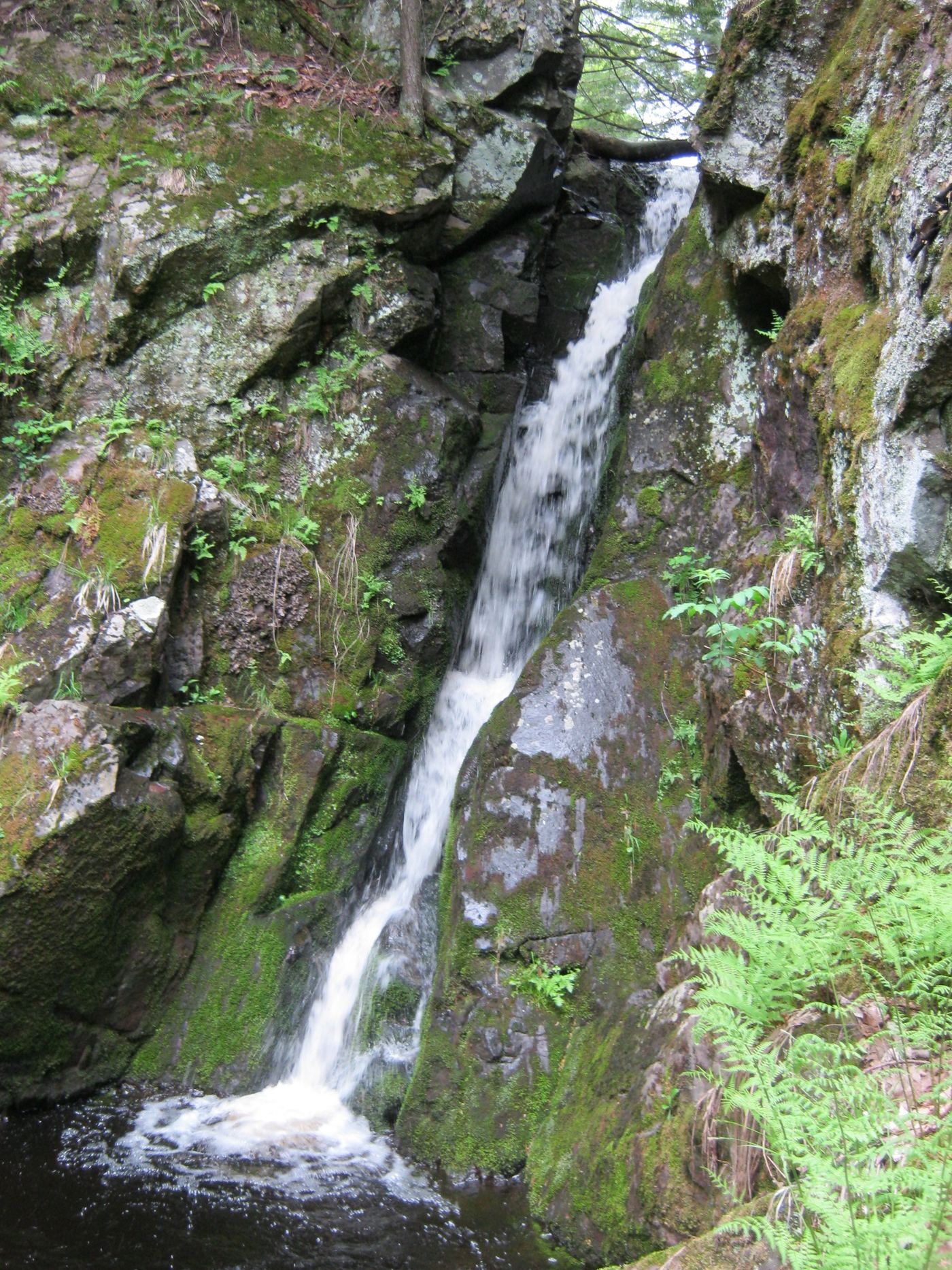
Gleason Falls is a sharp 10-foot drop in a deep canyon on Gleason Creek. Drive south on Norwich Road from M-64 for 12.5 miles, turn left on unmarked Victoria Road, and drive 3 miles east to park near a logging trail on the right, about 0.2 mile past Gleason Creek. Follow logging roads south roughly parallel to the creek, or follow the creek downstream if confused. The guide author says the canyon is best reached by bypassing the falls and doubling back. There is no marked trail, and land ownership is not stated.
Construction incomplete; waterfall approach undeveloped
Michigan
Distance not verified
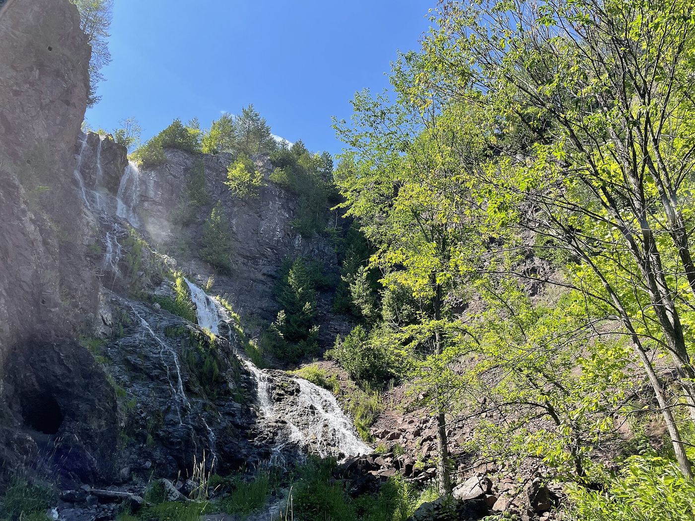
Construction is incomplete as checked October 27, 2026. The completed accessible section ends at the creek bridge; waterfall access improvements are planned for 2027.
Official state park trail, parking and pass requirement documented
Michigan
About 1 mile return
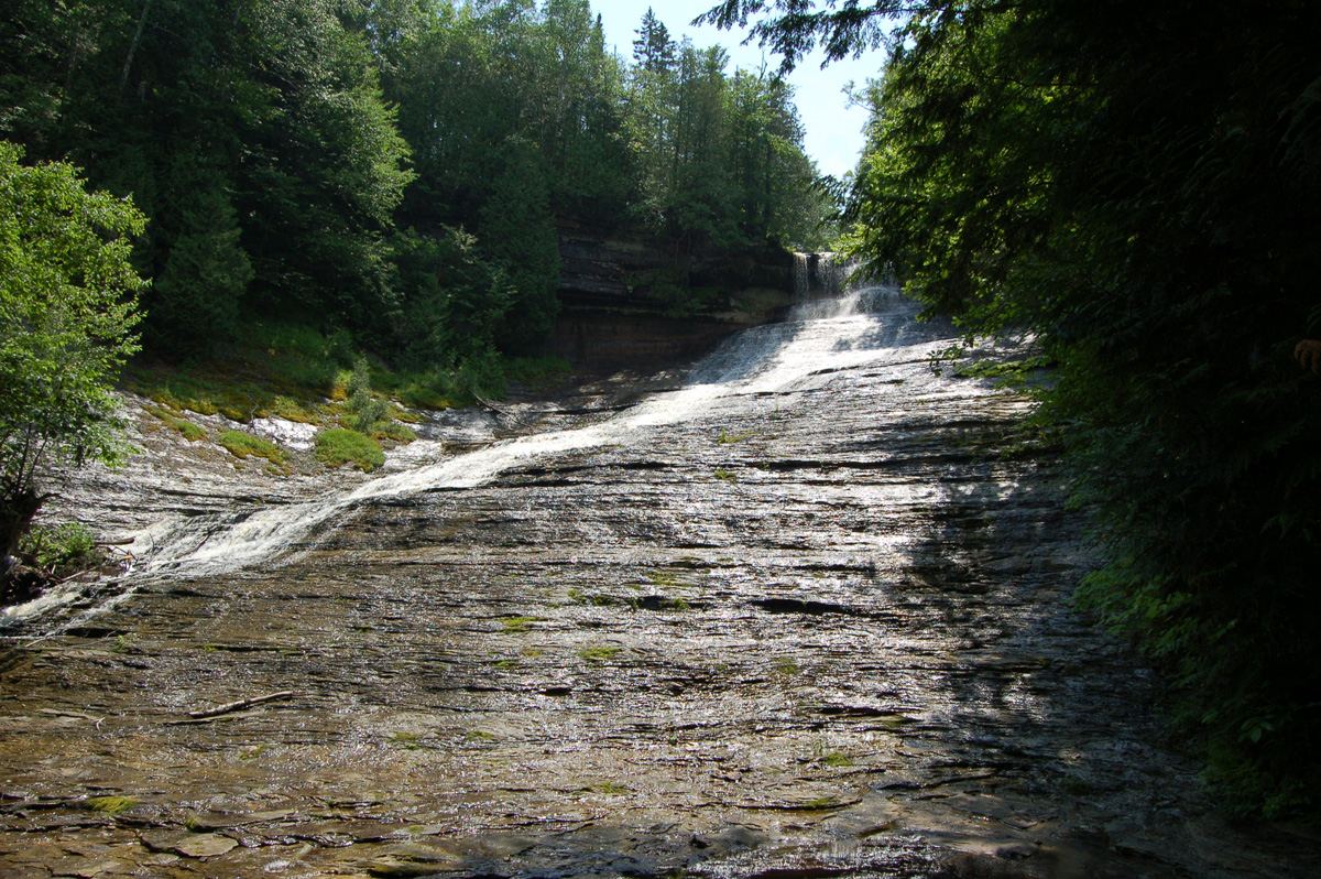
From the parking area, a half-mile natural-surface trail leads to three observation platforms over Laughing Whitefish Falls. The upper platform is above the falls with no stairs. A wooden staircase leads to the middle platform (20 stairs) and the lower platform (137 stairs from the top). Return the same way.
Published trail route with distances
Michigan
About 0.8 mile each way
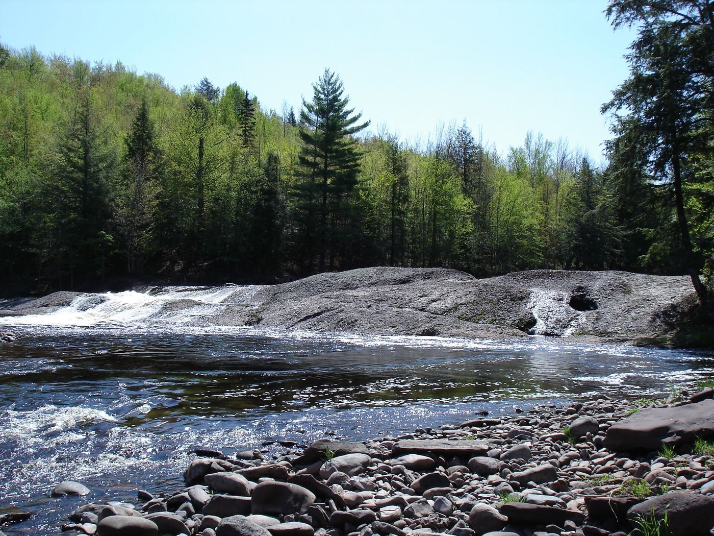
From Wakefield take M-28 to County Road 519 and go north about 12 miles to the North Country Trail parking area. Cross the road to the east and follow the trail about 0.6 mile to the spur to Lepisto Falls, then about 0.2 mile to the falls. Iagoo Falls is a short way downstream (north). Return the same way.
Verified approach to the upper edge; restricted view of Lower Falls
Michigan
Return walk; endpoint-specific distance unverified
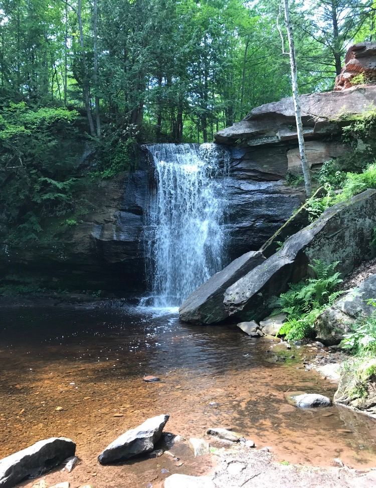
Walk the rough access road to its T-junction, turn downstream and follow the main path past Middle Falls. Continue downhill to the open view at Lower Falls, then return the same way. The waterfall is barely visible from above; this route does not include a descent to its base.
Published route in a state park scenic area
Michigan
Part of a 2.3-mile loop
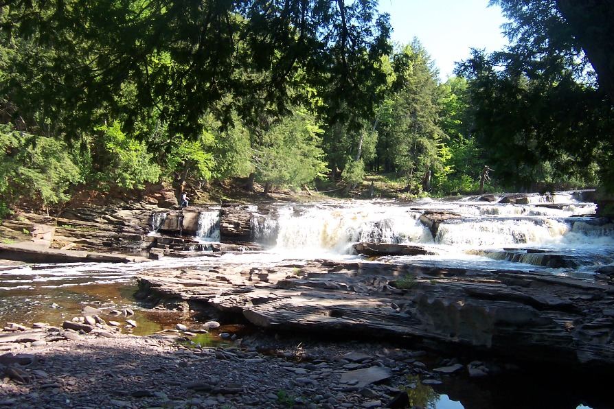
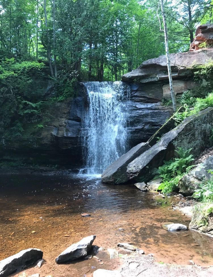
Park at the Presque Isle Scenic Area at the north end of Presque Isle Road and take the path along the river to the falls. Manido Falls lies between Manabezho Falls downstream and Nawadaha Falls upstream. Stairs lead to an overlook just above the falls on the west side. The falls can also be reached on the 2.3-mile East and West River Trail loop.
Source-reviewed route and parking
Michigan
Exact middle-falls round-trip distance not published in reviewed sources
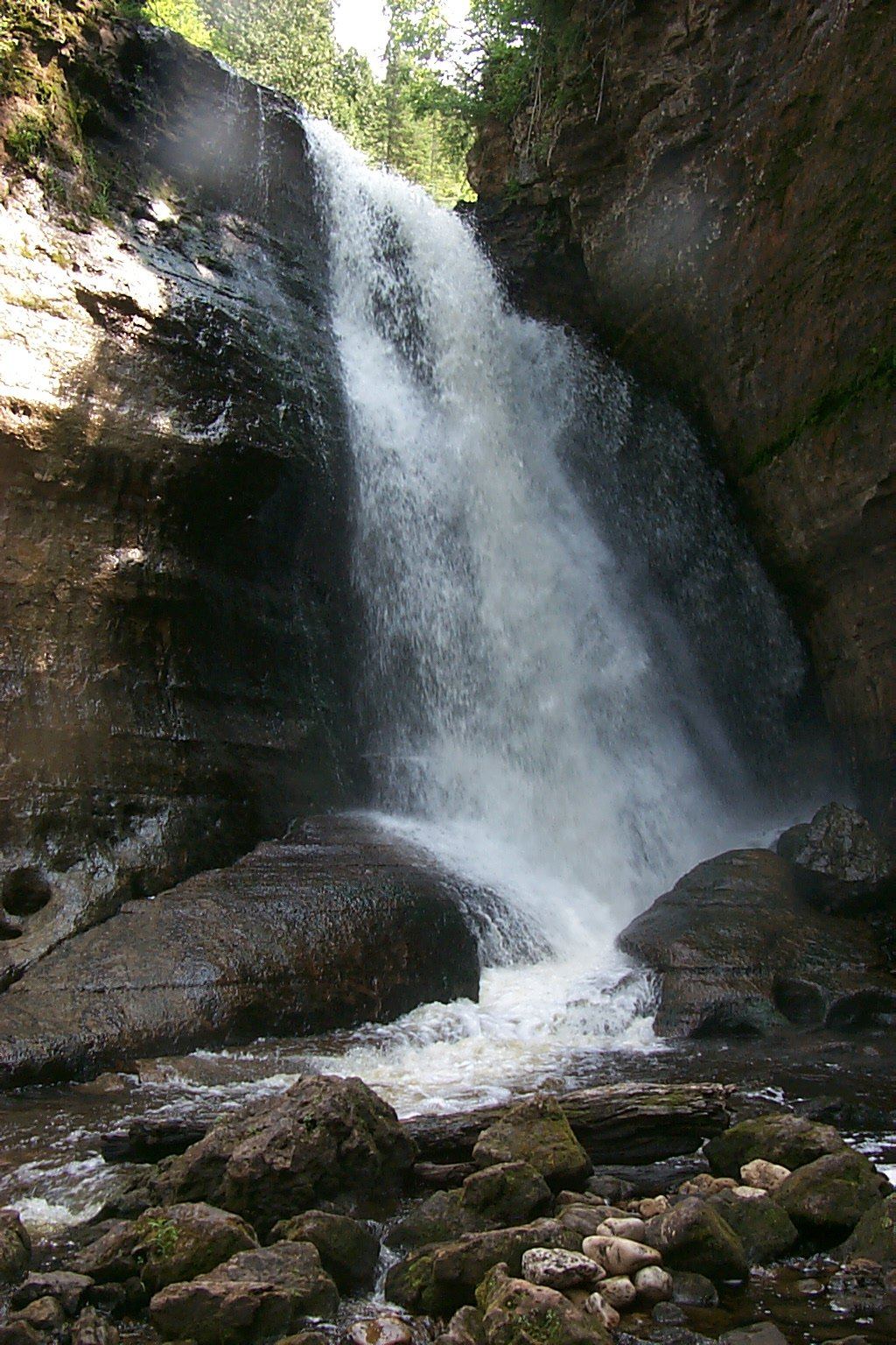
Walk the rough access track from Golf Course Road to its T-junction, then take the downstream path beside Dover Creek to Middle Hungarian Falls. Visit Keweenaw describes reaching the middle drop after a few hundred yards downstream. Return along the same path. The land-trust map labels the middle waterfall separately from the upper waterfall and dam.
Michigan
0.6 mile one way
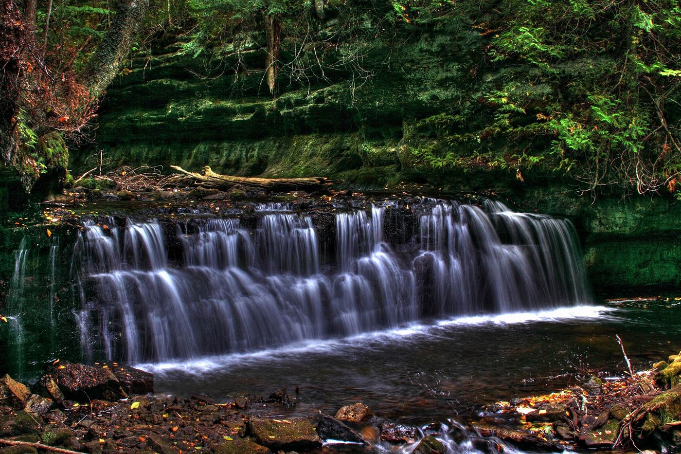
Walk to the two falls platforms; the lower platform requires stairs.
Official national lakeshore route, parking and fee documented
Michigan
Almost 1 mile one way
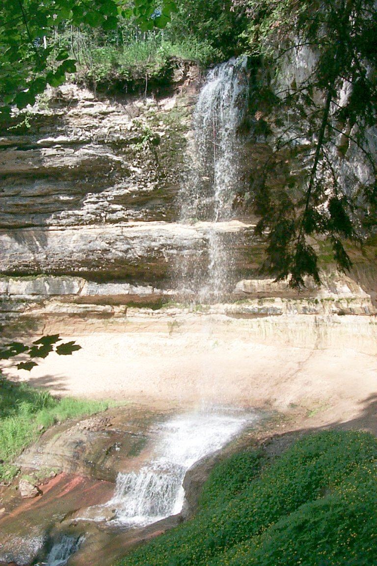
Mosquito Falls drops over an 8-foot rock shelf on the Mosquito River in Pictured Rocks National Lakeshore. Drive about 15 miles east of Munising on Alger County Road H-58, then about 5 miles north to the parking area at the end of Chapel Road. Walking toward Mosquito Beach, take the side trail almost a mile to the falls. Return the same way.
Trail closed
Michigan
Closed; normal paved approach is 800 feet
Trail closed after the April 2025 washout. NPS reports no safe falls viewing access.
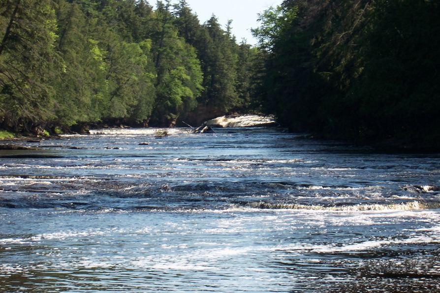
Published loop route in a state park scenic area
Michigan
Part of a 2.3-mile loop
Nawadaha Falls is the most upstream of the three named Presque Isle River falls. Start at the Presque Isle River bridge on South Boundary Road or at the Presque Isle Scenic Area lot and follow the River Trail along the river. GoWaterfalling reports a viewing platform added after 2001. Continue downstream to Manido and Manabezho Falls on the loop.
Michigan
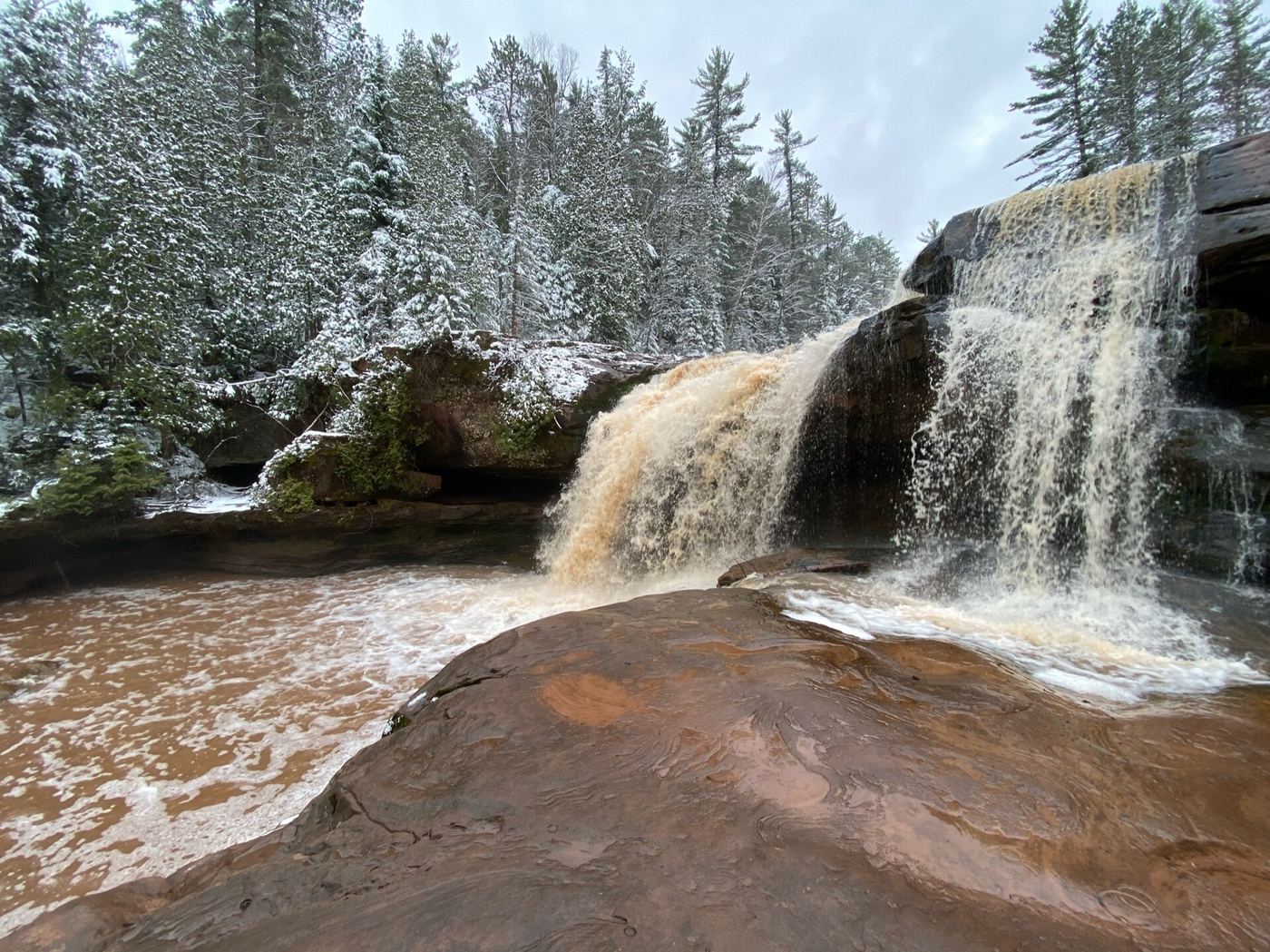
Walking distance not confirmed
The regional tourism map directs visitors along the North Country Trail past Peanut Butter Falls to O Kun de Kun Falls on the Baltimore River.
Michigan
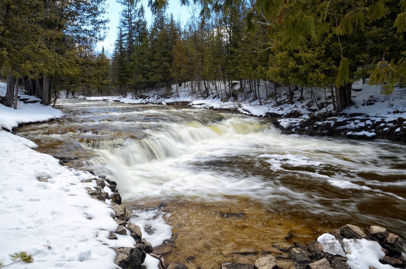
Paved approach; measured distance not confirmed
Use the day-use area across the road from Ocqueoc Falls State Forest Campground, then follow the paved path to the falls.
Michigan
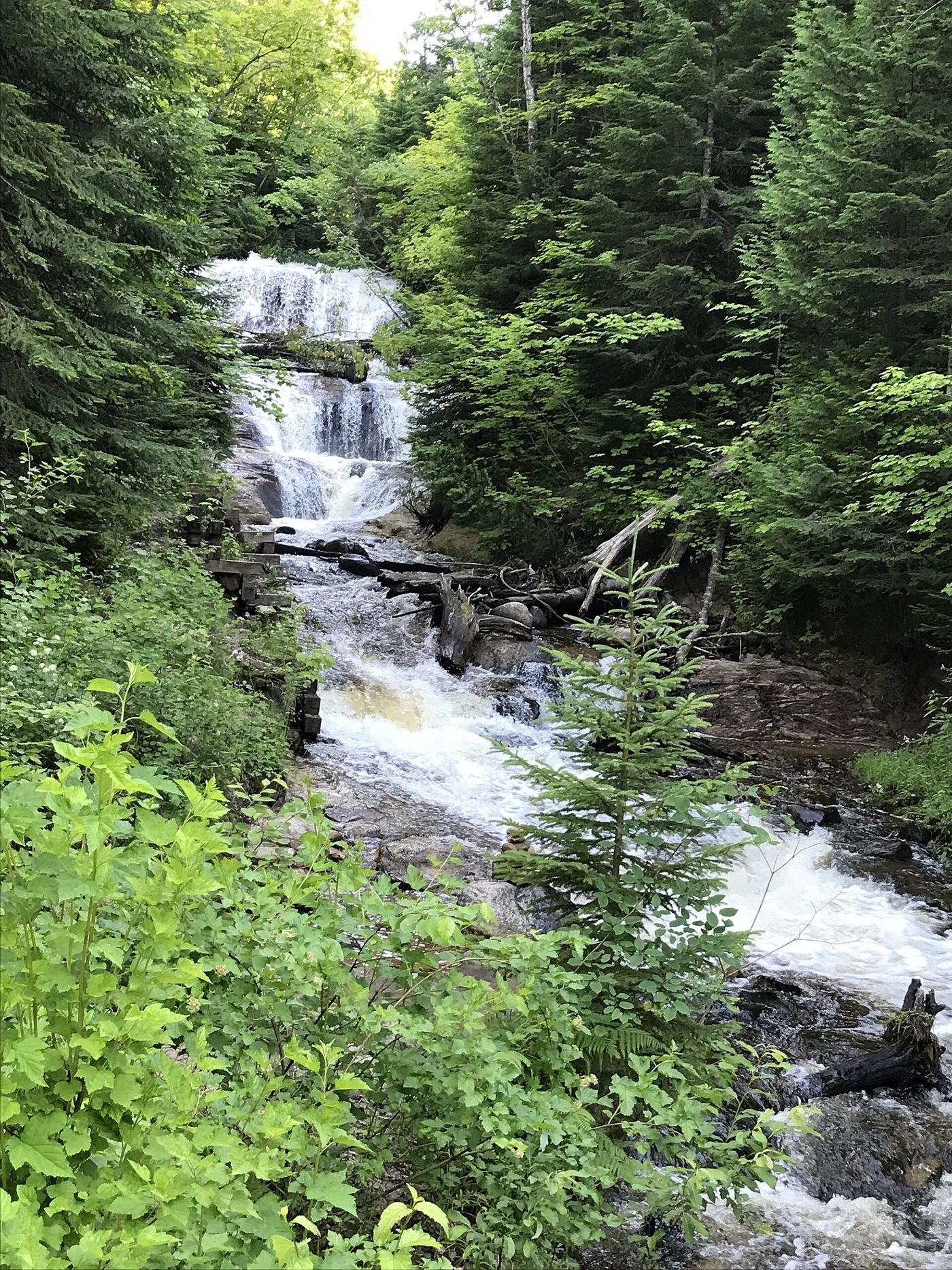
Short approach followed by 168 stairs
Use the stairs for the falls view.
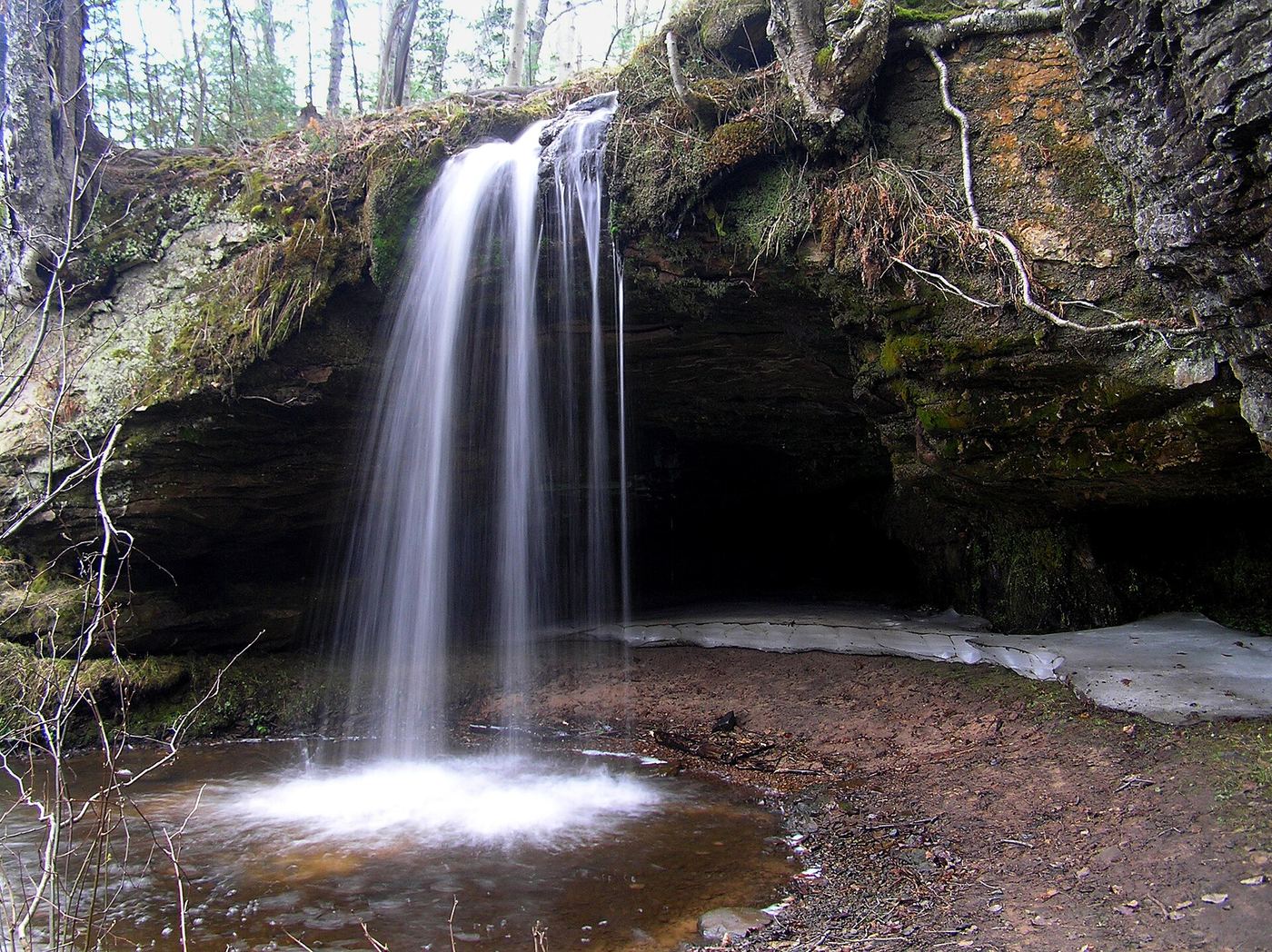
Roadside falls opposite a state roadside park
Michigan
Across the highway from the roadside park
Scott Falls drops about 10 feet over a sandstone cliff into a small pool beside M-28 near Au Train. It is across the road from the H.J. Rathfoot State Roadside Park and can be seen from the highway. Park at the roadside park and cross M-28 with care for a closer view.
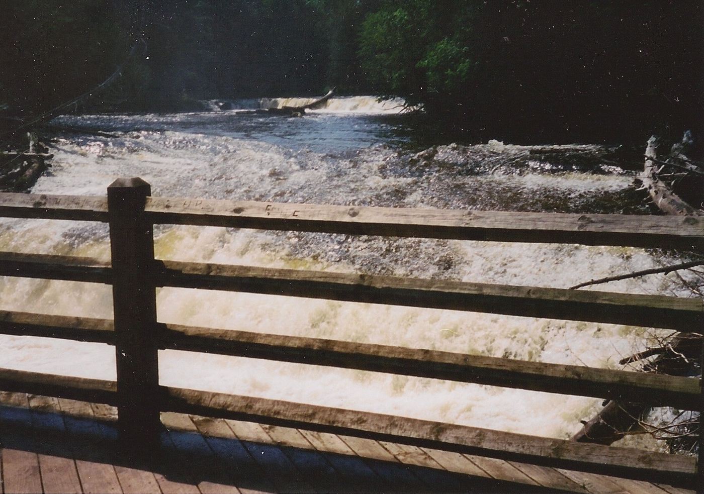
Official state park access and pass requirement documented
Michigan
Short walk to the first platform; boardwalk about 0.5 mile
The Lower Falls is a series of smaller cascades around an island, about four miles downstream of the Upper Falls on M-123. From the Lower Falls parking lot, a short walk leads to a viewing platform, and a half-mile accessible boardwalk gives more views. You can also cross the Ronald A. Olson Island Bridge to the island or rent a rowboat.
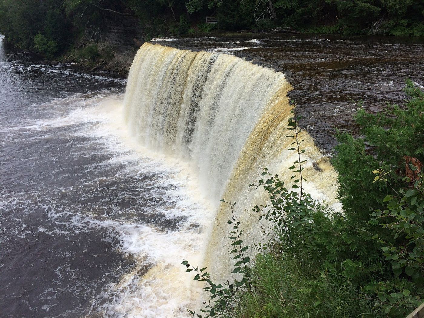
Official state park viewpoints and boardwalk
Michigan
Short walk; the boardwalk to the brink is 1,100 feet
From the Upper Falls day-use area on M-123, follow the paved path to the accessible viewing platforms, or take the 1,100-foot accessible boardwalk through old-growth forest to the brink of the falls. Stairs lead to further viewpoints. The North Country Trail continues about four miles downstream to the Lower Falls.
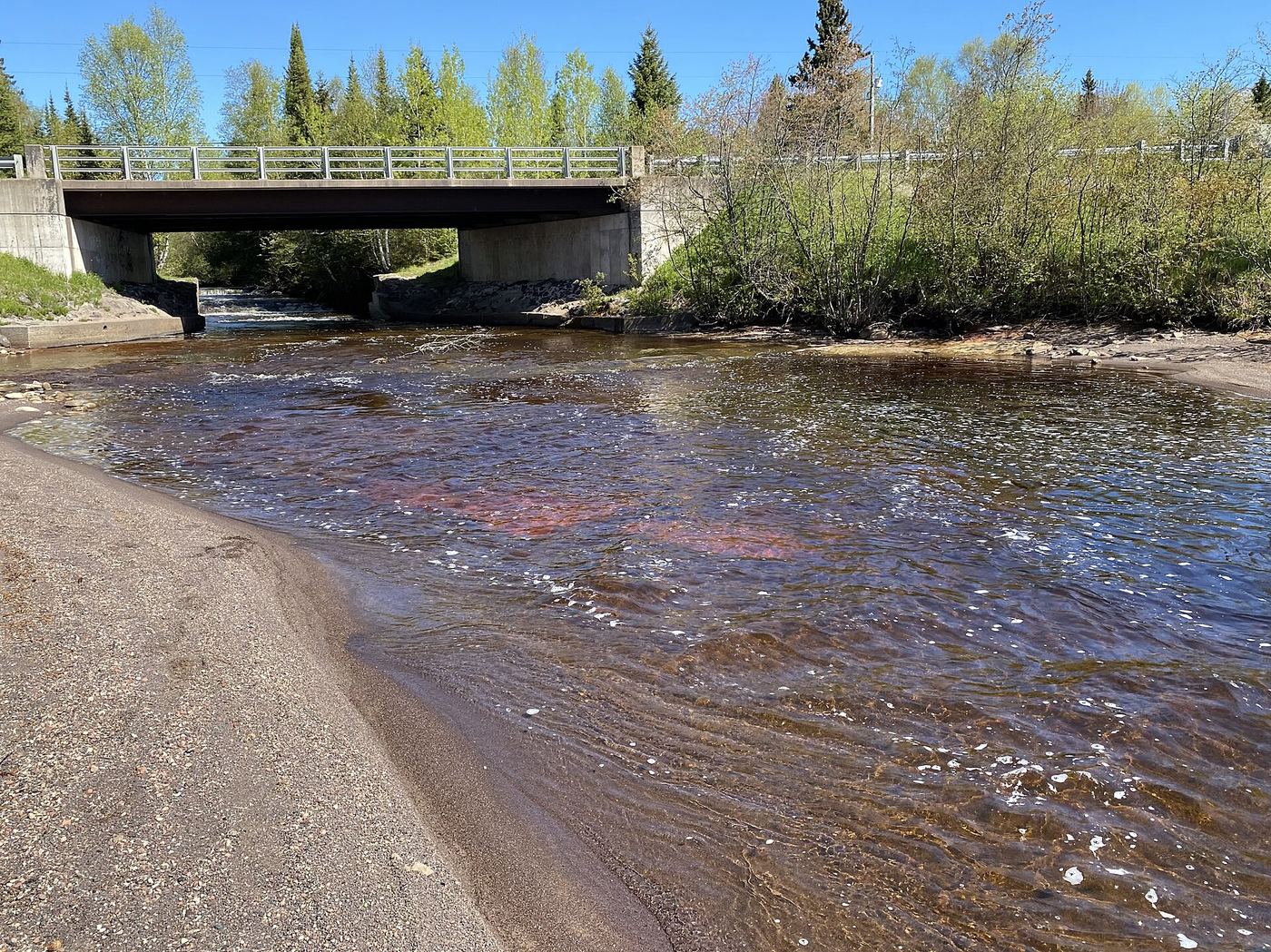
Roadside park; low drops
Michigan
A short walk from the park
Tobacco Falls is a series of low stepping drops where the Tobacco River enters Lake Superior, less than a mile north of Gay. Park at the roadside park by the river bridge. The falls are on the land side of the road: walk under the bridge on the cement footings, or cross the road and take the paths down to the falls. The park also has the shoreline and old dock ruins.
State scenic site; staircase to the upper falls; Recreation Passport
Michigan
Short; no published distance
Upper Bond Falls is the series of cascades and rapids above the main 40-foot drop at Bond Falls on the Middle Branch of the Ontonagon River, a Michigan DNR scenic site. From US-45 at Paulding, go 2.5 miles east on Bond Falls Road. A paved, accessible path leads to the lower falls. The upper falls can be reached by the staircase next to the falls, or by parking on the road past the main parking area.
Verified approach to the upper viewpoint; distance unknown
Michigan
Return walk; endpoint-specific distance unverified
Walk the rough access road to the T-junction, turn right and then slightly left toward Dover Creek and the dam. Pass the reservoir and follow the gorge-edge path to the easier upper viewpoint. Return the same way; the steep scramble to the base is optional and excluded here.
Official scenic site trail and parking documented
Michigan
About 0.1 mile one way
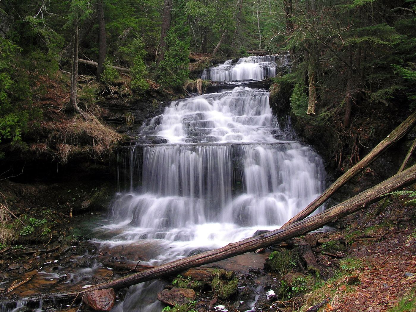
From Munising, take M-28 east 1.2 miles, turn right on M-94 west, and after 0.3 mile turn left into the small parking area. A 0.1-mile packed-gravel trail and boardwalk with a few steps leads to an observation platform over Wagner Falls. Return the same way.
Backcountry hike in a state park; distance to this falls not published
Michigan
Under 5.3 miles one way; exact distance to Bathtub Falls not published
Bathtub Falls is the lowest named drop on the Big Carp River in Porcupine Mountains Wilderness State Park, downstream of Big Carp Falls and Shining Cloud Falls. From South Boundary Road, take the Pinkerton Trail to the Lake Superior Trail and then the Big Carp River Trail upstream; this route passes Bathtub Falls. The exact trailhead lot on South Boundary Road and the distance to this falls are not stated in the source.
Location map; no photo available.
Partial guide: roadside route documented; falls on private property
Michigan
A few hundred yards one way
Drive County Road 510 north of Marquette to the small bridge over Big Pup Creek, less than two miles south of the 510 bridge over the Yellow Dog River. A rough path follows the creek downstream from the road past several small drops over dark volcanic rock. The falls are on private property.
Location map; no photo available.
Signed lot and short path documented
Michigan
Short path from the lot to the river
Bonanza Falls, also called Greenwood Falls, is a wide set of stepping drops on the Big Iron River. Less than a mile south of Silver City on M-64, turn into a small drive and parking lot on the west side of the road with a sign for Greenwood Falls. Follow the path straight to the river to view the upper falls, then follow the path and river downstream for more drops.
Location map; no photo available.
Firsthand route and national forest parking documented
Michigan
A little over 1 mile one way per Go Waterfalling
From M-28 about 1.3 miles east of Bergland, take unpaved Forest Road 400 north for 7.3 miles, turn right at the Cascade Falls sign, and drive about 0.3 mile to the end to park. Follow the main trail by the Ottawa National Forest sign to the top of the multi-tiered falls on Cascade Creek. The rougher Bluff Trail is an optional side loop with views of the Trap Hills.
Location map; no photo available.
Visitor directions only; landowner and rules not confirmed
Michigan
Short walk; distance not published
Cataract Dam Falls is a set of natural drops below a dam on the Middle Branch Escanaba River. Turn right on County Road EEF about 3 miles north of Gwinn and drive 1.7 miles to Cataract Basin, keeping left at forks on the dirt road. Park at the basin, walk to the dam, and follow the small footpath downstream to the river gauge. The path is hard to see in thick undergrowth; stay close to the river. The lower falls are near a sandy bend past a large metal pipe.
Location map; no photo available.
Published trail route to a beach falls; published distances differ
Michigan
About 3 to 3.7 miles one way; published figures differ
From the parking lot at the end of Chapel Road, take the trail toward Chapel Lake and Chapel Falls. Continue past Chapel Falls to Lake Superior near Chapel Rock. Follow the shoreline trail a short distance to the left to Chapel Beach, where Chapel Creek slides over sandstone into the lake. Return the same way or continue on the park loop.
Location map; no photo available.
Backcountry trail in a state park; Recreation Passport
Michigan
A little over 3 miles one way
Explorers Falls is on the Little Carp River in Porcupine Mountains Wilderness State Park. Park at the end of Little Carp River Road off South Boundary Road and follow the Little Carp River Trail downstream past Overlooked Falls and Greenstone Falls. Trappers Falls is about 3 miles from the trailhead, and Explorers Falls is just past it. Return the same way.
Location map; no photo available.
Roadside wayside viewpoint documented
Michigan
Roadside; the falls are beside the wayside
Fumee Falls is on the north side of US 2 about 6 miles east of Iron Mountain, at a small wayside with restrooms and a water pump. The main drop is about 10 feet with two smaller drops above it. A stair and boardwalk, added in 2004, lead to the top of the main drop.
Location map; no photo available.
Partial closures at Gorge Falls viewing facilities
Michigan
Short walk; distance not stated
Marked trails and stairways lead to Gorge Falls viewpoints. Partial closures affect this site.
Location map; no photo available.
Repairs in progress; tread and stair caution
Michigan
0.75 mile approach to falls; approximately 1.5 miles out and back.
The official trail descends toward Great Conglomerate Falls on the Black River.
Location map; no photo available.
Published route on a state park trail; distance not published
Michigan
Under 3 miles each way; exact distance not published
From the parking area at the end of Little Carp River Road, walk the Little Carp River Trail to the bridge at Overlooked Falls. Cross the river at the bridge and continue on the Little Carp River Trail to the left to Greenstone Falls. Return the same way.
Location map; no photo available.
County park; falls visible from the road
Michigan
A few hundred feet from parking
Haven Falls is a steep fanning drop on Haven Creek in a small county roadside park on the northwest shore of Lac La Belle. From US-41, head south on Lac La Belle Road for about 4.3 miles, bear right at the fork and go about half a mile more; the park is on the right. The falls are at the back of the park and can be seen from the road. Smaller upstream drops are reached by a crumbling, steeper climb.
Location map; no photo available.
Trail and bridge closed; partial guide with unverified day-hiker parking
Michigan
Approximately 1 mile listed; distance convention unclear
Closed route: the published trail follows Haymeadow Creek through forest to a footbridge at the falls rapids.
Location map; no photo available.
Official winter ice viewing access; exact formation not confirmed
Michigan
About 0.25 to 0.5 mile along the road, then uphill to the cliff base
This spot is on the inland cliffs between Munising Falls and Sand Point in Pictured Rocks National Lakeshore, where NPS says water seeping from the sandstone freezes into ice curtains 20 to 50 feet high in winter. Park at the Sand Point Beach lot and walk back along Sand Point Road 1/4 to 1/2 mile. Watch for signs on the left for ice viewing and climbing spots, then walk uphill to the base of the cliffs. Which ice formation this is has not been confirmed.
Location map; no photo available.
Published short trail to a viewing platform
Michigan
About 0.3 mile each way
Take US 2 west into Wisconsin. About 0.6 mile past Highway 51, turn right at the sign for the falls and follow the gravel road to the trailhead parking area. A 0.3-mile trail leads to a viewing platform above the falls on the Montreal River, which forms the Michigan and Wisconsin line.
Location map; no photo available.
Roadside falls; optional creek climb
Michigan
Main drop visible from the road
Jacob's Falls is a tall slide down smooth rock on Jacob's Creek beside M-26, near the Jampot bakery run by monks. The main drop can be seen from the car. Park near the falls or at the Jampot parking area. To see more of the drops, follow the creek upstream, or use the footpath on the east bank if the creek is too rough. Upper Jacob's Falls is about half a mile further upstream.
Location map; no photo available.
Researched route and starting area
Michigan
Short walk; numeric length unknown.
A short natural trail follows the river toward Kakabika Falls.
Location map; no photo available.
Firsthand route on the North Country Trail documented; distance not stated
Michigan
Distance not stated in the source
Park at the trailhead on the east side of US-45, 7.8 miles north of Bruce Crossing, marked by brown North Country Trail signs. Take the short gravel spur onto the NCT, turn east, and follow it to the Baltimore River. The low falls are where the trail first dips down the bank, a short steep scramble below the tread. O Kun de Kun Falls is a short distance further downstream.
Location map; no photo available.
Forest road and riverside trail
Michigan
About 0.9 mile one way, about 1.8 miles return
Little Garlic Falls is on the Little Garlic River north of Marquette. Take Big Bay Road (County Road 550) north from Marquette. About 1,000 feet past the Little Garlic River crossing, turn left onto a forest dirt road and drive 1.68 miles. Park and find the hiking trail heading north, then hike along the east and north bank of the river to the falls.
Location map; no photo available.
Partial guide: rough two-track route documented; land ownership not confirmed
Michigan
A few hundred feet in on the two-track, then a short walk to the drops
One mile south of the County Road 510 bridge over Big Pup Creek, take a two-track east. Little Pup Creek crosses the track twice a few hundred feet in. Past the second crossing the road ahead is blocked; park there. The larger drops are just below the second crossing; follow the right branch of the road, which runs beside the creek, rather than bushwhacking.
Location map; no photo available.
Visitor directions only; distance and land permission not confirmed
Michigan
Distance not published
Lower Big Pup Falls is a set of drops, about 30 feet in total, on Big Pup Creek before it joins the Yellow Dog River. About a mile north of the County Road 510 bridge over Big Pup Creek, a dirt road heads east into a clearing. Park there and take the two-track down to the creek. The alternative route follows the creek downstream from a smaller bridge and involves difficult bushwhacking through tag alder swamps. Land ownership and distance are not confirmed.
Location map; no photo available.
State park parking and stair route documented
Michigan
Short walk with many stairs
Enter the western end of Porcupine Mountains Wilderness State Park at the Presque Isle entrance off County Road 519. Manabezho Falls is the closest falls to the main parking lot. A short walk down many steps leads to a viewing platform. The falls can be seen from trails on both sides of the river; Manido and Nawadaha Falls are upstream.
Location map; no photo available.
Roadside parking and short path to overlook documented
Michigan
Short path from the road to the platform
Manganese Falls drops into a deep, narrow gorge just outside Copper Harbor. Turn south on 2nd Street (Manganese Road) next to the Pines Resort and drive 0.7 mile to a wide shoulder. Walk the short path to the viewing platform, which gives a partial view of the crest and gorge. The platform sits above a sheer cliff; do not climb over the fences.
Location map; no photo available.
Firsthand route and parking documented; railroad crossing
Michigan
Short walk; distance not stated
Park in the gravel areas on the east side of the US-41 bridge over the Falls River in L'Anse. Walk downstream, cross the railroad tracks, and follow the trail to a wooden bench high on the bank that overlooks Middle Falls. For a longer walk, start at the L'Anse marina, go south on Main Street, and follow the path upstream on the town side past Lower Falls.
Location map; no photo available.
State land route to the lower falls; upper falls path not confirmed
Michigan
About 1.3 miles to the lower falls, plus an unmeasured walk upstream
From Copper Harbor, follow US-41 to its end and continue on Mandan Road about 7.5 miles to Hoar Lake Road. Turn south 1.6 miles to the Hoar Lake Loop, then west 0.6 mile to an unnamed forest road heading west. Park alongside it and walk the road, which has berms, 1.3 miles to Montreal Falls at the river mouth. For the upper falls, follow the narrow path upstream on the western bank. One visitor did not find the upper drop after a few hundred yards.
Location map; no photo available.
Walk or bike on a closed dirt road; short foot trail
Michigan
About 1.5 miles one way, about 3 miles return
Morgan Falls is a 20-foot drop where Morgan Creek tumbles into the Carp River, about two miles south of Marquette. Park at the Noquemanon Trail Network South Trails Trailhead on M-553. Continue down M-553 about 0.25 mile to Mount Marquette Road, a dirt road heading west that is closed to motor vehicles. Walk or bike 1.2 miles on it, then turn south on a foot trail for about 200 feet to the falls. Some local sources apply the name Morgan Falls to a cascade further upstream; this guide is for the falls at the creek's confluence with the Carp River.
Location map; no photo available.
Partial guide: 2008 roadside route; land ownership and road condition not confirmed
Michigan
Roadside; the falls are within a dozen feet of the pull-off
From US-41 in Marquette, take County Road 492 south 3.5 miles and turn left on County Road HQ, then left at the first fork onto a small two-track. Drive the bumpy track 0.8 mile; the small blocky drops are on the left just past a culvert, beside a small pull-off.
Location map; no photo available.
State park trail past mine ruins; Recreation Passport
Michigan
About 1.25 miles one way, about 2.5 miles return
Nonesuch Falls is on the Little Iron River in the southeast corner of Porcupine Mountains Wilderness State Park. Park at the North Country Trail parking lot off South Boundary Road and hike about 1.25 miles to the falls. The trail passes the ruins of the Nonesuch Mine site, an abandoned copper mine and small ghost town.
Location map; no photo available.
Partial guide: unmarked creekside approach; land permission not confirmed
Michigan
A few hundred yards one way per Go Waterfalling
Take Baraga Plains Road west from US-41 for 3.5 miles and park just after the pond on the left. Walk back to the culvert that drains the pond under the road and follow the creek downstream to the falls. The east side of the creek is easier. The falls cannot be seen from the road.
Location map; no photo available.
Short published walk in a state park
Michigan
A few hundred feet
Park at the end of Little Carp River Road off South Boundary Road in Porcupine Mountains Wilderness State Park. Walk a few hundred feet down the Little Carp River Trail to the first bridge, where Overlooked Falls is. Greenstone Falls is farther along the same trail.
Location map; no photo available.
Partial platform closures at Potawatomi Falls
Michigan
Short walk; distance not stated
An asphalt trail from the southern edge of Gorge parking lot reaches the Potawatomi Falls viewing platform. Some platforms are closed.
Location map; no photo available.
Small park at the falls; short walk
Michigan
Short walk from the park; no published distance
Power House Falls is a 15-foot drop on the Falls River, about 40 feet wide, beside an old power house. From US-41 about 1 mile south of L'Anse, turn west on Power Dam Road at the sign for the falls. Follow it about a mile; where it branches after crossing the train tracks, follow the second sign to a small park at the falls. Small drops lie just above the falls.
Location map; no photo available.
Partial guide: short signed path documented; road mileage conflicts and land permission unconfirmed
Michigan
A couple hundred feet from the road per Go Waterfalling
From Skanee Road, turn south on Arvon Road (east of the Slate River bridge). Turn left on the unmarked road (All Wood Road on some maps) and park near the wooden logging bridge over the Slate River. Follow the river downstream past the sign for Quartzite Falls a short distance on a smooth path through cedars. Black Slate Falls is just upstream.
Location map; no photo available.
Repairs in progress; possible trail and platform closures
Michigan
0.5 mile approach; approximately 1 mile out and back.
Use the west-side trail from the Rainbow Falls lot. Construction can affect access.
Location map; no photo available.
Closed for construction since May 18, 2026
Michigan
0.25 miles to falls; 0.5 miles return calculated
Closed for construction: the usual route descends from the parking area to Sandstone Falls.
Location map; no photo available.
Published backcountry route in a state park
Michigan
About 8.2 miles one way from Lake of the Clouds, or 5.3 miles by the shorter route
Shining Cloud Falls is on the Big Carp River Trail. The shorter route starts on South Boundary Road: take the Pinkerton Trail to the Lake Superior Trail, then the Big Carp River Trail upstream, passing Bathtub Falls and Big Carp Falls. The longer route follows the Big Carp River Trail from Lake of the Clouds along the escarpment and down into the valley. Return the same way or plan an overnight trip.
Location map; no photo available.
Roadside park and short walk
Michigan
Short walk downstream from M-26; no published distance
Silver River Falls is about 15 feet wide, where the Silver River splits and drops about seven feet over a rock outcrop, then runs as rapids to a second drop into a small pool. It is on M-26 about 4.5 miles east of Eagle Harbor. A small roadside park with picnic tables and grills is across M-26; walk a short way downstream from the road to the falls.
Location map; no photo available.
Signed access road and parking area documented
Michigan
Short paths from the parking area; distance not stated
Head northeast from L'Anse on Skanee Road about 7 miles and turn right at a small brown access sign onto Silver Falls Road. After 0.6 mile, take the left fork to the open parking area with an outhouse. Paths lead down to the river and around the lower drops, two chutes ending in a deep pool. The larger upper falls, a quarter mile upstream, are a separate and harder approach.
Location map; no photo available.
Visitor directions only; exact drop and land permission not confirmed
Michigan
Distance not published
Slate River Falls is a 10-foot drop into a deep pool where the Slate River leaves its gorge. Park on either side of the Slate River bridge on Skanee Road, about 11 miles east of L'Anse, and follow the river upstream to the falls. Going farther upstream to other drops involves a tough climb. Slate Falls is most likely this lowest drop.
Location map; no photo available.
Official county park with paved path
Michigan
Short walk; distance not published
Stepping Stone Falls is a Genesee County park where the Flint River becomes Mott Lake. Park in the park lot and follow the paved, ADA-compliant path through the park to the falls. Paths continue to Bluebell Beach and the Bluegill Boat Launch, and a footbridge from the Flint River Bike Path at Carpenter and Bray also leads to the falls. Colored lights illuminate the falls on summer nights.
Location map; no photo available.
Researched route and starting area
Michigan
Distance unknown.
Descend the official Sturgeon Falls trail into the gorge and along the river.
Location map; no photo available.
Researched walking route
Michigan
0.5–1 mile; trip basis unspecified
Signed viewing areas overlook the Montreal River falls near Lake Superior. The tourism directions explicitly cross into Michigan.
Location map; no photo available.
Power company site open to the public; short walk
Michigan
Short walk to the upper overlook; steeper trail down to the lower view
Superior Falls is on the Montreal River on the Michigan and Wisconsin line, a few hundred yards from Lake Superior. A dam above the falls diverts most of the water, but a minimum flow is kept. From US-2 in Wisconsin, take Highway 122 north into Michigan. About half a mile past the border, turn left on the gravel road signed Superior Falls to the power company parking area. Follow the sign for the upper viewing area. A trail leads down to Lake Superior and along the river for the lower view.
Location map; no photo available.
Roadside falls; land permission not confirmed
Michigan
A few yards from the shoulder parking
Ten Foot Falls is a small drop with a swimming hole on the Eagle River between Phoenix and Eagle River. From US-41 at Phoenix, turn left onto M-26 and drive 0.8 mile; park on the shoulder. The falls are a few yards into the woods. Land ownership and permission were not confirmed from an owner or land manager.
Location map; no photo available.
Firsthand route and small parking area documented; rough two-track
Michigan
Short walk downhill from the turnaround; up to about 3/4 mile more if walking the two-track
Take Plains Road north from M-28 for about 3.4 miles, crossing the Sturgeon River, and turn left on the small signed sandy road. Take the first left fork to a two-car parking area at the turnaround. A trail leads downhill to the river; take the first split right to view the low, wide falls from downstream. The North Country Trail passes here.
Location map; no photo available.
Roadside park with short footpath
Michigan
Lower drop beside the lot; upper falls a short walk
The roadside park is on the south side of US-41 about 11 miles west of Michigamme and 20 miles south of L'Anse. The lower drop, rocky rapids under a footbridge, is visible from the parking lot. Behind the restrooms and picnic bench, a small footpath leads into the woods to the second, taller drop, a slide over bedrock. The main Tioga Falls is a different falls about 2 miles downstream.
Location map; no photo available.
State park trail route documented; distance derived from trail junction figures
Michigan
About 2.1 miles one way (derived)
Trap Falls is on the Upper Carp River in the interior of the Porcupine Mountains. From the Government Peak Trailhead on M-107, hike south on the Government Peak Trail past a pair of backcountry campsites to Trap Falls, about 2.1 miles. Return the same way. Longer routes reach the falls from South Boundary Road by the Lost Lake or Union Spring trails.
Location map; no photo available.
Published backcountry route in a state park
Michigan
About 3 miles each way
From the parking area at the end of Little Carp River Road, follow the Little Carp River Trail past Overlooked Falls and Greenstone Falls for about 3 miles to Trappers Falls, a slide falls on the Little Carp River. At least one stream crossing is involved. Explorers Falls is a short way farther; the two are often confused. Return the same way.
Location map; no photo available.
Partial guide: wayside and stair documented; view of the upper drops not confirmed
Michigan
Short stair and boardwalk from the wayside
Fumee Falls is on the north side of US 2 about 6 miles east of Iron Mountain at a small wayside. Above the 10-foot main drop are two smaller drops. A stair and boardwalk added in 2004 lead to the top of the main drop. Go Waterfalling does not say whether the upper drops are fully visible from the boardwalk.
Location map; no photo available.
Roadside falls; parking not confirmed
Michigan
Roadside; no walking distance published
Warner Falls is beside M-35 a few miles south of Palmer, where the highway crosses Warner Creek. A sign on the bridge marks the falls, and the falls can be seen from the bridge. GoWaterfalling says you can get to the base and the top. Where to park safely off the highway was not confirmed.
Location map; no photo available.
Tourism-bureau route from a roadside parking area; distance sources disagree
Michigan
About 0.35 mile one way per Travel Marquette; another guide says about 1 mile
Yellow Dog Falls is a drop of about 20 feet on the Yellow Dog River, split by a large boulder. From Marquette, take County Road 550 toward Big Bay, then County Road 510; the last part of 510 is dirt. Park at the small area by the Yellow Dog River bridge and walk northeast along the river on the trail to the falls. Return the same way.
Location map; no photo available.