Superior Falls
Gogebic County, Michigan
Your visit at a glance
- Waterfall height
- Not recorded
- Location
- Gogebic County, Michigan
- Access status
- Power company site open to the public; short walk
- The walk
- Short walk to the upper overlook; steeper trail down to the lower view
- Ground & access
- Upper view is easy. The trail to the lower view is steep.
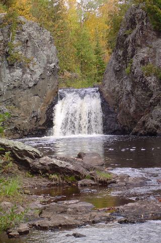
Superior Falls is on the Montreal River on the Michigan and Wisconsin line, a few hundred yards from Lake Superior. A dam above the falls diverts most of the water, but a minimum flow is kept. From US-2 in Wisconsin, take Highway 122 north into Michigan. About half a mile past the border, turn left on the gravel road signed Superior Falls to the power company parking area. Follow the sign for the upper viewing area. A trail leads down to Lake Superior and along the river for the lower view.
Plan your visit
Power company parking area off Highway 122 just inside Michigan, to the upper viewing area at Superior Falls
No walking distance is published. The upper viewing area is signed from the parking area; a trail continues down to Lake Superior for the lower view.
Upper view is easy. The trail to the lower view is steep.
Where to start
Power company parking area at the end of the gravel road signed Superior Falls, about half a mile into Michigan on Highway 122.
Timing & water
Best in early spring. Water levels below the dam can change.
Before you go
No fee was mentioned. The site is kept open by the hydro plant operator.
Visitor informationMore waterfalls nearby
Within 40 straight-line miles. Road and trail distances will differ.
- Superior FallsResearched walking routeGogebic County, MI0.2 miN
- Saxon Falls RoadIron County, WI2.4 miSE
- Lower Potato River FallsCounty park stair trail to a deck facing the lower fallsIron County, WI8.7 miSW
- Upper Potato River FallsCounty park trail to an observation deckIron County, WI8.7 miSW
- Foster FallsCounty forest road to a parking area near the fallsIron County, WI9.7 miS
- Interstate FallsPublished short trail to a viewing platformGogebic County, MI12 miSE
 Wren FallsRough forest road to a trail parking area and an overlook above the fallsIron County, WI12 miS
- Upson FallsTown park with a short trail to the fallsIron County, WI13 miS
- CascadesPartial guide: state park trail; exact feature not confirmedAshland County, WI17 miSW