Cataract Dam Falls
Marquette County, Michigan
Your visit at a glance
- Waterfall height
- Not recorded
- Location
- Marquette County, Michigan
- Access status
- Visitor directions only; landowner and rules not confirmed
- The walk
- Short walk; distance not published
- Ground & access
- Faint footpath through thick undergrowth along the river bank.
Cataract Dam Falls is a set of natural drops below a dam on the Middle Branch Escanaba River. Turn right on County Road EEF about 3 miles north of Gwinn and drive 1.7 miles to Cataract Basin, keeping left at forks on the dirt road. Park at the basin, walk to the dam, and follow the small footpath downstream to the river gauge. The path is hard to see in thick undergrowth; stay close to the river. The lower falls are near a sandy bend past a large metal pipe.
Plan your visit
Cataract Basin on County Road EEF north of Gwinn, footpath from the dam downstream
The guide author describes a small footpath from the dam to a river gauge, then the lower falls past a large metal pipe. No distance is given.
Faint footpath through thick undergrowth along the river bank.
Where to start
At Cataract Basin, which has a gravel boat launch, per the guide author.
Timing & water
Water level depends on dam releases.
Before you go
No fee information found. The dam owner and any access rules were not confirmed.
Visitor informationVisit sources
More waterfalls nearby
Within 40 straight-line miles. Road and trail distances will differ.
- Warner FallsRoadside falls; parking not confirmedMarquette County, MI9.1 miNW
- Lower Carp FallsMarquette County, MI13 miN
- Morgan FallsWalk or bike on a closed dirt road; short foot trailMarquette County, MI14 miN
- Morgan Meadows FallsPartial guide: 2008 roadside route; land ownership and road condition not confirmedMarquette County, MI14 miN
- Lower Morgan Meadows FallsMarquette County, MI14 miN
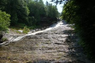 Laughing White Fish FallsOfficial state park trail, parking and pass requirement documentedAlger County, MI22 miE
- Little Garlic FallsForest road and riverside trailMarquette County, MI24 miN
- Little Pup FallsPartial guide: rough two-track route documented; land ownership not confirmedMarquette County, MI28 miN
- Big Pup FallsPartial guide: roadside route documented; falls on private propertyMarquette County, MI29 miN