Manido Falls
Gogebic County, Michigan
Your visit at a glance
- Waterfall height
- Not recorded
- Location
- Gogebic County, Michigan
- Access status
- Published route in a state park scenic area
- The walk
- Part of a 2.3-mile loop
- Ground & access
- Boardwalk and stairs on the west side; the east side is rugged with roots and stairs.
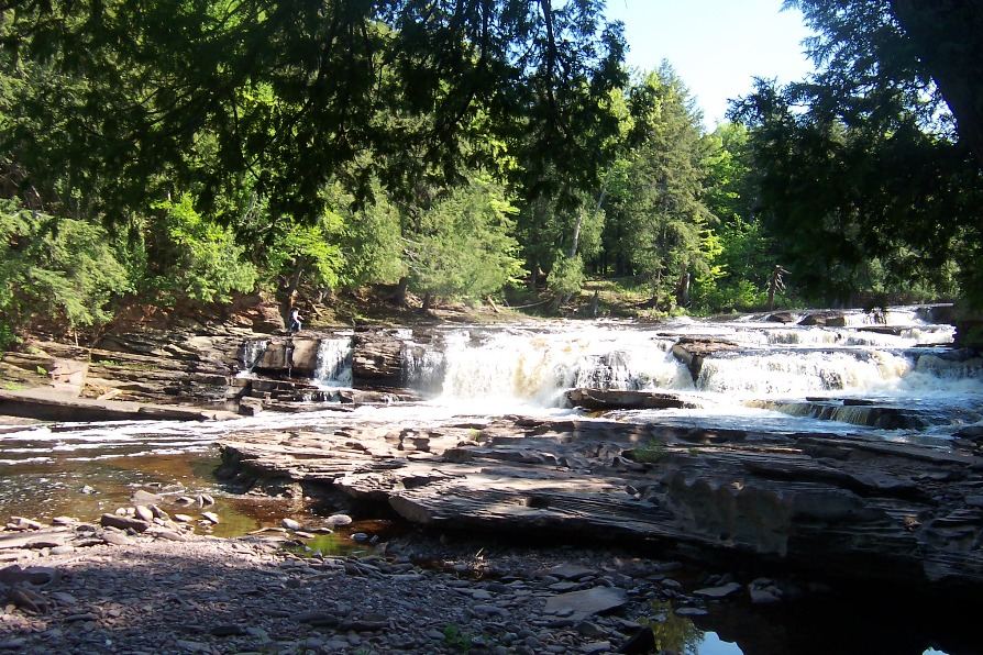
Park at the Presque Isle Scenic Area at the north end of Presque Isle Road and take the path along the river to the falls. Manido Falls lies between Manabezho Falls downstream and Nawadaha Falls upstream. Stairs lead to an overlook just above the falls on the west side. The falls can also be reached on the 2.3-mile East and West River Trail loop.
Plan your visit
Presque Isle Scenic Area parking to Manido Falls on the West River Trail
The Western U.P. waterfall map gives the East and West River Trail loop as 2.3 miles from the Presque Isle River bridge on South Boundary Road. No separate one-way figure to Manido Falls was published.
Boardwalk and stairs on the west side; the east side is rugged with roots and stairs.
Where to start
Presque Isle Scenic Area lot, reached by County Road 519 from Wakefield.
Timing & water
Park roads including South Boundary Road from Headquarters Road to the Pinkerton Trailhead close December 1 through late spring. The Presque Isle Scenic Area stays reachable by County Road 519.
Before you go
Michigan Recreation Passport required for vehicle entry, per Michigan DNR. Check current prices with the DNR.
Visitor informationVisit sources
More waterfalls nearby
Within 40 straight-line miles. Road and trail distances will differ.
- Manabezho FallsState park parking and stair route documentedGogebic County, MI0.2 miN
 Nawadaha FallsPublished loop route in a state park scenic areaGogebic County, MI0.3 miSW
- Iagoo FallsGogebic County, MI3.2 miSE
 Lepisto FallsPublished trail route with distancesGogebic County, MI3.5 miSE
- Explorers FallsBackcountry trail in a state park; Recreation PassportGogebic County, MI4.5 miNE
- Trappers FallsPublished backcountry route in a state parkGogebic County, MI4.5 miNE
- Rainbow FallsRepairs in progress; possible trail and platform closuresGogebic County, MI4.7 miSW
- Trader's FallsGogebic County, MI4.9 miNE
- Sandstone FallsClosed for construction since May 18, 2026Gogebic County, MI5.0 miSW