WaterfallNear Me

Virginia waterfall visits

Compare 35 Virginia waterfall visits by the approach, terrain, and where to start. Some routes have closures or unresolved details; read the individual guide before travelling.

35 visit options

Dark Hollow Falls, VA

National park trail route and parking documented

Virginia

Dark Hollow Falls

1.4 miles round trip (NPS)

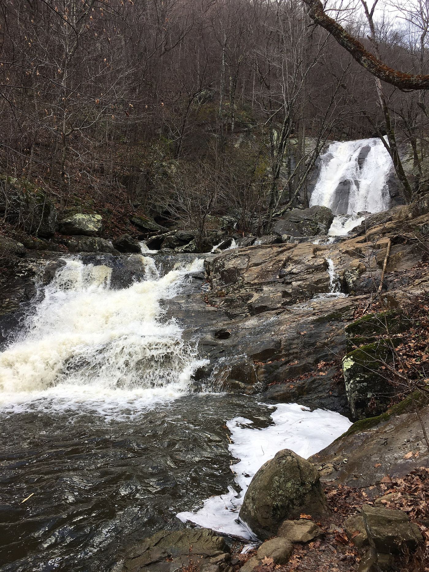
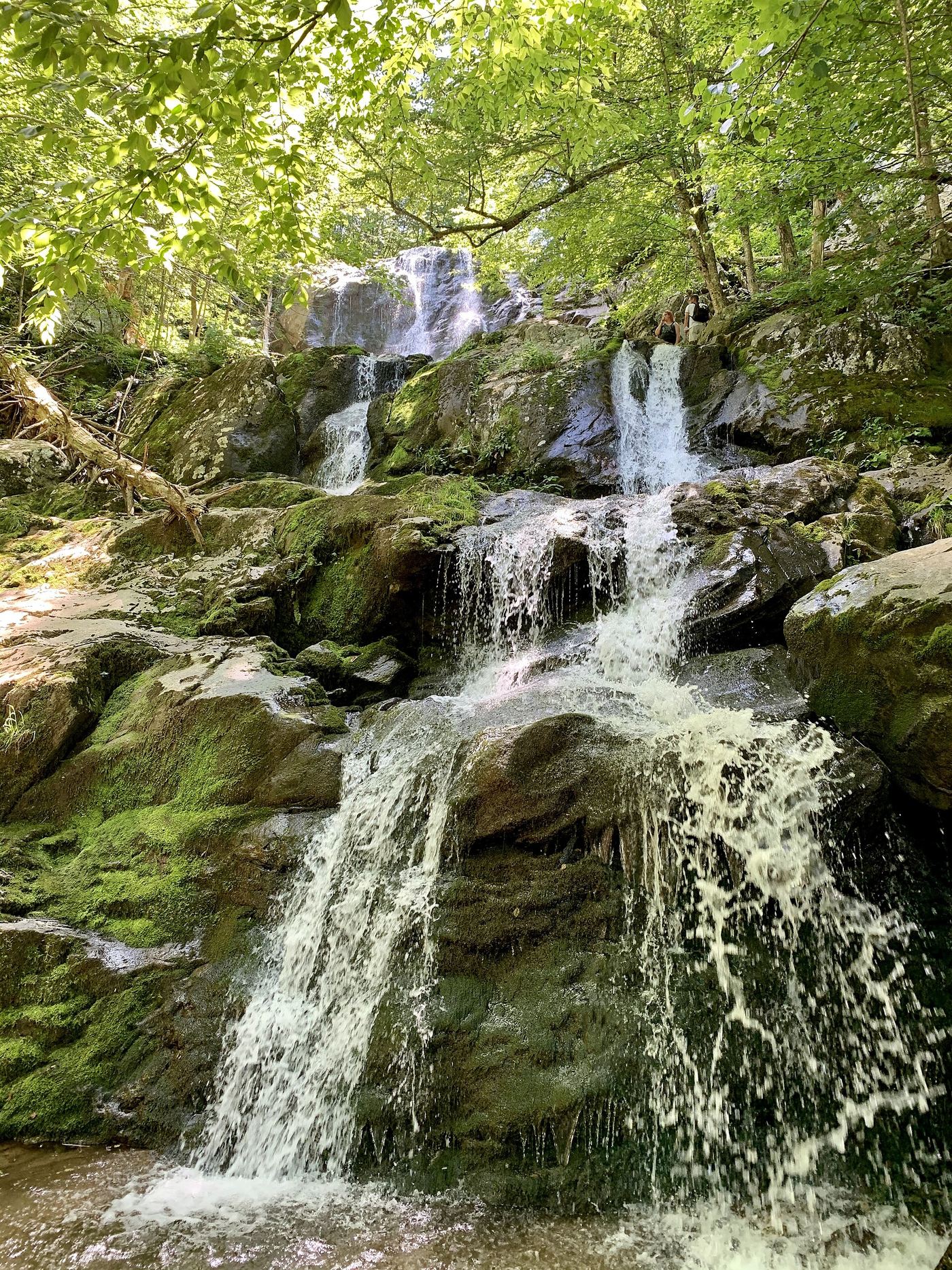
Dark Hollow Falls is in the Central District of Shenandoah National Park. From the trailhead at the Dark Hollow Falls Parking Area (Skyline Drive mile 50.7), the trail follows a stream steeply downhill for 0.75 mile to the falls. Return by the same route, climbing back up to the parking area. NPS describes the return climb as challenging and says to take your time, especially when the trail is wet.

Photo creditPhoto: APK, CC BY-SA 4.0, via Wikimedia Commons
Falling Spring Falls, VA

State-owned roadside overlook with a short paved path

Virginia

Falling Spring Falls

Short paved walk from the parking area to the overlook; no distance is published

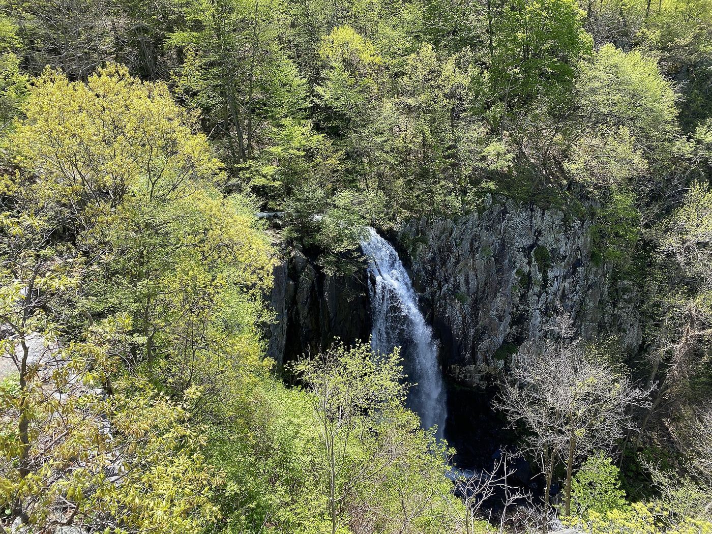
Falling Spring Falls is an 80-foot waterfall that drops from an overhanging limestone ledge beside US-220 in the Alleghany Highlands. The Virginia Department of Conservation and Recreation owns the site and Douthat State Park maintains it. Park in the small pull-off and walk the short paved path to the overlook, which has picnic tables and interpretive signs. Access beyond the overlook is not allowed, and the state says this is strictly enforced.

Photo creditPhoto: U.S. Geological Survey from Reston, VA, USA, Public domain, via Wikimedia Commons
Jones Run Falls, VA

National park trail from a Skyline Drive parking area; entrance fee

Virginia

Jones Run Falls

3.2-mile round trip, per the NPS

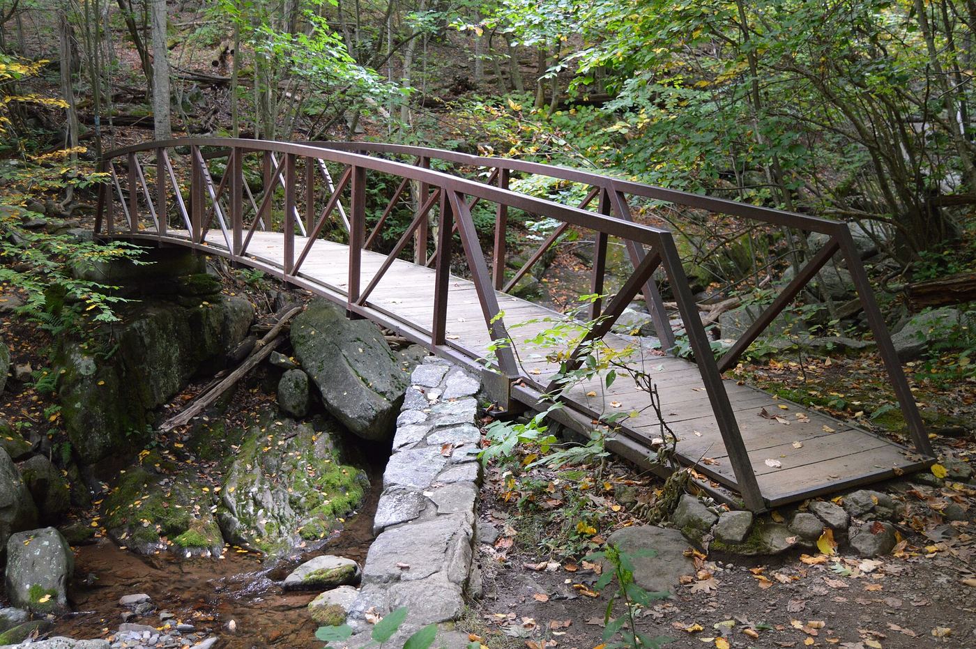
Jones Run Falls is a 42-foot waterfall on Jones Run in the South District of Shenandoah National Park. From the trailhead at the front of the Jones Run Parking Area, cross the Appalachian Trail and follow the blue-blazed Jones Run Trail downhill through the forest. The trail crosses Jones Run once, then follows the stream past cascades to a switchback and the falls. Return the same way; the return is uphill. The Jones Run Trail continues down to the Doyles River, and a longer NPS circuit from Browns Gap links Jones Run Falls with the Doyles River falls.

Photo creditPhoto: John Manard, CC BY-SA 2.0, via Wikimedia Commons
Lower Whiteoak Falls, VA

Guide: easy trail from the boundary parking area

Virginia

Lower Whiteoak Falls

2 miles round trip (NPS)

Lower Whiteoak Falls is the lowest of the six waterfalls in Whiteoak Canyon, Shenandoah National Park. The park calls this the easier way to the canyon. From the Whiteoak Canyon parking area at the park boundary, start on the Whiteoak Canyon Trail and keep right at the junction with the Cedar Run Trail. Cross a small stream and continue to the base of the lower falls. Return the same way.

Photo creditPhoto: Fredlyfish4, CC BY 4.0, via Wikimedia Commons
Overall Run Falls, VA

National park trail route and parking documented

Virginia

Overall Run Falls

5.1 miles round trip (NPS)

Overall Run Falls, at 93 feet the tallest waterfall in Shenandoah National Park, is reached by a hike into designated Wilderness. From the Mathews Arm Campground registration parking area, take the Traces Trail to the yellow-blazed Mathews Arm Road, which becomes the Mathews Arm Trail. Stay right at the Beecher Ridge Trail junction and continue to the Tuscarora-Overall Run Trail. Turn left; after about 0.1 mile a side trail gives a view of the upper falls. Continue downhill on the main trail about 1,300 feet to views of the 93-foot falls. Retrace your steps.

Photo creditPhoto: TheTurducken, CC BY 2.0, via Wikimedia Commons
Rose River Falls, VA

Guide: 4-mile park loop past the falls

Virginia

Rose River Falls

4-mile circuit (NPS)

Rose River Falls is a 67-foot waterfall on the Rose River Loop Trail in the Shenandoah Wilderness. From the north end of Fishers Gap parking area, cross Skyline Drive and start down the fire road. Just after the chain, turn left onto the yellow-blazed Skyland-Big Meadows Horse Trail. In about 0.6 mile take the blue-blazed Rose River Loop Trail and follow it past the falls. Continue to the bridge, then climb a steep, rocky section past cascades. At the fire road, turn right across the bridge and walk about one mile uphill back to Skyline Drive. A short side trip from the fire road leads to the base of Dark Hollow Falls.

Photo creditPhoto: Nyttend, Public domain, via Wikimedia Commons
Scott's Run Falls, VA

County park trail route and parking documented

Virginia

Scott's Run Falls

0.7 mile to the falls (Go Hike Virginia)

Scott's Run Falls is near the mouth of Scott's Run in Scott's Run Nature Preserve, a Fairfax County park. From the parking area on Georgetown Pike, start at the back of the lot at the vehicle barrier and pass a kiosk with a park map. Follow the light blue-blazed Potomac Heritage Trail, a wide gravel trail alongside Scott's Run. Cross the run twice, then make a short but steep climb and descent to the waterfall. Return the same way, or continue on the longer loop described by Go Hike Virginia.

Photo creditPhoto: Mdy66, CC BY-SA 4.0, via Wikimedia Commons
Upper Overall Run Falls, VA

National park trail route and parking documented; viewpoint of the upper falls

Virginia

Upper Overall Run Falls

Under 5.1 miles round trip (NPS gives 5.1 miles for the hike that continues past this viewpoint)

The upper falls of Overall Run sit above the 93-foot main falls in Shenandoah National Park Wilderness. From the Mathews Arm Campground registration parking area, take the Traces Trail to the yellow-blazed Mathews Arm Road, which becomes the Mathews Arm Trail. Stay right at the Beecher Ridge Trail junction and continue to the Tuscarora-Overall Run Trail. Turn left and follow it about 0.1 mile to a side trail; NPS says the upper falls can be seen from there. The main falls are about 1,300 feet farther downhill. Return the same way.

Photo creditPhoto: TheTurducken, CC BY 2.0, via Wikimedia Commons

Route and parking researched

Virginia

Apple Orchard Falls

2.6 miles return in the waterfall guide

Start at Sunset Fields Overlook and follow the Apple Orchard Falls Trail down to the bridge viewpoint at the waterfall.

Location map; no photo available.

Nature preserve trail to a distant overlook of the falls

Virginia

Bent Mountain Falls

The Nature Conservancy gives the shortest distance to the viewpoint as 1.6 miles

Bent Mountain Falls is a 200-foot waterfall on the side of Bent Mountain that drops into Bottom Creek, in The Nature Conservancy's Bottom Creek Gorge Preserve. It is seen from a distance from the Malcolm and Jimmie Black Overlook; you cannot get close to the falls. From the gate, walk the gravel entrance road (Black Trail) to the trailhead kiosk and the fork at about 0.6 mile. Go Hike Virginia turns left on the Yellow Trail past a pond and above Bottom Creek, then at about the 2.1-mile mark veers left onto the Red Trail to the overlook. The Red Trail also runs from the entrance road to the overlook. Return the way you came, or continue on the Red Trail back to the entrance road. The falls are east of the overlook, so morning light can be in your eyes.

Location map; no photo available.

Published hike route and national park parking documented

Virginia

Big Rock Falls

5.4 miles out and back (Go Hike Virginia)

Big Rock Falls is on Mill Prong below Big Meadows in Shenandoah National Park, a short way above Rapidan Camp. From the parking area across Skyline Drive from Big Meadows Wayside, walk past the kiosk along the Rapidan Fire Road for a flat 1.2 miles. Turn right at the sign for the yellow-blazed Mill Prong Horse Trail, which becomes narrower and steeper. At the 2.2-mile mark, turn left to stay on the yellow-blazed trail (the blue-blazed Mill Prong Trail goes right across Mill Prong). Follow Mill Prong downstream to the falls at the 2.7-mile mark, where a log crosses the stream. Retrace your steps.

Location map; no photo available.

State park trail route from Camp Carson Picnic Area; parking fee

Virginia

Blue Suck Falls

Hike length 2.4 miles per Waterfall Hero; the falls are reached at 1.2 miles

Blue Suck Falls is a tiered sliding waterfall on Blue Suck Run in Douthat State Park. Waterfall Hero gives this route: from the north end of the Camp Carson Picnic Area parking, take the blazed Blue Suck Falls Trail upstream along Blue Suck Run. The trail crosses the stream. At 0.5 miles turn left to stay on the Blue Suck Falls Trail, and at 0.8 miles turn right to stay on it. The trail crosses below the base of the falls at 1.2 miles. Return the same way.

Location map; no photo available.

National forest trail route, parking and fee documented

Virginia

Cascades

4-mile loop (USFS)

Cascades Falls is a 66-foot waterfall on Little Stony Creek in the Jefferson National Forest. From the Cascades parking lot, the lower trail, a designated National Recreation Trail, follows Little Stony Creek for two miles to the falls, with stone steps, walls and several bridges close to the water. The upper trail climbs steadily through the forest above the creek and is wider and less rocky. The Forest Service says many hikers take the lower trail up to the falls and return by the upper trail.

Location map; no photo available.

Park trail route from Meadow Spring; steep final descent; entrance fee

Virginia

Cave Falls

5.2 miles round trip per Go Hike Virginia

Cave Falls is the waterfall on the Hazel River in Shenandoah National Park that hikers also call Hazel Falls, named for small caves beside it. Jenn Gonzalez on The Outbound describes the route: from the Meadow Spring parking lot, start at the trail post to the right of the lot. Keep left at the first trail post, and keep left again at the next post onto the White Rocks Trail. At a third post marked for Cave Falls, turn right. The path drops steeply down rocks to a gorge with cascades, a pool and the falls. Climb back to the White Rocks Trail and return the way you came.

Location map; no photo available.

Guide: wilderness trail to a falls with a swimming hole

Virginia

Cedar Run Falls

About 1.3 miles each way from the lower lot; 2.6 miles out and back

Cedar Run Falls is a waterfall with a deep pool and a natural rock slide above it, in the Shenandoah Wilderness in Shenandoah National Park. From the far side of the lower Whiteoak Canyon parking lot, follow the Cedar Run Trail 0.1 mile across an iron bridge and turn left at the fork to stay on Cedar Run Trail. The blue-blazed trail crosses Cedar Run after 0.2 mile and climbs about another mile to the main falls. Reaching the base and pool means leaving the trail and crossing back over Cedar Run near the top of the falls. Return the same way. You can also start from Hawksbill Gap on Skyline Drive and walk down 1.6 miles, a steeper option.

Location map; no photo available.

Partial: rail-trail route documented; Galax parking details and current trail status unconfirmed

Virginia

Chestnut Creek Falls

Roughly 5 miles one way from the Galax trailhead (Waterfall Hero Hikes)

Chestnut Creek Falls is a cascading waterfall on Chestnut Creek beside the New River Trail, a rail-trail in New River Trail State Park. A visitor account starts at the state park trailhead in Galax, crosses Chestnut Creek on two bridges and follows the trail north past the Cliffview area to the falls. Go Hike Virginia says the falls are near milepost 47, with a shaded picnic table and bench beside the trail. The visitor account describes good views from a bridge and the picnic area. Return the same way. The exact trailhead parking in Galax is not described.

Location map; no photo available.

Guide: short forest trail to a small falls

Virginia

Comer’s Creek Falls

Falls trail about 1/4 mile to the Appalachian Trail, then a short distance; Waterfall Hero lists the hike as 0.6 miles

Comers Creek Falls is a small waterfall on Comers Creek in Mount Rogers National Recreation Area, Jefferson National Forest. From the pull-off on Homestead Road, take the blue-blazed Comers Creek Falls Trail (#4576) down along the creek. It ends in about a quarter mile at the Appalachian Trail. Turn right and go a short distance to where the Appalachian Trail crosses the creek. The footbridge there was washed out. Before the crossing you can scramble up to the base for a good view of the falls. Return the same way.

Location map; no photo available.

Fire road walk to a view of the falls; exact viewpoint not described; off-trail to the stream

Virginia

Dry Run Falls

3.2 miles round trip per Virginia Trail Guide

Dry Run Falls is a set of falls and cascades on Dry Run in Shenandoah National Park. Virginia Trail Guide describes parking at the South River Overlook, crossing Skyline Drive and walking down the Dry Run Falls Fire Road on the west side. The road passes Lost Cliffs. The falls can be seen from the road, though fallen trees can block the view. To get close to the stream you must bushwhack down the ravine; there is no path. Return the same way, uphill. The account does not pinpoint where along the road the falls are seen.

Location map; no photo available.

Guide: short loop beside the cascades

Virginia

Falling Water Cascades

1.4-mile loop (Waterfall Hero)

Fallingwater Cascades is a series of cascades and slides on Fallingwater Creek near Peaks of Otter. From the parking area, go left on the Fallingwater-Flat Top National Recreation Trail. It reaches the creek at the top of the cascades after about 0.2 mile and then descends beside them. About halfway down, a side path leads out to the top of the biggest drop. Continue to the base of the main drop. The trail goes a short way downstream, crosses the creek and climbs gradually back to the parking area to finish the loop.

Location map; no photo available.

Source-reviewed route and parking

Virginia

Falls of Dismal

0.1 mile round trip

From the signed roadside pull-off on SR 671, follow the short trail to the falls. Giles County tourism describes easy terrain with slippery rocks at the viewpoint.

Location map; no photo available.

Partial: national forest trail then an unofficial side path; forest road gate status varies

Virginia

Falls Ridge Waterfall

2.2 miles (Waterfall Hero Hikes; one way or round trip not stated)

This waterfall, called Falls Run Waterfall by Waterfall Hero Hikes, is a 60-foot waterfall on Falls Run in the Lee Ranger District of the George Washington National Forest. From the small parking area before the gate on Forest Road 252, walk past the gate for 0.1 mile and turn right on the yellow-blazed Falls Ridge Trail (#572), which climbs steeply. After a left-hand switchback the trail curves right; at a cairn there, take the obvious unofficial path to the left. About 0.1 mile along it the path splits; go left and down, past large cliffs, to the waterfall. Return the same way. The final path is not an official trail.

Location map; no photo available.

Guide: state park trail under the Natural Bridge to the falls

Virginia

Lace Falls

2.2 miles out and back (trail report)

Lace Falls is a cascade on Cedar Creek at the far end of the Cedar Creek Trail in Natural Bridge State Park. Start at the Visitor Center and buy park admission there, or at the Trail Store if you arrive before the Visitor Center opens. A stairway of 137 steps leads down to the gorge, where tickets are checked. The trail then passes under the Natural Bridge, goes past Saltpeter Cave and follows Cedar Creek to Lace Falls, where the trail ends. Return the same way. Part of the trail is paved.

Location map; no photo available.

National park trail route and parking documented

Virginia

Lands Run Falls

1.3 miles round trip (NPS)

Lands Run Falls is a series of cascades that drop about 80 feet into a gorge in the North District of Shenandoah National Park. From the Lands Run parking area (Skyline Drive mile 9.2), follow the fire road downhill for about 0.6 mile and look for a small stream that flows under the road. Follow the stream about 25 feet on the right to the top of a small waterfall, where the cascades begin. Turn around and return the same way.

Location map; no photo available.

Official park loop to a viewing platform; entrance fee

Virginia

Lewis Spring Falls

3.3-mile circuit hike per the National Park Service

Lewis Spring Falls, which the National Park Service calls Lewis Falls, is an 81-foot waterfall below Big Meadows in Shenandoah National Park. From the Big Meadows amphitheater parking area, walk downhill from the concrete marker post and turn left on the Appalachian Trail. Stay right onto the blue-blazed Lewis Falls Trail. It descends steeply over rocks to a fenced viewing platform beside the falls. To return, take the trail up to a fire road and turn right, then in a few yards turn left onto the Appalachian Trail and follow it uphill to the parking area. Virginia Trail Guide says there is no good, safe way to reach the base of the falls and that there have been fatalities at this waterfall.

Location map; no photo available.

National park trail from a Skyline Drive parking area; entrance fee

Virginia

Lower Doyles River Falls

Go Hike Virginia reached the Lower Falls at its 1.8-mile mark; the NPS gives 3.3 miles round trip for both falls

Lower Doyles River Falls is the 63-foot lower drop on the Doyles River in the South District of Shenandoah National Park. From the Doyles River Parking Area, follow the blue-blazed Doyles River Trail across the Appalachian Trail and past the access trails to Doyles River Cabin and Browns Gap Road. The trail reaches the river and crosses it on rocks. Trail posts mark the Upper Falls and then the Lower Falls, a little farther down the trail. Retrace your steps to return; the return is uphill. The Upper Falls has its own listing.

Location map; no photo available.

Partial guide: off-trail creek descent; exact drop not confirmed

Virginia

Naked Creek Falls

About 1 mile out and back (The Outbound), with about 1,000 feet of elevation change

Naked Creek Falls is a series of falls on Naked Creek below Skyline Drive in Shenandoah National Park. There is no trail; this is a bushwhack for experienced hikers. Park at Naked Creek Overlook and walk through the field, staying to the left. Where the woods begin, the creek is on your left. Make your way to it and follow it downstream to the falls, staying toward the right side of the creek as you descend, which the guide says is easier, and climbing over rocks and fallen trees. Return by following the creek back up to the overlook. Which drop this listing marks is not confirmed.

Location map; no photo available.

Short riverside trail from a gravel-road parking lot

Virginia

Panther Falls

About 0.4 miles per the Virginia Association of Counties

Panther Falls is a 10-foot waterfall and popular swimming hole on the Pedlar River in Amherst County. From US 60 east of Buena Vista, turn right onto the gravel Panther Falls Road immediately after passing under the Blue Ridge Parkway. Drive just over 3 miles down the mountain to a small parking lot on the left with an information kiosk at the trailhead. The trail runs beside the Pedlar River; walk downstream about a quarter mile and look for large boulders at the falls. Return the same way.

Location map; no photo available.

Official park trail to an observation point; entrance fee

Virginia

South River Falls

2.6-mile round trip to the observation point per the National Park Service

South River Falls is an 83-foot waterfall in Shenandoah National Park. Just below the comfort station at the South River Picnic Grounds, take the blue-blazed South River Falls Trail. Cross the Appalachian Trail and stay on the South River Falls Trail to a stone-walled observation point that overlooks the falls. Retrace your steps, or continue on the steep, rocky trail to the base of the falls. The route has one stream crossing.

Location map; no photo available.

National forest wilderness trail with five river crossings

Virginia

St. Mary's Falls

Go Hike Virginia lists the out-and-back hike as 4.7 miles; the falls are 0.1 mile past its 2.3-mile river crossing

St. Mary's Falls is on the St. Mary's River in the St. Mary's Wilderness of the George Washington National Forest, near Vesuvius. The St. Mary's River Trail (also called the St. Mary's Falls Trail) starts at the back of the trailhead parking lot, beside a kiosk with a large map. It climbs gently through the forest beside the river. The first four of the five river crossings come within half a mile, starting at about 1.2 miles; there are no bridges or stepping stones, so expect to wade. Near the end, skirt the river against a rock wall on the left, make the last crossing, pass a few campsites, and reach the falls and its pool. There is no viewing platform. Return the same way, crossing the river five more times.

Location map; no photo available.

Guide: state park trails to a small falls

Virginia

Stony Run Falls

About 6 miles for the route described (Waterfall Hero)

Stony Run Falls is a small waterfall on Stony Run in Douthat State Park. Park at the end of the gravel road to Camp Carson Picnic Area, just past the entrance station. At the north end of the parking area, take the blue-blazed Blue Suck Falls Trail upstream beside Blue Suck Run; it crosses the stream. At 0.5 mile turn left to stay on Blue Suck Falls Trail, and at 0.8 mile turn left onto Locust Gap Trail. Follow it 1.5 miles and turn right onto Stony Run Trail. Go 0.7 mile to the first switchback to the right; the falls are just past it. The visitor page says shorter routes exist but does not describe them.

Location map; no photo available.

Partial: roadside viewpoint described by a visitor source; parking area not confirmed by the land manager

Virginia

Straight Branch Falls

Under 0.1 mile (Waterfall Hero Hikes)

Straight Branch Falls, also called Estella Falls, is a 20-foot waterfall on Straight Branch in the Mount Rogers National Recreation Area, Jefferson National Forest. It is beside US 58 east of Damascus. From Damascus, drive east on US 58 for 5.8 miles; the falls are on the left. The account suggests passing the falls and turning around, then parking in a small grassy area just before the guardrail while heading west. Walk behind the guardrail to view the falls. Use care beside the road.

Location map; no photo available.

Guide: park trail down to the upper falls

Virginia

Upper Doyles River Falls

3.1 miles out and back to the upper falls (Hiking Project)

Upper Doyles River Falls is the first of two waterfalls on the Doyles River Trail in Shenandoah National Park. From the parking area near mile 81 on Skyline Drive, take the Doyles River Trail downhill and cross the Appalachian Trail. Stay right where a side trail climbs to the locked Doyles River Cabin, and continue about two-thirds of a mile to Browns Gap Road. Cross the road; the trail crosses the Doyles River after a few hundred yards. Follow the trail as it bends right in a wide hairpin to a low point with a sign, where the whole falls comes into view. Trail posts mark the upper and lower falls. Return uphill the same way.

Location map; no photo available.

Short loop on Wintergreen trails, stated open to the public

Virginia

Upper Shamokin Falls

0.6 miles out and back to the falls, or a 0.8-mile loop, per the Wintergreen Property Owners Association

Upper Shamokin Falls is a series of cascades on Wintergreen's mountain. The Wintergreen Property Owners Association states that its trails are open to the public. From the Laurel Springs Connector Trail, turn left on the yellow-blazed Upper Shamokin Falls Trail and walk about a quarter mile to the falls. Return the same way, or continue on, turn left at the Loggers Alley Trail and left on Morgan's Loop to close the loop. Two Outliers gives a Blue Ridge Parkway start: from the Dripping Rock parking area, take a short connector trail uphill to Laurel Springs Drive, turn left and walk about half a mile along the road to the trailhead.

Location map; no photo available.

National park trail from a Skyline Drive parking area; entrance fee

Virginia

Upper Whiteoak Falls

4.6-mile round trip, per the NPS; the viewpoint is about 2.3 miles from the start

Upper Whiteoak Falls is the highest of the waterfalls in Whiteoak Canyon in the Central District of Shenandoah National Park. From the trailhead at the Whiteoak Canyon parking area, take the Whiteoak Canyon Trail downhill. Pass the junctions for the Old Rag Fire Road and the Limberlost Trail. About 2.3 miles from the start you reach a rocky ledge with a view of the upper falls. Retrace your steps to return; the return is uphill. The trail continues down the canyon past the lower falls, which have their own listings.

Location map; no photo available.

Trail from a Blue Ridge Parkway overlook; unsigned trailhead

Virginia

White Rock Falls

2.2 miles round trip from The Slacks Overlook per NPPlan

White Rock Falls is a series of cascades on the White Rock Falls Trail, which runs 2.5 miles between The Slacks Overlook and the White Rock Gap Parking Area on the Blue Ridge Parkway. NPPlan recommends starting at The Slacks for the shortest walk. Leave the C-shaped lot at its left side, cross the Parkway and turn left; the unsigned trailhead is about 50 yards down, dropping into a gully. The cascades begin about a mile into the hike. Return the same way.

Location map; no photo available.

Choose another state All mapped waterfalls in Virginia