Cascades
Giles County, Virginia
Your visit at a glance
- Waterfall height
- Not recorded
- Location
- Giles County, Virginia
- Access status
- National forest trail route, parking and fee documented
- The walk
- 4-mile loop (USFS)
- Ground & access
- Moderate. The lower trail is rocky, with stone steps and walkways carved into rock; the upper trail is wider and less rocky. Elevation from 2,200 to 2,900 feet.
Cascades Falls is a 66-foot waterfall on Little Stony Creek in the Jefferson National Forest. From the Cascades parking lot, the lower trail, a designated National Recreation Trail, follows Little Stony Creek for two miles to the falls, with stone steps, walls and several bridges close to the water. The upper trail climbs steadily through the forest above the creek and is wider and less rocky. The Forest Service says many hikers take the lower trail up to the falls and return by the upper trail.
Plan your visit
Cascades parking lot at the end of Cascade Drive (SR 623) near Pembroke, lower Cascades Trail along Little Stony Creek to Cascades Falls, returning by the upper trail or the same way
The Forest Service gives the Cascades Trail as a 4.0-mile loop. Its lower portion follows Little Stony Creek for two miles to the falls.
Moderate. The lower trail is rocky, with stone steps and walkways carved into rock; the upper trail is wider and less rocky. Elevation from 2,200 to 2,900 feet.
Where to start
Cascades parking lot. From Blacksburg, take US 460 west about 14 miles to Pembroke, turn right on Cascade Drive (SR 623) and follow it about 4 miles to the lot. Restrooms with water at the lot.
Timing & water
The Forest Service says the trail is open all year.
Before you go
$3.00 day-use fee (Forest Service). An annual pass is available for $30.00.
Visitor informationVisit sources
More waterfalls nearby
Within 40 straight-line miles. Road and trail distances will differ.
- Falls of DismalSource-reviewed route and parking10 ft (3 m) · Giles County, VA22 miSW
- The CascadesAlleghany County, VA28 miNE
- Beaverdam FallsAlleghany County, VA28 miNE
- Camp CreekMontgomery County, VA28 miSE
- Bent Mountain FallsNature preserve trail to a distant overlook of the falls200 ft (61 m) · Montgomery County, VA28 miSE
- Middle CascadesAlleghany County, VA28 miNE
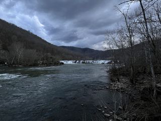 Sandstone FallsShort accessible national park boardwalk to river fallsSummers County, WV32 miNW