Falling Spring Falls
Alleghany County, Virginia
Your visit at a glance
- Waterfall height
- 262 ft (80 m)
- Location
- Alleghany County, Virginia
- Access status
- State-owned roadside overlook with a short paved path
- The walk
- Short paved walk from the parking area to the overlook; no distance is published
- Ground & access
- Short paved path to a railed overlook.
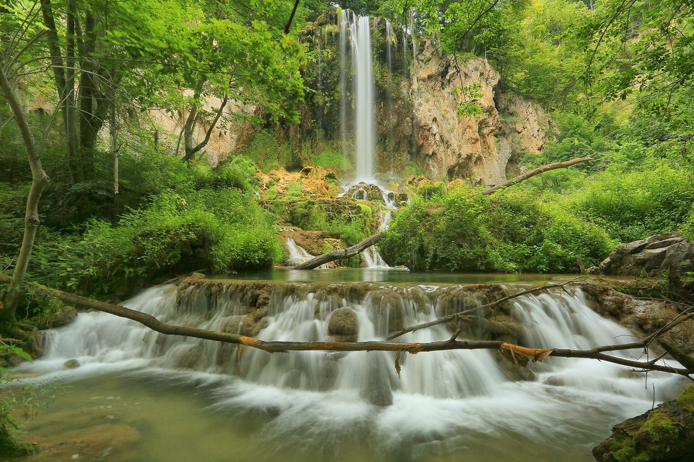
Photo credit
Photo: U.S. Geological Survey from Reston, VA, USA, Public domain, via Wikimedia CommonsFalling Spring Falls is an 80-foot waterfall that drops from an overhanging limestone ledge beside US-220 in the Alleghany Highlands. The Virginia Department of Conservation and Recreation owns the site and Douthat State Park maintains it. Park in the small pull-off and walk the short paved path to the overlook, which has picnic tables and interpretive signs. Access beyond the overlook is not allowed, and the state says this is strictly enforced.
Plan your visit
Roadside pull-off on US-220 north of Covington, then a short paved path to the overlook
Virginia State Parks describes a short paved walk from the parking area to the overlook but gives no distance.
Short paved path to a railed overlook.
Where to start
Small pull-off on the west side of US-220. From I-64 exit 16A, follow US-220 north about 12 miles through Covington, then about 5 more miles; the falls are on the left.
Timing & water
Hours are not listed. Virginia State Parks notes there is no cell service.
Before you go
No fee is mentioned. The NPS says the site does not accept the America the Beautiful pass and that fees are set by the managing partner.
Visitor informationVisit sources
More waterfalls nearby
Within 40 straight-line miles. Road and trail distances will differ.
- Stony Run FallsGuide: state park trails to a small fallsAlleghany County, VA6.5 miE
- Blue Suck FallsState park trail route from Camp Carson Picnic Area; parking feeBath County, VA7.4 miE
- Middle CascadesAlleghany County, VA21 miSW
- Beaverdam FallsAlleghany County, VA21 miSW
- The CascadesAlleghany County, VA21 miSW
- Lace FallsGuide: state park trail under the Natural Bridge to the fallsRockbridge County, VA27 miSE
- Lower Falls of Hills CreekNational forest trail with stairs to the lower falls platform63 ft (19.2 m) · Pocahontas County, WV30 miNW
- Middle Falls of Hills CreekDeveloped national forest trail with boardwalks and stairs; second of three falls45 ft (13.7 m) · Pocahontas County, WV30 miNW
- Upper Falls of Hills CreekPaved, accessible national forest path to the upper falls platform25 ft (7.6 m) · Pocahontas County, WV30 miNW