Lace Falls
Rockbridge County, Virginia
Your visit at a glance
- Waterfall height
- Not recorded
- Location
- Rockbridge County, Virginia
- Access status
- Guide: state park trail under the Natural Bridge to the falls
- The walk
- 2.2 miles out and back (trail report)
- Ground & access
- A stairway of 137 steps at the start, then a mostly gentle path along the creek, partly paved. The park says accessibility accommodations can be requested at the Visitor Center.
Lace Falls is a cascade on Cedar Creek at the far end of the Cedar Creek Trail in Natural Bridge State Park. Start at the Visitor Center and buy park admission there, or at the Trail Store if you arrive before the Visitor Center opens. A stairway of 137 steps leads down to the gorge, where tickets are checked. The trail then passes under the Natural Bridge, goes past Saltpeter Cave and follows Cedar Creek to Lace Falls, where the trail ends. Return the same way. Part of the trail is paved.
Plan your visit
Natural Bridge State Park Visitor Center, down the steps to the Cedar Creek Trail, under the Natural Bridge and along Cedar Creek to the Lace Falls viewing area at the end of the trail
A firsthand trail report gives 2.2 miles round trip on the Cedar Creek Trail out and back to Lace Falls. The trail ends at the falls.
A stairway of 137 steps at the start, then a mostly gentle path along the creek, partly paved. The park says accessibility accommodations can be requested at the Visitor Center.
Where to start
Natural Bridge State Park Visitor Center parking, 6477 South Lee Highway, Natural Bridge.
Timing & water
No season limits are stated.
Before you go
Park admission is required for the Cedar Creek Trail; buy it at the Visitor Center or at the Trail Store. The price is not stated. No booking is needed.
Visitor informationVisit sources
More waterfalls nearby
Within 40 straight-line miles. Road and trail distances will differ.
- Apple Orchard FallsRoute and parking researchedBotetourt County, VA8.3 miS
- Falling Water CascadesGuide: short loop beside the cascadesBedford County, VA11 miS
- Panther FallsShort riverside trail from a gravel-road parking lotAmherst County, VA15 miE
- Stony Run FallsGuide: state park trails to a small fallsAlleghany County, VA23 miNW
- Blue Suck FallsState park trail route from Camp Carson Picnic Area; parking feeBath County, VA24 miNW
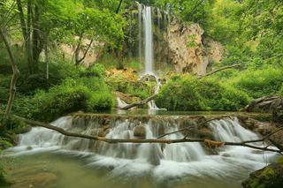 Falling Spring FallsState-owned roadside overlook with a short paved path262 ft (80 m) · Alleghany County, VA27 miNW
- St. Mary's FallsNational forest wilderness trail with five river crossingsAugusta County, VA32 miNE
- White Rock FallsTrail from a Blue Ridge Parkway overlook; unsigned trailheadNelson County, VA33 miNE
- Beaverdam FallsAlleghany County, VA37 miW