White Rock Falls
Nelson County, Virginia
Your visit at a glance
- Waterfall height
- Not recorded
- Location
- Nelson County, Virginia
- Access status
- Trail from a Blue Ridge Parkway overlook; unsigned trailhead
- The walk
- 2.2 miles round trip from The Slacks Overlook per NPPlan
- Ground & access
- Forest trail. The trailhead is unsigned and hard to see from the road.
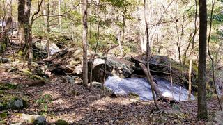
White Rock Falls is a series of cascades on the White Rock Falls Trail, which runs 2.5 miles between The Slacks Overlook and the White Rock Gap Parking Area on the Blue Ridge Parkway. NPPlan recommends starting at The Slacks for the shortest walk. Leave the C-shaped lot at its left side, cross the Parkway and turn left; the unsigned trailhead is about 50 yards down, dropping into a gully. The cascades begin about a mile into the hike. Return the same way.
Plan your visit
The Slacks Overlook, Blue Ridge Parkway, across the Parkway to the White Rock Falls Trail and down to the cascades
NPPlan gives 2.2 miles round trip from The Slacks Overlook and 2.8 miles round trip from the White Rock Gap Parking Area. The cascades start about a mile in from The Slacks and continue downstream for about a quarter mile. The whole trail is 2.5 miles one way between the two lots.
Forest trail. The trailhead is unsigned and hard to see from the road.
Where to start
The Slacks Overlook on the Blue Ridge Parkway, a C-shaped pull-through lot that can fill on nice days. The White Rock Gap Parking Area at milepost 18.5 is the other end of the trail.
Timing & water
No season limits are stated.
Before you go
No fee is mentioned.
Visitor informationVisit sources
More waterfalls nearby
Within 40 straight-line miles. Road and trail distances will differ.
- St. Mary's FallsNational forest wilderness trail with five river crossingsAugusta County, VA3.4 miNW
- Upper Shamokin FallsShort loop on Wintergreen trails, stated open to the publicAugusta County, VA7.1 miE
- Panther FallsShort riverside trail from a gravel-road parking lotAmherst County, VA19 miSW
 Jones Run FallsNational park trail from a Skyline Drive parking area; entrance fee42 ft (12.8 m) · Albemarle County, VA30 miNE
- Lower Doyles River FallsNational park trail from a Skyline Drive parking area; entrance fee62 ft (19 m) · Albemarle County, VA30 miNE
- Upper Doyles River FallsGuide: park trail down to the upper falls28 ft (8.5 m) · Albemarle County, VA31 miNE
- Lace FallsGuide: state park trail under the Natural Bridge to the fallsRockbridge County, VA33 miSW
- Apple Orchard FallsRoute and parking researchedBotetourt County, VA37 miSW