Upper Shamokin Falls
Augusta County, Virginia
Your visit at a glance
- Waterfall height
- Not recorded
- Location
- Augusta County, Virginia
- Access status
- Short loop on Wintergreen trails, stated open to the public
- The walk
- 0.6 miles out and back to the falls, or a 0.8-mile loop, per the Wintergreen Property Owners Association
- Ground & access
- Steep and rocky. Rocks at the edge of the falls are slippery when wet and icy in winter.
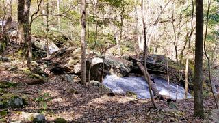
Upper Shamokin Falls is a series of cascades on Wintergreen's mountain. The Wintergreen Property Owners Association states that its trails are open to the public. From the Laurel Springs Connector Trail, turn left on the yellow-blazed Upper Shamokin Falls Trail and walk about a quarter mile to the falls. Return the same way, or continue on, turn left at the Loggers Alley Trail and left on Morgan's Loop to close the loop. Two Outliers gives a Blue Ridge Parkway start: from the Dripping Rock parking area, take a short connector trail uphill to Laurel Springs Drive, turn left and walk about half a mile along the road to the trailhead.
Plan your visit
On-street parking near 2070 Laurel Springs Drive, Wintergreen, Laurel Springs Connector Trail and Upper Shamokin Falls Trail to the falls, optional Morgan's Loop
The Wintergreen Property Owners Association says the hike is 0.6 miles in total if you return at the falls, and 0.8 miles with Morgan's Loop. Two Outliers says starting from the Dripping Rock parking area on the Blue Ridge Parkway adds a little over a mile round trip.
Steep and rocky. Rocks at the edge of the falls are slippery when wet and icy in winter.
Where to start
On-street parking at the trailhead near 2070 Laurel Springs Drive in Wintergreen, per the Property Owners Association; Two Outliers says trailhead parking is limited. Alternative: the Dripping Rock parking area on the Blue Ridge Parkway.
Timing & water
Two Outliers says the trail can usually be hiked year round, with ice in winter.
Before you go
Go Hike Virginia lists the hike as free. No reservation is mentioned.
Visitor informationVisit sources
More waterfalls nearby
Within 40 straight-line miles. Road and trail distances will differ.
- White Rock FallsTrail from a Blue Ridge Parkway overlook; unsigned trailheadNelson County, VA7.1 miW
- St. Mary's FallsNational forest wilderness trail with five river crossingsAugusta County, VA9.5 miW
 Jones Run FallsNational park trail from a Skyline Drive parking area; entrance fee42 ft (12.8 m) · Albemarle County, VA24 miNE
- Lower Doyles River FallsNational park trail from a Skyline Drive parking area; entrance fee62 ft (19 m) · Albemarle County, VA25 miNE
- Upper Doyles River FallsGuide: park trail down to the upper falls28 ft (8.5 m) · Albemarle County, VA25 miNE
- Panther FallsShort riverside trail from a gravel-road parking lotAmherst County, VA25 miSW
- Cedar FallsRockingham County, VA38 miNE
- South River FallsOfficial park trail to an observation point; entrance fee89 ft (27 m) · Greene County, VA39 miNE
- Dry Run FallsFire road walk to a view of the falls; exact viewpoint not described; off-trail to the streamRockingham County, VA39 miNE