Lower Doyles River Falls
Albemarle County, Virginia
Your visit at a glance
- Waterfall height
- 62 ft (19 m)
- Location
- Albemarle County, Virginia
- Access status
- National park trail from a Skyline Drive parking area; entrance fee
- The walk
- Go Hike Virginia reached the Lower Falls at its 1.8-mile mark; the NPS gives 3.3 miles round trip for both falls
- Ground & access
- Descending forest trail with a stream crossing; the return climbs. The NPS says the trail does not meet ADA accessibility guidelines.
Lower Doyles River Falls is the 63-foot lower drop on the Doyles River in the South District of Shenandoah National Park. From the Doyles River Parking Area, follow the blue-blazed Doyles River Trail across the Appalachian Trail and past the access trails to Doyles River Cabin and Browns Gap Road. The trail reaches the river and crosses it on rocks. Trail posts mark the Upper Falls and then the Lower Falls, a little farther down the trail. Retrace your steps to return; the return is uphill. The Upper Falls has its own listing.
Plan your visit
Doyles River Parking Area at Skyline Drive mile 81.1, down the blue-blazed Doyles River Trail past the Upper Falls to the Lower Falls
The NPS gives the Doyles River Falls hike, to the Upper and Lower Falls, as a 3.3-mile round trip with 1,189 feet of elevation gain. Go Hike Virginia reached the Upper Falls at its 1.5-mile mark and the Lower Falls at its 1.8-mile mark, including a short side trip to Doyles River Cabin.
Descending forest trail with a stream crossing; the return climbs. The NPS says the trail does not meet ADA accessibility guidelines.
Where to start
Doyles River Parking Area on the east side of Skyline Drive at mile 81.1; Go Hike Virginia says there is room for at least a dozen cars.
Timing & water
The NPS lists the hike as open year round. Go Hike Virginia found both falls at a trickle in a dry August. Pets must be on a leash no longer than 6 feet.
Before you go
A Shenandoah National Park entrance fee is required: $30 per private vehicle, valid for seven consecutive days. The NPS lists no separate activity fee and no reservation for this hike.
Visitor informationVisit sources
- Shenandoah National Park: Doyles River Falls hike
- Shenandoah National Park: Doyles River Falls hike
- Shenandoah National Park: Doyles River Falls hike
- Go Hike Virginia: Doyles River Falls
- Go Hike Virginia: Doyles River Falls
- Shenandoah National Park: Fees and Passes
- Shenandoah National Park: Fees and Passes
More waterfalls nearby
Within 40 straight-line miles. Road and trail distances will differ.
- Upper Doyles River FallsGuide: park trail down to the upper falls28 ft (8.5 m) · Albemarle County, VA0.2 miNE
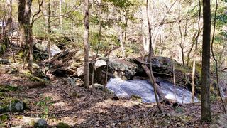 Jones Run FallsNational park trail from a Skyline Drive parking area; entrance fee42 ft (12.8 m) · Albemarle County, VA1.0 miSW
- Cedar FallsRockingham County, VA14 miNE
- South River FallsOfficial park trail to an observation point; entrance fee89 ft (27 m) · Greene County, VA14 miNE
- Dry Run FallsFire road walk to a view of the falls; exact viewpoint not described; off-trail to the streamRockingham County, VA14 miNE
- Big Creek Falls151 ft (46 m) · Page County, VA19 miNE
- Upper Big Creek Falls33 ft (10 m) · Page County, VA19 miNE
- Naked Creek FallsPartial guide: off-trail creek descent; exact drop not confirmedPage County, VA22 miNE
- Big Rock FallsPublished hike route and national park parking documentedMadison County, VA23 miNE