St. Mary's Falls
Augusta County, Virginia
Your visit at a glance
- Waterfall height
- Not recorded
- Location
- Augusta County, Virginia
- Access status
- National forest wilderness trail with five river crossings
- The walk
- Go Hike Virginia lists the out-and-back hike as 4.7 miles; the falls are 0.1 mile past its 2.3-mile river crossing
- Ground & access
- Rocky wilderness trail with five unbridged river crossings on the way in and the same five on the way back. Go Hike Virginia says there are few signs or blazes and the trail is largely unmarked on purpose. Water depth varies through the year.
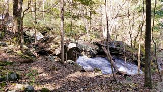
St. Mary's Falls is on the St. Mary's River in the St. Mary's Wilderness of the George Washington National Forest, near Vesuvius. The St. Mary's River Trail (also called the St. Mary's Falls Trail) starts at the back of the trailhead parking lot, beside a kiosk with a large map. It climbs gently through the forest beside the river. The first four of the five river crossings come within half a mile, starting at about 1.2 miles; there are no bridges or stepping stones, so expect to wade. Near the end, skirt the river against a rock wall on the left, make the last crossing, pass a few campsites, and reach the falls and its pool. There is no viewing platform. Return the same way, crossing the river five more times.
Plan your visit
St. Mary's Falls trailhead at the end of St. Mary's Road near Vesuvius, then the St. Mary's River Trail upstream with five river crossings to the falls
Go Hike Virginia lists the out-and-back hike as 4.7 miles with 400 feet of elevation gain. It reached the first river crossing at about 1.2 miles, the last crossing at 2.3 miles and the falls 0.1 mile farther.
Rocky wilderness trail with five unbridged river crossings on the way in and the same five on the way back. Go Hike Virginia says there are few signs or blazes and the trail is largely unmarked on purpose. Water depth varies through the year.
Where to start
Lot at the dead end of St. Mary's Road; the last 0.7 mile is bumpy gravel that Go Hike Virginia managed in a sedan. Room for at least 20 cars. When the lot is full there is nowhere else to park.
Timing & water
No season is stated. River crossings are deeper after rain. Go Hike Virginia notes that camping is not allowed within 150 feet of either side of the St. Mary's Trail.
Before you go
No fee is mentioned. Go Hike Virginia lists the hike as free and dog friendly.
Visitor informationVisit sources
More waterfalls nearby
Within 40 straight-line miles. Road and trail distances will differ.
- White Rock FallsTrail from a Blue Ridge Parkway overlook; unsigned trailheadNelson County, VA3.4 miSE
- Upper Shamokin FallsShort loop on Wintergreen trails, stated open to the publicAugusta County, VA9.5 miE
- Panther FallsShort riverside trail from a gravel-road parking lotAmherst County, VA18 miSW
 Jones Run FallsNational park trail from a Skyline Drive parking area; entrance fee42 ft (12.8 m) · Albemarle County, VA30 miNE
- Lower Doyles River FallsNational park trail from a Skyline Drive parking area; entrance fee62 ft (19 m) · Albemarle County, VA31 miNE
- Upper Doyles River FallsGuide: park trail down to the upper falls28 ft (8.5 m) · Albemarle County, VA31 miNE
- Lace FallsGuide: state park trail under the Natural Bridge to the fallsRockbridge County, VA32 miSW
- Apple Orchard FallsRoute and parking researchedBotetourt County, VA37 miSW
- Blue Suck FallsState park trail route from Camp Carson Picnic Area; parking feeBath County, VA39 miW