Upper Overall Run Falls
Warren County, Virginia
Your visit at a glance
- Waterfall height
- 29 ft (8.8 m)
- Location
- Warren County, Virginia
- Access status
- National park trail route and parking documented; viewpoint of the upper falls
- The walk
- Under 5.1 miles round trip (NPS gives 5.1 miles for the hike that continues past this viewpoint)
- Ground & access
- NPS rates the hike moderately strenuous, with 1,291 feet of elevation gain, and it enters designated Wilderness. Unless rain is plentiful, the falls may have little or no water. The trail does not meet ADA accessibility guidelines.
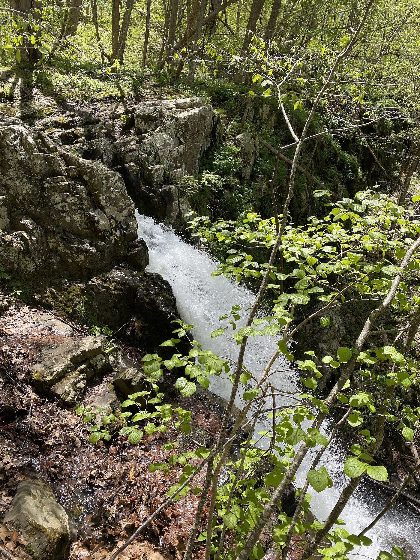
The upper falls of Overall Run sit above the 93-foot main falls in Shenandoah National Park Wilderness. From the Mathews Arm Campground registration parking area, take the Traces Trail to the yellow-blazed Mathews Arm Road, which becomes the Mathews Arm Trail. Stay right at the Beecher Ridge Trail junction and continue to the Tuscarora-Overall Run Trail. Turn left and follow it about 0.1 mile to a side trail; NPS says the upper falls can be seen from there. The main falls are about 1,300 feet farther downhill. Return the same way.
Plan your visit
Mathews Arm Campground registration parking area, Traces Trail, Mathews Arm Road and Mathews Arm Trail, then the Tuscarora-Overall Run Trail to the side trail with a view of the upper falls
NPS gives no separate distance for the upper falls. Its 5.1-mile round trip continues from the upper falls side trail about 1,300 feet farther downhill to the 93-foot falls. NPS says the Appalachian Trail start at mile 21 adds another mile.
NPS rates the hike moderately strenuous, with 1,291 feet of elevation gain, and it enters designated Wilderness. Unless rain is plentiful, the falls may have little or no water. The trail does not meet ADA accessibility guidelines.
Where to start
Mathews Arm Campground registration parking area (North District, Skyline Drive mile 22.2). If the campground is closed, NPS says to park at mile 21 and take the Appalachian Trail to the Tuscarora-Overall Run Trail, which adds another mile.
Timing & water
NPS lists the hike as open year round, but the Mathews Arm Campground start depends on the campground being open (see parking). NPS notes closures along Overall Run to protect outcrop ecosystems. Pets are allowed on a leash no longer than 6 feet.
Before you go
A Shenandoah National Park entrance pass is required ($30 per private vehicle, valid for seven consecutive days). NPS lists no reservation for this hike.
Visitor informationVisit sources
More waterfalls nearby
Within 40 straight-line miles. Road and trail distances will differ.
 Overall Run FallsNational park trail route and parking documented93 ft (28.3 m) · Warren County, VA0.1 miNW
- Greasy Falls20 ft (6 m) · Warren County, VA1.5 miE
- Miller FallsRappahannock County, VA4.5 miE
- Lands Run FallsNational park trail route and parking documentedWarren County, VA6.4 miNE
- Cave FallsPark trail route from Meadow Spring; steep final descent; entrance feeRappahannock County, VA10 miS
- Upper Whiteoak FallsNational park trail from a Skyline Drive parking area; entrance fee85 ft (26 m) · Madison County, VA16 miS
- Upper Whiteoak Falls62 ft (19 m) · Madison County, VA16 miS
 Lower Whiteoak FallsGuide: easy trail from the boundary parking area59 ft (18 m) · Madison County, VA16 miS
- Cedar Run FallsGuide: wilderness trail to a falls with a swimming holeMadison County, VA17 miS