Falls Ridge Waterfall
Shenandoah County, Virginia
Your visit at a glance
- Waterfall height
- 26 ft (8 m)
- Location
- Shenandoah County, Virginia
- Access status
- Partial: national forest trail then an unofficial side path; forest road gate status varies
- The walk
- 2.2 miles (Waterfall Hero Hikes; one way or round trip not stated)
- Ground & access
- Steep climb on the Falls Ridge Trail, then an unofficial path down past cliffs. Rocks around the waterfall are very slippery.
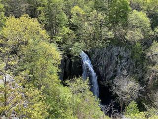
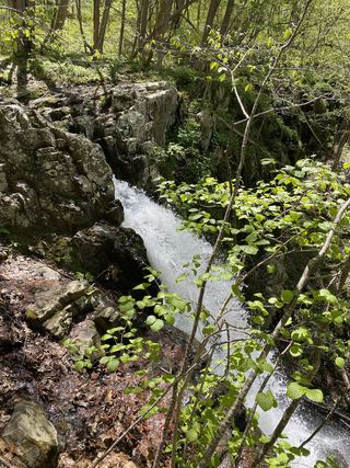
This waterfall, called Falls Run Waterfall by Waterfall Hero Hikes, is a 60-foot waterfall on Falls Run in the Lee Ranger District of the George Washington National Forest. From the small parking area before the gate on Forest Road 252, walk past the gate for 0.1 mile and turn right on the yellow-blazed Falls Ridge Trail (#572), which climbs steeply. After a left-hand switchback the trail curves right; at a cairn there, take the obvious unofficial path to the left. About 0.1 mile along it the path splits; go left and down, past large cliffs, to the waterfall. Return the same way. The final path is not an official trail.
Plan your visit
Small parking area before the gate on Forest Road 252, the yellow-blazed Falls Ridge Trail (#572), then an unofficial side path from a cairn down to the waterfall on Falls Run
Waterfall Hero Hikes lists the hike length as 2.2 miles and does not say whether this is one way or round trip.
Steep climb on the Falls Ridge Trail, then an unofficial path down past cliffs. Rocks around the waterfall are very slippery.
Where to start
Small parking area before the gate on Forest Road 252, a gravel road reached from Route 675, CR 717 and CR 691 west of I-81 exit 279. Another visitor account found a gate on Forest Road 252 closed and walked the road for about 2 miles each way, so how far you can drive may vary.
Timing & water
Water flow is best in spring or after heavy rain. Forest Road 252 gate status may vary.
Before you go
No fee is mentioned.
Visitor informationVisit sources
More waterfalls nearby
Within 40 straight-line miles. Road and trail distances will differ.
- Mountain FallsFrederick County, VA26 miNE
 Overall Run FallsNational park trail route and parking documented93 ft (28.3 m) · Warren County, VA27 miE
 Upper Overall Run FallsNational park trail route and parking documented; viewpoint of the upper falls29 ft (8.8 m) · Warren County, VA27 miE
- Greasy Falls20 ft (6 m) · Warren County, VA28 miE
- Hooks Mill FallsHampshire County, WV30 miNE
- Lewis Spring FallsOfficial park loop to a viewing platform; entrance fee79 ft (24 m) · Page County, VA30 miSE
- Miller FallsRappahannock County, VA31 miE
- Upper Whiteoak FallsNational park trail from a Skyline Drive parking area; entrance fee85 ft (26 m) · Madison County, VA31 miSE
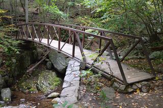 Rose River FallsGuide: 4-mile park loop past the falls66 ft (20 m) · Madison County, VA31 miSE