Straight Branch Falls
Washington County, Virginia
Your visit at a glance
- Waterfall height
- Not recorded
- Location
- Washington County, Virginia
- Access status
- Partial: roadside viewpoint described by a visitor source; parking area not confirmed by the land manager
- The walk
- Under 0.1 mile (Waterfall Hero Hikes)
- Ground & access
- Roadside viewing behind a guardrail. The way down to creek level is a short but steep scramble.
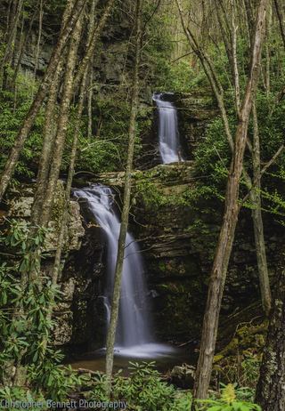
Straight Branch Falls, also called Estella Falls, is a 20-foot waterfall on Straight Branch in the Mount Rogers National Recreation Area, Jefferson National Forest. It is beside US 58 east of Damascus. From Damascus, drive east on US 58 for 5.8 miles; the falls are on the left. The account suggests passing the falls and turning around, then parking in a small grassy area just before the guardrail while heading west. Walk behind the guardrail to view the falls. Use care beside the road.
Plan your visit
Small grassy roadside area beside US 58 about 5.8 miles east of Damascus, then a few steps behind the guardrail to view the falls
Waterfall Hero Hikes lists the hike length as less than 0.1 mile.
Roadside viewing behind a guardrail. The way down to creek level is a short but steep scramble.
Where to start
Small grassy area just before the guardrail on the westbound side of US 58, about 5.8 miles east of Damascus. No official source confirms this parking area.
Timing & water
No seasonal closure is mentioned.
Before you go
No fee is mentioned.
Visitor informationVisit sources
More waterfalls nearby
Within 40 straight-line miles. Road and trail distances will differ.
- Whitetop Laurel FallsWashington County, VA2.0 miW
 Gentry Creek FallsResearched walking routeJohnson County, TN5.3 miS
- Comer’s Creek FallsGuide: short forest trail to a small fallsGrayson County, VA14 miE
- Sharpes FallsAshe County, NC16 miSE
- Bluff Mountain FallsAshe County, NC19 miSE
- Blue Hole FallsShort national forest trail and parking documentedCarter County, TN25 miSW
- Nana FallsPartial guide: roadside view; no parking spot describedAshe County, NC25 miSE
- Laurel Creek FallsPartial: short informal path; landowner and permission not confirmedWatauga County, NC28 miS
- Abrams FallsWashington County, VA30 miW