Blue Hole Falls
Carter County, Tennessee
Your visit at a glance
- Waterfall height
- Not recorded
- Location
- Carter County, Tennessee
- Access status
- Short national forest trail and parking documented
- The walk
- 0.4-mile out-and-back trail (Elizabethton Star figure)
- Ground & access
- Short trail with exposed roots and very steep stairs that can be slick. Not wheelchair accessible. Rocks around the falls are slippery; cliffs above the falls.
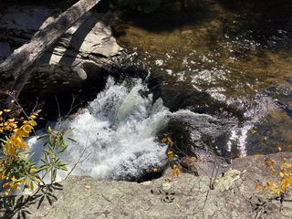
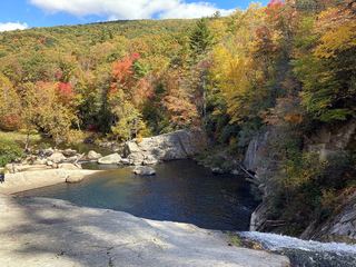
Blue Hole Falls is a waterfall in several sections on Mill Creek in the Holston Mountain area of Cherokee National Forest, with a swimming hole (the Blue Hole) at the main drop. From the pull-off, an old road on the north side leads down to the creek above the uppermost section; the path continues past a mossy cascade and descends to the main falls and pool. The Elizabethton Star describes two paths at the start: a longer, less steep one beside the stream and a steeper one with exposed roots, and a set of very steep stairs down to the pool. Another obvious path from the parking area leads to cliffs above the falls with a view of the main pool and lower section. Return the same way.
Plan your visit
Panhandle Road pull-off off TN 91, trail and steps down Mill Creek to the Blue Hole
The Elizabethton Star gives the out-and-back trail as 0.4 mile. Two guides give the pull-off at 0.9 mile up Panhandle Road from TN 91.
Short trail with exposed roots and very steep stairs that can be slick. Not wheelchair accessible. Rocks around the falls are slippery; cliffs above the falls.
Where to start
From Elizabethton, drive north on TN 91 about 10.1 miles from US 19E and turn left onto Panhandle Road (it becomes a forest road). Park at the large pull-off 0.9 mile from the turn.
Timing & water
No season limits are stated. The site is very popular with swimmers in warm weather.
Before you go
No fee is mentioned.
Visitor informationVisit sources
More waterfalls nearby
Within 40 straight-line miles. Road and trail distances will differ.
- Laurel FallsForest Service route and trailheads documentedCarter County, TN12 miS
- Dennis Cove WaterfallNational forest trail route documented; three wading fordsCarter County, TN13 miS
- Coon Den FallsGuide: steep forest trail; park at the gravel area past the trailheadCarter County, TN13 miS
- Twisting FallsPartial guide: unofficial steep path; land ownership not statedCarter County, TN15 miS
- Mountaineer FallsCarter County, TN16 miS
 Splash Dam FallsPartial guide: unmarked side path and unofficial connector; scramble to the baseCarter County, TN16 miS
- Jones FallsPartial guide: the link from the forest road to the Appalachian Trail is an unofficial pathCarter County, TN17 miS
- Buckeye Creek FallsTown park trail; loop bridge out since September 2024, out-and-back worksWatauga County, NC17 miSE
 Elk River FallsSource-reviewed route and parking49 ft (15 m) · Avery County, NC17 miS