Waterfalls near Marion, NC
123 named waterfalls within 30 miles of Marion, closest first. Distances are straight-line from the town center.
Visits with route details
Read the walking route, starting point and current access notes.
- Buck Creek FallsPartial guide: obscured roadside view of a private waterfall; parking permission at the gate not confirmedMcDowell County, NC
 Toms Creek FallsCheck current trail conditionsMcDowell County, NC
- Roaring Fork FallsSource-reviewed route and parkingYancey County, NC
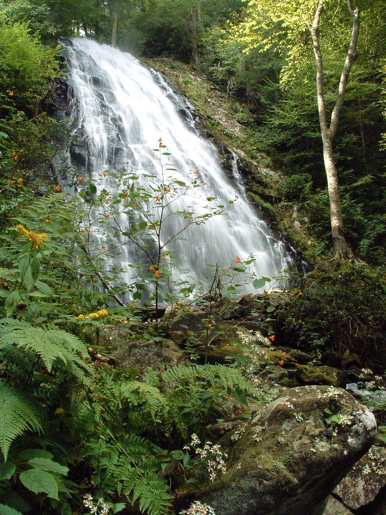
 Crabtree FallsTrail listed closed66 ft (20 m) · Yancey County, NC
- Bon Ami FallsPrivate mine attraction with roadside overlook; fee for the mine tourMitchell County, NC
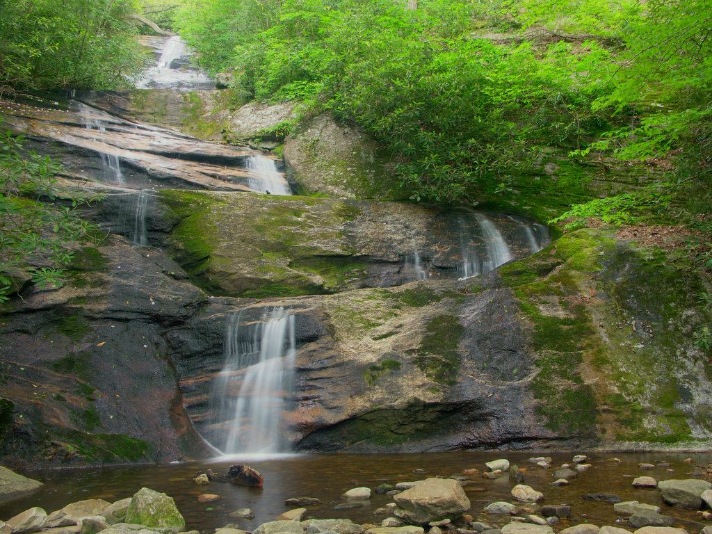
 Setrock Creek FallsShort Forest Service trail from Black Mountain CampgroundYancey County, NC
- Lower Catawaba FallsNational forest trail; view from the trail onlyMcDowell County, NC
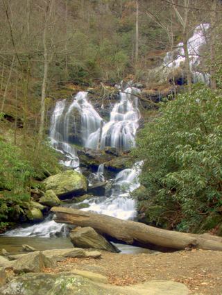 Catawba FallsLoop open; upper platform and Wildflower Trail closedMcDowell County, NC
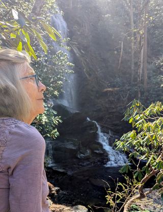 Upper Catawba FallsPartial: loop trail open; the Forest Service lists the upper viewing platform as closedMcDowell County, NC
- Davids FallsNational forest trail; river crossings on the spurMcDowell County, NC
- Whiteoak Creek FallsShort paths from the end of a county road to a national forest waterfallYancey County, NC
- Graybeard FallsPrivate conservation land open to hikers; blazed trailBuncombe County, NC
- Cathedral FallsWilderness trails to a view across the riverBurke County, NC
- Sally Queen FallsPartial: bushwhack with no trail; storm blowdowns reportedRutherford County, NC
- Brushy Ridge FallsWilderness trails to a river-bend campsite view; difficultBurke County, NC
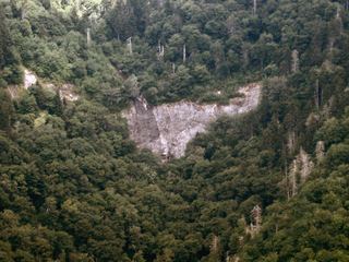 Glassmine FallsOverlook approach verified; no public access to the waterfallBuncombe County, NC
- Pot Branch FallsShort walk on old roads in South Mountains Game Land; rough gravel road with a fordRutherford County, NC
- Steels Creek FallsNational forest trail; creek crossing and steep scramble to the viewBurke County, NC
- Falling Water Branch FallsPartial guide: no built trail, steep overgrown grades, route uncertain after Helene, parking not formalizedYancey County, NC
- Beverly Hillbilly FallsNational forest trail then a creek walk; exact location not confirmed by a sourceBurke County, NC
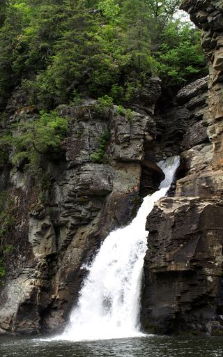 Linville FallsResearched visit notesBurke County, NC
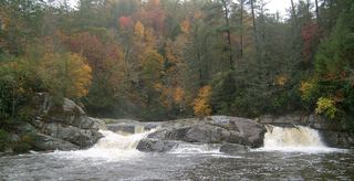 Upper Linville FallsBlue Ridge Parkway trail to an overlook; some nearby trails closedBurke County, NC
- Teacups FallsPartial guide: exact waterfall and total distance not confirmed; creek wade and scramblesBurke County, NC
- Duggers Creek FallsShort Park Service trail from the Linville Falls lot; Helene trail closures in the area notedBurke County, NC
- Upper Steels Creek FallsPartial: forest road closed to vehicles; walk-in parking not describedBurke County, NC
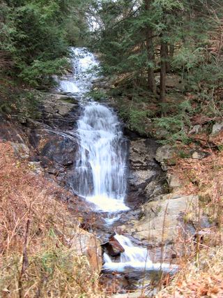 Walker FallsPartial guide: roadside falls on a road closed to vehicles since Hurricane Helene; walking distance unknownBuncombe County, NC
- Newt FallsPartial: forest road closed to cars; parking at the closure not confirmed; difficult descentBurke County, NC
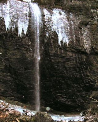 Douglas FallsGraybeard approach documented; Big Ivy road approach has a motor-vehicle closure.Buncombe County, NC
- Upper Creek FallsRoute and parking documented; secondary route details attributed98 ft (30 m) · Burke County, NC
- Burnthouse Branch FallsPartial guide: the access trail is on the Forest Service Helene closure listBurke County, NC
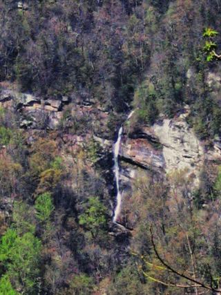 Rainbow FallsDistant view only from Inspiration Point; admission fee; falls not open to the publicRutherford County, NC
- Little River FallsPartial guide: final approach is a steep bushwhack near a dangerous cliff topBurke County, NC
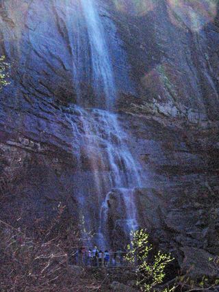 Hickory Nut FallsState park trail with admission fee; official trail descriptionRutherford County, NC
- Ten Foot FallsRoadside view in the reopened Wilson Creek Gorge day use areaCaldwell County, NC
- Phillips Branch FallsForest trail and steep scramble path; Wilson Creek day use area reopened 202643 ft (13 m) · Caldwell County, NC
- Little Bearwallow FallsPartial guide: usual trailhead closed after Helene; long alternative with restricted road accessBuncombe County, NC
- Chestnut Cove Branch FallsNational forest trails; wading for the viewAvery County, NC
- North Harper Creek FallsNational forest trails; one creek crossingAvery County, NC
- Harper Creek FallsPartial: Harper Creek Trail closed after Hurricane HeleneCaldwell County, NC
- Bard FallsPublished national forest trail route; creek wadeAvery County, NC
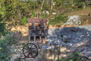 McGalliard FallsTown park with a short path; listed hours 8 AM to 8 PMBurke County, NC
- Upper Little Lost Cove FallsPartial: walk on a road closed to vehicles, then an unsigned steep path; older route descriptionAvery County, NC
- Little Lost Cove FallsPartial: forest road walk, then a steep rough path with off-trail scramblingAvery County, NC
- Huntfish Sidekick FallsForest Service trail; side view and base of Sidekick Falls at the trail endAvery County, NC
- Huntfish FallsSigned national forest trail; steep return; current storm-recovery status not confirmedAvery County, NC
- Thorps Creek FallsNational forest trail from a campgroundCaldwell County, NC
- Middle Gragg Prong FallsNational forest trail; three creek crossings16 ft (5 m) · Avery County, NC
- Gragg Prong FallsNational forest trail with wet creek crossings33 ft (10 m) · Avery County, NC
- Upper Gragg Prong FallsNational forest trail with a wade across Gragg ProngAvery County, NC
- Turtle Rock FallsPartial guide: informal route from one visitor description; parking not describedPolk County, NC
Closest with a photo
All 123 waterfalls
- Buck Creek FallsPartial guide: obscured roadside view of a private waterfall; parking permission at the gate not confirmedMcDowell County, NC6.7 miNW
- Toms Creek FallsCheck current trail conditionsMcDowell County, NC7.1 miNW
- Hickory Branch FallsMcDowell County, NC10 miW
- Curtis Creek FallsMcDowell County, NC11 miW
- Licklog Branch FallsMcDowell County, NC11 miW
- Slick FallsMcDowell County, NC11 miW
- Roaring Fork FallsSource-reviewed route and parkingYancey County, NC12 miNW
- Crabtree FallsTrail listed closed66 ft (20 m) · Yancey County, NC12 miNW
- Stillhouse FallsMcDowell County, NC12 miN
- Grassy Creek FallsMitchell County, NC13 miN
- Bon Ami FallsPrivate mine attraction with roadside overlook; fee for the mine tourMitchell County, NC13 miNW
- Setrock Creek FallsShort Forest Service trail from Black Mountain CampgroundYancey County, NC13 miW
- Somey Creek FallsRutherford County, NC14 miSE
- Standing Rock FallsMcDowell County, NC14 miSW
- Shoal Creek FallsBurke County, NC14 miE
- Lower Catawaba FallsNational forest trail; view from the trail onlyMcDowell County, NC14 miW
- Resurrection FallsRutherford County, NC14 miSE
- Upper Shoal Creek FallsBurke County, NC14 miE
- Catawba FallsLoop open; upper platform and Wildflower Trail closedMcDowell County, NC14 miSW
- Upper Catawba FallsPartial: loop trail open; the Forest Service lists the upper viewing platform as closedMcDowell County, NC15 miSW
- Middle Fork Rock Creek Falls79 ft (24 m) · Yancey County, NC15 miNW
- Lower Middle Creek FallsYancey County, NC15 miNW
- Squawroot FallsYancey County, NC15 miNW
- Middle Creek FallsYancey County, NC15 miNW
- Camp Celo FallsYancey County, NC15 miNW
- Anaconda FallsYancey County, NC15 miNW
- Crevice FallsYancey County, NC15 miNW
- Timber FallsYancey County, NC15 miNW
- Split Rock FallsYancey County, NC15 miNW
- Davids FallsNational forest trail; river crossings on the spurMcDowell County, NC15 miSW
- Guyot FallsYancey County, NC15 miNW
- Laurel Leap FallsMcDowell County, NC15 miN
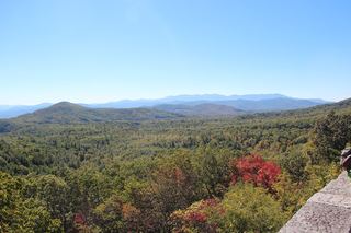 Bear Den FallsMcDowell County, NC15 miN
- Whiteoak Creek FallsShort paths from the end of a county road to a national forest waterfallYancey County, NC15 miNW
- Graybeard FallsPrivate conservation land open to hikers; blazed trailBuncombe County, NC15 miW
- Locust Creek FallsYancey County, NC16 miNW
- Galvladi FallsYancey County, NC16 miNW
- English FallsMcDowell County, NC16 miN
- Cathedral FallsWilderness trails to a view across the riverBurke County, NC16 miNE
- Upper Whiteoak Creek FallsYancey County, NC16 miNW
- Mitchell Falls33 ft (10 m) · Yancey County, NC17 miNW
- Sally Queen FallsPartial: bushwhack with no trail; storm blowdowns reportedRutherford County, NC17 miSE
- Mossy Ledge FallsBurke County, NC17 miNE
- Mill FallsMcDowell County, NC17 miN
- Brushy Ridge FallsWilderness trails to a river-bend campsite view; difficultBurke County, NC18 miN
Show the other 78 waterfalls, 18 mi to 30 mi away
- Mossy Chute FallsBurke County, NC18 miNE
- Buck Creek FallsBurke County, NC18 miNE
- Orange Rock FallsBurke County, NC18 miNE
- Glassmine FallsOverlook approach verified; no public access to the waterfallBuncombe County, NC18 miW
- Pot Branch FallsShort walk on old roads in South Mountains Game Land; rough gravel road with a fordRutherford County, NC18 miSE
- Steels Creek FallsNational forest trail; creek crossing and steep scramble to the viewBurke County, NC19 miNE
- Gingercake Creek FallsBurke County, NC19 miNE
- Falling Water Branch FallsPartial guide: no built trail, steep overgrown grades, route uncertain after Helene, parking not formalizedYancey County, NC19 miNW
- Black Mountain FallsRutherford County, NC19 miSE
- Beverly Hillbilly FallsNational forest trail then a creek walk; exact location not confirmed by a sourceBurke County, NC19 miNE
- Linville FallsResearched visit notesBurke County, NC19 miN
- Upper Linville FallsBlue Ridge Parkway trail to an overlook; some nearby trails closedBurke County, NC19 miN
- Teacups FallsPartial guide: exact waterfall and total distance not confirmed; creek wade and scramblesBurke County, NC19 miNE
- Duggers Creek FallsShort Park Service trail from the Linville Falls lot; Helene trail closures in the area notedBurke County, NC19 miN
- Rip Breeches FallsBurke County, NC20 miNE
- Zig Zag FallsBurke County, NC20 miNE
- Beautimos FallsCleveland County, NC20 miSE
- Upper Steels Creek FallsPartial: forest road closed to vehicles; walk-in parking not describedBurke County, NC20 miNE
- Walker FallsPartial guide: roadside falls on a road closed to vehicles since Hurricane Helene; walking distance unknownBuncombe County, NC20 miW
- Newt FallsPartial: forest road closed to cars; parking at the closure not confirmed; difficult descentBurke County, NC20 miNE
- Broad River FallsBuncombe County, NC20 miSW
- Cascades FallsBuncombe County, NC20 miW
- Douglas FallsGraybeard approach documented; Big Ivy road approach has a motor-vehicle closure.Buncombe County, NC21 miW
- Ripshin Branch FallsBurke County, NC21 miNE
- Upper Creek FallsRoute and parking documented; secondary route details attributed98 ft (30 m) · Burke County, NC21 miNE
- Goliath Falls118 ft (36 m) · Burke County, NC21 miNE
- MIddle Raven Cliff FallsBurke County, NC21 miNE
- Lower Raven Cliff FallsBurke County, NC21 miNE
- Upper Raven Cliff Falls46 ft (14 m) · Burke County, NC21 miNE
- Burnthouse Branch FallsPartial guide: the access trail is on the Forest Service Helene closure listBurke County, NC21 miNE
- Rainbow FallsDistant view only from Inspiration Point; admission fee; falls not open to the publicRutherford County, NC21 miSW
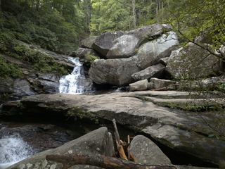 Big Bear FallsBurke County, NC22 miE
- Tom's FallsBuncombe County, NC22 miSW
- Camp Minnehaha FallsBuncombe County, NC22 miSW
- 4x4 FallsBurke County, NC22 miNE
- Bottomless PoolsRutherford County, NC22 miSW
- High Shoals FallsBurke County, NC22 miE
- Upper High Shoals FallsBurke County, NC22 miE
- Silver FallsRutherford County, NC22 miSW
- Little River FallsPartial guide: final approach is a steep bushwhack near a dangerous cliff topBurke County, NC22 miE
- Hickory Nut FallsState park trail with admission fee; official trail descriptionRutherford County, NC22 miSW
- Skidder FallsAvery County, NC22 miNE
- RazorbackCaldwell County, NC22 miNE
- Ten Foot FallsRoadside view in the reopened Wilson Creek Gorge day use areaCaldwell County, NC23 miNE
- Triple DropCaldwell County, NC23 miNE
- Boat BusterCaldwell County, NC23 miNE
- Thunder HoleCaldwell County, NC23 miNE
- Wolf Creek FallsRutherford County, NC23 miSW
- Upper South Harper Creek FallsAvery County, NC23 miNE
- South Harper Creek FallsAvery County, NC23 miNE
- Pool Creek FallsRutherford County, NC23 miSW
- Upper Pool Creek FallsRutherford County, NC23 miSW
- Phillips Branch FallsForest trail and steep scramble path; Wilson Creek day use area reopened 202643 ft (13 m) · Caldwell County, NC24 miNE
- Little Bearwallow FallsPartial guide: usual trailhead closed after Helene; long alternative with restricted road accessBuncombe County, NC24 miSW
- Adako FallsCaldwell County, NC24 miNE
- Chestnut Cove Branch FallsNational forest trails; wading for the viewAvery County, NC24 miNE
- North Harper Creek FallsNational forest trails; one creek crossingAvery County, NC24 miNE
- Harper Creek FallsPartial: Harper Creek Trail closed after Hurricane HeleneCaldwell County, NC24 miNE
- Bard FallsPublished national forest trail route; creek wadeAvery County, NC25 miNE
- Bead and Lace FallsHenderson County, NC25 miSW
- McGalliard FallsTown park with a short path; listed hours 8 AM to 8 PMBurke County, NC25 miE
- Upper Little Lost Cove FallsPartial: walk on a road closed to vehicles, then an unsigned steep path; older route descriptionAvery County, NC25 miNE
- Little Lost Cove FallsPartial: forest road walk, then a steep rough path with off-trail scramblingAvery County, NC25 miNE
- Huntfish Sidekick FallsForest Service trail; side view and base of Sidekick Falls at the trail endAvery County, NC26 miNE
- Huntfish FallsSigned national forest trail; steep return; current storm-recovery status not confirmedAvery County, NC26 miNE
- Destiny FallsCaldwell County, NC26 miNE
- Thorps Creek FallsNational forest trail from a campgroundCaldwell County, NC26 miNE
- Middle Gragg Prong FallsNational forest trail; three creek crossings16 ft (5 m) · Avery County, NC26 miNE
- Gragg Prong FallsNational forest trail with wet creek crossings33 ft (10 m) · Avery County, NC26 miNE
- Upper Gragg Prong FallsNational forest trail with a wade across Gragg ProngAvery County, NC26 miNE
- Puncheon Camp Creek FallsHenderson County, NC27 miSW
- Fall Creek FallsMitchell County, NC28 miN
- Andrews Creek FallsAvery County, NC29 miN
- Green Grotto FallsPolk County, NC29 miSW
- Barn Ridge Creek FallsCaldwell County, NC30 miNE
- Turtle Rock FallsPartial guide: informal route from one visitor description; parking not describedPolk County, NC30 miSW
- Rainy FallsPolk County, NC30 miSW
- Little Wilson Creek FallsAvery County, NC30 miNE