Waterfalls in Maine
103 named waterfalls in 14 counties. Browse mapped locations and recorded heights. A map listing does not confirm public access or a walking route.
Visits with route details
Read the walking route, starting point and current access notes.
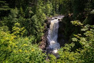 Moxie FallsResearched visit notesSomerset County, ME
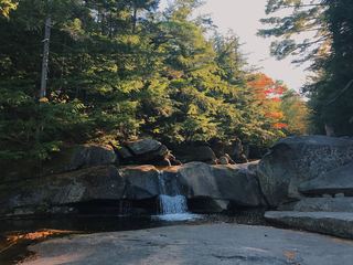 Screw Auger FallsResearched visit notesOxford County, ME
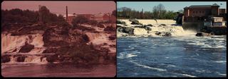 Great FallsUrban riverwalk to a public overlook; easyAndroscoggin County, ME
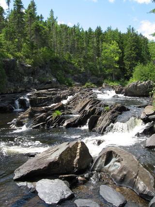 Stair FallsTrail network, trailhead and access fee documentedPiscataquis County, ME
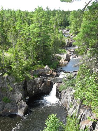 Billings FallsTrail network, trailhead and access fee documentedPiscataquis County, ME
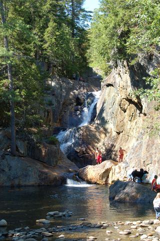 Smalls fallsState rest area with a short gorge trailFranklin County, ME
- Nesowadnehunk FallsRoadside falls identified; parking and private land permission not confirmed7 ft (2.1 m) · Piscataquis County, ME
- Grand PitchTrail manager route, parking and distance documentedPenobscot County, ME
- Haskell Rock PitchOfficial monument route with published distancePenobscot County, ME
- Rumford FallsRoadside view in town; flow controlled by damsOxford County, ME
- Abol FallsPartial guide: firsthand route documented; land ownership and parking permission unconfirmed5 ft (1.5 m) · Piscataquis County, ME
- Presumpscot FallsPublished town and Portland Trails route to a viewpointCumberland County, ME
- PumgustuckTown park overlook named; parking and path not confirmedCumberland County, ME
- Swans FallsPartial guide: paddling access and fee documented; no walking viewpoint describedOxford County, ME
- Kees FallsNational forest trail route and trailhead documentedOxford County, ME
- Kezar FallsGuidebook route with matching coordinates; land owner not confirmedOxford County, ME
- Mad River FallsGuidebook route with matching coordinates; seasonal roadOxford County, ME
- Mariaville FallsLand trust preserve route and parking documentedHancock County, ME
- Sarampus FallsRoadside rest area viewpoint documentedFranklin County, ME
- Howe FallsPark trail route documented; park fees and rules applyPiscataquis County, ME
- Little FallsParking at the falls mentioned by two sources; owner and path not confirmedWashington County, ME
- Buttermilk FallsTrail manager route and checkpoint fee documented; river fordPiscataquis County, ME
- Little Wilson Lower FallsTrailhead parking and short path documentedPiscataquis County, ME
- Little Niagara FallsAppalachian Trail hike in Baxter State Park; park entry fee for non-residentsPiscataquis County, ME
- Big Niagara FallsAppalachian Trail hike in Baxter State Park; park entry fee for non-residentsPiscataquis County, ME
- Grand PitchPublished trail route in a national monumentPenobscot County, ME
- Pond PitchNational monument trail route and trailhead documentedPenobscot County, ME
- Screw Auger FallsPublished trail route and access fee; river fordPiscataquis County, ME
- Austinm Stream FallsShort walk on private timber land; current permission not confirmedSomerset County, ME
- Cascade Falls WaterfallPublished trail system and parkingYork County, ME
- Lovers LeapPartial guide: trail and lookout documented; sources name cliffs and rapids, not a waterfallPenobscot County, ME
- Angel FallsPublished trail with parking coordinates; stream crossings and logging roadFranklin County, ME
- Fish River FallsTrail listing with parking documented; private land open by courtesyAroostook County, ME
- Sawtelle FallsShort trail and pull-off documented by two visitor sourcesPenobscot County, ME
- Little Wilson Upper FallsTrail route, parking and land ownership documentedPiscataquis County, ME
- Big Wilson FallsPartial guide: parking pull-off documented; path and land permission not confirmedPiscataquis County, ME
- Indian Stream FallsRecent visitor route; land owner and trail status not confirmedPiscataquis County, ME
- Duck Brook WaterfallBridge and staircase confirmed by NPS; parking and exact falls not confirmedHancock County, ME
- Orris FallsLand trust trailhead, route and distance documentedYork County, ME
- Houston Brook FallsVisitor route and parking documented; private timber land open to the publicSomerset County, ME
- Hadlock FallsTrail route, parking and park fee documentedHancock County, ME
- Grand FallsShort hike from a rafting put-in on a long dirt roadSomerset County, ME
- Bad Little FallsTown park viewpoint documented by visitor accountsWashington County, ME
- Man O War WaterfallGuidebook route and national park fees documentedHancock County, ME
- Cold Stream FallsPublic land trail with logging-road accessSomerset County, ME
- South Branch FallsFirsthand route and designated parking documented; state park rules applyPiscataquis County, ME
- Orin FallsNational monument trail on an old logging roadPenobscot County, ME
- Ledge FallsRoadside park viewpoint with designated parking documentedPiscataquis County, ME
- Shin FallsVisitor route and parking documented; private land open to the publicPenobscot County, ME
- Tumbledown Dick FallsPublic land trail route documented; gate fee appliesPiscataquis County, ME
- Cowyard FallsShort route documented; private road and land, permission not reconfirmedPiscataquis County, ME
- Gauntlet FallsRoadside falls on private logging roads; checkpoint feePiscataquis County, ME
Closest to you
Recorded waterfall heights
- Grand Falls20 ft (6 m) · Penobscot County
- Nesowadnehunk FallsRoadside falls identified; parking and private land permission not confirmed7 ft (2.1 m) · Piscataquis County
- Abol FallsPartial guide: firsthand route documented; land ownership and parking permission unconfirmed5 ft (1.5 m) · Piscataquis County
Waterfalls near a town
By county
Piscataquis County 35
- Abol FallsPartial guide: firsthand route documented; land ownership and parking permission unconfirmed5 ft (1.5 m) · Piscataquis County
- Big Niagara FallsAppalachian Trail hike in Baxter State Park; park entry fee for non-residentsPiscataquis County
- Big Wilson FallsPartial guide: parking pull-off documented; path and land permission not confirmedPiscataquis County
- Billings FallsTrail network, trailhead and access fee documentedPiscataquis County
- Buttermilk FallsTrail manager route and checkpoint fee documented; river fordPiscataquis County
- Cooper Brook FallsPiscataquis County
- Cowyard FallsShort route documented; private road and land, permission not reconfirmedPiscataquis County
- Gauntlet FallsRoadside falls on private logging roads; checkpoint feePiscataquis County
- Grand PitchPiscataquis County
- Green FallsPiscataquis County
- Hays Brook FallsPiscataquis County
- Howe FallsPark trail route documented; park fees and rules applyPiscataquis County
- Indian Stream FallsRecent visitor route; land owner and trail status not confirmedPiscataquis County
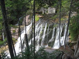 Katahdin FallsPiscataquis County
- Ledge FallsPiscataquis County
- Ledge FallsRoadside park viewpoint with designated parking documentedPiscataquis County
- Little Allagash FallsPiscataquis County
- Little Niagara FallsAppalachian Trail hike in Baxter State Park; park entry fee for non-residentsPiscataquis County
- Little Wilson Lower FallsTrailhead parking and short path documentedPiscataquis County
- Little Wilson Upper FallsTrail route, parking and land ownership documentedPiscataquis County
- Lower FallsPiscataquis County
- Mud Gauntlet FallsPiscataquis County
- Nesowadnehunk FallsRoadside falls identified; parking and private land permission not confirmed7 ft (2.1 m) · Piscataquis County
- Norway FallsPiscataquis County
- Screw Auger FallsPublished trail route and access fee; river fordPiscataquis County
- Slugundy Lower FallsPiscataquis County
- Slugundy Upper FallsPiscataquis County
- South Branch FallsFirsthand route and designated parking documented; state park rules applyPiscataquis County
- Stair FallsTrail network, trailhead and access fee documentedPiscataquis County
- Thompson Brook Lower FallsPiscataquis County
- Thompson Brook Upper FallsPiscataquis County
- Tumbledown Dick FallsPublic land trail route documented; gate fee appliesPiscataquis County
- Upper FallsPiscataquis County
- Vaughn Stream FallsPiscataquis County
- Wassataquoik Grand FallsPiscataquis County
Penobscot County 13
- Godfrey PitchPenobscot County
- Grand Falls20 ft (6 m) · Penobscot County
- Grand FallsPenobscot County
- Grand PitchTrail manager route, parking and distance documentedPenobscot County
- Grand PitchPublished trail route in a national monumentPenobscot County
- Haskell Rock PitchOfficial monument route with published distancePenobscot County
- Lovers LeapPartial guide: trail and lookout documented; sources name cliffs and rapids, not a waterfallPenobscot County
- Mossy FallsPenobscot County
- Orin FallsNational monument trail on an old logging roadPenobscot County
- Pond PitchNational monument trail route and trailhead documentedPenobscot County
- Sawtelle FallsShort trail and pull-off documented by two visitor sourcesPenobscot County
- Shin FallsVisitor route and parking documented; private land open to the publicPenobscot County
- The Hulling MachinePenobscot County
Aroostook County 12
- Allagash FallsAroostook County
- Beans FallsAroostook County
- Fish River FallsTrail listing with parking documented; private land open by courtesyAroostook County
- Fish River FallsAroostook County
- Four Foot PitchAroostook County
- Hastings FallsAroostook County
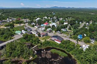 Island FallsAroostook County
- Red River FallsAroostook County
- Red River FallsAroostook County
- Rocky Brook FallsAroostook County
- Upper FallsAroostook County
- Warren FallsAroostook County
Oxford County 10
- Bisco FallsOxford County
- Hiram FallsOxford County
- Kees FallsNational forest trail route and trailhead documentedOxford County
- Kezar FallsGuidebook route with matching coordinates; land owner not confirmedOxford County
- Mad River FallsGuidebook route with matching coordinates; seasonal roadOxford County
- Rumford FallsRoadside view in town; flow controlled by damsOxford County
- Screw Auger FallsResearched visit notesOxford County
- Steep FallsOxford County
- Swans FallsPartial guide: paddling access and fee documented; no walking viewpoint describedOxford County
- The FallsOxford County
Somerset County 9
- Austinm Stream FallsShort walk on private timber land; current permission not confirmedSomerset County
- C and H PitchSomerset County
- Cold Stream FallsPublic land trail with logging-road accessSomerset County
- Grand FallsShort hike from a rafting put-in on a long dirt roadSomerset County
- Heald Stream FallsSomerset County
- Holeb FallsSomerset County
- Houston Brook FallsVisitor route and parking documented; private timber land open to the publicSomerset County
- Long FallsSomerset County
- Moxie FallsResearched visit notesSomerset County
Hancock County 6
- Duck Brook WaterfallBridge and staircase confirmed by NPS; parking and exact falls not confirmedHancock County
- Ellsworth FallsHancock County
- Hadlock FallsTrail route, parking and park fee documentedHancock County
- Long FallsHancock County
- Man O War WaterfallGuidebook route and national park fees documentedHancock County
- Mariaville FallsLand trust preserve route and parking documentedHancock County