Mad River Falls
Oxford County, Maine
Your visit at a glance
- Waterfall height
- Not recorded
- Location
- Oxford County, Maine
- Access status
- Guidebook route with matching coordinates; seasonal road
- The walk
- About 1.6 miles one way
- Ground & access
- Four river crossings, usually ankle-deep in summer but deeper in high water. Scrambling to the base is extremely steep and not recommended.
From the trailhead across ME 113 from Brickett Place, follow the yellow-blazed Royce Trail generally north. At 0.3 mile the trail forks right at a field clearing; watch for markers. Cross the Mad River four times, then climb steeply about 150 feet to a signed spur on the left at about 1.6 miles. The spur leads 50 feet to an elevated, partly hidden view of the 70-foot falls. Return the same way.
Plan your visit
Royce Trail from Brickett Place on ME 113 to the Mad River Falls spur
New England Waterfalls gives 1.6 miles one-way, about 300 feet of gain, plus a 50-foot spur to the viewpoint.
Four river crossings, usually ankle-deep in summer but deeper in high water. Scrambling to the base is extremely steep and not recommended.
Where to start
Hiker parking lot at Brickett Place on ME 113, 19.7 miles north of US-302 in Fryeburg. White Mountain National Forest parking fee area.
Timing & water
ME 113 through Evans Notch is a gated seasonal road, usually open mid-May to between early October and early November. In the off season, park near the gate south of Brickett Place without blocking it and walk 0.2 mile north.
Before you go
Per-vehicle parking fee at a self-service kiosk; it was $5 per day in 2017. Federal interagency passes are accepted. Check the current fee.
Visitor informationVisit sources
More waterfalls nearby
Within 40 straight-line miles. Road and trail distances will differ.
- Hermit FallsNational forest trail and short loopCoos County, NH1.8 miSW
- Brickett FallsNational forest trail from a small roadside trailheadCarroll County, NH2.9 miSW
- Emerald PoolResearched route and starting areaCarroll County, NH3.7 miS
- Chandler GorgeNational forest trails and a signed side loopCarroll County, NH4.2 miSW
- Kees FallsNational forest trail route and trailhead documentedOxford County, ME4.8 miNE
- Thompson FallsResearched route and starting areaCoos County, NH11 miW
- Kezar FallsGuidebook route with matching coordinates; land owner not confirmedOxford County, ME11 miSE
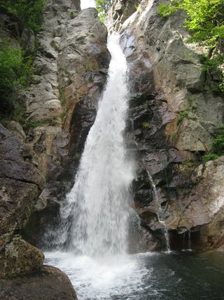 Glen Ellis FallsNational forest scenic area; short trail with stone steps; parking fee64 ft (19.5 m) · Coos County, NH13 miW
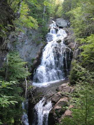 Crystal Cascades FallsNational forest trail to an overlook69 ft (21 m) · Coos County, NH13 miW