Gauntlet Falls
Piscataquis County, Maine
Your visit at a glance
- Waterfall height
- Not recorded
- Location
- Piscataquis County, Maine
- Access status
- Roadside falls on private logging roads; checkpoint fee
- The walk
- A few steps from the parking lot
- Ground & access
- Steep, sloping rock ledges. Keep children close. Jumping from the ledges is risky.
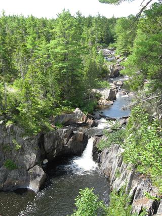
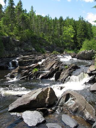
Gauntlet Falls is a swimming spot with high ledges in the North Maine Woods south of Jo-Mary Lake. Drive the Jo-Mary Road from Route 11 between Millinocket and Brownville Junction and pay at the Jo-Mary Checkpoint. About 6 miles on, continue onto Johnson Pond Road for about 2.6 miles, then turn left onto B Pond Road for about 3.5 miles to the parking lot. Short trails from the lot lead to the falls and to the lower section and Mud Gauntlet Falls.
Plan your visit
KI Jo-Mary Road from Route 11 through the Jo-Mary Checkpoint, Johnson Pond Road and B Pond Road to the Gauntlet Falls parking lot
The visitor account says the falls are right at the parking area with no real hike. The 12.2 miles from the checkpoint are a drive on logging roads, not a walk.
Steep, sloping rock ledges. Keep children close. Jumping from the ledges is risky.
Where to start
Parking lot at the falls on B Pond Road, about 12.2 miles from the Jo-Mary Checkpoint. An outhouse and a campsite are by the lot.
Timing & water
Logging roads with active operations; slow down for skidders. Seasonal gate hours were not confirmed.
Before you go
A per-person day-use fee is paid in cash at the Jo-Mary Checkpoint. The visitor reported $10 per day for Maine residents and $15 for others, free under 15 and 70 and over. Current rates were not confirmed.
Visitor informationVisit sources
More waterfalls nearby
Within 40 straight-line miles. Road and trail distances will differ.
- Mud Gauntlet FallsPiscataquis County, ME0.2 miSE
- Cooper Brook FallsPiscataquis County, ME7.4 miN
- Hays Brook FallsPiscataquis County, ME12 miW
- Tumbledown Dick FallsPublic land trail route documented; gate fee appliesPiscataquis County, ME13 miN
- Screw Auger FallsPublished trail route and access fee; river fordPiscataquis County, ME14 miW
- Buttermilk FallsTrail manager route and checkpoint fee documented; river fordPiscataquis County, ME15 miW
 Billings FallsTrail network, trailhead and access fee documentedPiscataquis County, ME15 miW
 Stair FallsTrail network, trailhead and access fee documentedPiscataquis County, ME15 miW
- Grand Falls20 ft (6 m) · Penobscot County, ME17 miE